Public Tags
Other tags: Easdale
Showing latest 50 of 65 images tagged with island:Easdale tag.
|
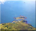
Island of Easdale off Seil
by Rob Farrow for square NM7317 The little island seen in the centre of the image here is Easdale; the main land... (more)
|

|
Easdale Sound
by Rob Farrow for square NM7317 Taken from the passing MV Hebridean Isles looking at Easdale Sound the narrow... (more)
Tags:
top:Coastal
type:Cross Grid
island:Easdale
top:Estuary, Marine
top:Islands
island:Seil
subject:Sound
|

|
Easdale - Looking over Easdale village to Seil
by Rob Farrow geograph for square NM7317 Taken from the top of the 38m (125') hill at the centre of the island of... (more)
Tags:
top:Coastal
island:Easdale
place:Ellenabeich
type:Geograph
top:Islands
island:Seil
subject:View
Village
top:Village, Rural Settlement
|

|
Easdale - looking over Easdale Sound to Dùn Mòr
by Rob Farrow geograph for square NM7317 A little T-ended stone-built pier juts into Easdale Sound from the island of... (more)
Tags:
top:Coastal
top:Docks, Harbours
island:Easdale
place:Ellenabeich
type:Geograph
top:Islands
island:Seil
Slate Islands
subject:Sound
top:Village, Rural Settlement
|

|
Easdale - The ferry
by Rob Farrow for square NM7417 A close-up of the little ferry seen in NM7417 : Easdale - Ferry on its way to Ellenabeich, Seil as it briskly brings... (more)
Tags:
type:Close Look
top:Coastal
island:Easdale
place:Ellenabeich
subject:Ferry
top:Islands
island:Seil
Slate Islands
|

|
Easdale - Ferry on its way to Ellenabeich, Seil
by Rob Farrow geograph for square NM7417 The little passenger ferry that plies the short route across Easdale Sound is... (more)
Tags:
top:Coastal
top:Docks, Harbours
island:Easdale
place:Ellenabeich
subject:Ferry
type:Geograph
top:Islands
island:Seil
Slate Islands
top:Village, Rural Settlement
|

|
Easdale - Preparing to board the ferry
by Rob Farrow geograph for square NM7417 A few prospective passengers wait on NM7417 : Easdale - Ferry slipway for the little ferry (seen... (more)
Tags:
top:Coastal
top:Docks, Harbours
island:Easdale
place:Ellenabeich
subject:Ferry
Ferry Terminal
type:Geograph
top:Islands
island:Seil
Slate Islands
top:Village, Rural Settlement
|

|
Easdale - Ferry slipway
by Rob Farrow geograph for square NM7417 Looking over Easdale Sound to the slipway on Easdale where NM7417 : Easdale - The ferry comes... (more)
Tags:
top:Coastal
top:Docks, Harbours
island:Easdale
place:Ellenabeich
Ferry Terminal
type:Geograph
top:Islands
island:Seil
Slate Islands
subject:Slipway
top:Village, Rural Settlement
|
|
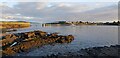
Seil - Ellenabeich - wall, pier and view to Easdale
by Rob Farrow geograph for square NM7417 The wall beside NM7417 : Seil - Ellenabeich - All that remains of Eilean nam Beathach is on the left, beyond it is the remains of... (more)
Tags:
top:Coastal
top:Docks, Harbours
island:Easdale
place:Ellenabeich
type:Geograph
top:Islands
Pier
island:Seil
subject:Sound
top:Village, Rural Settlement
Wall
|

|
Seil - Looking over to the eastern end of Easdale
by Rob Farrow geograph for square NM7417 Taken from near to the little ferry waiting room at Ellenabeich looking over... (more)
Tags:
top:Coastal
top:Docks, Harbours
island:Easdale
Easdale Sound
place:Ellenabeich
type:Geograph
top:Islands
island:Seil
material:Slate
Slate Islands
subject:Sound
top:Village, Rural Settlement
|
|
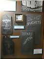
Easdale - The sizes of slates
by Rob Farrow for square NM7316 One of many interesting displays within NM7316 : Easdale - Folk museum
This shows the main sizes... (more)
Tags:
type:Close Look
top:Coastal
subject:Display
island:Easdale
top:Educational Sites
Folk Museum
type:Inside
top:Islands
Slate Islands
top:Village, Rural Settlement
|
|
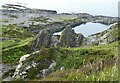
Easdale - Large flooded quarry from Easdale hill
by Rob Farrow geograph for square NM7317 Looking down on one of the larger flooded quarries on Easdale island from the... (more)
Tags:
top:Coastal
top:Derelict, Disused
island:Easdale
type:Geograph
top:Islands
subject:Quarry
top:Quarrying, Mining
Slate Islands
|

|
Easdale - View across flooded quarries to distant Garbh Eileach
by Rob Farrow geograph for square NM7317 Two flooded quarries (the nearer much smaller than the further) on the... (more)
Tags:
top:Coastal
top:Derelict, Disused
island:Easdale
island:Garbh Eileach
type:Geograph
top:Islands
subject:Landscape
top:Quarrying, Mining
Slate Islands
View
|

|
Easdale - View across the top of Easdale
by Rob Farrow geograph for square NM7317 Taken from near to NM7317 : Easdale - Toposcope and gull, atop the 38m (125') hill on Easdale... (more)
Tags:
top:Coastal
top:Derelict, Disused
island:Easdale
island:Garbh Eileach
type:Geograph
top:Islands
subject:Landscape
top:Quarrying, Mining
Slate Islands
View
|

|
Easdale - View southwestwards from the hill
by Rob Farrow geograph for square NM7317 Taken from by the toposcope atop the 125' (38m) hill in the centre of... (more)
|
|
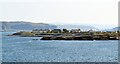
Easdale village from the sea
by Rob Farrow geograph for square NM7317 The cluster of houses that form Easdale's only settlement as seen from the... (more)
|
|
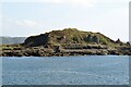
Easdale from the sea
by Rob Farrow for square NM7317 Looking over at the central hill of the island of Easdale (see shared... (more)
|

|
Easdale - Remains of quarry-working building
by Rob Farrow geograph for square NM7317 There are a series of low walls forming enclosures which were associated with... (more)
Tags:
top:Coastal
top:Derelict, Disused
island:Easdale
type:Geograph
top:Islands
top:Quarrying, Mining
subject:Ruin
Slate Islands
|
|
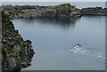
Easdale - Flooded quarry with swimmer
by Rob Farrow for square NM7316 This little flooded quarry is at the head (landward side) of NM7316 : Easdale - Rubha nam Faoileann and... (more)
Tags:
top:Coastal
type:Cross Grid
top:Derelict, Disused
island:Easdale
top:Islands
top:Lakes, Wetland, Bog
subject:Quarry
top:Quarrying, Mining
Slate Islands
|
|
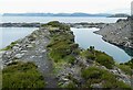
Easdale - Ridge between two quarries
by Rob Farrow geograph for square NM7317 This is a view along the ridge that separates the two quarries seen in... (more)
Tags:
top:Coastal
top:Derelict, Disused
island:Easdale
type:Geograph
top:Islands
top:Lakes, Wetland, Bog
subject:Quarry
top:Quarrying, Mining
Slate Islands
|
|
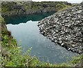
Easdale - Toe of boot-shaped flooded quarry
by Rob Farrow geograph for square NM7317 The smaller of the two quarries seen in NM7317 : Easdale - Looking down on two flooded quarries is shaped rather like a... (more)
Tags:
top:Coastal
top:Derelict, Disused
island:Easdale
type:Geograph
top:Islands
top:Lakes, Wetland, Bog
subject:Quarry
top:Quarrying, Mining
Slate Islands
|
|
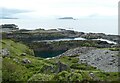
Easdale - Looking down on two flooded quarries
by Rob Farrow geograph for square NM7317 Taken from the path that leads up to the top of the hill in Easdale looking down... (more)
Tags:
top:Coastal
top:Derelict, Disused
island:Easdale
type:Geograph
top:Islands
top:Lakes, Wetland, Bog
subject:Quarry
top:Quarrying, Mining
Slate Islands
|
|
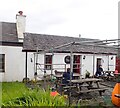
Easdale - Front courtyard of 'The Puffer'
by Rob Farrow geograph for square NM7317 Outside seating at The Puffer in Easdale. Inside there are two rooms, a bar at... (more)
Tags:
Bar
top:Business, Retail, Services
top:Coastal
island:Easdale
type:Geograph
top:Islands
subject:Public House
Restaurant
Slate Islands
top:Village, Rural Settlement
|
|
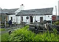
Easdale - The Puffer bar and restaurant
by Rob Farrow geograph for square NM7317 Easdale's rightly famous pub and restaurant, The Puffer. A great place to... (more)
Tags:
Bar
top:Business, Retail, Services
top:Coastal
island:Easdale
type:Geograph
top:Islands
subject:Public House
Restaurant
Slate Islands
top:Village, Rural Settlement
|

|
Easdale - Steps down into the harbour
by Rob Farrow for square NM7317 These steps - unsurprisingly created from slabs of slate - lead down into the... (more)
Tags:
type:Close Look
top:Coastal
top:Docks, Harbours
island:Easdale
top:Islands
Slate Islands
subject:Steps
top:Village, Rural Settlement
|
|
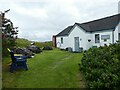
Easdale - Folk museum
by Rob Farrow geograph for square NM7316 Tucked away at the eastern end of Easdale village is this charming little... (more)
Tags:
top:Coastal
island:Easdale
top:Educational Sites
Folk Museum
type:Geograph
top:Islands
subject:Museum
Slate Islands
top:Village, Rural Settlement
|
|
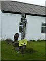
Easdale - The signpost
by Rob Farrow for square NM7317 A somewhat humorous signpost in the centre of Easdale village gives the... (more)
Tags:
type:Close Look
top:Coastal
island:Easdale
top:Islands
top:Paths
subject:Signpost
Slate Islands
top:Village, Rural Settlement
|

|
Easdale - Whitewashed cottages in the centre of the village
by Rob Farrow geograph for square NM7317 The whole of Easdale island is a conservation area, with pretty much every... (more)
Tags:
top:Coastal
island:Easdale
type:Geograph
top:Housing, Dwellings
top:Islands
Slate Islands
subject:Village
top:Village, Rural Settlement
|

|
Easdale - Cottages and track in the village
by Rob Farrow for square NM7317 The track leads to an L-shaped cluster of cottages on the western side of the... (more)
Tags:
top:Coastal
subject:Cottages
type:Cross Grid
island:Easdale
top:Housing, Dwellings
top:Islands
top:Paths
Slate Islands
Track
top:Village, Rural Settlement
|

|
Easdale - A gap in the wall
by Rob Farrow geograph for square NM7317 The coastal path around Easdale island passes through this gap in a wall before... (more)
Tags:
top:Coastal
island:Easdale
Gap
type:Geograph
top:Islands
subject:Path
Slate Islands
top:Village, Rural Settlement
Wall
|

|
Easdale - Coastal path approaches the village
by Rob Farrow geograph for square NM7317 If walking in an anticlockwise direction around Easdale on its coastal path a... (more)
Tags:
top:Coastal
island:Easdale
type:Geograph
top:Islands
subject:Path
top:Paths
Slate Islands
top:Village, Rural Settlement
Wall
|

|
Easdale - New build at east of island
by Rob Farrow geograph for square NM7417 This large newly built property (or perhaps a major refurbishment) is situated... (more)
Tags:
top:Coastal
island:Easdale
type:Geograph
subject:House
top:Housing, Dwellings
top:Islands
Slate Islands
top:Village, Rural Settlement
|

|
Easdale - Half-boat seat
by Rob Farrow geograph for square NM7316 Beside one of the paths through Easdale village is this seat made from half of a... (more)
Tags:
top:Coastal
island:Easdale
type:Geograph
top:Islands
Slate Islands
top:Village, Rural Settlement
|

|
Easdale - Large flooded quarry on the west of the island
by Rob Farrow geograph for square NM7317 This large, almost rectangular quarry is situated on the west of the island of... (more)
Tags:
top:Coastal
top:Derelict, Disused
island:Easdale
type:Geograph
top:Islands
top:Lakes, Wetland, Bog
top:Quarrying, Mining
Slate Islands
|

|
Easdale - pathway to flooded quarry
by Rob Farrow geograph for square NM7317 This pathway between walls of slate leads down to NM7317 : Easdale - Flooded Windmill Quarry
Tags:
top:Coastal
top:Derelict, Disused
island:Easdale
type:Geograph
top:Islands
subject:Path
top:Quarrying, Mining
Slate Islands
|

|
Easdale - Former quarry buildings
by Rob Farrow geograph for square NM7317 Some of the many ruined buildings associated with the former slate industry on... (more)
Tags:
top:Coastal
top:Derelict, Disused
island:Easdale
type:Geograph
top:Islands
top:Quarrying, Mining
subject:Ruin
Slate Islands
|

|
Easdale - Track, ruins and rocks
by Rob Farrow geograph for square NM7317 The coastal path around Easdale runs through a fascinating landscape of former... (more)
|

|
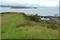
Esadale - Ruins of former quarrying buildings
by Rob Farrow geograph for square NM7317 Ruins of buildings which once were an integral part of the quarrying industry on... (more)
Tags:
top:Coastal
top:Derelict, Disused
island:Easdale
type:Geograph
top:Islands
top:Quarrying, Mining
subject:Ruin
Slate Islands
|
|
Easdale - View across the top of the hill to Insh Island
by Rob Farrow geograph for square NM7317 Looking across the top of the 38m (125') hill in the centre of Easdale to... (more)
Tags:
top:Coastal
island:Easdale
type:Geograph
Hilltop
island:Insh Island
top:Islands
Slate Islands
subject:View
|

|
Easdale - The rocks of Rubha nam Faoileann
by Rob Farrow geograph for square NM7316 A 'ground-level' view of NM7316 : Easdale - Rubha nam Faoileann looking along the... (more)
|

|
Easdale - View southwestwards from the top of the hill
by Rob Farrow geograph for square NM7317 Although the hill at the centre of Easdale only climbs to 38m (125') the... (more)
Tags:
top:Coastal
top:Derelict, Disused
island:Easdale
type:Geograph
top:Islands
top:Quarrying, Mining
Slate Islands
subject:View
|

|
Easdale - Duckweed covered pool
by Rob Farrow geograph for square NM7317 I came across this little pool part-way up the hill at the centre of Easdale by... (more)
Tags:
top:Coastal
top:Derelict, Disused
island:Easdale
Flooded
type:Geograph
top:Islands
top:Lakes, Wetland, Bog
subject:Pool
top:Quarrying, Mining
Shaft
Slate Islands
|

|
Easdale - Gull perched on ruin
by Rob Farrow geograph for square NM7317 A gull (probably a Common Gull, Larus canus) perches eyeing the surroundings on... (more)
Tags:
top:Coastal
top:Derelict, Disused
island:Easdale
type:Geograph
top:Islands
top:Quarrying, Mining
subject:Ruin
Slate Islands
|

|
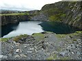
Easdale - Former quarry buildings
by Rob Farrow geograph for square NM7317 There are many abandoned and ruinous buildings around the coast of Easdale that... (more)
Tags:
top:Coastal
top:Derelict, Disused
island:Easdale
type:Geograph
top:Islands
top:Quarrying, Mining
subject:Ruin
material:Slate
Slate Islands
|
|
Easdale - Quarry of the Hill from the northwest
by Rob Farrow geograph for square NM7317 The coastal path around Easdale passes between NM7317 : Easdale - Flooded Windmill Quarry and NM7317 : Easdale - Quarry of the Hill... (more)
Tags:
top:Coastal
island:Easdale
Flooded Quarry
type:Geograph
top:Islands
top:Lakes, Wetland, Bog
subject:Quarry
former:Quarry
top:Quarrying, Mining
Slate Islands
|
|
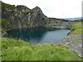
Easdale - Quarry of the Hill
by Rob Farrow geograph for square NM7317 This former quarry has flooded, whether as a result of the 1881 or subsequent... (more)
Tags:
top:Coastal
island:Easdale
Flooded Quarry
type:Geograph
top:Islands
top:Lakes, Wetland, Bog
subject:Quarry
former:Quarry
top:Quarrying, Mining
Slate Islands
|

|
Easdale - Flooded Windmill Quarry
by Rob Farrow geograph for square NM7317 This flooded quarry is not shown on the OS maps as a lake but rather a shelf of... (more)
Tags:
top:Coastal
island:Easdale
type:Geograph
top:Islands
subject:Lagoon
top:Lakes, Wetland, Bog
top:Quarrying, Mining
Slate Islands
|

|
Easdale - Wild flowers by the path
by Rob Farrow for square NM7317 On the left are some of the many examples on Easdale of NM7317 : Easdale - Sedum anglicum (English Stonecrop), while I... (more)
Tags:
type:Close Look
top:Coastal
island:Easdale
flower:English Stonecrop
subject:Flora
top:Islands
Slate Islands
flower:Stonecrop
top:Wild Animals, Plants and Mushrooms
flower:Wild Thyme
|

|
Easdale - Sedum anglicum (English Stonecrop)
by Rob Farrow for square NM7317 Sedum anglicum (English Stonecrop) is a low-growing perennial succulent with... (more)
Tags:
type:Close Look
top:Coastal
island:Easdale
flower:English Stonecrop
subject:Flower
top:Islands
Slate Islands
flower:Stonecrop
top:Wild Animals, Plants and Mushrooms
|
|
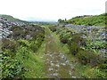
Easdale - Coastal path
by Rob Farrow geograph for square NM7317 A well-marked path (with several off-shoots) allows an easy circumnavigation of... (more)
|
