|
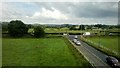
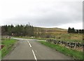
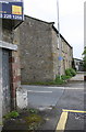
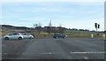
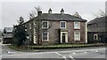
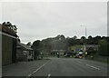
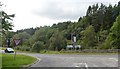
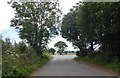
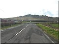
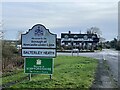
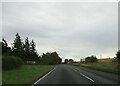
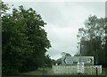
Junction of A523 and B5358, north of Prestbury
by Christopher Hilton
geograph for square SJ9078
The B5358, Bonis Hall Lane, passes under the railway line here and meets the... (more)
|
|
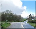
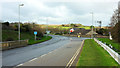
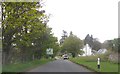
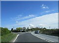
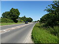
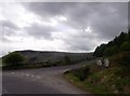
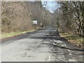
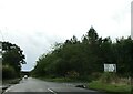
The junction of the A702 and the B7075
by Ann Cook
geograph for square NX6481
Trolane Bridge can be seen beyond the junction.
|
|
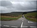
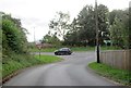
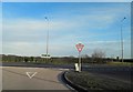
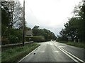
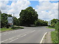
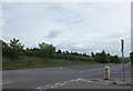
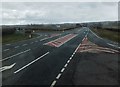
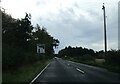
A junction of A and B-classified roads near Elrick farm
by Stanley Howe
geograph for square NJ4126
The A-road (A941) is the one that has had white paint 'spilled' on it;... (more)
|
|
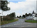
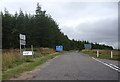
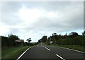
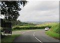
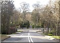
Road junction at Carrbridge, near Aviemore
by Malc McDonald
geograph for square NH9023
A road junction at Carrbridge, in the Cairngorms National Park. The road ahead... (more)
|
|
The B729 joins the A713
by Ann Cook
geograph for square NX5693
|
|
A68 and B road junction before bridging the River Tweed
by Martin Dawes
geograph for square NT5735
This junction takes traffic down to the north bank of the River Tweed where it... (more)
|
|
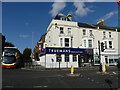
A road and B road junction in Bridgend
by Jaggery
geograph for square SS9079
The B4181 Coychurch Road viewed across the A473 Cowbridge Road.
|
|
Road junction at Enstone
by Malc McDonald
geograph for square SP3724
The junction of the A44 and B4030 roads at Enstone in Oxfordshire. The chevron... (more)
|
|
Junction of A65 and road to Bellbusk with Church Close Farm on far side
by Roger Templeman
for square SD9055
|
|
A389 in Padstow
by Derek Harper
geograph for square SW9175
The junction, with the B3276 New Street, is also shown in SW9175 : The A389. The A... ( more) |
|
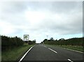
B road junction coming up on the right on A697
by Martin Dawes
geograph for square NT7345
|
|
B road junction with A68
by Martin Dawes
geograph for square NT6324
|
|
The junction of Hove Street and (opposite) Sackville Road with Church Road, Hove
by Ruth Sharville
geograph for square TQ2804
Hove Street, becoming Sackville Road, is the A 2023. Church Road is the B2066.
|
|
Yellow grid at the junction of the A40 and B4521, Abergavenny
by Jaggery
geograph for square SO3014
The grid defines a keep clear zone. The A40 Hereford Road is on the camera side.... (more)
|
|
Bridge and road junction, Carnwath
by Jim Barton
geograph for square NS9646
The A70 bridge over the line from Carstairs Junction to Edinburgh and the... (more)
|
|
Junction west of Padstow
by Derek Harper
geograph for square SW9074
The B3276 heads north from the junction with the A389 and Green Lane (left -... (more)
|
|
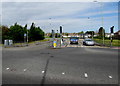
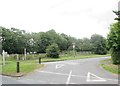
Junction of B9119 with A944 at Westhill (E)
by Stanley Howe
geograph for square NJ8406
A traffic-light controlled entry to a dual-carriage highway (R) into Aberdeen.
|
|
B950/A924 junction at Kirkmichael
by Stanley Howe
geograph for square NO0859
Approaching the junction and war memorial on the B950 from Dalmunzie, to join... (more)
|
|
B1206 junction with A15
by Steve Fareham
geograph for square SK9699
|
|
Your choice, A or B?
by Stanley Howe
geograph for square NJ4126
Both the A941 to Rhynie and the B9002 to Lumsden take one into the embrace of... (more)
|
|
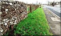
House at Red Dial Farm on SE side of A595 opposite south end of B5304
by Roger Templeman
for square NY2545
|
|
Junction of B1211 onto A18 near Melton Ross Quarries
by Martin Dawes
geograph for square TA0811
Note the white road coming from the B1211 onto the A18, produced by the many... (more)
|
|
Junction of B6354 to Ford and Etal. Flodden Lodge
by Martin Dawes
geograph for square NT9236
To the right the gateposts of a carriageway to Sybil's Well on Flodden Hill
|
|
Sign for the Richard Hillary RAF Memorial on B6460
by Martin Dawes
geograph for square NT7345
The Memorial is on the roadside junction leading to the WW2 Charterhouse... (more)
|
|
Traffic lights at junction with A623
by Martin Dawes
geograph for square SK2374
Hassop Road B6001 into Calver Low. Eyre Arms centre over the A623
|
|
Looking towards junction of B1159 and A149
by David Pashley
geograph for square TG3625
|
|
A44 approaching Enstone
by Malc McDonald
geograph for square SP3823
The trunk A44 road approaching Enstone in north Oxfordshire.
|
|
Road junction on a bend on the A6105 toward Earlston
by Martin Dawes
geograph for square NT5939
The B6397 wanders through the countryside to join the A6089 into Kelso by Floors... (more)
|
|
A939 road signs
by Stanley Howe
geograph for square NJ1519
At the B9136 junction on the east bank of the River Avon.
|
|
Junction of A944 from Alford with B993 to Torphins
by Stanley Howe
geograph for square NJ6610
Haddon Croft corner, Millbank.
|
|
Mill Bank Hall
by Stanley Howe
geograph for square NJ6610
At the junction of B993 with A 944. Seen from the carpark, whence there is now a... (more)
|
|
Road sign on A892
by Stanley Howe
geograph for square NO7666
At Elsinore junction.
|
|
Approaching A92 junction
by Stanley Howe
geograph for square NO7666
On B9120 from Laurencekirk.
|
|
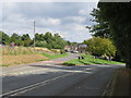
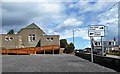
Junction of A1035 and Main Road Sigglesthorne
by Martin Dawes
geograph for square TA1546
The village is only a few yards down this road
|
|
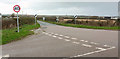
Sliproad junction
by Stanley Howe
geograph for square NN9128
Access to A822 (N&S on right) and B8063 (on left).
|

|
Den of Lindores
by Stanley Howe
geograph for square NO2517
Junction of B936 with A913.
|
|
Junction of the A68 and the B6398
by Barbara Carr
geograph for square NT5732
To the north of Newtown St Boswells.
|
|
The A719 and Mochrum Hill
by Ann Cook
geograph for square NS2610
The A719 bends to the right at the junction. The B7023 goes to the left.
|
|
A714 at the junction with the B734
by Ann Cook
geograph for square NX2089
|
|
Approach to a bridge over the Bo Burn
by Stanley Howe
geograph for square NO6998
On the A980 from Banchory; with an entrance to Raemoir House Hotel ahead at the... (more)
|
|
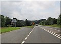
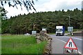
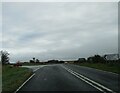
Junction on the A1
by Barbara Carr
geograph for square NU1133
Seen from the road out of Belford, the A1 goes southward to Alnwick, while the... (more)
|
|
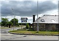
County, borough and hamlet signs
by Jonathan Hutchins
geograph for square SJ7450
Entering Staffordshire from Cheshire on the A531: The Broughton restaurant and... (more)
|
|
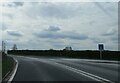
Junction of B1266 on the left from A171
by Martin Dawes
geograph for square NZ7612
Another wet and overcast day but it got out later at Runswick Bay
|
|
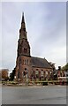
Holy Trinity Church
by Roger Templeman
geograph for square NY1381
The spire of the church is an Ordnance Survey intersected station trig point,... (more)
|
|
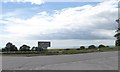
Junction of B1211 and A18 at Melton Ross Quarries
by Martin Dawes
geograph for square TA0811
The white trail out on to the A18 made by the limestone lorries
|
|
Junction with B6346 while approaching Station Sawmills
by Martin Dawes
geograph for square NU0420
Road goes off to Eglingham and eventually Alnwick
|
|
Junction of B6352 on the right from A697
by Martin Dawes
geograph for square NT9335
To the left the track into Tileshed Sawmill, said on OS map to be disused.
|
|
Approaching junction of B6352 on the right
by Martin Dawes
geograph for square NT9335
In the trees to the left is Tilesheds Sawmill the O/S map states it is disused
|
|
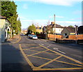
A6 approaching B6413 junction in Plumpton
by Roger Templeman
geograph for square NY4937
|
|
Road signs on A1094 at road junction north of Snape
by Martin Dawes
geograph for square TM3959
Behind the sign is a cul-de-sac with St John the Baptist church to the left
|