
|
Path junction in Ferndown Forest
by Malc McDonald
geograph for square SU0602
Paths meet in woodland in Dorset. The path ahead is on the route of the... (more)
|

|
National Cycle Network route 67, Harrogate
by Malc McDonald
geograph for square SE3157
A National Cycle Network "millennium milepost" at a path junction on... (more)
|

|
Parley Common, near Ferndown
by Malc McDonald
geograph for square SZ0999
A path and a track on Parley Common in Dorset.
|

|
Castleman Trailway near Broadstone
by Malc McDonald
geograph for square SZ0197
A view along the Castleman Trailway in woodland between Broadstone and Wimborne... (more)
|

|
Path junction in woodland near Ringwood
by Malc McDonald
geograph for square SU1204
A junction of two paths in woodland at Ashley Heath, near Ringwood.
|

|
Poole Harbour Trail near Wareham
by Malc McDonald
geograph for square SY9292
Trails met in a forest in Dorset. Both of the trails ahead are on the route of... (more)
|

|
Paths meet near Barmouth
by Malc McDonald
geograph for square SH6316
A junction of footpaths in woodland near Barmouth, in north Wales. This area is... (more)
|

|
Paths meet near Barmouth
by Malc McDonald
geograph for square SH6316
A junction of footpaths in woodland near Barmouth, in north Wales. This area is... (more)
|

|
Paths on Epsom Common
by Malc McDonald
geograph for square TQ1860
A junction of paths on Epsom Common in Surrey.
This image was taken during... (more)
|

|
Footpaths in Southborough
by Malc McDonald
geograph for square TQ5743
A junction of footpaths in woodland in the village of Southborough, near... (more)
|

|
Junction of paths on the Sandstone Trail
by Christopher Hilton
geograph for square SJ4952
|

|
Paths in RSPB Arne, near Wareham
by Malc McDonald
geograph for square SY9788
A junction of paths in the Purbeck Heaths National Nature Reserve. The path... (more)
|

|
Paths in RSPB Arne, near Wareham
by Malc McDonald
geograph for square SY9888
A junction of paths in the Purbeck Heaths National Nature Reserve. This part of... (more)
|

|
Castleman Trailway near Broadstone
by Malc McDonald
geograph for square SZ0094
A junction on the Castleman Trailway south of Broadstone. Here, National Cycle... (more)
|

|
Path junction in Moors Valley Country Park, near Ringwood
by Malc McDonald
geograph for square SU1105
Paths diverge in Moors Valley Country Park. Yellow flowers adorn a gorse bush... (more)
|
|
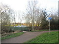
London LOOP near Tolworth
by Malc McDonald
geograph for square TQ2064
A path leading off the London LOOP near Tolworth. The path junction is within... (more)
|

|
Paths in woodland, Harrogate
by Malc McDonald
geograph for square SE3156
A junction of paths in woodland in Harrogate. The path to the right is shared... (more)
|
|
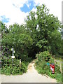
Public footpaths near Cirencester
by Malc McDonald
geograph for square SP0300
A public footpath leading into trees near Cirencester in Gloucestershire. Four... (more)
|
|
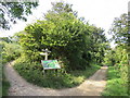
Footpaths near Brighton
by Malc McDonald
geograph for square TQ3207
Footpaths in the South Downs National Park, close to Brighton.
|
|
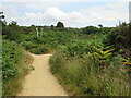
Paths at Ham Common, Poole
by Malc McDonald
geograph for square SY9890
A junction of paths at Ham Common, on the edge of Poole Harbour.
|
|
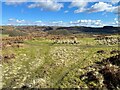
Paths near Appletree Holme
by Adrian Taylor
geograph for square SD2788
At this junction of paths on Blawith Common northbound walkers following The... (more)
|
|
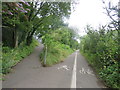
Path junction, Leatherhead
by Malc McDonald
geograph for square TQ1657
Footpaths meet, in the Surrey town of Leatherhead.
The markings show that the... (more)
|

|
Junction of paths on the Sandstone Trail
by Christopher Hilton
geograph for square SJ4952
|

|
Paths at Arne, near Wareham
by Malc McDonald
geograph for square SY9888
A junction of paths on the Purbeck Heaths National Nature Reserve. Here, there... (more)
|

|
Parley Common, near Ferndown
by Malc McDonald
geograph for square SZ0899
Paths on Parley Common in Dorset.
|

|
Paths cross near Shere
by Malc McDonald
geograph for square TQ0747
Two paths cross on a hillside near Shere, in Surrey. The path which bears left... (more)
|
|
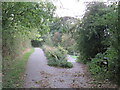
National Cycle Network route 67, Harrogate
by Malc McDonald
geograph for square SE3157
The path to the left is shared by pedestrians and cyclists, and follows the... (more)
|

|
National Cycle Network route 67, Harrogate
by Malc McDonald
geograph for square SE3156
A path following the course of a dismantled railway on the outskirts of... (more)
|

|
Four ways to go, near Lound Hill
by Christine Johnstone
geograph for square SE4908
North and south along Lound Lane [a public byway]. East on the public bridleway... (more)
|

|
National Cycle Network near Poole
by Malc McDonald
geograph for square SY9994
Route 25 of the National Cycle Network descends from a former railway embankment... (more)
|

|
Junction of paths near Heligan Mill
by David Smith
geograph for square SX0045
The lower path leads directly to Heligan Gardens; the upper one is part of NCN3... (more)
|

|
Junction of paths above Highcombe Bottom
by Christopher Hilton
geograph for square SU8837
|

|
Parting of the ways
by Stanley Howe
geograph for square NO5298
Two paths diverge just west of Aboyne's War Memorial Building; uphill right... (more)
|

|
A farm building near the path through Denwood Belt
by Stanley Howe
geograph for square NO7497
From a path and track junction.
|

|
Footpath marker at a paths junction in Denwood Belt
by Stanley Howe
geograph for square NO7397
The arrows indicate the right hand track for both 'Red' and... (more)
|

|
A paths junction in Banchory
by Stanley Howe
geograph for square NO7095
By the River Dee.
|

|
Paths junction
by Stanley Howe
geograph for square NO7496
Deeside Way crossing the underpass pathway from Milton of Crathes craft centre... (more)
|

|
Signpost at junction of paths, Arrow Valley Country Park, Redditch
by P L Chadwick
geograph for square SP0667
Near the main car parks and the north eastern end of the lake.
|

|
Footpath junction in Calverley Wood
by Stephen Craven
geograph for square SE2037
To the left, Thornhill Drive, a permissive bridleway. To the right, an unnamed footpath.
|

|
Path junction in Milton Wood near Crathes Castle
by Stanley Howe
geograph for square NO7396
'White' and 'Yellow' paths diverge; white ahead to the East Lodge.
|

|
Fingerpost, Flinter Gill Outrake
by Karl and Ali
geograph for square SD6985
By the junction with the Occupation Road bridleway. This is a popular short walk... (more)
|
|
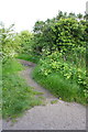
Junction of Sir John's Lane with a footpath
by Roger Templeman
geograph for square ST6076
|
|
Paths near Enfield
by Malc McDonald
geograph for square TQ3599
Footpaths through a green space in north London's outer suburbs.
|

|
Blue marks the way
by Christine Johnstone
geograph for square SO6112
Waymark for Beechenhurst's Sculpture Trail, north-west of Speech House.
|

|
Meeting point...
by Bill Harrison
geograph for square NJ8508
...of paths up Brimmond Hill.
|

|
Outskirts of Hovingham
by Pauline E
geograph for square SE6675
Approaching the village along the Ebor Way.
|

|
Paths on the moor
by Bill Harrison
geograph for square NJ6522
Straight ahead leads to Oxen Craig in the distance; going left heads to Hermit Seat.
|
|
Footpath towards St Margaret's Church from Canning Place
by Roger Templeman
geograph for square SK5805
|

|
Tracks crossing in the inclosure
by Christine Johnstone
geograph for square SO6212
On the route of Beechenhurst's Sculpture Trail.
|

|
Gravestones in Wolsingham churchyard
by Trevor Littlewood
geograph for square NZ0737
A section of the graveyard surrounding the Church of St. Mary and St. Stephen... (more)
|
