|
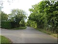
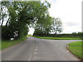
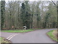
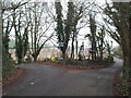
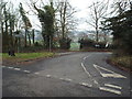
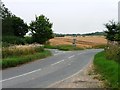
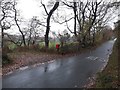
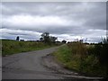
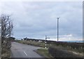
Road junction near Stevenage
by Malc McDonald
geograph for square TL3022
A minor road junction in north Hertfordshire countryside.
|
|
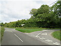
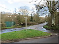
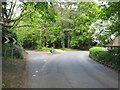
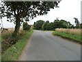
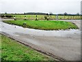
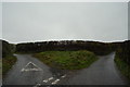
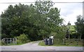
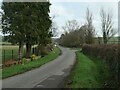
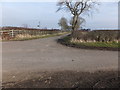
Road junction near Buntingford
by Malc McDonald
geograph for square TL3234
A junction of minor lanes in the north Hertfordshire countryside.
|
|
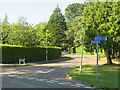
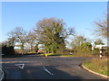
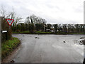
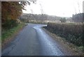
Road junction near Lymington
by Malc McDonald
geograph for square SZ3294
A junction of minor roads on the outskirts of Lymington, in Hampshire. The post... (more)
|
|
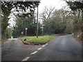
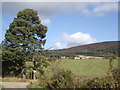
Road junction near Lymington
by Malc McDonald
geograph for square SZ3294
The junction of Woodside Lane to the left and Viney Road to the right, on the... (more)
|
|
Road junction near South Cerney
by Malc McDonald
geograph for square SU0497
A road junction close to South Cerney in Gloucestershire. The road ahead forms... (more)
|
|
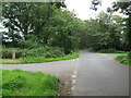
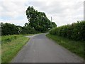
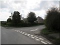
Road junction near Speldhurst
by Malc McDonald
geograph for square TQ5541
A junction of minor roads in countryside near Tunbridge Wells in Kent.
|
|
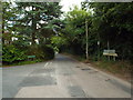
Country lanes near Otford
by Malc McDonald
geograph for square TQ5560
A junction of country lanes in Kent countryside, near Otford.
|
|
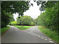
Road junction near Speldhurst
by Malc McDonald
geograph for square TQ5541
A junction of minor roads in countryside near Tunbridge Wells in Kent.
|
|
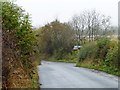
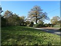
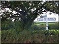
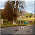
Road junction near Meesden
by Malc McDonald
geograph for square TL4332
A junction of minor roads near the village of Meesden, in north Hertfordshire/
|
|
Road junction in Arford, near Bordon
by Malc McDonald
geograph for square SU8236
A junction of minor roads in the village of Arford, in the county of Hampshire.
|
|
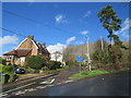
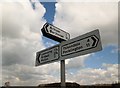
Bury Road, Branksome Park, near Poole
by Malc McDonald
geograph for square SZ0590
Bury Road in Branksome Park, a suburb of Poole.
The signs indicate that this... (more)
|
|
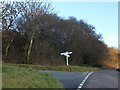
Road junction near Shoreham
by Malc McDonald
geograph for square TQ5162
A country lane junction near the Kent village of Shoreham.
|
|
Road junction near Shoreham
by Malc McDonald
geograph for square TQ5162
The junction of Castle Farm Road and Cockerhurst Road, in woodland in Kent.
|
|
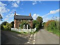
Corner House, Romney Street, near Otford
by Malc McDonald
geograph for square TQ5561
Corner House in Romney Street, a small hamlet in Kent countryside.
|
|
Blackmore Road, Hook End, near Doddinghurst
by Malc McDonald
geograph for square TQ5899
Blackmore Road at its junction with Hook End Road and Outings Lane, at Hook End... (more)
|
|
Road junction near Crowcombe
by Malc McDonald
geograph for square ST1638
A traditional signpost stands at a junction of minor roads at Dead Woman's... (more)
|
|
High Street, Shoreham
by Malc McDonald
geograph for square TQ5162
This rural road leading into the village of Shoreham is the high street.
|
|
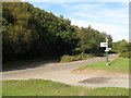
Minor road junction SW of Talgarth
by Jaggery
geograph for square SO1433
70 metres west of the B4560, there is a junction along this minor road.
Left... (more)
|
|
Church Road, Chelsfield
by Malc McDonald
geograph for square TQ4763
This image was taken at the junction of Church Road, Chelsfield Hill and Worlds End Lane.
|
|
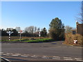
Junction of White House and Park Lanes
by Christine Johnstone
geograph for square NZ2222
Straight on [north] for White House Farm, right [east] for Park House.
|
|
Junction of Walsham Road and Kiln Lane
by Christine Johnstone
geograph for square TL9670
Looking west. A 41 metre spot height.
|
|
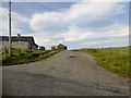
Road to High Cocklaw
by Barbara Carr
geograph for square NT9454
Minor road junction with attractive farm-sign.
|
|
Junction on Walsham Road
by Christine Johnstone
geograph for square TL9770
A smaller lane runs south at Hillwatering Farm.
|
|
Tip's Cross, near Doddinghurst
by Malc McDonald
geograph for square TL5800
Tip's Cross is a crossroads in the Essex countryside, near Ongar. A... (more)
|
|
Junction at Hawkbarrow Cottage
by Graham Robson
geograph for square NY1004
The junction of the track leading to Hawkbarrow Cottage and the minor road... (more)
|
|
Junction of the bridleway and Wighill Lane
by Christine Johnstone
geograph for square SE4948
A grass triangle makes access to Healaugh Grange easier, at a sharp bend.
|
|
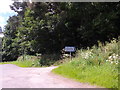
Minor Road To Aultivullin
by Rude Health
geograph for square NC8267
The minor road heads west to Aultivullin from the Strathy Point road.
|
|
Newlands Lane with minor road junction
by Martin Dawes
geograph for square SE9271
The minor road coming in from the left is from Sherburn
|
|
Road junction at Cwm Camlais - uchaf
by John Winder
geograph for square SN9527
This astonishingly dull photograph (well, that's what my wife said upon... (more)
|
|
Minor Rural Road Junction
by David Pashley
geograph for square TG3023
|
|
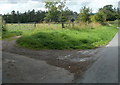
Wide grass verge, Stone Heath
by Christine Johnstone
geograph for square SJ9735
On the south side of the minor road junction.
|
|
Afflochie/Glentrusta Junction
by Stanley Howe
geograph for square NO4862
Off minor road at Balquharn.
|
|
A T-junction of minor roads in Birse hamlet
by Stanley Howe
geograph for square NO5596
With a domestic driveway ahead.
|
|
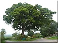
Roadside tree, Celleron
by Christine Johnstone
geograph for square NY4925
What came first, the junction or the tree?
|
|
Farmland at Bovey Cross and its signpost
by David Smith
for square SX7968
The styles of writing on the fingers of the signpost distinguish between the... (more)
|
|
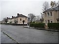
Gelston Street, Shettleston
by Christine Johnstone
geograph for square NS6463
Looking towards the junction with Dalry Street.
|
|
Minor road to East Quartains
by Stanley Howe
geograph for square NJ7800
Off minor road from Burnside Quartains.
|
|
36 metre spot height at a Netherby road junction
by Christine Johnstone
geograph for square SE3346
Where Chapel Hill meets Wharfe Lane.
|
|
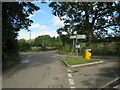
All the information you need at a minor road junction
by Martin Dawes
for square SE7962
|
|
Minor roads junction on Acklam Wold
by Martin Dawes
geograph for square SE7962
|
|
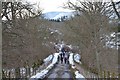
On the minor road from Garvald
by Jim Barton
geograph for square NT1048
Walkers on the road from Garvald approaching the T-junction with the road to... (more)
|
|
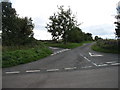
Minor road junction in Pandy
by Jaggery
geograph for square SO3322
Turn left for Llanthony, or ahead on the right for Longtown.
|
|
Bommertown Cross
by David Smith
geograph for square SS8225
A crossroads of minor roads, a short way south of Bommertown Farm. Woodland... (more)
|
|
Junction of minor roads at Mountain Bower
by David Purchase
geograph for square ST8075
For a small hamlet there are a lot of roads meeting here! Three roads cross at... (more)
|
|
Road junction south of Embleton
by Barbara Carr
geograph for square NU2322
Embleton is to the left. The minor road to the right leads to Dunstan Steads.
|
|
Minor road junction west of Felkington
by Barbara Carr
geograph for square NT9344
|
|
Minor roads junction
by Stanley Howe
geograph for square NJ7906
By Woodsde Cottage, Garlogie.
|
|
Junction for Blairhead
by Stanley Howe
geograph for square NJ6501
Off minor road between Ferretfold and Pitcullen. Coirmoir visible in centre.
|
|
Minor road to Hirn
by Stanley Howe
geograph for square NJ7601
From the Couper's Road junction.
|

|
Junction for West Coldstream
by Stanley Howe
geograph for square NJ7700
Off minor road from Burnside Quatrains.
|