|
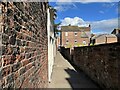
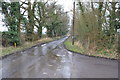
Long Lane, Carlisle
by Adrian Taylor
geograph for square NY3956
Long Lane is a public footpath connecting Castle Street and Fisher Street in Carlisle.
|
|
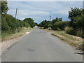
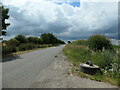
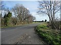
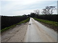
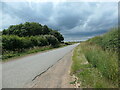
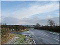
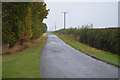
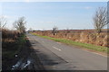
Long Lane heading east from Stocks Heath Lane
by Christine Johnstone
geograph for square SK9851
Towards Ermine Street and Brauncewell.
|
![NZ4308 : Long Lane [2] by Christine Johnstone](https://s0.geograph.org.uk/geophotos/04/41/60/4416072_e79f6989_120x120.jpg)
|
Long Lane [2]
by Christine Johnstone
geograph for square NZ4308
Heading south-west to Picton. There is a 49 metre spot height at the bend.
|
![NZ4308 : Long Lane [1] by Christine Johnstone](https://s1.geograph.org.uk/geophotos/04/41/60/4416061_0e1f5adb_120x120.jpg)
|
Long Lane [1]
by Christine Johnstone
geograph for square NZ4308
Heading north-east to the A67.
|
|
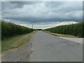
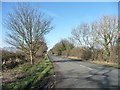
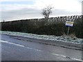
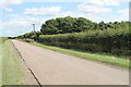
59 metre spot height on Long Lane, east of Brompton
by Christine Johnstone
geograph for square SE3997
Looking north at the entrance to Low Moor. This is a former Roman road.
|
|
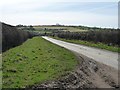
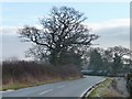
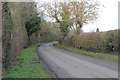
Long Lane, heading west to Leadenham
by Christine Johnstone
geograph for square SK9651
On Leadenham Heath, under a leaden sky.
|
|
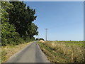
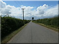
Long Lane heading west from Stocks Heath Farm
by Christine Johnstone
geograph for square SK9851
Crossing Leadenham Heath.
|
|
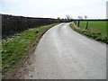
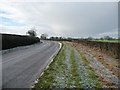
Asymmetric verges on Long Lane, east of Well
by Christine Johnstone
geograph for square SE2781
Space for more bales.
|
|
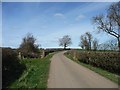
Long Lane, near Low Moor
by Christine Johnstone
geograph for square SE3998
Looking north on this former Roman Road.
|
|
Long Lane, east of Brompton
by Christine Johnstone
geograph for square SE3997
Looking south along this former Roman road.
|
|
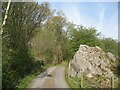
Roadside rock near Pickle Wood
by Adrian Taylor
geograph for square SD2786
The rock outcrop is beside the minor road from Lowick to Kiln Bank which is... (more)
|
|
Long Lane, New Buckenham
by Geographer
geograph for square TM1089
At the junction with Cherry Tree Road
|
|
Long Lane, New Buckenham
by Geographer
geograph for square TM0988
|
|
Long Lane at a 58 metre spot height
by Christine Johnstone
geograph for square NZ3800
Diverting sharply westwards from the route of a Roman road, which it had been... (more)
|
|
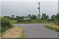
Long Lane, heading east
by Christine Johnstone
geograph for square SE5635
There is an 8 metre spot height at the crossroads.
|
|
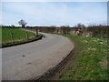
Long Lane, Cawood Common
by Christine Johnstone
geograph for square SE5635
Heading west from Broad Lane.
|
|
Long Lane, heading south towards Whorlton Nook
by Christine Johnstone
geograph for square NZ3800
South from here it is both the route of a Roman road and a parish boundary.
|
|
Reepool Bridge, from the south
by Christine Johnstone
geograph for square SE3899
Carrying Long Lane over Ing Beck. A crossing known to the Romans, but not in this form.
|
|
Looking south from a passing place on Long Lane
by Christine Johnstone
geograph for square SE3998
A former Roman road.
|
|
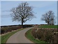
Long Lane approaching Willow Farm from the west
by Christine Johnstone
geograph for square SJ4861
With a beautiful winter tree near the bend.
|
|
Trees at a bend in Long Lane
by Christine Johnstone
geograph for square SJ4861
Looking westwards.
|
|
Long Lane, looking west
by Christine Johnstone
geograph for square SJ4961
The asymmetric verge is as wide as the road.
|
|
Long Lane
by Julian P Guffogg
geograph for square TQ7748
At the time the picture was taken there were large amounts of water running down... (more)
|
|
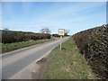
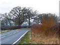
Long Lane, Leadenham Heath
by Christine Johnstone
geograph for square SK9751
Heading west towards Leadenham.
|
|
Long Lane, Brauncewell
by Christine Johnstone
geograph for square TF0051
Heading west from a 57 metre spot height.
|
|
Tree alongside Long Lane
by Christine Johnstone
geograph for square SE3899
Just north of Reepool Bridge.
|
![SE3898 : One train may follow another [2] by Christine Johnstone](https://s3.geograph.org.uk/geophotos/04/41/31/4413139_c2d18fa8_120x120.jpg)
|
One train may follow another [2]
by Christine Johnstone
geograph for square SE3898
Southbound train at the Long Lane level crossing, three minutes after... (more)
|
![SE3898 : One train may follow another [1] by Christine Johnstone](https://s0.geograph.org.uk/geophotos/04/41/31/4413136_f56685f4_120x120.jpg)
|
One train may follow another [1]
by Christine Johnstone
geograph for square SE3898
Northbound train at the Long Lane level crossing. This is the line between... (more)
|
|
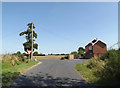
Turn left for Hargrave
by Christine Johnstone
geograph for square SJ4961
Junction of Long Lane and Mill Lane, north of Higher Huxley Hall. Also a 24... (more)
|
|
Warning! CCTV surveillance zone, Long Lane
by Christine Johnstone
geograph for square SJ4961
The lane has a wide verge on the north side. There must have been a problem with... (more)
|
|
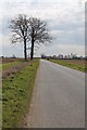
Bend in Long Lane
by J.Hannan-Briggs
geograph for square SK8553
|
|
Junction on Long Lane
by J.Hannan-Briggs
geograph for square SK7875
Left for East Drayton.
|

|
Long Lane
by J.Hannan-Briggs
geograph for square SK8035
Facing south west.
|
|
Long Lane towards Ingham
by Julian P Guffogg
geograph for square SK9383
|
|
Woodland along Long Lane
by J.Hannan-Briggs
geograph for square SK9751
|
|
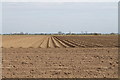
Furrows off Long Lane
by J.Hannan-Briggs
geograph for square TF2922
|
|
Long Lane
by J.Hannan-Briggs
geograph for square TF2922
Coming from Moulton.
|
|
Long Lane
by J.Hannan-Briggs
geograph for square SK6355
|
![SK4645 : Bridge 25 from Shipley Lock [no 72] by Christine Johnstone](https://s3.geograph.org.uk/geophotos/06/18/52/6185259_dee639fc_120x120.jpg)
|
Bridge 25 from Shipley Lock [no 72]
by Christine Johnstone
geograph for square SK4645
Carrying Long Lane [a public bridleway] over the Erewash Canal.
|