
|
Mill Lane, Creeting St.Mary
by Geographer
geograph for square TM0856
At Mill Lane Bridge
|

|
Mill Lane, Barham
by Geographer
geograph for square TM1451
At the junction with Mill Lane & Cooper's Road
|

|
Mill Lane & Mill Lane Bridge over the A1120
by Geographer
geograph for square TM0658
|

|
Mill Lane, Creeting St.Mary
by Geographer
geograph for square TM0856
Approaching Mill Lane Bridge
|

|
Mill Lane junction with Rampton Lane
by Julian P Guffogg
geograph for square SK7881
Mill Lane continues as a track.
|

|
Subscription Mill, Mill lane
by J.Hannan-Briggs
geograph for square SK8880
A tower mill from 1801. The white wooden cap is a modern fibreglass copy. Grade II listed.
|

|
Shopping Precinct off Mill Lane, Bromsgrove
by Oliver Mills
geograph for square SO9670
A widened side street off the High Street, following the alignment of Mill Lane... (more)
|

|
3 metre spot height on Mill Lane
by Christine Johnstone
geograph for square SE8128
Looking north from the junction with Bennetland Lane.
|

|
Crossroads on the south side of Hambleton
by Christine Johnstone
geograph for square SE5530
Mill Lane, Haugh Lane, Field Lane and Gateforth Lane meet at a 12 metre spot height.
|

|
Mill Lane, Hambleton, looking westwards
by Christine Johnstone
geograph for square SE5530
Skirting the edge of the village. Ferrybridge power station is on the horizon,... (more)
|

|
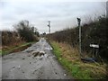
Mill Lane, south-east of Hargrave
by Christine Johnstone
geograph for square SJ4961
Heading north from the junction with Long Lane.
|
|
The original Mill Lane, near Rawcliffe
by Christine Johnstone
geograph for square SE6722
Running south-east from the A614 near Hazel Bank Farm, now bisected by the... (more)
|

|
Mill Lane, Baylham
by Geographer
geograph for square TM1152
Near Baylham Mill
|

|
Trees on Mill Lane
by J.Hannan-Briggs
geograph for square SK1833
The lane leads to Foston Mill Farm.
|

|
Mill Cottage, Mill Lane, Mill Hill, Cayton
by Christine Johnstone
geograph for square TA0683
So completely converted that it looks like a homage to a windmill, rather than a... (more)
|
|
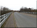
Mill Lane Bridge over the A1120
by Geographer
geograph for square TM0658
At the junction with Creeting Road East
|

|
Mill Lane & Bridge
by Geographer
geograph for square TM0856
|

|
Mill Lane towards Caunton
by J.Hannan-Briggs
geograph for square SK7360
The Mill can be seen on the right.
|

|
Junction of Castle Dyke Lane and Mill lane
by J.Hannan-Briggs
geograph for square TF2353
|

|
Mill Lane Mews, Ashby-de-la-Zouch
by Oliver Mills
geograph for square SK3516
Converted to shops and businesses in the late 1970s. With all shops currently... (more)
|

|
Mill Lane, Kearby
by Christine Johnstone
geograph for square SE3446
Heading north from Chapel Hill towards Bodrum Hill.
|
|
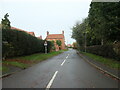
Mill Lane, Normanton on Trent
by Christine Johnstone
geograph for square SK7969
Once leading to Normanton windmill. Now lined with new houses and leading to the... (more)
|

|
Church Lane, Creeting St.Mary
by Geographer
geograph for square TM0956
This road used to continue to the junction with Mill Lane & Jack's... (more)
|

|
Mill Lane
by J.Hannan-Briggs
geograph for square SK9018
Towards Fosse Lane.
|

|
Junction of Mill Lane and Woodgate Lane
by J.Hannan-Briggs
geograph for square SK8855
There are rifle ranges beyond the gate, hence the yellow sign.
|

|
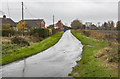
Mud on a corner of Mill Lane
by J.Hannan-Briggs
geograph for square TF4778
Near Glebe Farm.
|
|
Mill Lane
by Julian P Guffogg
geograph for square SK8192
Towards West Wharton Farm.
|

|
Mill Lane, Creeting St.Peter
by Geographer
geograph for square TM0757
Near Clamp Farm
|

|
Mill Lane
by Julian P Guffogg
geograph for square SK8954
Towards Brant Broughton.
|

|
Mill Lane west of South Witham
by J.Hannan-Briggs
geograph for square SK9118
|

|
Mill Lane
by J.Hannan-Briggs
geograph for square TF0434
|

|
Mill Lane towards Welton
by J.Hannan-Briggs
geograph for square TF0282
|

|
Mill Lane
by J.Hannan-Briggs
geograph for square TF0987
Smith's Top Farm in the distance
|

|
Mill Lane facing north
by J.Hannan-Briggs
geograph for square TF4664
|

|
Mill Lane, near Irby in the Marsh
by J Hannan
geograph for square TF4664
Heading north.
|

|
Mill Lane, Baylham
by Geographer
geograph for square TM1152
|

|
Mill Lane, Stowupland
by Geographer
geograph for square TM0658
|

|
Mill Lane, Weybread
by Geographer
geograph for square TM2480
At the entrance to Weybread Lakes Lodges
|

|
Mill Lane, Needham
by Geographer
geograph for square TM2281
|

|
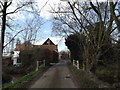
Bridge on Mill Lane
by Geographer
geograph for square TM2281
|
|
Mill Lane, Needham
by Geographer
geograph for square TM2281
|

|
Path & Mill Lane
by Geographer
geograph for square TM2281
|

|
Mill Lane, Needham
by Geographer
geograph for square TM2281
|

|
Mill Lane, Needham
by Geographer
geograph for square TM2281
|

|
Mill Lane
by J.Hannan-Briggs
geograph for square TF5077
Facing east.
|
|
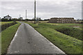
Straw Bales off Mill Lane
by J.Hannan-Briggs
geograph for square TF5177
Close to the old railway track.
|

|
Mill Lane
by J.Hannan-Briggs
geograph for square TF5566
|

|
Mill Lane becomes a track
by J.Hannan-Briggs
geograph for square SK6426
Towards Willoughby Lodge.
|
|
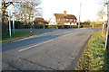
Junction of Pluckley Road and Mill Lane
by Julian P Guffogg
geograph for square TQ8842
|

|
Oast house on Mill Lane
by Julian P Guffogg
geograph for square TQ8041
|
