Public Tags
Tag: Langdale·Pikes
Other tags: mountain:Langdale Pikes
place:Langdale Pikes
Showing latest 50 of 56 images tagged with Langdale Pikes tag.

|
Blea Tarn on a sunny and calm September afternoon
by Rich Tea geograph for square NY2904 Looking north across Blea Tarn, with the Langdale Pikes in the distance to the... (more)
Tags:
Blea Tarn
type:Geograph
subject:Lake
top:Lakes, Wetland, Bog
place:Langdale Pikes
top:Rocks, Scree, Cliffs
Side Pike (Cumbria)
top:Uplands
|

|
Looking down Great Langdale, from the path to Crinkle Crags
by Christopher Hilton for square NY2705 Across the valley, the Langdale Pikes: Pike of Stickle on the extreme left,... (more)
Tags:
Dale
Glacial Valley
near:Great Langdale
place:Lake District
Lake District
Langdale Pikes
Mountains
top:Rocks, Scree, Cliffs
U Shaped Valley
U-Shaped Valley
top:Uplands
Valley
|

|
The Langdale Pikes from above High Arnside
by Adrian Taylor geograph for square NY3301 Tags:
Cumbria
type:Geograph
Lake District
place:Langdale Pikes
Langdale Pikes
Lingmoor Fell
place:Little Langdale
Little Langdale
subject:Mountain
top:Rocks, Scree, Cliffs
The Lake District National Park
top:Uplands
|
|
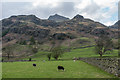
Langdale Pikes
by Ian Capper geograph for square NY2906 Looking up to the Langdale Pikes from the floor of Great Langdale.
|

|
Great Langdale, from the road over to Blea Tarn
by Christopher Hilton geograph for square NY2805 Top right, Pike o' Stickle and Gimmer Crag, the western Langdale Pikes.
Tags:
Glacial Valley
place:Great Langdale
Great Langdale
national park:Lake District
Lake District
place:Lake District
Langdale Pikes
Mountains
U Shaped Valley
U-Shaped Valley
top:Uplands
|

|
Langdale Pikes
by Ian Capper for square NY2807 A telephoto view of the Langdale Pikes from Wray Castle, with Pike of Stickle on... (more)
Tags:
type:Cross Grid
place:Harrison Stickle
place:Langdale Pikes
place:Pavey Ark
place:Pike of Stickle
top:Uplands
place:Wray Castle
|

|
The Langdale Pikes seen from the Band
by Graham Robson for square NY2707 Looking towards the Langdale Pikes, which tower steeply above Great Langdale,... (more)
|

|
View to the Langdale Pikes
by Philip Halling geograph for square NY2903 View to the Langdale Pikes from near The Mound in Little Langdale.
|

|
View to the Langdale Pikes
by Philip Halling geograph for square NY2903 View to the Langdale Pikes from near The Mound in Little Langdale.
|

|
The Langdale Pikes
by Philip Halling for square NY2904 The Langdale Pikes viewed from near Fell Foot in Little Langdale.
|

|
Looking down the path up Crinkle Crags from Great Langdale
by Christopher Hilton geograph for square NY2604 The little rocky outcrop in the front foreground is Markeens. Back right, Pike... (more)
|
|
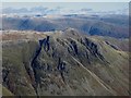
The Langdale Pikes
by Graham Robson for square NY2707 Looking towards the Langdale Pikes from the summit of Bowfell. Numerous Lake... (more)
|

|
Belle Grange and Langdale Pikes
by Gerald England for square SD3898 Viewed from Windermere. In the background, the Langdale Pikes in NY2707 are... (more)
|
|
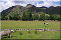
Sheep grazing, Great Langdale
by Ian Taylor geograph for square NY2906 In the valley bottom near Side House. The Langdale Pikes are in the background,... (more)
Tags:
top:Farm, Fishery, Market Gardening
subject:Farming
Fells
Flat Valley
type:Geograph
Grazing Sheep
Great Langdale
Langdale Pikes
|

|
Sheep grazing, Great Langdale
by Ian Taylor geograph for square NY2906 In the valley bottom. The Langdale Pikes are in the background, with Harrison... (more)
Tags:
top:Farm, Fishery, Market Gardening
subject:Farming
Fells
Flat Valley
type:Geograph
Grazing Sheep
Great Langdale
Langdale Pikes
|

|
Towards Rossett Pike
by Ian Capper geograph for square NY2407 Looking towards Rossett Pike from near Angle Tarn, with the Langdale Pikes in... (more)
|

|
Great Langdale from below Lingmoor Tarn
by Ian Taylor geograph for square NY3005 The Langdale Pikes dominate the view.
|

|
Pike o'Stickle from Harrison Stickle, 1960
by Alan Murray-Rust for square NY2707 I recall that I and my elder brother climbed up from Langdale past Stickle Tarn,... (more)
Tags:
type:Cross Grid
Fells
place:Lake District
Langdale Pikes
top:Moorland
Pike O Stickle
top:Rocks, Scree, Cliffs
top:Uplands
|

|
Looking down Browney Gill to the Langdale Pikes
by Christopher Hilton geograph for square NY2604 Descending from the left in the middle distance is The Band, the long ridge... (more)
Tags:
Dale
near:Great Langdale
place:Lake District
Lake District
Langdale Pikes
Mountains
top:Uplands
Valley
|

|
Near summit of Lingmoor Fell
by Andrew Hill geograph for square NY3004 Category: Mountains Icy pool near summit of Lingmoor Fell. Langdale Pikes in the background.
|

|
Blea Tarn and the Langdale Pikes
by Rich Tea geograph for square NY2904 Tags:
Blea Tarn
type:Geograph
subject:Lake
top:Lakes, Wetland, Bog
place:Langdale Pikes
Side Pike (Cumbria)
top:Uplands
|
|
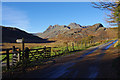
Side Gates
by Ian Taylor geograph for square NY2904 The road by Blea Tarn, with Side Pike (right) and the Langdale Pikes in the... (more)
|

|
Loughrigg Tarn
by Ian Taylor geograph for square NY3404 A classic view of the Langdale Pikes (centre right), with Bowfell on the left.
|

|
Mickleden
by Ian Capper for square NY2606 Looking down on Mickleden from the top of Rossett Gill, with the Langdale Pikes... (more)
|
|
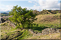
Above Tarn Hows
by Ian Capper geograph for square NY3300 A tree and drystone wall above Tarn House, with the Langdale Pikes in the left background.
|
|
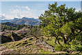
Above Tarn Hows
by Ian Capper geograph for square NY3300 A drystone wall above Tarn House, with the Langdale Pikes in the background.
|
|
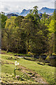
Narcissus, Tarn Hows
by Ian Capper geograph for square SD3299 A Narcissus in flower above Tarn Hows, with the unmistakable profile of the... (more)
Tags:
place:Langdale Pikes
Narcissus
place:Tarn Hows
top:Uplands
top:Wild Animals, Plants and Mushrooms
|
|
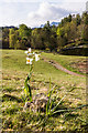
Narcissus, Tarn Hows
by Ian Capper geograph for square SD3299 A Narcissus in flower above Tarn Hows, with the unmistakable profile of the... (more)
Tags:
place:Langdale Pikes
Narcissus
place:Tarn Hows
top:Uplands
top:Wild Animals, Plants and Mushrooms
|

|
Lingmoor Tarn
by Ian Taylor geograph for square NY3005 Frozen, but not solid. The Langdale Pikes form the skyline.
|

|
Lingmoor Tarn
by Ian Taylor geograph for square NY3005 Frozen, but not solid. The Langdale Pikes are in the background.
|

|
Brown How, Lingmoor Fell
by Ian Taylor geograph for square NY3004 Looking NW from Brown How (highest point), to the Langdale Pikes.
|

|
River Brathay and Elter Water
by Ian Taylor geograph for square NY3303 An autumnal view looking across the river and lake towards the Langdale Pikes.
Tags:
Elterwater
top:Lakes, Wetland, Bog
Langdale Pikes
subject:River
River Brathay
top:Rivers, Streams, Drainage
|

|
River Brathay
by Ian Taylor geograph for square NY3303 An autumnal view looking across the river towards the Langdale Pikes.
|

|
View of the Langdale Pikes and Pavey Ark
by Norman Caesar geograph for square NY3304 |

|
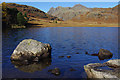
Small Tarn on Lingmoor Fell
by Ian Taylor geograph for square NY3004 On the west side above Birk Knott. In the background are Crinkle Crags (left),... (more)
|
|
Blea Tarn
by Ian Taylor geograph for square NY2904 A classic view with the Langdale Pikes in the background.
Tags:
Blea Tarn
Boulders
top:Lakes, Wetland, Bog
Langdale Pikes
top:Rocks, Scree, Cliffs
top:Uplands
|

|
Langdale Pikes from Skelwith Fold
by Christopher Hilton geograph for square NY3402 Tags:
national park:Lake District
Lake District
place:Lake District
Langdale Pikes
Mountains
top:Uplands
|

|
On Windermere
by Gerald England geograph for square SD3998 Looking towards the Langdale Pikes which have a light covering of snow.
|

|
Looking north from Wetherlam to the Langdale Pikes
by Christopher Hilton geograph for square NY2901 |

|
Tarn near Holme Ground
by Andrew Hill geograph for square NY3101 Category: Mountains Small tarn north of Holme Fell on lovely day with lingering autumn colours.... (more)
|

|
Blea Tarn View
by Gordon Griffiths geograph for square NY2904 The view across the Blea Tarn with the Langdale Pikes in the background.
|

|
Blea Tarn Scene
by Gordon Griffiths geograph for square NY2904 The view across the Blea Tarn with the Langdale Pikes in the background.
Tags:
Blea Tarn
type:Geograph
Lake
Lake District
top:Lakes, Wetland, Bog
Langdale Pikes
subject:Mountainside
|

|
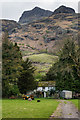
Wray Castle parkland
by Ian Capper geograph for square NY3701 Parkland at Wray Castle with the Langdale Pikes in the background.
|
|
Rossett
by Ian Capper geograph for square NY2906 17th century grade II listed farmhouse - see... (more)
Tags:
top:Farm, Fishery, Market Gardening
Grade II Listed
place:Harrison Stickle
top:Housing, Dwellings
place:Langdale Pikes
Rossett
top:Uplands
|

|
Late afternoon sun above Wise Een Tarn
by Christopher Hilton geograph for square SD3797 On the horizon: at the left, Wetherlam, and on the right the unmistakeable... (more)
Tags:
Drystone Wall
top:Farm, Fishery, Market Gardening
Fields
Gate
Lake District
national park:Lake District
place:Lake District
top:Lakes, Wetland, Bog
Langdale Pikes
Mountains
Sunset View
top:Uplands
|

|
Tarn Hows: the Langdale Pikes in the distance
by Christopher Hilton geograph for square SD3299 Tags:
national park:Lake District
Lake District
place:Lake District
top:Lakes, Wetland, Bog
Langdale Pikes
Mountains
Tarn
Tarn Hows
top:Uplands
|

|
Langdale Pikes from Skelwith Fold, sunset
by Christopher Hilton geograph for square NY3402 Tags:
top:Farm, Fishery, Market Gardening
place:Lake District
national park:Lake District
Lake District
Langdale Pikes
Mountains
Sheep
top:Uplands
top:Woodland, Forest
|

|
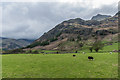
Lane to the New Dungeon Ghyll Hotel
by Graham Robson geograph for square NY2906 The short lane leading to the New Dungeon Ghyll Hotel and a small collection of... (more)
Tags:
type:Geograph
top:Geological Interest
Langdale
mountain:Langdale Pikes
top:Roads, Road Transport
|
|
Great Langdale
by Ian Capper geograph for square NY2906 Harrison Stickle in the right background and the valley of Mickleden on the left.
Tags:
top:Farm, Fishery, Market Gardening
place:Great Langdale
place:Harrison Stickle
place:Langdale Pikes
place:Mickleden
top:Uplands
|

|
View down into Great Langdale from Crinkle Crags
by Christopher Hilton for square NY2504 Tags:
Dale
Glacial Valley
near:Great Langdale
place:Lake District
Lake District
Langdale Pikes
Mountains
U Shaped Valley
U-Shaped Valley
top:Uplands
Valley
|
