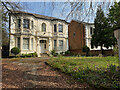
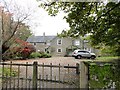
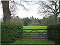
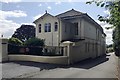
![SE3339 : Shadwell Park [8] by Christine Johnstone](https://s3.geograph.org.uk/geophotos/03/04/49/3044935_e2041a65_120x120.jpg)
|
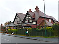
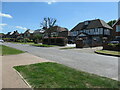
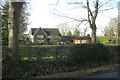
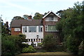
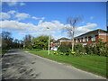
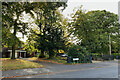
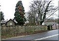
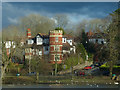
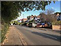
Shadwell Park [8]
by Christine Johnstone
geograph for square SE3339
Large detached houses on Shadwell Park Drive.
|
|
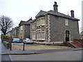
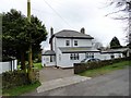
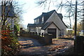
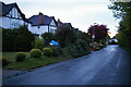
Large House in Berkswell
by Nigel Mykura
geograph for square SP2477
This apparently modern large detached house on the south side of Station Road... (more)
|
|
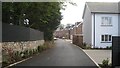
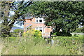
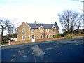
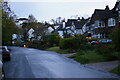
Large detached house on Charlton Road
by Christine Johnstone
geograph for square ST6374
With a back garden development behind it.
|
|
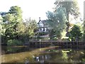
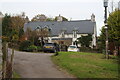
Very large detached house off Kenilworth Road, Coventry
by Robin Stott
geograph for square SP3074
There are many such properties especially on the west side of Kenilworth Road.... (more)
|
|
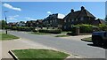
The south side of Brookmans Avenue
by Christine Johnstone
geograph for square TL2404
One of the earliest roads in Brookmans Park, a commuting village developed in... (more)
|
|
Houses on the south side of Brookmans Avenue
by Christine Johnstone
geograph for square TL2404
One of the earliest roads in Brookmans Park, a commuting village developed in... (more)
|
|
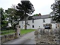
Stobilee House, Dipton
by Robert Graham
geograph for square NZ1553
Large detached house on the lane which leads west from North Road to The Avenue.... (more)
|
|
Amberley Gardens, Kingsteignton
by Robin Stott
geograph for square SX8673
A development of large detached houses off Broadway Road, on the site of an... (more)
|
|
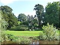
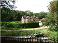
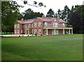
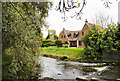
Moreby Hall, from the River Ouse
by Christine Johnstone
geograph for square SE5943
Grade 2* listed, built 1828-33. Apparently on sale for £2.5m [down from £2.8m in 2014].
|
|
Lantern House, Chessetts Wood Road
by Robin Stott
geograph for square SP1872
Chessetts Wood Road is characterised by large detached houses, some behind high... (more)
|
|
Canalside house, Salwarpe
by Christine Johnstone
geograph for square SO8761
The Droitwich Barge Canal towpath here forms part of the Monarch's Way.
|
|
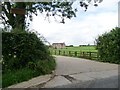
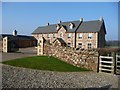
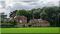
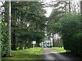
Entrance to Church Farm
by Christine Johnstone
geograph for square SP9595
On the west side of the road from Laxton to Bulwick.
|
|
Villa for sale, Warwick New Road, Royal Leamington Spa
by Robin Stott
geograph for square SP3065
This type of large detached house is typical of older parts of Leamington.
|
|
Villa, Warwick New Road, Royal Leamington Spa
by Robin Stott
geograph for square SP3065
This type of large detached house is typical of older parts of Leamington.
|
|
Dulwich Wood Avenue, Crystal Palace
by Robin Stott
geograph for square TQ3371
A wide street of large detached houses seen from Farquhar Road.
|
|
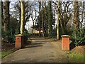
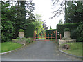
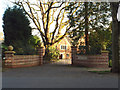
Top of the drive to Barrells Park, Ullenhall Lane
by Robin Stott
geograph for square SP1266
The view through the gates. Barrells Park appears to be a single large detached... (more)
|
|
Entrance to Barrells Park, Ullenhall Lane
by Robin Stott
geograph for square SP1266
Barrells Park appears to be a single large detached house in extensive grounds.
|
|
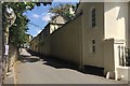
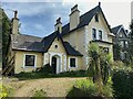
Rear of house, Clevedon Road, Beechwood
by M J Roscoe
geograph for square ST3388
Detached house on west side of road.
|
|
Burwain Hall in 2017
by Christine Johnstone
geograph for square NY6420
|
|
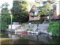
House with a floating landing stage
by Christine Johnstone
geograph for square SO8457
On the east bank of the Severn, at the western end of Chacewater Avenue.
|
|
New house, built to look old
by Christine Johnstone
geograph for square SO9161
Between the Worcester and Birmingham Canal and Hazel Wood, near Shernal Green.... (more)
|
|
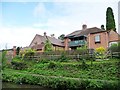
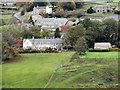
Detached houses on the north side of South Side
by Martin Dawes
geograph for square TA0564
|
|
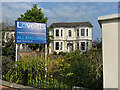
The Mews, The Park, Blaenavon
by M J Roscoe
for square SO2508
Detached house on private road.
|
|
Moorlands, Goldcliff Road
by M J Roscoe
geograph for square ST3583
Detached house in the countryside.
|
|
House with long landing stage, Park View Terrace
by Christine Johnstone
geograph for square SO8456
On the east bank of the Severn. Seen from a narrowboat heading upstream.
|
|
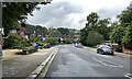
North end of Walmley Road, Sutton Coldfield
by Robin Stott
geograph for square SP1395
Big detached houses sit in big gardens behind a broad strip of mature trees a... (more)
|
|
Large building near Cothill School
by Vieve Forward
geograph for square SU4699
Possibly part of the school.
|
|
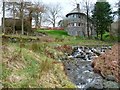
Ford on the old road, across Rigg Beck
by Christine Johnstone
geograph for square NY2320
Looking upstream from the footbridge. The old road is this side of the house,... (more)
|
|
Edmundbyers House from the south
by Robert Graham
geograph for square NZ0149
A view of the west side of Edmundbyers village from the Muggleswick road.... (more)
|
|
Edmundbyers House
by Robert Graham
geograph for square NZ0149
A large private property on the south side of the village. This started out as a... (more)
|
|
Glebe House
by Trevor Littlewood
geograph for square SJ7286
Glebe House is a large residence in the small settlement of Little Bollington;... (more)
|
|
Elm Park House
by Robert Graham
geograph for square NZ1053
Large house over the road from the farm of the same name near Shotley Bridge.... (more)
|
|
Large house on Manor Road, Medomsley
by Robert Graham
geograph for square NZ1254
This is called Stewards House, which suggests it had some importance at one... (more)
|
|
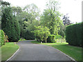
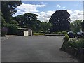
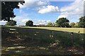
Tended grounds near the Grange, by Mill Lane, Kingswood
by Robin Stott
geograph for square SP1871
The building glimpsed through the trees is a large property called The Terets,... (more)
|
|
Large house east of church in Cannich
by Trevor Littlewood
geograph for square NH3431
The house lies on the north side of the A831 in Cannich; it's east of the... (more)
|
|
Red House
by Trevor Littlewood
geograph for square NZ3543
The large, apparently Victorian house lies to the east of buildings at Elmore... (more)
|
|
Large house on east side of River Witham
by Trevor Littlewood
geograph for square SK9237
The river is flowing north, downstream, past the house which is named River View.
|
|
Allensford Hall
by Robert Graham
geograph for square NZ0750
Large house beside the A68 on the eastern side of the bridge over the River Derwent.
|
|
West Common Road, Hayes, evening
by Christopher Hilton
geograph for square TQ4065
|
|
West Common Road, Hayes, evening
by Christopher Hilton
geograph for square TQ4065
|
|
Rhyswg Fawr Farm
by M J Roscoe
geograph for square ST2294
Large house on private rural road.
|
|
Large house overlooking Roath Park lake
by Robin Drayton
geograph for square ST1879
At the junction of Lake Road East with Cefn-Coed Road.
|
|
The drive to The Terets, Rising Lane, Kingswood
by Robin Stott
geograph for square SP1872
If you have the money you can buy space, privacy and seclusion with one of the... (more)
|
|
Lendrick: the Forder Lane frontage, Bishopsteignton
by Robin Stott
geograph for square SX9073
Lendrick is one of the large houses along Forder Lane. Residents looked out over... (more)
|
|
Huntly: parking and a glimpse of the gardens, Forder Lane, Bishopsteignton
by Robin Stott
geograph for square SX9073
The Bishopsteignton village website... (more)
|
|
Huntly: the Forder Lane frontage, Bishopsteignton
by Robin Stott
geograph for square SX9073
The Bishopsteignton village website... (more)
|
|
Roof of a private house north of Preston Bagot church
by Robin Stott
geograph for square SP1766
An aerial photo shows an isolated large property among immaculate grounds... (more)
|
|
Four Oaks House and entrance, Ladywood Road, Four Oaks Park, Sutton Coldfield
by Robin Stott
geograph for square SP1197
One of many large houses in mature grounds along Ladywood Road.
|
|
The Cottage, 197 Church Road, Upper Norwood
by Robin Stott
geograph for square TQ3370
This 'cottage' is one of many large villas in Church Road.
Photo... (more)
|
|
Large houses, Penns Lane, Birmingham
by Robin Stott
geograph for square SP1393
Penns Lane drops down into the valley of the Plants Brook.
|