Public Tags
Tag: Long·Bridge
Other tags: bridge:Long Bridge
Showing images tagged with Long Bridge tag.
|
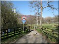
The approach to Long Bridge
by Adrian Taylor geograph for square NY2523 Formerly the A594 road before Portinscale was by-passed, the original Long... (more)
Tags:
road:A594
sign:Cyclists Dismount
Cyclists Dismount Sign
type:Geograph
bridge:Long Bridge
No Motorcycles Sign
subject:Path
top:Paths
near:Portinscale
Public Footpath
river:River Derwent
The Cumbria Way
ldp:The Cumbria Way
long distance path:The Cumbria Way
|

|
Slipway and Long Bridge
by Ian Capper geograph for square SS5632 Slipway off Taw Vale with Long Bridge over the River Taw in the background.... (more)
|

|
Dolphin lamp standard and Long Bridge
by Ian Capper geograph for square SS5532 One of a series of dolphin lamp standards along Taw Vale (this one without its... (more)
|
|
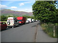
The old A594 near Long Bridge
by Adrian Taylor geograph for square NY2523 Prior to the construction of Portinscale by-pass, this was the main A594 road... (more)
Tags:
road:A594
Cumbria
type:Geograph
near:Keswick
Lake District
Long Bridge
Old Road
Parked Vehicles
near:Portinscale
subject:Road
top:Roads, Road Transport
|

|
Dolphin lamp standard and Long Bridge
by Ian Capper geograph for square SS5532 One of a series of dolphin lamp standards along Taw Vale. They probably date... (more)
|

|
Long Bridge
by Ian Capper geograph for square SS5532 Bridge over the River Taw, seen just after sunrise.
Long Bridge originates... (more)
Tags:
place:Barnstaple
top:Estuary, Marine
type:Geograph
Grade I Listed
Long Bridge
River Taw
top:Rivers, Streams, Drainage
top:Roads, Road Transport
|

|
Long Bridge
by Ian Capper geograph for square SS5532 Bridge over the River Taw, seen just after sunrise.
Long Bridge originates... (more)
|

|
Long Bridge, Coggeshall
by Geographer geograph for square TL8422 On the B1024 Bridge Street
Tags:
B Road (Classified B)
B1024
on:B1024 Bridge Street
over:Black Ditch
subject:Bridge
at:Coggeshall
type:Geograph
Long Bridge
top:Roads, Road Transport
top:Village, Rural Settlement
|

|
Dornie and Eilean Donan Castle
by Richard Dorrell for square NG8825 This aerial view shows Eilean Donan Castle on its island at the mouths of Loch... (more)
Tags:
A87
bucket:Aerial
top:Coastal
place:Dornie
place:Eilean Donan Castle
top:Historic Sites and Artefacts
Island
Long Bridge
top:Roads, Road Transport
top:Village, Rural Settlement
|

|
Long Bridge, near Alfriston
by Julian P Guffogg geograph for square TQ5203 |
|
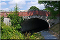
Long Bridge - No. 128, Montgomery Canal
by Phil Champion geograph for square SJ1901 Carrying the B4390.
Tags:
place:Berriew
subject:Canal
Canal Bridge
top:Canals
Long Bridge
canal:Montgomery
Montgomery Canal
National Cycle Network
NCN Route 81
top:Roads, Road Transport
Towpath
|
|
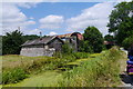
The Montgomery Canal near Berriew Wharf
by Phil Champion geograph for square SJ1900 This was the site of the old Lloyd's Coal Wharf. Currently the workshop of... (more)
Tags:
place:Berriew
Berriew Wharf
subject:Canal
former:Canal Wharf
top:Canals
Long Bridge
canal:Montgomery
National Cycle Network
NCN Route 81
top:Village, Rural Settlement
|
