
|
Footbridge over a brook on the Centenary Way
by Ian Calderwood
geograph for square SK2741
The Centenary Way was devised to celebrate the centenary of the Derbyshire... (more)
|

|
Heading east across an icy field on the Centenary Way
by Ian Calderwood
geograph for square SK2742
The Centenary Way was devised to celebrate the centenary of the now-defunct... (more)
|
|
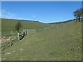
Footpaths crossing, Lang Dale
by Christine Johnstone
geograph for square TA0477
The Centenary Way and the Yorkshire Wolds Way crossing the public footpath... (more)
|
|
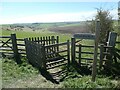
Yorkshire Wolds Way above Lang Dale
by Christine Johnstone
geograph for square TA0477
At a 153 metre spot height. Also on the Centenary Way. The kissing gate has been... (more)
|

|
Looking back down Lang Dale. Footpath junction
by Martin Dawes
geograph for square TA0477
The fingerpost on the other side of the gate is the Wolds Way and Centenary Way crossing
|

|
Field edge footpath back toward Huskit Hill
by Martin Dawes
geograph for square SE6771
This is the route of both the Ebor Way and Centenary Way
|

|
Track toward Howthorpe Farm
by Martin Dawes
geograph for square SE6772
The track is also the route of Ebor Way and Centenary Way
|
|
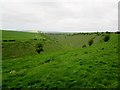
Deep Dale from the footpath above
by Martin Dawes
geograph for square SE8562
The Yorkshire Wolds Way and Centenary Way both enjoy this view
|
|
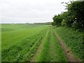
Field track and walking highway
by Martin Dawes
geograph for square SE8462
This is on the route of both the Yorkshire Wolds Way, 79 miles and the Centenary... (more)
|
|
Wharram Percy Farm from North Plantation
by Martin Dawes
for square SE8463
Cross square. A view over the head of Deep Dale to Wharram Percy Farm showing... (more)
|
|
Tree at the junction above Toisland Wold
by Christine Johnstone
geograph for square SE8362
Straight on / west for the Centenary Way, Left / south for the Yorkshire Wolds... (more)
|

|
Plank bridge at a footpath junction
by Ian Calderwood
geograph for square SK2641
The Centenary Way crosses a drain on a single plank at a junction with the... (more)
|

|
Centenary Way on Idlicote Hill
by Derek Harper
for square SP2943
|

|
Houses on Stratford Road, Shipston-on-Stour
by Derek Harper
geograph for square SP2540
Terraced houses on the Centenary Way.
|

|
Houses in Shipston-on-Stour
by Derek Harper
for square SP2540
On Church Street, the A3400. On the left is Cedar Lawn... (more)
|

|
Centenary Way by Hill Clumps
by Derek Harper
geograph for square SP2742
Footpath 195 SS166y/3 runs along the south side of the wood. Meanwhile, the... (more)
|

|
Access road and Centenary Way at Field House Farm
by Martin Dawes
geograph for square TA0876
The farm road curves round to the right, The Centenary Way goes straight ahead... (more)
|

|
Public footpath heading west in Water Dale
by Christine Johnstone
geograph for square SE8461
The grass path, not the chalk track, which is private. The footpath is part of... (more)
|

|
Path on the east side of Court Dale
by Christine Johnstone
geograph for square SE8461
Part of both the Centenary Way and the Chakland Way. Mapped as a public bridleway.
|

|
Centenary Way and Chalkland Way, Court Dale
by Christine Johnstone
geograph for square SE8461
Crossing open access land on the east side of the dale. Mapped as a bridleway.
|

|
Path leading to Middle Woodloes Farm
by Ian S
geograph for square SP2767
|

|
Path leading to Middle Woodloes Farm
by Ian S
geograph for square SP2768
|

|
Path leading to Middle Woodloes Farm
by Ian S
geograph for square SP2768
|

|
Path leading to Middle Woodloes Farm
by Ian S
geograph for square SP2768
|

|
Path leading to Middle Woodloes Farm
by Ian S
geograph for square SP2768
|

|
Path leading to Middle Woodloes Farm
by Ian S
geograph for square SP2769
|

|
Path leading to Middle Woodloes Farm
by Ian S
geograph for square SP2769
|

|
Ginnel off Lockwood Street, York
by Christine Johnstone
geograph for square SE6052
Part of "York's oldest and longest ginnel". The route of the... (more)
|

|
Urban path, Groves Court, York
by Christine Johnstone
geograph for square SE6052
Part of "York's oldest and longest ginnel". The route of the... (more)
|
|
Snowdrops along the Yorkshire Wolds Way
by Christine Johnstone
geograph for square SE8462
At the west end of North Plantation.
|

|
Public bridleway climbing east from Court Dale
by Christine Johnstone
geograph for square SE8462
Part of both the Centenary Way and the Chalkland way.
|

|
Centenary Way towards Rouncil Lane
by Ian S
geograph for square SP2769
|

|
Centenary Way towards Rouncil Lane
by Ian S
geograph for square SP2770
|

|
Centenary Way towards Rouncil Lane
by Ian S
geograph for square SP2770
|

|
Centenary Way near Oaks Farm
by Ian S
geograph for square SP2771
|

|
Centenary Way towards Rouncil Lane
by Ian S
geograph for square SP2771
|

|
Centenary Way towards Rouncil Lane
by Ian S
geograph for square SP2771
|

|
Centenary Way towards Malton Road
by Ian S
for square TA0877
|

|
Centenary Way at Field House Farm
by Ian S
geograph for square TA0876
|

|
Centenary Way at Field House Farm
by Ian S
geograph for square TA0876
|

|
Centenary Way towards Field House Farm
by Ian S
for square TA0876
|

|
Centenary Way towards Field House Farm
by Ian S
geograph for square TA0776
|

|
Centenary Way towards Field House Farm
by Ian S
geograph for square TA0776
|

|
Centenary Way towards Field House Farm
by Ian S
geograph for square TA0775
|

|
Centenary Way towards Field House Farm
by Ian S
geograph for square TA0675
|

|
Centenary Way towards Field House Farm
by Ian S
geograph for square TA0676
|

|
Centenary Way towards Field House Farm
by Ian S
geograph for square TA0676
|

|
Centenary Way towards Field House Farm
by Ian S
geograph for square TA0676
|

|
Centenary Way towards Field House Farm
by Ian S
geograph for square TA0676
|

|
Centenary Way towards Field House Farm
by Ian S
geograph for square TA0676
|
