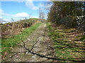
|
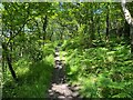
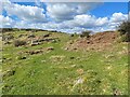
Track near Mount Barnard
by Adrian Taylor
geograph for square SD3578
Far from the sea and more than 110m (360 feet) above sea level, this track is... (more)
|
|
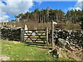
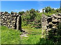
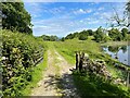
Cumbria Coastal Way, Speel Bank
by Adrian Taylor
geograph for square SD3581
The gate, on the footpath between Grassgarth and Speel Bank Farm is, like almost... (more)
|
|
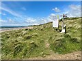
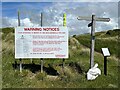
England Coast Path near Carl Crag
by Adrian Taylor
geograph for square SD0499
The warning sign relates to the MOD Eskmeals Range and is located beside the... (more)
|
|
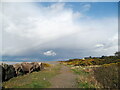
The Cumbria Coastal Way at Guards
by Adrian Taylor
geograph for square NY1256
Beside the Solway Firth, the sea defences that protect the coast north-east from... (more)
|
|
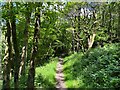
Path in High Stribers Wood
by Adrian Taylor
geograph for square SD3582
The path is a public footpath from Grassgarth to Birk Dault and although well... (more)
|
|
Path in High Stribers Wood
by Adrian Taylor
geograph for square SD3582
The path is a public footpath from Grassgarth to Birk Dault and although well... (more)
|
|
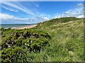
England Coast Path near Seascale
by Adrian Taylor
geograph for square NY0400
Almost lost in the vegetation, the narrow sandy path that forms the England... (more)
|
|
Information, direction and warnings
by Adrian Taylor
for square SD0499
This array of signs is beside the England Coast Path near Carl Crag.
|
|
Footpath near Speel Bank
by Adrian Taylor
geograph for square SD3581
This is the route of the public footpath from Speel Bank Farm to Grassgarth.... (more)
|
|
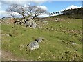
Rocks near Speel Bank
by Adrian Taylor
for square SD3681
The small wooden waymark post to the left of the photograph marks the route of... (more)
|

|
Lane near Mount Barnard
by Adrian Taylor
geograph for square SD3678
The lane is a public right of way from Holker to Howbarrow.
Far from the sea,... (more)
|
|
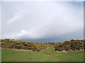
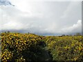
Coastal path near Grune House
by Adrian Taylor
geograph for square NY1356
The Cumbria Coastal Way passes between banks of gorse bushes north of Grune House.
|
|
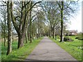
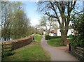
Bitts Park, Carlisle
by Adrian Taylor
for square NY4056
This path through Bitts Park parallel to the River Eden is the route of the... (more)
|
|
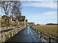
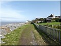
The Promenade, Grange-over-Sands
by Adrian Taylor
geograph for square SD4178
The Promenade behind Grange-over-Sands Station on a January morning with traces... (more)
|
|
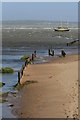
The Cumbria Coastal Way near Stainton
by Adrian Taylor
geograph for square NY3756
The fence beside the stile is clogged with flood debris. There is a lone... (more)
|
|
Coastal path near Grune House
by Adrian Taylor
geograph for square NY1356
The Cumbria Coastal Way passes between banks of gorse bushes near Grune House.
|
|
Footpath near the River Eden
by Adrian Taylor
geograph for square NY3957
Between Eden Place and the River Eden this public footpath provides a pleasant... (more)
|
|
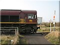
Train crossing the Cumbria Coastal Way
by Adrian Taylor
geograph for square NX9929
English, Welsh and Scottish Railway Class 66 locomotive number 66181 leaving... (more)
|
|
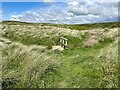
Gate, Bigland Heights
by Adrian Taylor
geograph for square SD3582
This gate is on the public footpath from Grassgarth to Birk Dault and although... (more)
|
|
Footbridge on the Coast Path
by Adrian Taylor
geograph for square SD0499
The footbridge crosses a small sike on the England Coast Path south of Seascale.
|
|
Grune
by Adrian Taylor
geograph for square NY1356
The sand and shingle spit leading up to Grune Point has been enclosed into... (more)
|
|
Old pier, Harrington
by Adrian Taylor
geograph for square NX9825
This old and eroded pier a short distance north of Harrington Harbour appears to... (more)
|
|
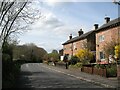
Caledonian Buildings, Etterby
by Adrian Taylor
geograph for square NY3857
Beside Etterby Road, these houses were built by the Caledonian Railway for... (more)
|
|
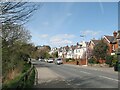
Etterby Scaur
by Adrian Taylor
geograph for square NY3957
This is the road from Carlisle city centre to Cargo and Rockcliffe; it is also... (more)
|
|
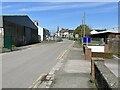
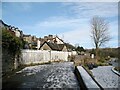
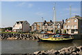
Station Road, Silloth
by Adrian Taylor
geograph for square NY1053
This nondescript part of Station Road serves the south side of Silloth docks and... (more)
|
|
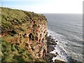
St. Bees Head
by Adrian Taylor
geograph for square NX9413
The 75m high red sandstone cliffs of St. Bees North Head.
The Cumbria Coastal... (more)
|
|
Gateway by Bigland Tarn
by Adrian Taylor
geograph for square SD3582
The track is a public footpath from Grassgarth to Birk Dault. Bigland House is... (more)
|
|
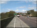
Eden Bridge, Carlisle
by Adrian Taylor
for square NY3956
Eden Bridge carries the main A7 road northwards from Carlisle City Centre; it is... (more)
|
|
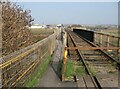
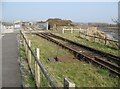
Bailey Lane Crossing approach
by Adrian Taylor
geograph for square SD4077
Originally a vehicular level crossing across the Carnforth to Barrow-in-Furness... (more)
|
|
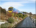
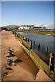
The Promenade, Grange-over-Sands
by Adrian Taylor
geograph for square SD4178
Class 185 number 185140 runs alongside The Promenade with a train for Barrow-in-Furness.
|
|
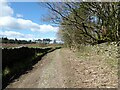
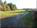
Track near Yaw Yeat Wood
by Adrian Taylor
geograph for square SD3678
Although well inland this lane is the route of the Cumbria Coastal Way and... (more)
|
|
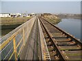
Workington Dock or Harbour Bridge
by Adrian Taylor
geograph for square NX9929
The north eastern part of this combined railway and footpath bridge crosses the... (more)
|
|
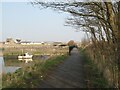
Footpath and cycleway, Town Quay
by Adrian Taylor
geograph for square NX9929
The footpath (also the Cumbria Coastal Way) leads from Curwen Road to Northside... (more)
|
|
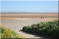
Skinburnessbank
by Adrian Taylor
geograph for square NY1255
The Cumbria Coastal Way at Skinburnessbank.
|
|
Workington Dock or Harbour Bridge
by Adrian Taylor
geograph for square NX9929
The railway and footpath bridge is in two distinct halves either side of the tip... (more)
|
|
The Front Haverigg from River Lazy
by Andy Deacon
geograph for square SD1678
The properties at The Front, Haverigg are seen from the sandy west bank of the... (more)
|
|
Railway into Workington Docks
by Adrian Taylor
geograph for square NX9929
The railway is mainly used for transporting steel rails for export and connects... (more)
|
|
Beach access at Haverigg
by Andy Deacon
geograph for square SD1578
This ramp provides emergency access for the Haverigg Inshore Rescue Service.
In... (more)
|
|
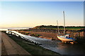
High Tide at Haverigg
by Andy Deacon
geograph for square SD1678
High tide at Haverigg Pool looking across to Sea View.
|
|
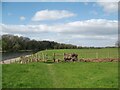
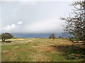
'As it opens out onto grazing land'
by Christine Johnstone
geograph for square SD3678
Quote from 'Walks from the Furness Line, Walk 5'. Here the track forms... (more)
|
|
Haverigg Pool and Duddon Estuary at high tide
by Andy Deacon
geograph for square SD1678
The Duddon estuary has a large tidal range and this photograph was shot shortly... (more)
|
|
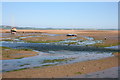
Low tide at Haverigg, Cumbria
by Andy Deacon
geograph for square SD1678
Boats rest on the sands near the mouth of the River Lazy also known as Haverigg... (more)
|
|
River Lazy Haverigg Pool
by Andy Deacon
geograph for square SD1678
The River Lazy flows out to the Duddon Channel.
|
|
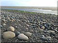
Large stones on beach near Silecroft
by Andy Deacon
geograph for square SD1378
Wide angle shot to show both close-up of representative stones and an overview... (more)
|
|
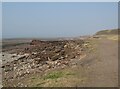
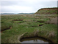
Lenibrick Point
by Karl and Ali
geograph for square SD3475
The point is formed from glacial debris and has been shored up with some... (more)
|
|
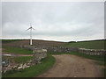
New wind turbine near Strand Bridge
by Karl and Ali
geograph for square SD3575
The turbine is too small for major power production and maybe only serves nearby... (more)
|