
|
Downs Link and Sussex Border Path near Rudgwick
by Malc McDonald
geograph for square TQ0734
A view of the Downs Link path near Rudgwick in West Sussex. The path also forms... (more)
|

|
Downs Link, near Rudgwick
by Malc McDonald
geograph for square TQ0932
The Downs Link path follows a dismantled railway line for almost all of its... (more)
|

|
Downs Link, near Rudgwick
by Malc McDonald
geograph for square TQ0932
The Downs Link path follows a dismantled railway line for almost all of its... (more)
|

|
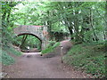
Double bridge near Rudgwick, West Sussex
by Malc McDonald
geograph for square TQ0932
The double bridge which crosses the River Arun near Rudgwick is unique in... (more)
|
|
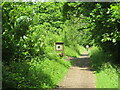
Downs Link near Cranleigh
by Malc McDonald
geograph for square TQ0341
The Downs Link path follows a dismantled railway line for most of its length.... (more)
|

|
Cox Green Road, near Rudgwick
by Malc McDonald
geograph for square TQ0734
Cox Green Road near Rudgwick, on the borders of Surrey and West Sussex. Here, a... (more)
|
|
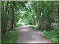
Downs Link, near Slinfold
by Malc McDonald
geograph for square TQ0932
A view of the Downs Link path as it approaches Slinfold in West Sussex. The... (more)
|
|
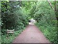
Downs Link at Slinfold, near Horsham
by Malc McDonald
geograph for square TQ1130
A view of the Downs Link path passing through Slinfold in West Sussex. The path... (more)
|
|
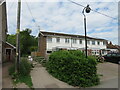
Downs Link at Slinfold, near Horsham
by Malc McDonald
geograph for square TQ1130
The path to the left of the houses forms part of the Downs Link path, which... (more)
|
|
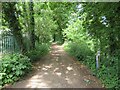
Downs Link near Bramley
by Malc McDonald
geograph for square TQ0143
The Downs Link path follows a dismantled railway line for most of its length.... (more)
|
|
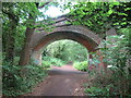
Bridge over the Downs Link path near Cranleigh
by Malc McDonald
geograph for square TQ0242
The Downs Link path follows a dismantled railway line for most of its length.... (more)
|
|
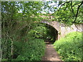
Downs Link near Cranleigh
by Malc McDonald
geograph for square TQ0242
The Downs Link path follows a dismantled railway line for most of its length.... (more)
|
|
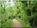
Downs Link near Cranleigh
by Malc McDonald
geograph for square TQ0242
The Downs Link path follows a dismantled railway line for most of its length.... (more)
|
|
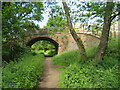
Downs Link near Cranleigh
by Malc McDonald
geograph for square TQ0341
The Downs Link path follows a dismantled railway line for most of its length.... (more)
|

|
Downs Link near Cranleigh
by Malc McDonald
geograph for square TQ0340
The Downs Link path follows a dismantled railway line for most of its length.... (more)
|
|
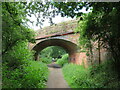
Downs Link, near Cranleigh
by Malc McDonald
geograph for square TQ0439
The Downs Link path follows a dismantled railway line for most of its length.... (more)
|
|
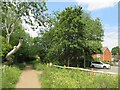
Downs Link, Cranleigh
by Malc McDonald
geograph for square TQ0539
The Downs Link path follows a dismantled railway line for most of its length.... (more)
|
|
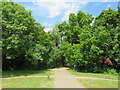
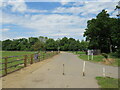
Downs Link, Cranleigh
by Malc McDonald
geograph for square TQ0538
The Downs Link path follows a dismantled railway line for most of its length.... (more)
|
|
Downs Link, Cranleigh
by Malc McDonald
geograph for square TQ0538
The Downs Link path follows a dismantled railway line for most of its length.... (more)
|

|
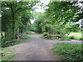
Downs Link, Cranleigh
by Malc McDonald
geograph for square TQ0538
The Downs Link path follows a dismantled railway line for most of its length.... (more)
|
|
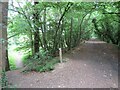
Downs Link near Cranleigh
by Malc McDonald
geograph for square TQ0637
The Downs Link path follows a dismantled railway line for most of its length.... (more)
|
|
Downs Link near Cranleigh
by Malc McDonald
geograph for square TQ0636
The Downs Link path follows a dismantled railway line for most of its length.... (more)
|

|
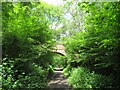
Downs Link near Cranleigh
by Malc McDonald
geograph for square TQ0636
The Downs Link path follows a dismantled railway line for most of its length.... (more)
|
|
Downs Link near Cranleigh
by Malc McDonald
geograph for square TQ0635
The Downs Link path follows a dismantled railway line for most of its length.... (more)
|

|
Downs Link, near Rudgwick
by Malc McDonald
geograph for square TQ0834
A view of the Downs Link path near Rudgwick in West Sussex. The path also forms... (more)
|
|
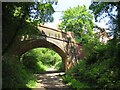
Bridge over the Downs Link path near Rudgwick
by Malc McDonald
geograph for square TQ0833
A view of the Downs Link path near Rudgwick in West Sussex. The path follows a... (more)
|
|
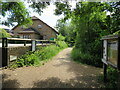
Downs Link at Rudgwick station site
by Malc McDonald
geograph for square TQ0833
The Downs Link path follows a dismantled railway line for most of its length.... (more)
|
|
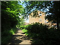
Downs Link, Rudgwick
by Malc McDonald
geograph for square TQ0833
A view of the Downs Link path at Rudgwick in West Sussex. The path follows a... (more)
|
|
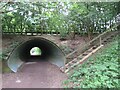
Downs Link, near Slinfold
by Malc McDonald
geograph for square TQ1031
A view of the Downs Link path near Slinfold in West Sussex. The path follows a... (more)
|
|
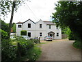
Downs Link, near Slinfold
by Malc McDonald
geograph for square TQ1031
A view of the Downs Link path as it approaches Slinfold in West Sussex. The... (more)
|
|
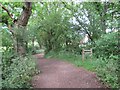
Houses at former railway station, Slinfold
by Malc McDonald
geograph for square TQ1130
The building in this image stands alongside the former railway station at... (more)
|
|
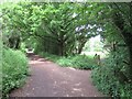
Downs Link approaching Slinfold
by Malc McDonald
geograph for square TQ1130
A view of the Downs Link path as it approaches Slinfold in West Sussex. The... (more)
|
|
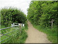
Downs Link, near Slinfold
by Malc McDonald
geograph for square TQ1230
The Downs Link path near Slinfold in West Sussex, with a footpath leading off to... (more)
|
|
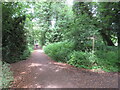
Downs Link, near Slinfold
by Malc McDonald
geograph for square TQ1230
A view of the Downs Link path near Slinfold in West Sussex. The path follows a... (more)
|
|
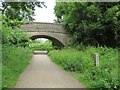
Downs Link near Horsham
by Malc McDonald
geograph for square TQ1330
The Downs Link walking and cycling path near Horsham in West Sussex. The path... (more)
|
|
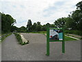
Downs Link near Horsham
by Malc McDonald
geograph for square TQ1329
A bridge carrying a road over the Downs Link path near Horsham. The path also... (more)
|
|
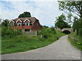
Former railway platform at Christ's Hospital, near Horsham
by Malc McDonald
geograph for square TQ1429
A disused platform at Christ's Hospital railway station, near Horsham in... (more)
|
|
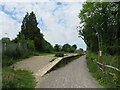
Downs Link at Christ's Hospital, near Horsham
by Malc McDonald
geograph for square TQ1429
The Downs Link path at Christ's Hospital, near Horsham. The path also... (more)
|
|
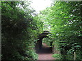
Disused platform at Christ's Hospital station, near Horsham
by Malc McDonald
geograph for square TQ1429
This platform at Christ's Hospital railway station was used by trains to... (more)
|
|
Downs Link at Christ's Hospital, near Horsham
by Malc McDonald
geograph for square TQ1429
A recently-opened section of the Downs Link, passing beneath the Arun Valley... (more)
|

|
Chilworth - Downs Link
by Colin Smith
geograph for square TQ0347
Looking uphill to St Martha's, the northern end of the Downs Link, a long... (more)
|

|
Downs Link, Rudgwick
by Malc McDonald
geograph for square TQ0833
A view of the Downs Link path at Rudgwick in West Sussex. The path follows a... (more)
|

|
DOWNS LINK 1984
by Colin Smith
for square TQ0348
A stone cairn on the eastern slopes of sandy St Martha's Hill carries this... (more)
|

|
St Martha's Hill - Downs Link
by Colin Smith
geograph for square TQ0348
This stone cairn on the eastern slopes of sandy St Martha's Hill carries a... (more)
|

|
Baynards station building, near Horsham
by Malc McDonald
geograph for square TQ0735
Baynards station was situated in Surrey countryside close to the Sussex border.... (more)
|

|
Downs Link Path
by Paul Gillett
geograph for square TQ2007
Heading North from Shoreham
|

|
Downs Link Path
by Paul Gillett
geograph for square TQ2017
near to Betley Bridge
|

|
Downs Link Path near Bramber
by Paul Gillett
geograph for square TQ1909
|

|
Downs Link Path near Henfield
by Paul Gillett
geograph for square TQ2016
|

|
Bridge over River Adur
by Paul Gillett
geograph for square TQ1909
|
