|
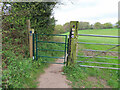
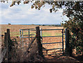
Gate on Oxfordshire and Chiltern Way footpaths
by David Hawgood
geograph for square SU7291
AS well as signs for Oxfordshire Way and Chiltern Way where they cross... (more)
|
|
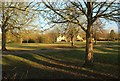
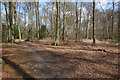
Former park exit
by Graham Horn
geograph for square SP4117
Three long distance paths, Oxfordshire Way, Wychwood Way and Shakespeare's... (more)
|
|
Akeman Street
by Graham Horn
geograph for square SP4117
The Roman Road Akeman Street is now used by this footpath, the Oxfordshire Way.... (more)
|
|
Approaching Blenheim Park
by Graham Horn
geograph for square SP4117
Four long distance routes use this footpath (to the left of the hedge), all... (more)
|
|
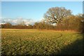
Green, Wyck Rissington
by Derek Harper
geograph for square SP1821
From the Oxfordshire Way and Diamond Way a few metres from where they meet the... (more)
|
|
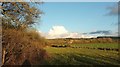
Fields in the dry valley below Pishill church
by Simon Mortimer
geograph for square SU7289
Looking north east from the Oxfordshire Way long distance path on the lane... (more)
|
|
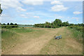
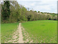
Oxfordshire Way nearing Wyck Rissington
by Derek Harper
geograph for square SP1821
Along with the Diamond Way, following bridleway HRW 7/2 round to the left side... (more)
|
|
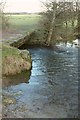
Ford on the Eye
by Derek Harper
geograph for square SP1721
|
|
Oxfordshire and Diamond Ways
by Derek Harper
geograph for square SP1821
Rising slightly as they follow bridleway HRW 7/3 across the field shown in... (more)
|
|
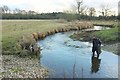
Boot-washing, River Eye
by Derek Harper
geograph for square SP1721
Alas, whichever way you are travelling along this stretch of the Oxfordshire Way... (more)
|
|
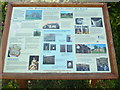
Information Board at Bix Bottom
by David Hillas
for square SU7286
This photo shows the information board which has been sponsored by Bix &... (more)
|
|
Difficulties on the Oxfordshire Way
by Derek Harper
geograph for square SP1821
And the Diamond Way, as both trails use this double gate to access bridleway HRW... (more)
|
|
Oxfordshire Way nearing Wyck Rissington
by Derek Harper
geograph for square SP1821
|
|
River Dikler
by Derek Harper
geograph for square SP1821
|
|
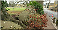
Broken wall, Station Road, Bourton-on-The-Water
by Derek Harper
geograph for square SP1620
The tree roots have effectively destroyed the roadside wall. This is on the... (more)
|
|
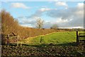
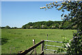
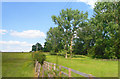
Field and boundary near Wyck Rissington
by Derek Harper
geograph for square SP1821
Looking southeast from the Oxfordshire Way and Diamond Way.
|
|
Field and boundary near Wyck Rissington
by Derek Harper
geograph for square SP1821
|
|
Oxfordshire Way crosses the track
by Des Blenkinsopp
geograph for square SP5219
Bridleway and long distance path crossover.
|
|
Road to Danesbrook Farm
by Des Blenkinsopp
geograph for square SP5910
The farm driveway is also part of the Oxfordshire Way long distance path.
|
|
The Oxfordshire Way near Bix Bottom
by David Hillas
geograph for square SU7287
This photo shows the Oxfordshire Way track looking south towards Bix Bottom,... (more)
|
|
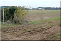
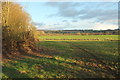
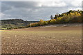
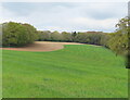
Autumn-sown cereal crop below Pishillbury Wood
by Simon Mortimer
geograph for square SU7289
Looking south-east from the Oxfordshire Way. A strip of game cover runs along... (more)
|
|
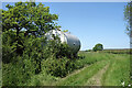
Tank by the Oxfordshire Way
by Des Blenkinsopp
geograph for square SP6009
The Oxfordshire Way is a well defined grassy farm track along here.
The tank... (more)
|
|
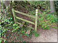
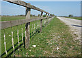
Stile on Oxfordshire Way public footpath near Hollandridge Farm
by David Hawgood
for square SU7291
Leaving a field the path goes down steeply through a beech wood to a bridleway... (more)
|
|
Oxfordshire Way at Danesbrook Farm
by Des Blenkinsopp
geograph for square SP5910
Leaving the neat tarmac drive to Danesbrook Farm, the Oxfordshire Way quickly... (more)
|
|
Gate on the Oxfordshire Way
by Des Blenkinsopp
geograph for square SP5313
The Oxfordshire Way leaves Noke and heads in more or less a straight line over... (more)
|
|
Stream through Long Plantation with culvert carrying Oxfordshire Way
by Roger Templeman
geograph for square SP5119
|
|
Oxfordshire Way crosses stream in Long Plantation
by Roger Templeman
geograph for square SP5119
|
|
Station Road, Bourton-On-The-Water
by Derek Harper
geograph for square SP1620
Followed by the Oxfordshire Way, although neither are we in Oxfordshire, nor is... (more)
|
|
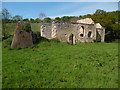
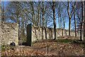
Remains of St James' Church, Bix Bottom
by David Hillas
geograph for square SU7286
This photo shows the remains of the Norman St James' Church on the... (more)
|
|
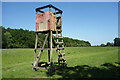
Falling Apart Round The Edges
by Des Blenkinsopp
geograph for square SP6008
Another of the wooden towers which are all along the Oxfordshire Way around the... (more)
|
|
View from a Footbridge, Polecat End
by Des Blenkinsopp
geograph for square SP5908
The Oxfordshire Way goes through a crescent shaped meadow around the edge of the... (more)
|
|
Oxfordshire Way public footpath near Hollandridge Farm
by David Hawgood
geograph for square SU7291
From this pasture the path drops down steeply through beech woods. There is some... (more)
|
|
The Oxfordshire Way near Islip
by Des Blenkinsopp
geograph for square SP5314
Leaving Islip. Next village is Weston on the Green. Older maps show another path... (more)
|
|
Road junction, Bourton-On-The-Water
by Derek Harper
geograph for square SP1720
On the right, Station Road swings around a bend; to the left, Roman Way heads... (more)
|
|
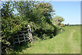
Old Gate in the Hedge
by Des Blenkinsopp
geograph for square SP5909
Beside the Oxfordshire Way. I think this old gate swung for the last time a good... (more)
|
|
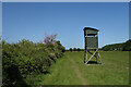
Hide on stilts by the Oxfordshire Way
by Des Blenkinsopp
geograph for square SP5909
There are a number of these at intervals all along here. I guess they are for... (more)
|
|
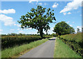
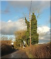
Thames Street, Charlbury
by Derek Harper
geograph for square SP3519
Used by the Oxfordshire Way.
|
|
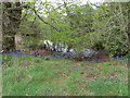
Pond and bluebells by Hollandridge Farm
by David Hawgood
geograph for square SU7291
Photo from Oxfordshire Way public footpath.
|
|
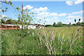
Hollandridge Farm field and beech wood
by David Hawgood
geograph for square SU7291
The field is partly recently sown grass, partly arable. Photo from Oxfordshire... (more)
|
|
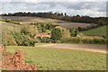
Countryside near Albury
by Des Blenkinsopp
geograph for square SP6504
Along the Oxfordshire Way between Albury and Tiddington.
|
|
Wool on the Wire, Akeman Street
by Des Blenkinsopp
geograph for square SP4218
The Oxfordshire Way on the old Roman Akeman Street in Blenheim Park.
Fields of... (more)
|
|
The Oxfordshire Way to Kirtlington
by Steve Daniels
geograph for square SP5219
|
|
The Oxfordshire Way to Weston-on-the-Green
by Steve Daniels
geograph for square SP5219
|
|
The Oxfordshire Way to Weston-on-the-Green
by Steve Daniels
geograph for square SP5219
|
|
Side door into Blenheim Park
by Des Blenkinsopp
geograph for square SP4318
Away from the grandiose gateways by the main entrances, the Oxfordshire Way uses... (more)
|
|
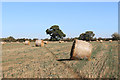
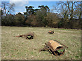
Three Rollers in a Field
by Des Blenkinsopp
geograph for square SU7289
By the Oxfordshire Way near Pishill.
|
|
The Oxfordshire Way near Maidensgrove
by Des Blenkinsopp
geograph for square SU7288
|
|
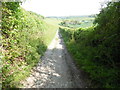
Moor Lane
by Derek Harper
geograph for square SP1721
The Oxfordshire Way follows footpath HBW 8/3 along this track; the footpath soon... (more)
|
|
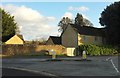
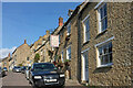
Sheep Street, Charlbury
by Derek Harper
geograph for square SP3519
Second on the left is Hone House... (more)
|
|
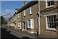
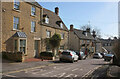
Sheep Street, Charlbury
by Derek Harper
geograph for square SP3519
In the centre is Ye Olde Three Horseshoes Inn... (more)
|