About tags on Geograph

Public Tags

Related Tags | Coverage Map
Prefix: looking towards    Tag:  High·Street  
Other tags: High Street     area:High Street     at:High Street     fell:High Street     near:High Street     off:High Street     on:High Street     p150 hill:High Street     place:High Street     road:High Street     street:High Street     to:High Street    

Showing images tagged with looking towards:High Street tag.

View all tagged images - In Browser
:

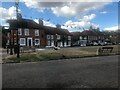
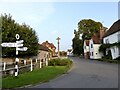
SU6822 : Looking towards the High Street, East Meon by Marika Reinholds Looking towards the High Street, East Meon by Marika Reinholds
geograph for square SU6822
East Meon is a pretty Hampshire village, the highest in the Meon Valley. It is... (more)
Tags: Cross   place:East Meon   Fingerpost   Fingerpost Sign   type:Geograph   street:High Street   looking towards:High Street   subject:Village   Village Main Road   Village Scene   Village Street   top:Village, Rural Settlement  
TM3783 : Entrance of Rookery Farm & footpath by Geographer Entrance of Rookery Farm & footpath by Geographer
geograph for square TM3783
Looking towards Highland Farm & High Street
TL7205 : Maldon Road, Great Baddow by Geographer Maldon Road, Great Baddow by Geographer
geograph for square TL7205
Looking towards Baddow Road/Tabors Hill & High Street near The Causeway
Tags: looking towards:Baddow Road   at:Great Baddow   looking towards:High Street   Maldon Road   subject:Road   Road Junction   top:Roads, Road Transport   looking towards:Tabors Hill   near:The Causeway   The Causeway  
SU9993 : Buildings in High Street, Chalfont St Giles by David Haines Buildings in High Street, Chalfont St Giles by David Haines
geograph for square SU9993
This photo shows houses and shops on the north side of the High Street, its... (more)
Tags: place:Chalfont St Giles   type:Geograph   road:High Street   street:High Street   looking towards:High Street   High Street   top:Village, Rural Settlement  
TM3684 : Entrance of Highland & Rookery Farms by Geographer Entrance of Highland & Rookery Farms by Geographer
geograph for square TM3684
Looking towards High Street
TM3483 : Looking towards High Street by Geographer Looking towards High Street by Geographer
geograph for square TM3483
Near the footpath & Hulver Cottages Road No.U1205
TL4957 : Church End, Cherry Hinton, Cambridge by Geographer Church End, Cherry Hinton, Cambridge by Geographer
geograph for square TL4957
Looking towards the junction with Teversham Drift, High Street & Fulbourn... (more)
NU2604 : The end of West Avenue by Adrian Taylor The end of West Avenue by Adrian Taylor
geograph for square NU2604
The end of West Avenue looking towards High Street. There is an Ordnance Survey... (more)
Tags: Amble   Bench Mark   Benchmark   top:City, Town Centre   type:Geograph   looking towards:High Street   top:Housing, Dwellings   Northumberland   top:Roads, Road Transport   subject:Street   West Avenue  
SJ9286 : High Street, Hazel Grove by Christine Johnstone High Street, Hazel Grove by Christine Johnstone
geograph for square SJ9286
Surprisingly, this short terraced street between Torkington Park and the A6 is... (more)
Tags: type:Geograph   place:Hazel Grove   looking towards:High Street   street:High Street   top:Housing, Dwellings   houses:Late 19C Terrace   subject:Terrace (Housing)  
TM3683 : Rumburgh Lane,  Ilketshall St.Margaret by Geographer Rumburgh Lane, Ilketshall St.Margaret by Geographer
geograph for square TM3683
Looking towards High Street near the footpaths Road No.C949
TM3584 : Brook Lane, Ilketshall St.Margaret by Geographer Brook Lane, Ilketshall St.Margaret by Geographer
geograph for square TM3584
Looking towards High Street near the footpaths Road No.U1207
Tags: Brook Lane   Footpaths   looking towards:High Street   subject:Road   top:Roads, Road Transport   U Classified Road   U Road (Classified U)  
TM3585 : Brook Lane, Ilketshall St.Margaret by Geographer Brook Lane, Ilketshall St.Margaret by Geographer
geograph for square TM3585
Looking towards High Street
Tags: Brook Lane   looking towards:High Street   near:Ilketshall St Margaret   subject:Road   top:Roads, Road Transport  
NU2604 : The north side of High Street, Amble by Christine Johnstone The north side of High Street, Amble by Christine Johnstone
geograph for square NU2604
At the west end of Queen Street.
Tags: Amble   top:City, Town Centre   type:Geograph   looking towards:High Street   subject:Street  
SJ5182 : High Street, Runcorn by Christine Johnstone High Street, Runcorn by Christine Johnstone
geograph for square SJ5182
A boater's view, looking under Queensway [part of the approach to the... (more)
Tags: Canal Towpath   top:City, Town Centre   type:Geograph   looking towards:High Street   Road Viaduct   place:Runcorn  
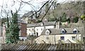
SO8902 : Buildings on High Street, Chalford by Christine Johnstone Buildings on High Street, Chalford by Christine Johnstone
geograph for square SO8902
Looking north from the canal bank.
Tags: looking towards:High Street   Hillside   Steep Sided Valley   subject:Village   top:Village, Rural Settlement  
SZ5685 : Newchurch High St by Chris McAuley Newchurch High St by Chris McAuley
geograph for square SZ5685
Newchurch High Street leading off The Shute.
Tags: looking towards:High Street   top:Islands   top:Roads, Road Transport  
SP0957 : Engrossed by Adrian Taylor Engrossed by Adrian Taylor
geograph for square SP0957
On the path beside St Nicholas’ Church at the top of the High Street on a cold... (more)
Tags: place:Alcester   top:City, Town Centre   type:Geograph   looking towards:High Street   subject:Path   top:Paths   Person   top:Religious Sites   St Nicholas Church   Walking   Warwickshire   Wheelie Bins  
SP9978 : Thrapston High Street by Des Blenkinsopp Thrapston High Street by Des Blenkinsopp
geograph for square SP9978
Tags: top:City, Town Centre   type:Geograph   looking towards:High Street   Painted Mini Roundabout   top:Roads, Road Transport  
SJ5182 : Buildings on the south side of High Street, Runcorn by Christine Johnstone Buildings on the south side of High Street, Runcorn by Christine Johnstone
geograph for square SJ5182
The green metal arch is part of the Silver Jubilee Bridge, across the Mersey.
Tags: top:City, Town Centre   type:Geograph   looking towards:High Street   place:Runcorn  
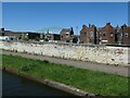
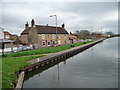
SE6109 : Moorings, south side of Barnby Dun liftbridge by Christine Johnstone Moorings, south side of Barnby Dun liftbridge by Christine Johnstone
geograph for square SE6109
The road parallel to the canal bank is High Street. Seen from the barge... (more)
Tags: Bridge Mooring   Canal Bank   top:Canals   looking towards:High Street   weather:Low Cloud   Moorings   canal:River Dun Navigation   canal:South Yorkshire Navigations   Village Edge  
TM3585 : Brook Lane, Ilketshall St.Margaret by Geographer Brook Lane, Ilketshall St.Margaret by Geographer
geograph for square TM3585
At the junction with Moles Lane & Low Street
Tags: Brook Lane   looking towards:High Street   at:Ilketshall St.Margaret   Low Street   Moles Lane   subject:Road   Road Junction   top:Roads, Road Transport  
View more in the Image Search or in Browser
View images matching 'High Street' anywhere in the tags
Don't click these: PotMel 1 PotMel 2