
|
Sizewell Beach, evening light
by Christopher Hilton
geograph for square TM4762
On the left, the concrete bulk of the original Sizewell nuclear power station,... (more)
|

|
View towards Sizewell from The Walks
by Christopher Hilton
geograph for square TM4661
Beyond the field covered by sheeting, a low earth bank marks a small reservoir,... (more)
|

|
Lane near Home Farm, Sizewell
by Simon Mortimer
geograph for square TM4762
Looking north towards Sizewell A and Sizewell B Power Stations.
|

|
Sizewell B nuclear power station, from the beach
by Christopher Hilton
geograph for square TM4763
Sizewell B, a pressurised-water reactor (PWR), was built next to the original... (more)
|

|
Sizewell: view along the coast path from the caravan site towards the power station
by Christopher Hilton
geograph for square TM4762
Visible in the distance is the original Sizewell nuclear power station,... (more)
|

|
View north-east off Leiston Road, North Warren
by Christopher Hilton
geograph for square TM4558
On the left, Sizewell nuclear power stations, and to the right the House in the... (more)
|

|
Sizewell Power Stations over the fields
by Christopher Hilton
for square TM4459
Seen from the Sandlings Walk.
|

|
Sizewell A and Sizewell B nuclear power stations
by Simon Mortimer
geograph for square TM4763
Sizewell A, in the foreground, comprised two Magnox reactors operating between... (more)
|

|
View across Minsmere RSPB reserve towards Sizewell nuclear power station
by Christopher Hilton
geograph for square TM4767
The white dome is Sizewell B power station, still active: the blocky building... (more)
|

|
Sizewell A Nuclear Power Station, from the beach
by Christopher Hilton
geograph for square TM4763
Sizewell A, the original power station on this site, was one of the... (more)
|

|
Sizewell nuclear power stations from the heathland to the south
by Christopher Hilton
geograph for square TM4762
The distinctive white dome is the pressurized-water reactor of Sizewell B... (more)
|

|
View towards Sizewell off Abbey Lane
by Christopher Hilton
geograph for square TM4363
On the horizon, the white dome of Sizewell B nuclear power station, then to its... (more)
|

|
Dyke behind the sea defences, Minsmere
by Christopher Hilton
geograph for square TM4766
Taken from the bridge that leads to the RSPB reserve's East Hide. On the... (more)
|

|
Beach at Minsmere
by Christopher Hilton
geograph for square TM4766
In the distance the breakwater marks the site of Minsmere Sluice, where a small... (more)
|

|
Sizewell B nuclear power station
by Simon Mortimer
geograph for square TM4763
A second nuclear power station at Sizewell was originally proposed in 1969.... (more)
|

|
North Warren, Aldeburgh
by Christopher Hilton
geograph for square TM4658
Wintering Barnacle Geese are in the foreground. In the distance, The House in... (more)
|

|
Decommissioned reactor hall, Sizewell A nuclear power station
by Simon Mortimer
geograph for square TM4763
The Magnox reactors of Sizewell A ceased generation in 2006. The turbine hall... (more)
|

|
Motorbikes at Sizewell Beach
by Simon Mortimer
geograph for square TM4762
Looking north towards the cafe and the decommissioned Sizewell A power station.
|

|
Sizewell Tea cafe
by Simon Mortimer
geograph for square TM4762
The cafe is situated on the beach in the small hamlet of Sizewell and... (more)
|

|
World War II graffiti, anti-tank obstacles, Minsmere
by Helena Hilton
geograph for square TM4766
A line of World War II concrete anti-tank obstacles runs behind the dunes at... (more)
|

|
Sizewell A and B from Dunwich Cliffs
by Chris Holifield
for square TM4763
|

|
Minsmere Sluice
by Christopher Hilton
geograph for square TM4766
The breakwater marks the site of the sluice draining the Minsmere marshes.... (more)
|

|
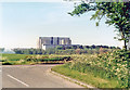
Sizewell Nuclear Power Station
by Geographer
for square TM4763
Taken from Grimsey's Lane
(Close up)
|
|
Sizewell A (Magnox) Nuclear Power Station, 1985
by Ben Brooksbank
for square TM4763
View from Sizewell Hall Road to the south, before Sizewell B was built.
|

|
View of Sizewell B from Sandy Lane, Leiston
by Simon Mortimer
geograph for square TM4663
Taken from the bridleway adjacent to Reckham Lodge.
|

|
View over Minsmere towards Sizewell
by Christopher Hilton
geograph for square TM4767
|

|
Site preparation for Sizewell C construction
by Simon Mortimer
geograph for square TM4663
Looking east from Sandy Lane, with the dome of Sizewell B visible in the background.
|

|
Looking towards Sizewell Nuclear Power Station
by Geographer
geograph for square TM4562
Taken from Grimsey's Lane
|

|
Sandy Lane on the edge of Leiston Common
by Simon Mortimer
geograph for square TM4663
Looking east, with the dome of Sizewell B visible in the distance.
|

|
Sizewell cliff in front of caravan site
by Martin Dawes
geograph for square TM4762
Paths running down to the beach, Sizewell and the power station to the north.
|

|
Sizewell village with Power Station beyond
by Martin Dawes
geograph for square TM4762
From shingle beach below caravan site
|
