Public Tags
Tag: Low·and·Narrow·Bridge
Showing images tagged with Low and Narrow Bridge tag.

|
Low and narrow bridge ahead, Cow Lane, Didcot
by Jaggery geograph for square SU5290 Extending for 40 metres over Cow Lane, the bridge carries many railway lines at... (more)
|

|
Low railway bridge in Didcot
by Jaggery geograph for square SU5290 The headroom shown is 3.7 metres (12' 3"). The car shows how narrow... (more)
|

|
North side of a low and narrow railway bridge, Cow Lane, Didcot
by Jaggery geograph for square SU5290 Extending for 40 metres over Cow Lane, the bridge carries many railway lines at... (more)
Tags:
type:Geograph
Low and Narrow Bridge
Railway Bridge Over Road
top:Railways
top:Roads, Road Transport
|
|
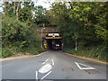
Railway bridge over Toms Lane, Kings Langley
by Malc McDonald geograph for square TL0702 This bridge carries the West Coast Main Line over Toms Lane.
|

|
Low bridge
by Jim Barton geograph for square NT3362 A height warning of 6' 3" on this narrow stone arch carrying the... (more)
|
|
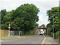
Lake Road, Poole
by Malc McDonald geograph for square SY9990 A low bridge carries a railway line across Lake Road in the suburbs of Poole.... (more)
Tags:
subject:Bridge
type:Geograph
Low and Narrow Bridge
Low Bridge
Low Bridge Warning Sign
Low Bridge Warning Signs
top:Roads, Road Transport
top:Suburb, Urban Fringe
|

|
Former railway bridge, Winscombe
by Malc McDonald geograph for square ST4157 A former railway bridge over Woodborough Road in Winscombe, in Somerset. The... (more)
Tags:
road:A371
subject:Bridge
Former Railway Bridge
bridge:Former Railway Over Road
type:Geograph
Low and Narrow Bridge
Low Bridge
National Cycle Network
NCN26
former:Railway Bridge
Railway Bridge (Former)
top:Roads, Road Transport
national cycle network:Route 26
county:Somerset
Strawberry Line
trail:Strawberry Line
near:Weston-Super-Mare
place:Winscombe
|
