Geograph - photograph every grid square
About tags on Geograph
Tags
Geographical Context
Subjects
Types
Other Prefixes
Public Tags
Related Tags
|
Coverage Map
Tag:
Low·Cliff
Showing images tagged with
Low Cliff
tag.
View all tagged images
-
In Browser
Search within these images
:
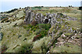
Low Cliffs at the Southern End of Humphrey Head
by
Chris Heaton
geograph for square
SD3973
Tags:
top:
Coastal
type:
Geograph
Low Cliff
Promontory
Sands
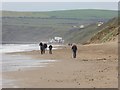
Walking party on rocky beach
by
Trevor Littlewood
geograph for square
HY2309
The beach is on the north side of Warebeth, not far from Stromness. It lies... (
more
)
Tags:
Boulders
top:
Coastal
type:
Geograph
Low Cliff
Rock Slabs
top:
Rocks, Scree, Cliffs
Rocky Shore
top:
Sport, Leisure
Stones
Walking Party
Rocks and low cliffs near North Sunderland Point
by
John Myers
geograph for square
NU2231
Tags:
subject:
Cliff
top:
Coastal
top:
Estuary, Marine
type:
Geograph
Low Cliff
near:
Seahouses
Tidal Rocks
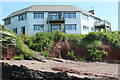
The Boathouse, Llanreath
by
M J Roscoe
geograph for square
SM9503
Apartments near the edge of the low cliff on the bank of the Cleddau.
Tags:
Balconies
top:
Estuary, Marine
type:
Geograph
subject:
House
top:
Housing, Dwellings
Low Cliff
Rocky Foreshore
Channel in the saltmarsh by Barker Scar
by
Christine Johnstone
geograph for square
SD3378
Looking west. This triangular area of saltmarsh is enclosed on the two seaward... (
more
)
Tags:
top:
Coastal
type:
Geograph
Low Cliff
subject:
Salt Marsh
Saltmarsh
Tidal Creek
Rocky Shore South of Halangy Porth
by
John Rostron
geograph for square
SV9012
Halangy Porth is a mix of boulders at the north and south end and sandy beach... (
more
)
Tags:
Boulder Clay
top:
Coastal
top:
Estuary, Marine
top:
Islands
Low Cliff
Rocky Shore
Moclett
by
Derek Harper
geograph for square
HY4949
Taken much later in the same day as
HY4949 : Moclett
, and with the tide low.
Tags:
top:
Coastal
Coastal Rocks
Croft
rock:
Devonian
top:
Farm, Fishery, Market Gardening
Farmland
type:
Geograph
top:
Geological Interest
Low Cliff
fences:
Post and Wire
top:
Rocks, Scree, Cliffs
gates:
Steel
Walls
Wave-Cut Platforms
Small cliffs at Gullane Bay
by
Jim Barton
geograph for square
NT4683
A line of small cliffs at Maggie's Loup.
Tags:
Cliff Path
top:
Coastal
type:
Geograph
top:
Grassland
Gullane
Low Cliffs
top:
Paths
top:
Rocks, Scree, Cliffs
Cliff erosion near Warren Point, Spurn
by
Christine Johnstone
geograph for square
TA4115
The clay cliffs of Holderness erode easily.
Tags:
subject:
Beach
top:
Coastal
Coastal Erosion
type:
Geograph
Low Cliff
Taftend, Westray from the air
by
Derek Harper
for square
HY4942
A croft that looks rather close to the cliff edge. Further along is Twiness and... (
more
)
Tags:
type:
Aerial
Aerial
top:
Coastal
Croft
type:
Cross Grid
top:
Farm, Fishery, Market Gardening
Farmland
top:
Housing, Dwellings
Low Cliff
top:
Rocks, Scree, Cliffs
Coast near Redcraig Geo
by
Derek Harper
geograph for square
HY5050
A reef runs out into the Bay of Burland.
Tags:
Breaking Waves
top:
Coastal
Coastal Rocks
type:
Geograph
Grassland
top:
Grassland
Low Cliffs
top:
Rocks, Scree, Cliffs
Rocky Foreshore
Grassy headland, Bay of Burland
by
Derek Harper
geograph for square
HY5050
Looking left from
HY5050 : Rocks near Redcraig Geo
.
Tags:
Breaking Waves
Clifftop Grassy Area
top:
Coastal
top:
Estuary, Marine
type:
Geograph
top:
Grassland
Low Cliffs
top:
Rocks, Scree, Cliffs
Rocky Foreshore
Sillock Noup
by
Derek Harper
geograph for square
HY4949
Looking right from
HY4949 : Sillock Noup
.
Tags:
top:
Coastal
Coastal Rocks
rock:
Devonian
type:
Geograph
top:
Geological Interest
Low Cliff
top:
Rocks, Scree, Cliffs
Storage Building
Coastal path approaching Renny Skerry and Noust of Nethertown
by
Trevor Littlewood
geograph for square
HY2407
The path is on the coast of the Orkney Mainland on the north side of the Sound... (
more
)
Tags:
top:
Boundary, Barrier
top:
Coastal
Dry Stone Wall
type:
Geograph
Grit-Surfaced Path
Low Cliff
top:
Paths
top:
Rocks, Scree, Cliffs
Beach below Minsmere Cliffs
by
Christopher Hilton
geograph for square
TM4767
Tags:
Beach
subject:
Beach
top:
Coastal
top:
Estuary, Marine
type:
Geograph
Low Cliffs
beach:
Shingle
Shingle
Shingle Beach
Snow on the beach
by
Trevor Littlewood
geograph for square
NU2516
A small sandy beach where the Howick Burn reaches the sea. The England Coastal... (
more
)
Tags:
top:
Air, Sky, Weather
top:
Coastal
type:
Geograph
top:
Heath, Scrub
Low Cliff
top:
Rocks, Scree, Cliffs
Scrub Vegetation
Snow on Beach
Winter Trees
Change of land use at Kilnsea
by
Christine Johnstone
geograph for square
TA4116
The military structures of Godwin Battery have fallen onto the beach. The cliff... (
more
)
Tags:
Bird Watchers
top:
Coastal
Coastal Erosion
Destroyed
type:
Geograph
Godwin Battery
place:
Kilnsea
Low Cliff
Crumbling Holderness cliffs
by
Christine Johnstone
geograph for square
TA4115
Looking north from Warren Head, along the North Sea coastline.
Tags:
subject:
Beach
top:
Coastal
Coastal Erosion
type:
Geograph
Low Cliff
Groynes on Hornsea Sands
by
Chris Heaton
geograph for square
TA2048
The northernmost set of groynes on Hornsea Sands - heading towards North Cliff
Tags:
Beach
top:
Coastal
Coastal Scene
type:
Geograph
Groynes
Low Cliffs
Sandy Beach North of Kilnsea
by
Chris Heaton
geograph for square
TA4116
Wonderful sandy and unspoilt beach, stretching for miles.
Tags:
top:
Coastal
Coastal Scene
type:
Geograph
Low Cliffs
Sandy Beach
High tide on the beach near Stone Gap
by
Oliver Dixon
geograph for square
NZ6522
Between Marske and Saltburn. Saltburn Pier can be seen in the distance.
Tags:
subject:
Beach
Beach
top:
Coastal
type:
Geograph
Low Cliff
top:
Rocks, Scree, Cliffs
A bleak day on Saltburn Sands
by
Oliver Dixon
geograph for square
NZ6521
It is just possible to make out the disused steelworks at Redcar in the distance.
Tags:
subject:
Beach
Beach
top:
Coastal
type:
Geograph
Low Cliff
top:
Rocks, Scree, Cliffs
Rack Wick and Taftend from the air
by
Derek Harper
for square
HY4942
An aerial view over part of the southern end of Westray. Rack Wick is the bay on... (
more
)
Tags:
Aerial
type:
Aerial
Bay
Beach
top:
Coastal
Crofts
type:
Cross Grid
top:
Farm, Fishery, Market Gardening
Farmland
Headland
top:
Housing, Dwellings
Low Cliffs
top:
Rocks, Scree, Cliffs
Bay of Burland
by
Derek Harper
geograph for square
HY5050
From the southern side of the bay.
Tags:
Bay
Breaking Waves
top:
Coastal
Coastal Rocks
rock:
Devonian
top:
Estuary, Marine
type:
Geograph
Headlands
Low Cliff
top:
Rocks, Scree, Cliffs
Rocky Foreshore
Head of Moclett
by
Derek Harper
geograph for square
HY4949
A much broader view than
HY4949 : Head of Moclett
.
Tags:
top:
Coastal
Coastal Rocks
rock:
Devonian
top:
Estuary, Marine
type:
Geograph
top:
Geological Interest
Low Cliff
fences:
Post and Wire
top:
Rocks, Scree, Cliffs
Walls
Wave-Cut Platforms
Foreshore north of Moclett Pier
by
Derek Harper
geograph for square
HY4949
A closer view than
HY4949 : Looking back to Moclett
of the rocky foreshore and the cattle pasture.
Tags:
Cattle Pasture
top:
Coastal
top:
Estuary, Marine
top:
Farm, Fishery, Market Gardening
Farmland
type:
Geograph
Low Cliff
Power Poles
top:
Rocks, Scree, Cliffs
Rocky Foreshore
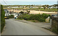
Road, Polzeath
by
Derek Harper
geograph for square
SW9378
The road from Trebetherick approaches the beach.
Tags:
Beach
Bench
top:
Coastal
top:
Estuary, Marine
type:
Geograph
Houses
top:
Housing, Dwellings
Low Cliff
Road
top:
Roads, Road Transport
Roadside Hedges
top:
Rocks, Scree, Cliffs
Seaside Village
top:
Sport, Leisure
Telegraph Poles
Trees
top:
Village, Rural Settlement
Walkers
Wall
Perran Sands
by
Des Blenkinsopp
geograph for square
SW5429
A small break in a length of coast which is mostly rocky. (The bag belongs to a... (
more
)
Tags:
top:
Coastal
type:
Geograph
Low Cliffs
Sandy Beach
The Beach South of Kilnsea
by
Chris Heaton
geograph for square
TA4215
Tags:
top:
Coastal
Coastal Scene
type:
Geograph
Low Cliffs
Sandy Beach
Waves
Caravans at Old Park Wood
by
Christine Johnstone
geograph for square
SD3378
On the east side of the Leven estuary.
Tags:
subject:
Caravan Park
type:
Geograph
Low Cliff
woodlands:
Old Park Wood
top:
Sport, Leisure
Rocky Access to Halangy Porth
by
John Rostron
geograph for square
SV9012
Halangy Porth is a mix of boulders at the north and south end and sandy beach... (
more
)
Tags:
top:
Coastal
top:
Estuary, Marine
top:
Islands
Low Cliff
Rocky Shore
Sandy Shore
Sedimentary rocks at Noust of Nethertown
by
Trevor Littlewood
geograph for square
HY2408
Noust of Nethertown is a location along the south coast of Orkney Mainland close... (
more
)
Tags:
top:
Boundary, Barrier
top:
Coastal
type:
Geograph
top:
Geological Interest
Low Cliff
Rocky Shore
Sedimentary Rock
Gullane Bay
by
Jim Barton
geograph for square
NT4683
The bay seen from Maggie's Loup.
Tags:
top:
Coastal
top:
Estuary, Marine
Firth of Forth
type:
Geograph
Gullane
Low Cliffs
Rocky Coast
Sandy Beach
Polzeath Brook
by
Derek Harper
geograph for square
SW9378
Ten years after
SW9378 : Stream, Polzeath
, and the stream can now be named.
Tags:
Beach
top:
Coastal
top:
Estuary, Marine
type:
Geograph
Houses
top:
Housing, Dwellings
Low Cliff
stream:
Polzeath Brook
top:
Rivers, Streams, Drainage
long distance path:
South West Coast Path
Surf Hire
fence:
Timber
Houses at Polzeath
by
Derek Harper
geograph for square
SW9378
A closer view of the terrace seen in
SW9378 : Road, Polzeath
.
Tags:
Beach
top:
Coastal
type:
Geograph
top:
Housing, Dwellings
Low Cliff
Road
Roadside Hedges
Seaside Village
Telegraph Poles
Terraced Houses
top:
Village, Rural Settlement
View more in the Image Search
or
in Browser
View images matching 'Low Cliff' anywhere
in
the tags
Don't click these:
PotMel 1
PotMel 2
☰
Home
View
Search
Marked Images
Maps
Browser
Explore
Showcase
New Images
Collections
Interact
Games
Discussions
Blog
Contributors
Submit
Statistics
Leaderboards
General
FAQ
Help Pages
Sitemap
Contact Us
Support Us
sponsored by
🔍︎
What to search:
Photos
Enter keywords or a location/postcode to search nearby images
Enter a Grid Reference
Placenames
Collections
Website Pages
Everything
Others:
Advanced Search
|
Image Browser
Or:
Coverage Map
|
Searchable Map
You are not logged in
|
login
|
register