Public Tags
Tag: Low·Cloud
Other tags: weather:Low Cloud
Showing latest 50 of 390 images tagged with Low Cloud tag.

|
Low cloud on the Cave Hill, Belfast (December 2017)
by Albert Bridge for square J3279 See J3279 : Snow on the Cave Hill, Belfast - December 2017(1). At 09.45 this bank of low cloud was passing over the upper... (more)
|

|
Low cloud, Belfast Lough
by Albert Bridge geograph for square J4482 The shore of Belfast Lough, to the south west of Grey Point, as a low cloud... (more)
|
|
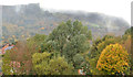
Low cloud and autumn trees, Belfast
by Albert Bridge geograph for square J3478 Autumn trees at the Loughside Park (foreground), autumn colours in the grounds... (more)
|

|
Slacks Wood
by Mick Garratt geograph for square NZ5812 A view over Slacks Wood, shrouded in low cloud, towards Capt. Cooks Monument (NZ5910).
Tags:
top:Air, Sky, Weather
Cloud
Hill
Low Cloud
weather:Low Cloud
Mist
weather:Snow
Snow
Wood
top:Woodland, Forest
|

|
Driveway on the Rothiemurchus Estate, near Aviemore
by Malc McDonald geograph for square NH9011 A driveway on the Rothiemurchus Estate in the Cairngorms National Park. The... (more)
Tags:
near:Aviemore
place:Cairngorms National Park
subject:Drive
Driveway
Farm Access Drive
Farm Drive
Farm Driveway
type:Geograph
weather:Low Cloud
Low Cloud
top:Roads, Road Transport
place:Rothiemurchus
Rothiemurchus Estate
place:Strathspey
|

|
Low cloud over Low Halsteads
by Christine Johnstone geograph for square SD8463 The cloud base is about 500 metres above sea level, and closing in. The land in... (more)
Tags:
top:Air, Sky, Weather
type:Geograph
Grazing Field
weather:Low Cloud
national park:Yorkshire Dales
|

|
Low cloud across Portmore Loch
by Jim Barton geograph for square NT2550 Dundreich has temporarily disappeared on a morning of low cloud - compare with... (more)
|

|
Low cloud and Kirkton Farm
by Jim Barton for square NN3628 Patches of low cloud drifting over Strath Fillan and on the Crianlarich hills... (more)
Tags:
top:Air, Sky, Weather
type:Cross Grid
Farm Buildings
top:Farm, Fishery, Market Gardening
Farmland
Forestry Plantations
Hillsides
weather:Low Cloud
long distance path:West Highland Way
top:Woodland, Forest
|

|
Low cloud over Soonhope, Peebles
by Jim Barton geograph for square NT2640 A still morning with low cloud hanging in wreaths below the tops.
Tags:
top:Air, Sky, Weather
type:Geograph
Grassy Moorland
Hill Pasture
Low Cloud
top:Moorland
View Up Valley
|
|
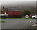
Rooftop solar panels on a Railway View house, Williamstown
by Jaggery geograph for square ST0090 Low cloud shrouds the distant hills on November 3rd 2017.
Tags:
top:Air, Sky, Weather
top:Energy Infrastructure
type:Geograph
top:Housing, Dwellings
Low Cloud
weather:Low Cloud
top:Roads, Road Transport
Solar Panels on Roof
top:Village, Rural Settlement
|

|
Low clouds on Gelli-goch above Ynyswen
by Jaggery geograph for square SS9497 Viewed on November 21st 2017.
Tags:
top:Air, Sky, Weather
type:Geograph
Low Cloud
weather:Low Cloud
top:Uplands
top:Village, Rural Settlement
top:Woodland, Forest
|

|
Low cloud above the Tummel
by Jim Barton geograph for square NN9460 Low cloud in the valley after a cold misty start to the day, seen from the path... (more)
Tags:
top:Air, Sky, Weather
type:Geograph
Low Cloud
top:Rivers, Streams, Drainage
View Across Valley
top:Woodland, Forest
|

|
Low cloud in Fionn Choirein
by Alan O'Dowd geograph for square NN2526 On a damp but mild day, low cloud was beginning to envelop the corrie, partially... (more)
|

|
Low cloud over the Isle of Dogs
by Stephen Craven for square TQ3780 The towers of Canary Wharf cut off by low cloud towards the end of a very wet... (more)
|

|
Bealach a' Mhaim
by Alan O'Dowd geograph for square NN2607 On the boggy bealach between Beinn Narnain and Beinn Ime, looking towards The... (more)
|

|
Low cloud, the Cave Hill, Belfast (3)
by Albert Bridge geograph for square J3279 See J3279 : Low cloud, the Cave Hill, Belfast (2). At a height of around 1,200 ft, the Cave Hill is prone to low... (more)
|

|
Low cloud, the Cave Hill, Belfast (2)
by Albert Bridge for square J3279 See J3279 : Low cloud, the Cave Hill, Belfast (1). At a height of around 1,200 ft, the Cave Hill is prone to low... (more)
|

|
Low cloud, the Cave Hill, Belfast (1)
by Albert Bridge geograph for square J3279 At a height of around 1,200 ft, the Cave Hill is prone to low cloud. Today it... (more)
|

|
Low cloud over Attadale
by Jim Barton for square NG9536 Hillside and woodlands on the fringe of a cloud layer lying at about 170m on a... (more)
Tags:
top:Air, Sky, Weather
Attadale Estate
Cloud Layer
Coniferous Plantation
type:Cross Grid
Grassy Moorland with Rushes
weather:Low Cloud
top:Moorland
top:Uplands
top:Woodland, Forest
|

|
A22 approaching Godstone interchange
by Malc McDonald geograph for square TQ3552 The A22 trunk road, approaching the Godstone interchange where it intersects... (more)
Tags:
road:A
road:A Road
road:A22
By-Pass
Dual Carriageway
Dual Carriageway Road
type:Geograph
near:Godstone
weather:Low Cloud
Low Cloud
place:North Downs
subject:Road
top:Roads, Road Transport
county:Surrey
Trunk Road
|

|
Trumlands Road and St Marychurch in low cloud
by Derek Harper geograph for square SX9166 A view from Lincoln Green across the Fleete valley, with part of Cuthbert Mayne... (more)
Tags:
top:Air, Sky, Weather
top:Educational Sites
type:Geograph
Houses
top:Housing, Dwellings
Low Cloud
top:Lowlands
Road Junction
top:Roads, Road Transport
Secondary School
top:Suburb, Urban Fringe
Trees
|

|
Martindale Forest fragment under low cloud
by Christine Johnstone geograph for square NY4415 On the east side of Ramps Gill, below the hidden Red Crag.
Tags:
top:Air, Sky, Weather
Deciduous Woodland
Fragment
national park:Lake District
place:Lake District
Low Cloud
weather:Low Cloud
Open Access Land
top:Uplands
Woodland
top:Woodland, Forest
|

|
Low cloud on Skaylock Hill
by Christine Johnstone geograph for square NZ0445 The base of the cloud is about 375 metres above sea level.
|

|
Sheep on rough grazing west of minor road
by Trevor Littlewood geograph for square SD1790 Sheep scattered about the poor quality pasture on a dull day with cloud low... (more)
Tags:
top:Air, Sky, Weather
top:Farm, Fishery, Market Gardening
type:Geograph
Low Cloud
top:Lowlands
Rough Grazing
Sheep
top:Uplands
|

|
Path down Pendle Side
by Bill Boaden geograph for square SD8040 The slightly gentler of the two main routes from the Barley side. Views are... (more)
|

|
High Pike in cloud
by Stephen Craven for square NY8003 The photo is taken from Lamps Moss, close to the summit of the road from... (more)
|

|
Low cloud, Bonnington farm
by Jim Barton geograph for square NT2538 Bands of cloud hanging in the valley with Newby Kipps in the background.
Tags:
top:Air, Sky, Weather
Farm Buildings
top:Farm, Fishery, Market Gardening
Farmland
type:Geograph
weather:Low Cloud
top:Moorland
|

|
Valley cloud above Peebles
by Jim Barton geograph for square NT2438 Low cloud drifting above the town and among the Glentress plantations across the... (more)
Tags:
top:Air, Sky, Weather
Coniferous Woodland
type:Geograph
Heather and Grass Moorland
Low Cloud
top:Moorland
View of Town
top:Woodland, Forest
|
|
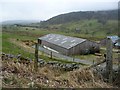
Farm building at Nabend
by Christine Johnstone geograph for square NY4125 Low cloud is obscuring some of the trees on Great Mell Fell. The farm building... (more)
Tags:
subject:Farm Building
top:Farm, Fishery, Market Gardening
type:Geograph
national park:Lake District
weather:Low Cloud
Nab
|

|
Valley cloud above the River Tummel
by Jim Barton for square NN9555 Low cloud hanging above the valley after a cold misty morning, seen from a... (more)
Tags:
top:Air, Sky, Weather
type:Cross Grid
Low Cloud
top:Rivers, Streams, Drainage
View Across Valley
|

|
The Afon Fathew valley under low cloud
by Christine Johnstone geograph for square SH6202 Judged against the summit of Ffridd Cocyn across the valley, the cloud is... (more)
|

|
Low grey clouds over West Field, near West Lilling
by Christine Johnstone geograph for square SE6365 The nearest buildings are at Eastfield Farm, the distant house at Westfield Farm.
Tags:
top:Air, Sky, Weather
top:Farm, Fishery, Market Gardening
subject:Farmland
Grey Clouds
weather:Low Cloud
|

|
Cloud envelops Beinn a' Chleibh
by Alan O'Dowd geograph for square NN2526 On a damp but mild day, low cloud was beginning to envelop the corrie, partially... (more)
|

|
Low cloud at Clarach Bay Holiday Village
by Christine Johnstone geograph for square SN5983 Looking north from the public footpath, across Dyffryn Clarach [the Clarach... (more)
Tags:
top:Air, Sky, Weather
subject:Caravan Park
place:Clarach Bay
Holiday Lodge
Holiday Village
weather:Low Cloud
top:Sport, Leisure
Static Caravan Park
|

|
Low cloud at Clarach Bay
by Christine Johnstone geograph for square SN5883 The cloud is about 90 metres above sea level.
|

|
Aspect near Ravenscar with low cloud
by Bill Boaden geograph for square NZ9701 The cloud is obscuring a lot of the view over Robin Hood's Bay.
|

|
Approaching low cloud on the M6
by Ann Cook geograph for square NY6006 This is just before Tebay Services East southbound on the M6. Within a few... (more)
|

|
Changing moods - low clouds
by Ann Cook geograph for square NX8853 Viewed from Fisher's Croft garden, the clouds are almost down to sea level.
|

|
Cloud over the Manor Valley
by Jim Barton for square NT2338 Low cloud on the hillsides in view from the ridge on Cademuir.
Tags:
top:Air, Sky, Weather
type:Cross Grid
Forest Boundary
weather:Low Cloud
top:Moorland
top:Uplands
View Up Valley
top:Woodland, Forest
|

|
A watery moon
by Bob Harvey for square TF0820 Above the frosted ground, a low cloud blanket, almost a risen fog, fills the... (more)
|

|
Low cloud from Auchtertyre
by Jim Barton geograph for square NN3528 Cloud drifting on the hills SE of Crianlarich seen from the West Highland Way... (more)
Tags:
top:Air, Sky, Weather
top:Farm, Fishery, Market Gardening
Farmland
Forestry Plantations
type:Geograph
Hillsides
weather:Low Cloud
long distance path:West Highland Way
top:Woodland, Forest
|
|
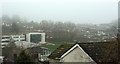
Cuthbert Mayne school in low cloud
by Derek Harper geograph for square SX9166 See SX9166 : Trumlands Road and St Marychurch in low cloud; this looks more to the right from the same spot in a vain... (more)
Tags:
top:Air, Sky, Weather
top:Educational Sites
type:Geograph
Houses
top:Housing, Dwellings
Low Cloud
top:Lowlands
School Chapel
Secondary School
top:Suburb, Urban Fringe
Trees
|

|
Sgiath nan Tarmachan ('wing of the ptarmigan')
by Alan O'Dowd geograph for square NN6219 This is the rather evocative name given on the map to the upper part of Ben... (more)
Tags:
top:Air, Sky, Weather
Ben Vorlich
top:Lakes, Wetland, Bog
Loch Earn
weather:Low Cloud
Low Cloud
Ridge
Snow
Snowy Mountainside
top:Uplands
|

|
Not a springlike day, Preston Sands
by Derek Harper for square SX8961 Miserable weather at the beach, with Torquay almost obliterated by low cloud,... (more)
Tags:
Beach
Breaking Waves
top:Coastal
Coastal Town
top:Estuary, Marine
type:Extra
Headland
Low Cloud
|

|
Wintry scene in Soonhope
by Jim Barton geograph for square NT2641 The temperature has stayed low since snowfalls on the 27th with low cloud adding... (more)
Tags:
top:Air, Sky, Weather
Coniferous Plantation
type:Geograph
Low Cloud
top:Paths
Snow Cover
Track
top:Woodland, Forest
|

|
Fenella Beach, Peel, just before sunset
by Christine Johnstone geograph for square SC2484 Half an hour before low tide.
Tags:
subject:Beach
Beach at Low Tide
top:Estuary, Marine
Fenellas Beach
type:Geograph
Grey Clouds
weather:Low Cloud
place:Peel
|
|
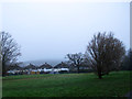
Western end of Eltham Park North
by Stephen Craven geograph for square TQ4375 Much of this side of the park is wooded, but with a small area of open land at... (more)
|

|
Buckden Village Stores
by Stephen Craven geograph for square SD9477 The village shop, with phone box alongside, on a day with low cloud in the dale.
|

|
Mist shrouds The Cobbler
by Alan O'Dowd geograph for square NN2606 The Cobbler (Ben Arthur) is largely hidden by low cloud in this view from the... (more)
|

|
Looking up to Beinn Bhàn through low cloud, Islay
by Becky Williamson geograph for square NR4057 |
