|
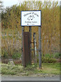
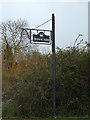
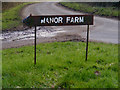
Manor Farm Fishing Lakes sign
by Geographer
for square TM1853
At the entrance to Manor Farm off the B1077 Ashbocking Road... (more)
|
|
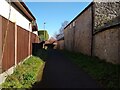
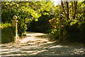
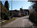
Footpath along the back of the Old Manor Inn
by Sofia
geograph for square ST3563
Footpath along the back of the Old Manor Inn. On the right former farm buildings... (more)
|
|
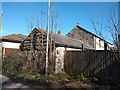
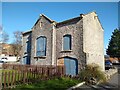
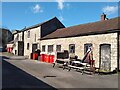
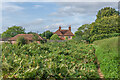
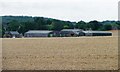
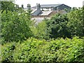
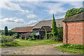
Former farm buildings
by Sofia
geograph for square ST3563
Former farm buildings of Manor Farm, which closed in 1980 when Manor Farm house... (more)
|
|
Former farm buildings
by Sofia
for square ST3563
Former farm buildings of Manor Farm, which closed in 1980 when Manor Farm house... (more)
|
|
Former farm buildings
by Sofia
for square ST3563
Former farm buildings of Manor Farm, which closed in 1980 when Manor Farm house... (more)
|
|
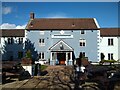
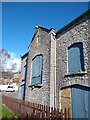
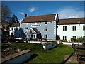
Old Manor Inn
by Sofia
geograph for square ST3563
The Old Manor Inn, Worle. Old farmhouse of Manor Farm. Converted into a public... (more)
|
|
Old Manor Inn
by Sofia
geograph for square ST3563
The Old Manor Inn, Worle. Old farmhouse of Manor Farm. Converted into a public... (more)
|
|
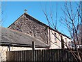
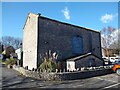
Old barn at former Manor Farm
by Sofia
geograph for square ST3563
Old barn and Cart House, located in the car park for the Old Manor Inn.... (more)
|
|
Old barn at former Manor Farm
by Sofia
geograph for square ST3563
Old barn and Cart House, located in the car park for the Old Manor Inn.... (more)
|
|
Old Manor Inn
by Sofia
geograph for square ST3563
The Old Manor Inn, Worle. Old farmhouse of Manor Farm. Converted into a public... (more)
|
|
Trethurffe Manor Entrance
by Mike Lyne
geograph for square SW8950
Entrance to the Trethurffe Manor farmhouse. The round balls on the top of the... (more)
|
|
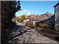
Newton's Road looking Northeast
by Sofia
geograph for square ST3563
Newton's Road looking Northeast towards Lyefield Road. The cream coloured... (more)
|
|
Former farm buildings
by Sofia
geograph for square ST3563
Former farm buildings of Manor Farm, which closed in 1980 when Manor Farm house... (more)
|
|
Hayloft of old barn at former Manor Farm
by Sofia
geograph for square ST3563
Hayloft of old barn and Cart House, located in the car park for the Old Manor... (more)
|
|
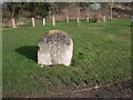
Stone near entrance to Eysey Manor Farm
by Vieve Forward
for square SU1194
This dressed stone is to be found near the entrance to Eysey Manor Farm (see... (more)
|
|
Eysey Manor
by Vieve Forward
geograph for square SU1194
Eysey Manor farmhouse (just right of centre to the rear) is Grade II Listed,... (more)
|
|
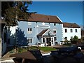
Old Manor Inn
by Sofia
geograph for square ST3563
The Old Manor Inn, Worle. Old farmhouse of Manor Farm. Converted into a public... (more)
|
|
Old Manor Inn
by Sofia
geograph for square ST3563
The Old Manor Inn, Worle. Old farmhouse of Manor Farm. Converted into a public... (more)
|
|
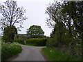
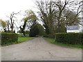
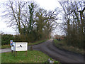
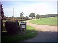
Entrance to Manor Farm & Swilland Manor
by Geographer
geograph for square TM1853
Off the B1077 Ashbocking Road
|
|
Entrance to Manor Farm
by Geographer
geograph for square TM3687
Off Manor Farm Lane
|
|
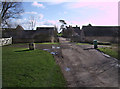
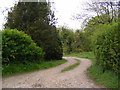
Manor Farm Lane & the entrance to Manor Farm
by Geographer
geograph for square TM3687
|
|
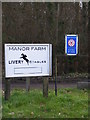
Manor Farm Livery Stables sign
by Geographer
for square TM4161
Off Grove Road at the entrance to Manor Farm
Link |
|
Manor Farm
by Ian Capper
geograph for square TQ0147
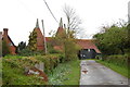
Farm off East Shalford Lane. The farmhouse, named Manor House, dates from the... (more)
|
|
Old Manor Inn
by Sofia
geograph for square ST3563
The Old Manor Inn, Worle. Old farmhouse of Manor Farm. Converted into a public... (more)
|
|
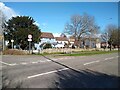
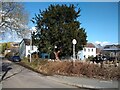
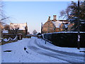
Newton's Road and Queen's Way junction
by Sofia
geograph for square ST3563
Junction of Newton's Road and Queen's Way, with the Old Manor Inn... (more)
|
|
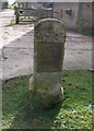
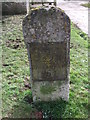
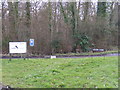
Thames & Severn Canal milestone, Eysey Manor Farm
by Vieve Forward
for square SU1194
One of two canal milestones outside the entrance to Eysey Manor Farm (see... (more)
|
|
Thames & Severn Canal milestone, Eysey Manor Farm
by Vieve Forward
for square SU1194
One of two canal milestones outside the entrance to Eysey Manor Farm (see... (more)
|
|
Footpath to Blacksmiths & Manor Roads & entrance to Manor Farm
by Geographer
geograph for square TM2651
Category: Footpath
Off Bredfield Road
|
|
Newton's Road looking Southwest
by Sofia
geograph for square ST3563
Newton's Road looking Southwest towards the junction with Queen's Way.... (more)
|
|
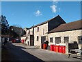
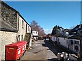
Service courtyard of the Old Manor Inn
by Sofia
geograph for square ST3563
Service courtyard of the Old Manor Inn. The stone building in the left was... (more)
|
|
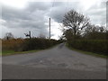
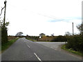
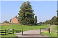
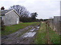
Entrance to Manor Farm
by Geographer
geograph for square TM1651
Off Ashbocking Road
|
|
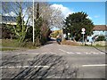
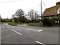
B1077 Ashbocking Road, Swilland
by Geographer
geograph for square TM1853
At the entrance to Swilland Manor & Manor Farm
|
|
The Green, Saxlingham Green
by Geographer
geograph for square TM2396
At the junction with Church Hill & Broaden Lane near Manor Farm
Postbox... (more)
|
|
Manor Farm
by Ian Capper
geograph for square SO3672
Farmhouse to Manor Farm, a farm on the outskirts of Brampton Bryan.
|
|
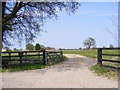
Entrance to Manor Farm
by Des Blenkinsopp
geograph for square SP5324
The buildings you see are Manor Farm Cottages. The Farm is along the road a bit.
|
|
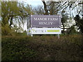
Manor Farm sign
by Geographer
for square TM1651
At the entrance to Manor Farm off Ashbocking Road
|
|
Manor Farm sign
by Geographer
for square TM1853
At the entrance to Manor Farm off the B1077 Ashbocking Road
|
|
Manor Farm, Notton
by Christine Johnstone
geograph for square SE3413
Looking south from the former railway line.
|
|
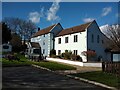
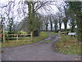
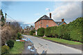
Entrance to Manor Farm, Glinton, in the winter
by Paul Bryan
geograph for square TF1505
The Manor House, built circa 1640 to 1650, can be seen on the right.
|
|
Entrance to Manor Farm
by Geographer
geograph for square TM2574
|
|
Manor Farm sign
by Geographer
for square TM4161
Off Grove Road at the entrance to Manor Farm
|
|
The entrance to Manor Farm
by Geographer
geograph for square TM4161
|
|
Manor Farm signs
by Geographer
geograph for square TM4161
Off Grove Road at the entrance to Manor Farm
Link |
|
Manor Farm, Grindale
by Christine Johnstone
geograph for square TA1371
Seen from the raised pavement outside the village church.
|
|
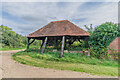
Oast at Manor Farm, Frittenden
by Julian P Guffogg
geograph for square TQ8141
|
|
Bridleway to Low Grange Farm
by Geographer
geograph for square TM3369
Category: Bridleway
Off Mill Road near Manor Farm & Bridleway Cottage
Peasenhall Bridleway No.3
|
|
The entrance to Manor Farm, Huntingfield
by Geographer
geograph for square TM3374
Category: Farm
Off Barell's Hill
|
|
Manor Farm
by Ian Capper
geograph for square TQ0147
Open sided barn at Manor Farm.
|
|
Manor Farm
by Ian Capper
geograph for square TQ0147
Outbuildings at Manor Farm.
|
|
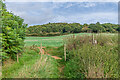
North from Manor Farm
by Ian Capper
geograph for square TQ0147
Looking north through a field entrance by Manor Farm.
|