Public Tags
Tag: Military·Range
Other tags: subject:Military Range
Showing latest 50 of 343 images tagged with Military Range tag.

|
Range Lookout Post C
by valenta geograph for square NH7757 Range Lookout Post C and CCTV camera on the Fort George military range. The... (more)
Tags:
top:Coastal
top:Defence, Military
top:Estuary, Marine
place:Fort George
type:Geograph
Military Firing Range
subject:Military Infrastructure
subject:Military Range
Military Training Area
|

|
12 to 1
by Oast House Archive geograph for square TR1533 Category: Firing range Numbers on embankments on Hythe Ranges, there are three such embankments along... (more)
|

|
1 to 12
by Oast House Archive geograph for square TR1533 Category: Firing range Numbers 1 to 12 on embankment at Hythe Ranges. One of three similar embankments.... (more)
|

|
Hythe Ranges
by Oast House Archive geograph for square TR1332 Category: Firing range |

|
Hythe Ranges
by Oast House Archive geograph for square TR1332 Category: Firing range |

|
View across Lulworth Ranges towards Lulworth Castle
by Phil Champion geograph for square SY8680 The farm is Monastery Farm, located well within the firing ranges.
Tags:
top:Defence, Military
Firing Range
type:Geograph
near:Lulworth Castle
place:Lulworth Ranges
subject:Military Range
Military Range
Ranges
|

|
The edge of the artillery range
by Philip Halling geograph for square SN9638 This is as far as it is possible to go today, the red flag is flying, just... (more)
Tags:
top:Defence, Military
top:Farm, Fishery, Market Gardening
Field
type:Geograph
subject:Military Range
Military Range
|

|
View across Lulworth Ranges from the coast path east of Arish Mell
by Phil Champion geograph for square SY8580 There are several tanks here, used as targets.
Tags:
top:Defence, Military
county:Dorset
Firing Range
type:Geograph
top:Grassland
Isle of Pubeck
top:Lowlands
near:Lulworth
Lulworth Ranges
place:Lulworth Ranges
subject:Military Range
Military Range
Target
near:Tyneham
|

|
Notices at the Bindon Hill entrance to the Lulworth Ranges Walks, Dorset
by Phil Champion for square SY8280 Tags:
Bindon Hill
Byelaws
type:Close Look
top:Defence, Military
county:Dorset
top:Lowlands
Lulworth Ranges
Military Firing Range
subject:Military Range
Notice
Range Walks
near:West Lulworth
|

|
Disused moving target railway near Arish Mell, Lulworth Ranges
by Phil Champion geograph for square SY8580 Targets would have been pulled along by cables. This equipment doesn't seem... (more)
Tags:
top:Defence, Military
Firing Range
type:Geograph
near:Lulworth
Lulworth Ranges
place:Lulworth Ranges
subject:Military Range
near:Tyneham
|

|
Fort George Range
by valenta geograph for square NH7657 The MOD allow public access to the dunes and the scrub area around the Fort... (more)
Tags:
top:Coastal
top:Defence, Military
fort:Fort George
type:Geograph
top:Heath, Scrub
Military Firing Range
subject:Military Range
top:Roads, Road Transport
|

|
View over the Bindon Range
by Philip Halling geograph for square SY8480 View over the Bindon Range, part of the Lulworth Range towards Lulworth Castle,... (more)
|

|
View over Bindon Range
by Philip Halling geograph for square SY8480 The Bindon military range viewed from the coast path high above Mupe Bay, a... (more)
Tags:
top:Defence, Military
Military Range
|

|
Donna Nook Range - Military Relics
by Colin Smith geograph for square TA4100 Concrete bases on the sand dunes at Somercotes Haven and overlooking the Humber... (more)
Tags:
top:Coastal
top:Defence, Military
top:Estuary, Marine
type:Geograph
Humber Estuary
subject:Military Range
Ministry of Defence
RAF Donna Nook
place:Somercotes Haven
Tidal Mudflats
|

|
Access road to the MOD Pendine complex
by Eirian Evans geograph for square SN2508 MOD Pendine is a military range operated by the defence technology company... (more)
Tags:
top:Defence, Military
type:Geograph
top:Lowlands
subject:Military Range
top:Village, Rural Settlement
|

|
Tank Range, Bushman's Road, Otterburn Ranges
by Andrew Curtis for square NT8201 This photo is a peak through a large crack in the iron of the nissen hut which... (more)
Tags:
type:Close Look
top:Defence, Military
top:Derelict, Disused
type:Inside
subject:Military Range
top:Railways
top:Uplands
|

|
Tank Range, Bushman's Road, Otterburn Ranges
by Andrew Curtis geograph for square NT8201 Woodland close to Bellshiel Law can be seen in the distance.
Tags:
top:Defence, Military
top:Derelict, Disused
type:Geograph
subject:Military Range
top:Moorland
top:Uplands
|

|
Tank Range, Bushman's Road, Otterburn Ranges
by Andrew Curtis geograph for square NT8201 Tags:
top:Defence, Military
top:Derelict, Disused
type:Geograph
subject:Military Range
top:Moorland
top:Uplands
|

|
Tank Range, Bushman's Road, Otterburn Ranges
by Andrew Curtis geograph for square NT8201 Tags:
top:Defence, Military
top:Derelict, Disused
type:Geograph
subject:Military Range
top:Moorland
top:Railways
top:Uplands
|

|
Tank Range, Bushman's Road, Otterburn Ranges
by Andrew Curtis geograph for square NT8201 View of the modern toilet block and Nissen hut (engine shed) close to... (more)
Tags:
top:Defence, Military
top:Derelict, Disused
type:Geograph
subject:Military Range
top:Moorland
top:Uplands
|

|
Mounthilly tank range from the air
by Thomas Nugent for square NT8201 The railway track at the tank range can be seen to the left of the centre of the... (more)
|

|
Former shooting butts, Rainham Marshes
by David Smith geograph for square TQ5479 For most of the 20th century, Rainham Marshes were used for military training;... (more)
Tags:
top:Defence, Military
type:Geograph
top:Lakes, Wetland, Bog
subject:Military Range
Military Training Area
Shooting Butts
|

|
Heathland near Tyneham
by Philip Halling geograph for square SY8779 Military range viewed from the South West Coast Path, further up the valley is... (more)
Tags:
top:Defence, Military
type:Geograph
top:Heath, Scrub
Heathland
subject:Military Range
Military Range
|

|
MOD range at Garelochhead
by Trevor Littlewood geograph for square NS2689 The southern boundary fence of the army range at Garelochhead as seen from the... (more)
Tags:
top:Boundary, Barrier
top:Defence, Military
Grassy Moorland
subject:Military Range
Military Range
MOD Warning Notice
top:Moorland
|

|
Tank Remains
by Rude Health for square NT8503 Tank remains on the edge of a military firing range near Otterburn.
Tags:
top:Defence, Military
subject:Military Range
top:Moorland
Otterburm Military Range
top:Uplands
|

|
Target Practice
by Rude Health geograph for square NT8503 Otterburn military range targets surrounded by numerous burnt out tanks.
Tags:
top:Defence, Military
subject:Military Range
top:Moorland
Otterburm Military Range
top:Uplands
|

|
Military Access gate On Tonerspuddle Heath
by Nigel Mykura geograph for square SY8291 The signs on the gate says:
Bovington Training Area
Military Training Area... (more)
|

|
Seriously no entry
by David Pashley geograph for square TL8298 Access gate to STANTA firing range. STANTA stands for STANford Training Area... (more)
Tags:
Access Gate
near:Bodney
top:Defence, Military
top:Flat Landscapes
type:Geograph
subject:Military Range
MOD Firing Range
Norfolk
top:Roads, Road Transport
|

|
Military Access Point, Bovington Training Areas
by Nigel Mykura geograph for square SY8289 This is one of the main entrances to a tank training area to the north west of... (more)
|

|
Air Defence Range Manorbier
by Eirian Evans geograph for square SS0797 From the coast path. The site is currently used as training and testing range... (more)
|

|
Battle Hill Firing Range
by David Robinson geograph for square NY9617 The range is crossed by several public rights of way. The gate here guards the... (more)
|

|
Ash Ranges - Wyke Common
by Colin Smith for square SU9152 View from Normandy Hill following the fence line separating army ranges (left)... (more)
Tags:
place:Ash Ranges
type:Cross Grid
top:Defence, Military
top:Heath, Scrub
subject:Military Range
|

|
Whitburn Rifle Ranges
by Andrew Curtis geograph for square NZ4162 At Whitburn there are five ranges, one 40 yards long for side arms, and four for... (more)
Tags:
top:Coastal
top:Defence, Military
top:Derelict, Disused
top:Farm, Fishery, Market Gardening
type:Geograph
subject:Military Range
top:Paths
|

|
Former Belper Volunteer Battalion firing range
by Ian Calderwood geograph for square SK3345 The range and its target wall pictured in SK3345 : Wall on Chevin Ridge, are grade 2 listed... (more)
Tags:
top:Defence, Military
top:Derelict, Disused
former:Firing Range
type:Geograph
Grade II Listed
subject:Military Range
top:Suburb, Urban Fringe
|

|
Military Access Gate
by Nigel Mykura geograph for square SY8390 This access gate opens onto the Wareham to Clouds Hill road on the north side of... (more)
|

|
Military Training Tracks
by Nigel Mykura geograph for square SY8290 These concrete roadways have been set out on the Bovington Training Area for... (more)
|

|
Tank training on Bovington Heath
by Nigel Mykura geograph for square SY8290 A parking area has been provided to allow the public to see part of the military... (more)
|

|
Track on Throop Heath
by Nigel Mykura geograph for square SY8291 Although this heathland is adjacent to the Bovington Military training area and... (more)
|

|
Disused range near Ailstone Farm
by David P Howard geograph for square SP2251 Category: Firing range View ESE from the footpath near Ailstone Farm, across what is marked on the map... (more)
|

|
Lane between Tyneham Church and School Museum
by David Martin geograph for square SY8880 For an interior view of the school, see SY8880 : Inside Tyneham School Museum.
Tags:
Abandoned Village
top:Defence, Military
top:Educational Sites
type:Geograph
top:Historic Sites and Artefacts
subject:Lane
Military Range
Museum
top:Village, Rural Settlement
|

|
Cattle grid on track within Lulworth Range
by David Martin geograph for square SY8978 The coast path follows this track around the perimeter of the military range.
Tags:
Cattle Grid
top:Defence, Military
type:Geograph
Military Range
top:Paths
top:Roads, Road Transport
subject:Track
|

|
Military rifle range
by DS Pugh geograph for square SE6458 One of a number of ranges on the common which are part of Queen Elizabeth Barracks.
|

|
Ash Vale Ranges - Danger Sign
by Colin Smith geograph for square SU8951 Red flag and danger signs at a military training area near Aldershot, the... (more)
Tags:
place:Ash Ranges
Danger Signs
top:Defence, Military
Fences
type:Geograph
subject:Military Range
Red Danger Flag
|

|
Ash Vale Ranges
by Colin Smith for square SU9051 Red flag and fencing at a military training area near Aldershot, the "Home... (more)
Tags:
place:Ash Ranges
type:Cross Grid
top:Defence, Military
Fences
subject:Military Range
top:Paths
Red Danger Flag
|
|
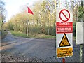
Ash Vale Ranges
by Colin Smith geograph for square SU8952 Red flag and danger signs at a military training area near Aldershot, the... (more)
Tags:
place:Ash Ranges
Danger Signs
top:Defence, Military
type:Geograph
subject:Military Range
Red Danger Flag
|

|
Penning Down, Wiltshire
by Rebecca A Wills geograph for square SU0355 Signs of military activity on the perimeter range road north of the Westdown... (more)
Tags:
top:Defence, Military
top:Farm, Fishery, Market Gardening
type:Geograph
top:Grassland
subject:Military Range
top:Uplands
|

|
Observation post west of Ridlees Cairn
by Andrew Curtis geograph for square NT8404 The observation post was probably built after World War I and is one of a pair,... (more)
Tags:
top:Defence, Military
top:Derelict, Disused
type:Geograph
subject:Military Range
top:Moorland
top:Uplands
|

|
Warning sign on the coast path above Mupe Bay, Lulworth Ranges
by Phil Champion geograph for square SY8480 The coast path had been rerouted slightly due to erosion.
Tags:
Bindon Hill
Cliffs
Coast
Coast Path
top:Coastal
top:Defence, Military
Firing Range
type:Geograph
top:Grassland
Lulworth Ranges
place:Lulworth Ranges
Military Range
Mupe Bay
Path
Sea Cliffs
Warning Notice
Warning Sign
|

|
Danger - Cliffs
by Phil Champion for square SY8480 Warning sign on the coast path above Mupe Bay as it climbs up the flank of... (more)
Tags:
Bindon Hill
Cliffs
type:Close Look
Coast
Coast Path
top:Coastal
top:Defence, Military
Firing Range
Lulworth Ranges
place:Lulworth Ranges
Military Range
Mupe Bay
top:Paths
Sea Cliffs
Warning Sign
|
