Public Tags
Tag: Muddy·Lane
Showing images tagged with Muddy Lane tag.

|
Mud on Woodcutts Lane, near Wimborne Minster
by Malc McDonald geograph for square SU0105 Woodcutts Lane is a minor lane through Dorset countryside.
This image was... (more)
Tags:
ceremonial county:Dorset
county:Dorset
time:Dusk
Dusk
type:Geograph
subject:Lane
Minor Lane
Minor Road
Minor Rural Lane
Minor Rural Road
Mud
Mud on Road
Muddy
Muddy Lane
top:Roads, Road Transport
Rural Lane
Rural Road
near:Wimborne
|

|
North Park Lane, near Godstone
by Malc McDonald geograph for square TQ3452 This muddy track near Godstone is called North Park Lane.
Traffic passes by... (more)
Tags:
near:Caterham
type:Geograph
near:Godstone
subject:Lane
Muddy Lane
Muddy Track
place:North Downs
Puddle
Puddles
top:Roads, Road Transport
county:Surrey
|
|
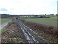
Bridle Path at Shitterton
by Nigel Mykura geograph for square SY8394 This very muddy bridle path leads from Shitterton up onto Black Hill. On some OS... (more)
|

|
Forest Edge, Thorney Hill, near Bransgore
by Malc McDonald geograph for square SZ1999 Forest Edge is an unmade road in the hamlet of Thorney Hill, in the New Forest... (more)
Tags:
near:Bransgore
weather:Dull
Dull Day
Dull Weather
type:Geograph
county:Hampshire
Muddy Lane
Muddy Road
Muddy Side Road
place:New Forest
national park:New Forest
New Forest
New Forest National Park
near:Ringwood
subject:Road
place:Thorney Hill
Unmade Lane
Unmade Road
top:Village, Rural Settlement
|
|
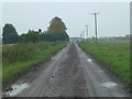
Muddy Middle Road near March
by Richard Humphrey geograph for square TL3897 Many country roads are covered in mud thanks to the potato and sugar beet... (more)
Tags:
Country Lane
Country Road
Fen
Fenland
top:Flat Landscapes
Mud
Muddy
Muddy Lane
top:Roads, Road Transport
|

|
Old Lane
by Richard Croft geograph for square TF0352 Muddy single track lane to old Brauncewell
|

|
Old Lane
by Richard Croft geograph for square TF0352 Muddy single-track lane from Old Brauncewell towards the A15
|

|
Tilden Lane
by Julian P Guffogg geograph for square TQ7447 Muddy and wet.
|

|
House at Hardington Marsh
by Nigel Mykura geograph for square ST5009 The road to Hardington Marsh is a dead-end and this house third but last house... (more)
|

|
Lane after muck-spreading
by Jonathan Hutchins geograph for square SJ8051 Cross Lane is in an extremely muddy state after farm vehicles have passed to and fro.
Tags:
near:Audley
top:Farm, Fishery, Market Gardening
type:Geograph
subject:Lane
Muck Spreading
Muddy Lane
top:Roads, Road Transport
top:Village, Rural Settlement
top:Waste, Waste Management
|

|
Danger mud on road
by Richard Humphrey geograph for square TF8323 A common sight near sugar beet fields in Norfolk this time of year. No effort... (more)
|

|
Muddy Wateringpit Lane
by David Pashley geograph for square TG3022 Tags:
top:Farm, Fishery, Market Gardening
type:Geograph
subject:Lane
top:Lowlands
Muddy Lane
top:Paths
top:Roads, Road Transport
|

|
Muddy lane with feeding pony
by Trevor Littlewood geograph for square NZ0836 The lane leads to an area known as The Batts which lies on the south side of the... (more)
Tags:
top:Farm, Fishery, Market Gardening
Feeding Pony
type:Geograph
Muddy Lane
top:Roads, Road Transport
|
|
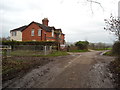
Cottages, Stainswick Lane
by Vieve Forward geograph for square SU2487 Red brick cottages next to a muddy Stainswick Lane.
|

|
Muddy lane towards North Farm
by J.Hannan-Briggs geograph for square TF2785 |

|
Miry Lane begins to live up to its name
by Christine Johnstone geograph for square SE0124 The stile leads to the former Nab End Quarries, now open access land.
Tags:
Bridleway
path:Bridleway
Lane
Muddy Lane
Muddy Path
Open Access Land
top:Paths
Public Bridleway
Stile
|

|
Muddy lane to Vemplett's Cross
by David Smith geograph for square ST0538 Tags:
Muddy Lane
top:Roads, Road Transport
|

|
Muddy lane, Galbally
by Kenneth Allen geograph for square H4770 This is where I was glad to have my Wellies on!
|
|
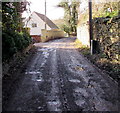
Muddy surface, Park Lane, Inchbrook
by Jaggery geograph for square SO8400 Viewed in December 2015.
|

|
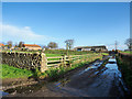
Muddy Ratsloe
by Anthony Vosper geograph for square SX9597 Approaching Ratsloe from Bowls Cross. Heavy winter's rain has washed mud... (more)
|
|
Barn at High Farm
by Trevor Littlewood geograph for square SE4256 A muddy lane gives access to the barn at High Farm in the village of Hopperton.
Tags:
subject:Barn
Barn
top:Farm, Fishery, Market Gardening
type:Geograph
top:Lowlands
Muddy Lane
top:Roads, Road Transport
|

|
Strawberry Lane
by Peter Holmes geograph for square TQ1016 A muddy patch on public bridleway 2483.
|

|
Smithy Lane, heading north-west
by Christine Johnstone geograph for square SK0713 Towards Longdon's Borough Lane.
Tags:
type:Geograph
Hedge-Lined Road
subject:Lane
Muddy Lane
Narrow Country Lane
top:Roads, Road Transport
Roadside Hedgerows
Single Track Lane
Single-Track Road
lane:Smithy Lane
|

|
Smithy Lane, heading south
by Christine Johnstone geograph for square SK0713 Winding its narrow way between Longdon's Borough Lane and Longdon... (more)
Tags:
type:Geograph
weather:Grey
Hedge-Lined Road
subject:Lane
Muddy Lane
Narrow Country Lane
top:Roads, Road Transport
Roadside Hedgerows
Single Track Lane
Single-Track Road
lane:Smithy Lane
|

|
Triangulation pillar, Poulton Downs
by Vieve Forward geograph for square SU2072 This triangulation pillar (trig point) is hidden in a muddy byway. Though... (more)
|

|
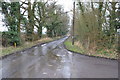
Mud on a corner of Mill Lane
by J.Hannan-Briggs geograph for square TF4778 Near Glebe Farm.
|
|
Long Lane
by Julian P Guffogg geograph for square TQ7748 At the time the picture was taken there were large amounts of water running down... (more)
|

|
Jackson's Lane, after snow
by Christine Johnstone geograph for square SE2318 Contrast this with a summertime view SE2318 : Jackson's Lane, Thornhill .
|

|
End of highway, Mead Lane
by M J Roscoe geograph for square ST4083 Approaching the end of the highway. The lane continues as a track, with public... (more)
Tags:
top:Boundary, Barrier
top:Flat Landscapes
type:Geograph
Grass Verge with Trees
subject:Lane
Muddy Lane
No Motor Vehicles Sign
Redwick Circular Walk
top:Roads, Road Transport
|

|
Low Straights Lane heading west-north-west
by Trevor Littlewood geograph for square SD9391 The farm road of Low Straights Lane to the north of Askrigg passing through... (more)
Tags:
top:Boundary, Barrier
Dry Stone Walls
top:Farm, Fishery, Market Gardening
type:Geograph
subject:Lane
Muddy Lane
top:Roads, Road Transport
Rough Grazing
|

|
Junction by Trebant Water
by Derek Harper geograph for square SX1759 The stream crossing can be seen in the background, just beyond a junction... (more)
|

|
Red Hall Lane
by Jonathan Hutchins geograph for square SJ7948 Tags:
near:Bateswood Country Park
Farm Track
type:Geograph
subject:Lane
Muddy Lane
top:Roads, Road Transport
|
|
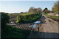
Mud and potholes on Oak Lane
by Bill Boaden geograph for square SJ9409 The mud comes from a field entrance near Oak Lane Farm.
Tags:
top:Farm, Fishery, Market Gardening
type:Geograph
top:Lowlands
Muddy Lane
top:Roads, Road Transport
|

|
Farm lane near to Whitrigg
by Trevor Littlewood geograph for square NY2038 The lane which is also initially a bridleway lies to the west of the small... (more)
Tags:
top:Boundary, Barrier
Bridleway
subject:Bridleway
Farm Road
top:Farm, Fishery, Market Gardening
Hedges
top:Lowlands
Muddy Lane
top:Roads, Road Transport
|

|
Lane towards Hallington
by J.Hannan-Briggs geograph for square TF2785 |

|
Garden Hill Lane
by Christine Johnstone geograph for square SU6221 Looks and feels like a stream bed, so the photographer has taken to the high... (more)
|

|
Lane running west from Loosebeare Cross
by David Smith geograph for square SS7105 Judging from old OS maps, this lane was once metalled. Now it is a rough track.
|

|
Heavy plant crossing, Dryham Lane
by Christine Johnstone geograph for square SE8732 It certainly has been.
|

|
Outbuildings at Mead Farm, Mead Lane
by M J Roscoe geograph for square ST4083 The pile of sand is used for bedding for dairy cattle.
Tags:
Agricultural Buildings
top:Boundary, Barrier
subject:Farm Building
Farmyard Entrance
top:Flat Landscapes
type:Geograph
Muddy Lane
top:Roads, Road Transport
|

|
Public Byway on Beacon Hill, East Devon
by Andrew Tryon geograph for square SY1192 Tags:
place:Beacon Hill
place:Devon
place:East Hill
place:England
type:Geograph
Muddy Lane
subject:Track
top:Uplands
top:Woodland, Forest
|
