Public Tags
Other tags: Peak
Showing images tagged with national park:Peak tag.
|
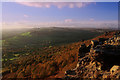
On the Edge
by Andy Stephenson geograph for square SK2575 Curbar Edge, looking north on a fine Autumn evening. Someone is perched on a... (more)
Tags:
top:Air, Sky, Weather
season:Autumn
Autumn Colour
Autumn Scene
Autumn Trees
subject:Cliff
Curbar
place:Curbar Edge
type:Geograph
top:Geological Interest
Golden Sunset
national park:Peak
Peak District
place:Peak District
national park:Peak District
Peak District National Park
top:Rocks, Scree, Cliffs
time:Sunset
top:Uplands
top:Woodland, Forest
|
|
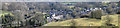
Stoney Middleton
by Dave Pickersgill geograph for square SK2275 Tags:
county:Derbyshire
top:Paths
national park:Peak
place:Peak District
national park:Peak District
Peak District
top:Roads, Road Transport
place:Stoney Middleton
top:Uplands
subject:Village
top:Village, Rural Settlement
|
|
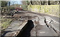
The road to Eyam
by Dave Pickersgill geograph for square SK2276 The currently closed road to Eyam.
Tags:
county:Derbyshire
place:Eyam
top:Paths
national park:Peak
place:Peak District
national park:Peak District
Peak District
subject:Road
top:Roads, Road Transport
top:Uplands
top:Village, Rural Settlement
|
|
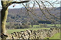
Stoke Hall Hotel and Froggatt
by Dave Pickersgill for square SK2476 Stoke Hall Hotel with the village of Froggatt in the background.
Tags:
county:Derbyshire
Froggatt Derbyshire
subject:Hotel
top:Moorland
top:Paths
national park:Peak
place:Peak District
national park:Peak District
Peak District
top:Roads, Road Transport
top:Uplands
top:Village, Rural Settlement
|

|
The Peak District
by Dave Pickersgill geograph for square SK2891 Tags:
type:Geograph
national park:Peak
Peak District National Park
top:Roads, Road Transport
subject:Sign
|

|
The Wheel Stones
by Stephen Burton geograph for square SK2088 Also known as The Coach and Horses this formation of Gritstone rocks is one of... (more)
Tags:
type:Geograph
Gritstone
rock:Millstone Grit
top:Paths
national park:Peak
Peak District
national park:Peak District
subject:Rock
top:Rocks, Scree, Cliffs
season:Summer
top:Uplands
Wheel Stones
|
|
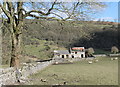
Ruined farmhouse
by Dave Pickersgill geograph for square SK2275 A ruined farmhouse in the National Park.
Tags:
county:Derbyshire
place:Eyam
top:Farm, Fishery, Market Gardening
top:Paths
national park:Peak
Peak District
place:Peak District
subject:Ruin
top:Uplands
top:Village, Rural Settlement
top:Woodland, Forest
|

|
Anniversary walk
by Dave Pickersgill geograph for square SK2090 On the 84th.anniversary of the Abbey Brook trespass, 'Walk Sheffield... (more)
Tags:
type:Geograph
top:Geological Interest
subject:Moorland
top:Paths
national park:Peak
national park:Peak District
top:People, Events
top:Sport, Leisure
Stocksbridge Walkers Are Welcome
top:Uplands
Walkers
|
|
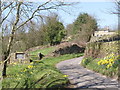
Back Lane, Low Holdworth
by Alan Murray-Rust geograph for square SK2890 A standard Peak National Park millstone sign, with Holdworth House Farm higher... (more)
Tags:
Boundary Stone
top:Boundary, Barrier
Country Lane
Daffodils
Farmstead
top:Lowlands
national park:Peak
top:Roads, Road Transport
|

|
Wain Stones
by Stephen Burton geograph for square SK0995 Tags:
Bleaklow
Dark Peak
type:Geograph
Named Rock Formation
national park:Peak
Peak District
top:Rocks, Scree, Cliffs
season:Spring
subject:Stone
place:The Dark Peak
top:Uplands
|
|
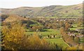
The Hope Valley
by Dave Pickersgill for square SK1783 The village of Hope and the Hope Valley in the Peak District.
Tags:
place:Derbyshire
place:Hope
place:Hope Valley
top:Moorland
national park:Peak
place:Peak District
Peak District
top:Roads, Road Transport
top:Sport, Leisure
top:Uplands
top:Village, Rural Settlement
|
|
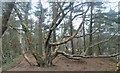
Mis-shapen tree
by Dave Pickersgill geograph for square SE2000 Tags:
type:Geograph
name:Langsett Reservoir
place:Langsett Reservoir
top:Paths
national park:Peak
place:Peak District
Peak District
subject:Tree
top:Uplands
Wood
top:Woodland, Forest
|

|
The Great Ridge Path
by Stephen Burton geograph for square SK1384 In the view of some people The Great Ridge footpath that runs between Lose Hill... (more)
Tags:
Dry Stone Wall
type:Geograph
Mam Tor
Mist
weather:Mist
top:Paths
national park:Peak
Peak District
subject:Ridge
Sheep Mesh
top:Uplands
season:Winter
|
|
Langsett Bank
by Dave Pickersgill geograph for square SE2000 Woods on the NE shore of Langsett reservoir.
Tags:
place:Langsett
top:Paths
national park:Peak
Peak District
place:Peak District
Reservoir
top:Uplands
top:Water Resources
top:Woodland, Forest
|

|
View over White Moss
by Alan Murray-Rust geograph for square SE0506 West Nab on the skyline is about as close as one gets to a peak in this part of... (more)
|

|
The Vale of Edale, High Peak District, Derbyshire
by Derek Voller geograph for square SK1283 |

|
The Vale of Edale, High Peak District, Derbyshire
by Derek Voller geograph for square SK1183 |

|
Langsett Reservoir
by Dave Pickersgill for square SK2099 Tags:
near:Barnsley
type:Cross Grid
place:Langsett
place:Langsett Reservoir
Langsett Reservoir
name:Langsett Reservoir
top:Paths
national park:Peak
place:Peak District
subject:Reservoir
top:Uplands
top:Water Resources
|

|
Track at Ladybower Wood
by Stephen Burton geograph for square SK2086 Track running up from the Ladybower Inn towards the Ladybower Wood... (more)
Tags:
type:Geograph
subject:Path
top:Paths
national park:Peak
Peak District
season:Summer
top:Uplands
top:Woodland, Forest
|

|
Grains in the water
by Stephen Burton geograph for square SK1094 Streams meeting to form the River Alport
Tags:
river:Alport
type:Geograph
top:Moorland
national park:Peak
Peak District
top:Rivers, Streams, Drainage
season:Spring
subject:Stream
top:Uplands
|

|
Five bar gate
by Stephen Burton geograph for square SK1587 This five bar gate is made with a Double Crossbars.
|

|
Path sign on Mickleden Edge
by Dave Pickersgill for square SK1998 Path sign on Mickleden Edge. Hazlehead Station is long closed.
Tags:
top:Heath, Scrub
place:Langsett
top:Moorland
top:Paths
national park:Peak
Peak District
Sign
top:Uplands
|

|
Alan R Reece
by Stephen Burton geograph for square SK0971 Memorial to an engineer who specialized in earth moving equipment... (more)
Tags:
Deep Dale
type:Geograph
subject:Memorial
top:Paths
national park:Peak
top:People, Events
season:Summer
top:Woodland, Forest
|

|
Milestone on the Holmfirth Road
by Alan Murray-Rust geograph for square SE0205 General view with the milestone seen here Link .
Tags:
road:A635
material:Cast Iron
Milestone
Moorland
national park:Peak
top:Roads, Road Transport
Turnpike Road
top:Uplands
Valley View
milestoneid:YW GFSLH02
milestoneid:YW GFSLH02
|

|
View from the Holmfirth Road
by Alan Murray-Rust geograph for square SE0205 Looking towards Holme Clough and Middle Edge Moss with Bill o'Jacks... (more)
|

|
White, Black and Brown
by Alan Murray-Rust geograph for square SE0506 This is White Moss (part of Marsden Moor), at Black Gate, with a lot of brown... (more)
|
