Public Tags
Showing images tagged with national trail:The Ridgeway tag.
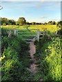
|
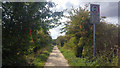
Gate on The Ridgeway National Trail
by PAUL FARMER
geograph for square SU5985
|
|
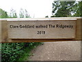
Wooden Plaque at Whiteleaf Hill
by David Hillas
for square SP8203
This wooden plaque in located on The Ridgeway above Whiteleaf Cross. It mentions... (more)
|
|
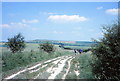
The Ridgeway, July 1979
by Jeff Buck
geograph for square SU2885
The Ridgeway was opened as a National Trail in 1973. This photo was taken in... (more)
|
|
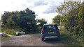
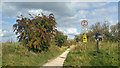
Vehicle parked on the Ridgeway near path to Wayland's Smithy Long Barrow
by Phil Champion
geograph for square SU2885
There is no public right of way along this part of the Ridgeway for... (more)
|
|
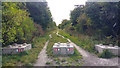
Concrete blocks on the Ridgeway near the path to Wayland's Smithy
by Phil Champion
geograph for square SU2885
This length of the Ridgeway is a Restricted Byway. There is no public right of... (more)
|
|
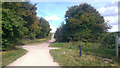
The Ridgeway, east of a crossroads near Waylands Smithy
by Phil Champion
geograph for square SU2885
|
|
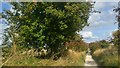
Apple tree on the Ridgeway, east of Wayland's Smithy
by Phil Champion
geograph for square SU2885
|
|
The Ridgeway climbing White Horse Hill, near Uffington Castle
by Phil Champion
geograph for square SU2986
|
|
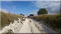
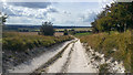
The Ridgeway, west of White Horse Hill
by Phil Champion
geograph for square SU2985
|
|
Crossroads of the Ridgeway and a track to Woolstone Hill Barn
by Phil Champion
geograph for square SU2985
|
|
The Ridgeway at White Horse Hill, below Uffington Castle
by Phil Champion
geograph for square SU2986
|
|
The Ridgeway, west of White Horse Hill
by Phil Champion
geograph for square SU2885
The ramparts of Uffington Castle Iron Age Hill Fort can be seen on the skyline.
|
|
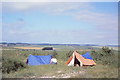
Pitching on the Ridgeway, July 1979
by Jeff Buck
geograph for square SU5382
Pitching tents on the Ridgeway at Roden Downs. Photo taken in July 1979 and... (more)
|
|
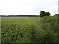
Fields by The Ridgeway
by David Purchase
geograph for square SU2784
The Ridgeway, a National Trail, follows the line of bushes leading to the centre... (more)
|
|
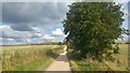
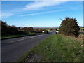
The Ridgeway at the road junction above Liddington
by Vieve Forward
geograph for square SU2180
The Ridgeway here runs alongside the busy main road from Liddington to Aldbourne.
|