|
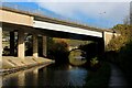
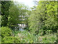
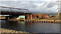
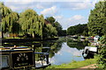
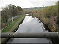
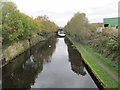
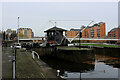
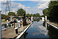
Calder and Hebble Navigation approaching the A629 Flyover
by Chris Heaton
geograph for square SE1021
The A629, Calderdale Way flyover crossing the Calder and Hebble Navigation - the... (more)
|
|
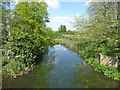
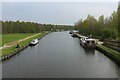
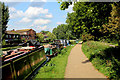
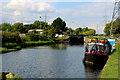
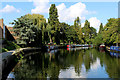
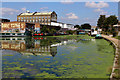
Calder and Hebble Navigation heading East towards Cromwell Bottom
by Chris Heaton
geograph for square SE1122
Pleasant stretch of the canal between Elland and Brighouse, as it passes through... (more)
|

|
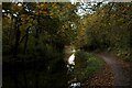
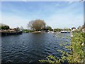
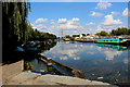
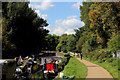
Calder and Hebble Navigation from Park Nook Lock
by Chris Heaton
geograph for square SE1122
|
|
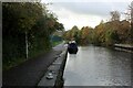
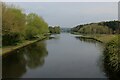
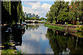
Looking South West along the Calder and Hebble Navigation
by Chris Heaton
geograph for square SE1121
As seen from Elland Lock
|
|
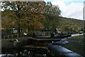
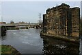
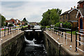
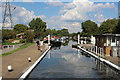
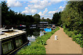
Elland Lock
by Chris Heaton
geograph for square SE1121
Lock system on the Calder and Hebble Navigation, near Elland
|
|
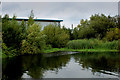
A branch of the River Lee Navigation
by Marathon
geograph for square TQ3695
The original River Lea flowed 70 miles from Leagrove Marsh near Luton to the... (more)
|
|
A branch of the River Lee Navigation
by Marathon
geograph for square TQ3695
The original River Lea flowed 70 miles from Leagrove Marsh near Luton to the... (more)
|
|
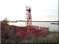
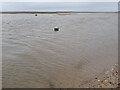
Navigation light at Cross Ness, near Thamesmead
by Malc McDonald
geograph for square TQ4781
A navigation beacon at Cross Ness, on a bend in the River Thames.
|
|
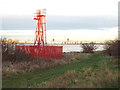
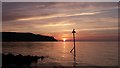
Navigation light at Margaret Ness, near Thamesmead
by Malc McDonald
geograph for square TQ4580
This navigation light is situated on the south bank of the Thames, at a bend in the river.
|
|
South East up the Aire and Calder Navigation from Fleet Bridge
by Chris Heaton
for square SE3828
|
|
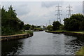
North West up the Aire and Calder Navigation from Fleet Bridge
by Chris Heaton
geograph for square SE3728
Enables boats and barges of substantial size to reach the city of Leeds
|
|
North Shore, Llandudno
by I Love Colour
for square SH8082
North Shore, Llandudno.
Great Orme silhouetted against the setting sun.
A... (more)
|
|
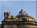
Dome on Clyde Navigation Trust Building, Broomielaw, Glasgow
by Becky Williamson
for square NS5864
Now the Clydeport building, this spectacular Italian Baroque-style landmark was... (more)
|
|
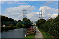
Aire & Calder Navigation with railway bridges
by Trevor Littlewood
geograph for square SE7322
South-west of Goole the Aire & Calder Navigation is crossed by the rail... (more)
|
|
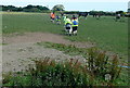
Navigation practice
by Graham Horn
geograph for square SW5237
This group was learning and practising navigation, using the route of St... (more)
|
|
Port and Starboard markers in Brancaster Harbour
by Ian Paterson
geograph for square TF7845
In this country, where the IALA* 'A' buoyage system applies, I can... (more)
|
|
River Lea Navigation beside Hackney Marsh (3)
by Chris Heaton
geograph for square TQ3685
The Capital Ring long distance trail follows the towpath beside the Navigation,... (more)
|
|
River Lea Navigation beside Hackney Marsh (2)
by Chris Heaton
geograph for square TQ3685
The Capital Ring long distance trail follows the towpath beside the Navigation,... (more)
|
|
River Lea Navigation beside Hackney Marsh (1)
by Chris Heaton
geograph for square TQ3685
The Capital Ring long distance trail follows the towpath beside the Navigation,... (more)
|
|
Don Navigation and Long Sandall Lock
by Jonathan Clitheroe
geograph for square SE6006
Wheatley Cut of the Dun (Don) Navigation pictured from a slightly precarious... (more)
|
|
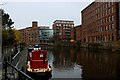
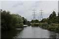
Narrowboat on the River Aire
by Christine Johnstone
geograph for square SE3132
The Emerald Lizard heading east on a river section of the Aire and Calder Navigation.
|
|
Starboard navigation beacon, Ards Estuary
by Rossographer
geograph for square C0935
Green starboard navigation beacon off the point of Ards marking the entrance to... (more)
|
|
Milby Cut, Boroughbridge
by Stephen Craven
geograph for square SE3967
|
|
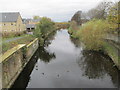
Calder & Hebble Navigation - Brewery Lane
by Betty Longbottom
geograph for square SE2419
|
|
Calder & Hebble Navigation - Forge Lane
by Betty Longbottom
geograph for square SE2319
|
|
Calder & Hebble Navigation - Forge Lane
by Betty Longbottom
geograph for square SE2319
|
|
Dismantled Railway Bridge on the Aire and Calder Navigation
by Chris Heaton
geograph for square SE3231
|
|
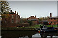
Thwaite House
by Chris Heaton
geograph for square SE3231
This was the house built for the owner of Thwaite Mills around 1825. It is part... (more)
|
|
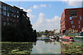
Rose Wharf beside the Aire and Calder Navigation
by Chris Heaton
geograph for square SE3132
Former flax mill and Grade II Listed Building, now converted into apartments
|
|
Leeds Lock
by Chris Heaton
geograph for square SE3032
Lock system on the Aire and Calder Navigation
|
|
Enfield Lock
by Chris Heaton
geograph for square TQ3798
One of the locks encountered along the River Lea Navigation
|
|
River Lea Navigation at Brimsdown (2)
by Chris Heaton
geograph for square TQ3797
|
|
River Lea Navigation at Brimsdown (1)
by Chris Heaton
geograph for square TQ3796
|
|
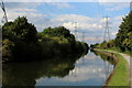
Canal Junction on the River Lea Navigation
by Chris Heaton
geograph for square TQ3696
Choked with various forms of aquatic vegetation, the junction is easy to miss.
|
|
Narrow Boats at Ponders End
by Chris Heaton
geograph for square TQ3695
Canal scene on the River Lea Navigation
|
|
River Lea Navigation beside the William Girling Reservoir(2)
by Chris Heaton
geograph for square TQ3694
|
|
River Lea Navigation beside the William Girling Reservoir(1)
by Chris Heaton
geograph for square TQ3694
|
|
Approaching Alfie's Lock
by Chris Heaton
geograph for square TQ3693
Lock No.15 on the River Lea Navigation, renamed Alfie's Lock - although it... (more)
|
|
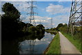
River Lea Navigation just South of the William Girling Reservoir
by Chris Heaton
geograph for square TQ3692
|
|
Along the Towpath beside River Lea Navigation
by Chris Heaton
geograph for square TQ3592
|
|
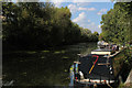
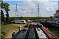
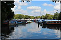
Springfield Marina
by Chris Heaton
geograph for square TQ3487
Marina and gathering of narrow boats on the River Lea Navigation beside... (more)
|
|
Stonebridge Locks (2)
by Chris Heaton
geograph for square TQ3590
Numbered No. 16 on the River Lea Navigation
|
|
Stonebridge Locks (1)
by Chris Heaton
geograph for square TQ3590
Numbered No 16 along the River Lea Navigation
|
|
River Lea Navigation at Tottenham Hale (2)
by Chris Heaton
geograph for square TQ3489
|
|
River Lea Navigation at Tottenham Hale (1)
by Chris Heaton
geograph for square TQ3489
|
|
River Lea Navigation at Markfield Park
by Chris Heaton
geograph for square TQ3488
|
|
Following the Towpath towards Lea Bridge
by Chris Heaton
geograph for square TQ3586
Beside the River Lea Navigation on the Capital Ring and Lea Valley Walk long... (more)
|
|
Towpath beside the River Lea Navigation
by Chris Heaton
geograph for square TQ3686
The Capital Ring long distance footpath approaching Lea Bridge
|
|
Hertford Union Canal
by Chris Heaton
geograph for square TQ3784
Looking south west across the Lea Navigation along the length of the Hertford Union.
|
|
Lea Navigation beside the Queen Elizabeth Olympic Park
by Chris Heaton
geograph for square TQ3784
The Hertford Union Canal comes in from the south west creating a wide watery... (more)
|