Public Tags
Tag: Navigation·Channel
Showing images tagged with Navigation Channel tag.

|
Navigation Channel at the Tees Barrage
by Oliver Dixon geograph for square NZ4618 The Tees Barrage is a barrage across the River Tees completed in 1996 used to... (more)
|

|
Navigation channel at the Tees Barrage
by Oliver Dixon geograph for square NZ4618 The Tees Barrage is a barrage across the River Tees completed in 1996 used to... (more)
|

|
Navigation channel, Breydon Water, west of bridge
by Christine Johnstone geograph for square TG5108 As you head upstream, you should keep red markers to left [port], and green... (more)
|

|
Navigation
by Colin Smith geograph for square TQ0253 The navigation channel is clearly marked on the northern span of Broadoak Bridge... (more)
Tags:
place:Burpham (Surrey)
Navigation Channel
top:Rivers, Streams, Drainage
bridge:Road Over River
river:Wey
Wey Navigation
|

|
Downstream navigation channel for smaller boats
by Christine Johnstone geograph for square TG5108 Smaller boats are directed to the south side of Breydon Bridge, not through the... (more)
Tags:
place:Breydon Water
top:Canals
Navigable River
Navigation Channel
Navigation Marker
place:Norfolk Broads
top:Rivers, Streams, Drainage
bridge:Road Over River
Tidal River
river:Yare
|

|
Entrance to the navigation channel at the Tees Barrage
by Oliver Dixon geograph for square NZ4618 The Tees Barrage is a barrage across the River Tees completed in 1996 used to... (more)
|

|
Navigation channel, Breydon Water
by Christine Johnstone geograph for square TG5007 North of Humberstone Farm.
|

|
Sunken boat near the shore, Breydon Water
by Christine Johnstone geograph for square TG5007 Well outside the marked navigation channel.
Tags:
place:Breydon Water
top:Canals
Estuary Shore
Local Nature Reserve
Mudflats
Navigable River
Navigation Channel
place:Norfolk Broads
River Estuary
top:Rivers, Streams, Drainage
sssi:Site of Special Scientific Interest
Special Protection Area for Birds
SSSI
Sunken Boat
Tidal River
Wrecked Boat
river:Yare
|

|
Navigation channel, Breydon Water
by Christine Johnstone geograph for square TG5107 Hugging the south bank at Cobholm Island.
|

|
Swash Channel Marker, Studland Bay
by David Dixon geograph for square SZ0486 The approach to Poole Harbour from the Western side is via Studland Bay. The... (more)
|

|
Tidal channel at Gibraltar Point
by Oliver Dixon geograph for square TF5657 A buoyed and marked channel through the tidal flats at the mouth of the Wash.
|

|
West Waterloo Dock, Liverpool
by Christine Johnstone geograph for square SJ3391 Redeveloped in 1868 and closed to shipping in 1988. Since 2009 it is part of the... (more)
Tags:
subject:Dock
top:Docks, Harbours
type:Geograph
place:Liverpool
Liverpool Canal Link
Navigation Buoy
Navigation Channel
Red Buoy
|
|
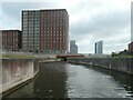
Central Docks Channel [aka Sid's Channel]
by Christine Johnstone geograph for square SJ3391 Since 2009 part of the Liverpool Canal Link, which takes canal boats from the... (more)
Tags:
former:Dock
top:Docks, Harbours
type:Geograph
place:Liverpool
Liverpool Canal Link
Navigation Channel
|

|
Doon The Watter - 25th June 2011 : Channel Through The Burnt Islands, Kyles of Bute
by Richard West geograph for square NS0175 The paddle steamer Waverley approaches the narrowest part of the Kyles of Bute -... (more)
|

|
Entrance to "Sid's Channel" [aka Central Docks Channel]
by Christine Johnstone geograph for square SJ3391 Since 2009 part of the Liverpool Canal Link, which takes canal boats from the... (more)
Tags:
top:Canals
subject:Dock
former:Dock
top:Docks, Harbours
type:Geograph
place:Liverpool
Liverpool Canal Link
Navigation Channel
|

|
Turn left for the River Bure
by Christine Johnstone geograph for square TG5107 The confluence of the Yare and the Bure. Smaller boats are discouraged from... (more)
Tags:
top:Canals
Navigable River
Navigation Channel
Navigation Marker
place:Norfolk Broads
River Confluence
top:Rivers, Streams, Drainage
Tidal River
river:Yare
colour:Yellow
|
|
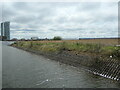
Infilled dock, Liverpool
by Christine Johnstone geograph for square SJ3391 Alongside the Central Docks Channel of the Liverpool Canal Link.
Tags:
former:Dock
top:Docks, Harbours
type:Geograph
Infilled
place:Liverpool
Liverpool Canal Link
Navigation Channel
|
|
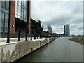
Entrance to West Waterloo Dock from Central Docks Channel
by Christine Johnstone geograph for square SJ3391 Waterloo Dock opened in 1834 and was redeveloped into two docks [East and West]... (more)
Tags:
former:Dock
Dock Entrance
top:Docks, Harbours
type:Geograph
place:Liverpool
Liverpool Canal Link
Navigation Channel
|
|
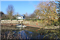
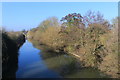
Ham Island from the Thames Path
by Des Blenkinsopp geograph for square SU9975 Looking across the New Cut which created the man made Ham Island in 1822 by... (more)
|
|
The New Cut at Ham Island
by Des Blenkinsopp geograph for square SU9975 A navigation canal which cuts off a wide river meander, creating Ham Island in... (more)
|

|
Tidal Marsh
by Colin Smith geograph for square SU7601 Saltmarsh between the eastern shore of Thorney Island and the Thorney Channel in... (more)
Tags:
place:Chichester Harbour
top:Estuary, Marine
Navigation Channel
Saltmarsh
place:Thorney Island
|

|
Thorney Channel
by Colin Smith for square SU7701 Pleasure craft to the east of Thorney Island, Chichester Harbour.... (more)
Tags:
place:Chichester Harbour
top:Estuary, Marine
Navigation Channel
Pleasure Boat
top:Sport, Leisure
place:Thorney Island
|

|
Wading birds, Breydon Water
by Christine Johnstone geograph for square TG4907 Avocets and other at Breydon South Flats, on a rising tide.
|

|
Site of mapped causeway, Breydon South Flats
by Christine Johnstone geograph for square TG4907 If it's here, it must be under the tidal stream.
Tags:
place:Breydon Water
top:Canals
former:Causeway
Estuary Shore
top:Estuary, Marine
Local Nature Reserve
Mudflats
Navigable River
Navigation Channel
place:Norfolk Broads
sssi:Site of Special Scientific Interest
Special Protection Area for Birds
SSSI
Tidal River
river:Yare
|

|
Small peninsula, Breydon South Flats
by Christine Johnstone geograph for square TG5007 One of several outcrops north of Humberstone Farm.
|
