Public Tags
Other tags: place:Albury
Showing latest 50 of 97 images tagged with near:Albury tag.

|
Albury Park entrance and lodge
by Malc McDonald geograph for square TQ0547 An entrance to Albury Park, in Surrey. The building to the left of the entrance... (more)
Tags:
near:Albury
top:Country Estates
Country Park Entrance
subject:Entrance
type:Geograph
near:Guildford
Park Lodge
building type:Park Lodge
county:Surrey
|

|
Albury Road, near Albury
by Malc McDonald geograph for square TL4326 Albury Road heading into the village of Albury, in north Hertfordshire.
Tags:
near:Albury
near:Bishops Stortford
near:Furneux Pelham
type:Geograph
county:Hertfordshire
road:Minor Road
Minor Road
Minor Rural Road
subject:Road
top:Roads, Road Transport
Rural Road
top:Village, Rural Settlement
|
|
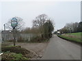
Albury Road, Clapgate, near Albury
by Malc McDonald geograph for square TL4424 The Albury village sign stands next to Albury Road as the road enters the hamlet... (more)
Tags:
near:Albury
near:Bishops Stortford
place:Clapgate
type:Geograph
subject:Hamlet
Hamlet
county:Hertfordshire
Minor Road
Rural Hamlet
Village Sign
Village Sign Hertfordshire
top:Village, Rural Settlement
|
|
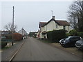
Albury Road, Clapgate, near Albury
by Malc McDonald geograph for square TL4424 Albury Road passing through the hamlet of Clapgate in rural north Hertfordshire.
Tags:
near:Albury
near:Bishops Stortford
place:Clapgate
type:Geograph
Hamlet
subject:Hamlet
county:Hertfordshire
Minor Road
Rural Hamlet
top:Village, Rural Settlement
|
|
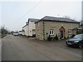
Albury Road, Clapgate, near Albury
by Malc McDonald geograph for square TL4425 Albury Road passing through the hamlet of Clapgate in rural north Hertfordshire.
Tags:
near:Albury
near:Bishops Stortford
place:Clapgate
type:Geograph
subject:Hamlet
Hamlet
county:Hertfordshire
road:Minor Road
Minor Road
Rural Hamlet
top:Village, Rural Settlement
|
|
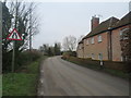
Albury Road, Clapgate, near Albury
by Malc McDonald geograph for square TL4425 Albury Road passing through the hamlet of Clapgate in north Hertfordshire.
Tags:
near:Albury
near:Bishops Stortford
place:Clapgate
type:Geograph
subject:Hamlet
Hamlet
county:Hertfordshire
road:Minor Road
Minor Road
Minor Rural Road
Rural Hamlet
top:Village, Rural Settlement
|

|
Yew tree, Albury Downs
by Alan Hunt geograph for square TQ0449 A Yew in the grass area of the Albury Downs near Newlands Corner. The Yew is a... (more)
Tags:
near:Albury
Albury Downs
Chalk Downland
top:Lowlands
top:Wild Animals, Plants and Mushrooms
tree:Yew
|

|
A248 road at Albury
by Malc McDonald geograph for square TQ0547 A double bend on the A248 road as it enters the village of Albury.
Tags:
road:A Road
road:A248
near:Albury
Double Bend
type:Geograph
near:Guildford
subject:Road
top:Roads, Road Transport
county:Surrey
|

|
A25 road near Albury
by Malc McDonald geograph for square TQ0648 A view eastwards along the A25 road between Albury and Shere in Surrey. The... (more)
|

|
Road junction near Albury
by Malc McDonald geograph for square TQ0547 A junction of minor roads in the Surrey Hills, near the village of Albury.
Tags:
near:Albury
type:Geograph
near:Guildford
Junction of Rural Roads
road:Minor Road
Minor Road
Minor Rural Road
Minor Rural Road Junction
subject:Road Junction
top:Roads, Road Transport
Rural Road
Rural Road Junction
county:Surrey
top:Woodland, Forest
|

|
Fields near Albury Mill
by Alan Hunt geograph for square TQ0347 The fields near Albury Mill. The cottage is on the mill access road.
Tags:
near:Albury
top:Farm, Fishery, Market Gardening
|

|
Barn near to Albury Hall
by Bikeboy geograph for square TL4225 Albury Hall was built in 1780 to replace an earlier house. It was requisitioned... (more)
Tags:
near:Albury
subject:Barn
near:Braughing
top:Farm, Fishery, Market Gardening
near:Furneux Pelham
|

|
Farmland near Albury Downs
by Ian Capper geograph for square TQ0448 Farmland south of the Albury Downs, seen in the background.
|

|
Farmland near Albury Downs
by Ian Capper geograph for square TQ0448 Farmland south of the Albury Downs. The track on the left leads to Newbarn.
|

|
Fields near the Albury Downs
by Alan Hunt geograph for square TQ0548 The fields north of the footpath from Water Lane to the A248 with the Albury... (more)
|

|
Access Road near Albury
by Alan Hunt geograph for square TQ0548 The access road from the A25 to the cottage near the Albury Sand Pit.
|

|
Pilgrims Way near Albury
by Alan Hunt geograph for square TQ0448 The Pilgrims Way long distance path going across a field near Albury.
|

|
New Road, near Albury
by Malc McDonald geograph for square TQ0646 New Road in Surrey countryside, close to the village of Albury. The road sign... (more)
Tags:
near:Albury
type:Geograph
near:Guildford
Level Crossing Warning Sign
road:Minor Road
Minor Road
Minor Rural Road
subject:Road
top:Roads, Road Transport
Rural Road
county:Surrey
Warning Sign
|

|
Albury Mill
by Alan Hunt geograph for square TQ0347 The former mill on the Tilling Bourne near Albury.
|

|
Footpath near Albury
by Alan Hunt geograph for square TQ0548 The footpath along the edge of the field approaching the A248. The Apostolic... (more)
|

|
Albury Sand Pit
by Alan Hunt geograph for square TQ0548 The operations area of the large sand extracion pit near Albury. The pit is on... (more)
|

|
Cattle near Albury
by Alan Hunt geograph for square TQ0548 Cattle in the field to the west of Albury Street.
|

|
Home Farm, Albury
by Alan Hunt geograph for square TQ0648 The buildings of Home Farm beside the A25, Shere Road near Albury.
|

|
Albury Downs
by Alan Hunt geograph for square TQ0448 Looking northeast from the Pilgrims Way near Water lane towards the woods on top... (more)
|

|
Albury Road, Gravesend
by Malc McDonald geograph for square TL4326 Albury Road entering the hamlet of Gravesend, in north Hertfordshire. Road... (more)
Tags:
30mph Limit
30mph Speed Limit Sign
30mph Speed Limit Signs
near:Albury
near:Bishops Stortford
type:Geograph
place:Gravesend
county:Hertfordshire
road:Minor Road
Minor Rural Road
subject:Road
Road Signs 30mph
top:Roads, Road Transport
Rural Road
Speed Limit 30mph
Start of the 30mph Speed Limit
|

|
Field on Albury Downs
by Ian Capper geograph for square TQ0549 Field on Albury Downs north of the Drove Road.
|

|
Path on Albury Downs
by Ian Capper geograph for square TQ0548 Path on the Albury Downs leading down through woodland to the A25.
|

|
Vineyard, Albury Downs
by Alan Hunt geograph for square TQ0548 The vineyards on the Albury Downs to the east of Newlands Corner.
|

|
Catholic Apostolic Church, Albury
by Alan Hunt geograph for square TQ0648 This privately owned church is on the Albury Estate. It was built in the 19th... (more)
|

|
View from Farm Hill, Albury
by Alan Hunt geograph for square TQ0648 Looking southwest from the footpath across Farm Hill in the Albury Estate. The... (more)
|

|
Silver Wood, Albury Estate
by Alan Hunt geograph for square TQ0648 The path through Silver Wood on the Albury Estate.
|

|
Open scrub, Albury Downs
by Alan Hunt geograph for square TQ0449 The lower part of the open access land at Newlands Corner, an area of managed... (more)
|

|
Ploughed field, Albury Downs
by Alan Hunt geograph for square TQ0448 The hedge at the top of a large ploughed field. Above the hedge is the open... (more)
|

|
Albury Downs
by Alan Hunt geograph for square TQ0448 The footpath running up the scarp of the North Downs from Newbarn to Newlands Corner.
|

|
Newbarn, Albury Downs
by Alan Hunt geograph for square TQ0448 The buildings of Newbarn in the dip below the North Downs ridge.
|

|
Path junction
by Ian Capper geograph for square TQ0649 Path junction on Albury Downs, with the North Downs Way running across the photo... (more)
Tags:
near:Albury
footpath:Fox Way
type:Geograph
footpath:North Downs Way
top:Paths
top:Woodland, Forest
|

|
Country lane near Albury
by Malc McDonald geograph for square TL4523 A minor lane through north Hertfordshire countryside, passing through the small... (more)
Tags:
near:Albury
near:Bishops Stortford
Country Lane
near:Farnham
type:Geograph
Hamlet
county:Hertfordshire
subject:Lane
Minor Lane
road:Minor Road
Minor Road
Narrow Country Lane
top:Roads, Road Transport
Rural Hamlet
Rural Lane
place:Upwick Green
|

|
Public footpath near Albury
by Malc McDonald geograph for square TL4326 A public footpath through north Hertfordshire countryside, photographed on a... (more)
Tags:
near:Albury
near:Bishops Stortford
path:Footpath
Footpath
Footpath Sign
Footpath Signpost
near:Furneux Pelham
type:Geograph
county:Hertfordshire
subject:Path
top:Paths
Public Footpath
sign:Public Footpath
Public Footpath Sign
Public Footpath Signpost
|

|
Pig fields near Postford
by Alan Hunt geograph for square TQ0347 Pig fields near Albury Mill with one of the ponds in the Tilling Bourne valley beyond.
|

|
Upwick Green, near Albury
by Malc McDonald geograph for square TL4524 A house in the small hamlet of Upwick Green, in rural north Hertfordshire.
Tags:
near:Albury
near:Bishops Stortford
Country Lane
type:Geograph
Hamlet
subject:Hamlet
county:Hertfordshire
Minor Lane
road:Minor Road
Minor Road
Narrow Country Lane
Rural Hamlet
Rural House
Rural Houses
Rural Lane
place:Upwick Green
top:Village, Rural Settlement
|

|
Upwick Green, near Albury
by Malc McDonald geograph for square TL4524 A country lane passing through the small hamlet of Upwick Green, in rural north... (more)
Tags:
near:Albury
near:Bishops Stortford
Country Lane
type:Geograph
Hamlet
subject:Hamlet
county:Hertfordshire
Minor Lane
road:Minor Road
Minor Road
Narrow Country Lane
Rural Hamlet
Rural Lane
place:Upwick Green
top:Village, Rural Settlement
|
|
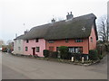
Thatched cottages in Clapgate, near Albury
by Malc McDonald geograph for square TL4424 Thatched cottages in the hamlet of Clapgate in north Hertfordshire.
Tags:
near:Albury
near:Bishops Stortford
place:Clapgate
building type:Cottage
Cottage
housing:Cottages
Cottages
subject:Cottages
type:Geograph
Hamlet
county:Hertfordshire
Rural Hamlet
Thatched Cottage
Thatched Cottages
top:Village, Rural Settlement
|
|
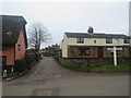
Road junction in Clapgate, near Albury
by Malc McDonald geograph for square TL4424 A road junction in the hamlet of Clapgate in north Hertfordshire. A traditional... (more)
Tags:
3-Arm Signpost
near:Albury
near:Bishops Stortford
place:Clapgate
type:Geograph
subject:Hamlet
Hamlet
county:Hertfordshire
road:Minor Road
Minor Road
Road Junction in Village
Rural Hamlet
Village Road Junction
top:Village, Rural Settlement
Wooden Sign Post
Wooden Signpost
|
|
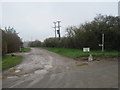
Public bridleway near Albury
by Malc McDonald geograph for square TL4425 Although this track in north Hertfordshire is a private road, the green sign... (more)
Tags:
near:Albury
near:Bishops Stortford
path:Bridleway
Bridleway
subject:Bridleway
rights of way:Bridleway
signpost:Bridleway
Bridleway Sign
Bridleway Signpost
type:Geograph
county:Hertfordshire
top:Paths
sign:Public Bridleway
Public Bridleway
Public Bridleway Signpost
top:Roads, Road Transport
Track and Bridleway
|

|
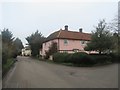
Old Police House, Gravesend, near Albury
by Malc McDonald geograph for square TL4325 The old police house in the small hamlet of Gravesend, in rural north Hertfordshire.
Tags:
near:Albury
near:Bishops Stortford
Former Police House
type:Geograph
place:Gravesend
county:Hertfordshire
subject:House
Old Police House
former:Police House
Rural Detached House
Rural House
top:Village, Rural Settlement
|
|
Gravesend, near Albury
by Malc McDonald geograph for square TL4325 The small hamlet of Gravesend, in rural north Hertfordshire.
Tags:
near:Albury
near:Bishops Stortford
type:Geograph
place:Gravesend
subject:Hamlet
county:Hertfordshire
top:Village, Rural Settlement
|
|
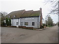
The Catherine Wheel, Gravesend, near Albury
by Malc McDonald geograph for square TL4325 The Catherine Wheel pub in the small hamlet of Gravesend, in north Hertfordshire.
Tags:
near:Albury
near:Bishops Stortford
top:Business, Retail, Services
type:Geograph
place:Gravesend
county:Hertfordshire
Pub
subject:Public House
Public House
Village Pub
Village Public House
top:Village, Rural Settlement
|

|
A248 near Albury
by Alan Hunt geograph for square TQ0548 Looking north along the A248 from the access road to the Apostolic Church... (more)
|

|
Vineyard shed, Albury Down
by Alan Hunt geograph for square TQ0548 The vineyards near Silent Pool on the North Downs
|

|
A25 near Albury
by Alan Hunt geograph for square TQ0548 Looking west along the A25 as it begins the ascent to Newlands Corner with the... (more)
|
