Public Tags
Showing images tagged with near:Aldershot tag.
|
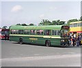
A Leyland National bus near Aldershot (1)
by David Hillas geograph for square SU8651 Taken in June 1981 between the A325 Farnborough Road and Queen's Avenue,... (more)
|
|
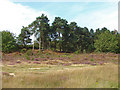
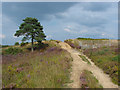
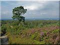
Lowland heath near Aldershot
by Alan Hunt geograph for square SU8450 A pine covered knoll in the large area of lowland heath to the west of Aldershot.
|
|
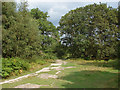
Dry heath near Aldershot
by Alan Hunt geograph for square SU8350 One of the many tracks across the large area of lowland heath to the west of... (more)
|
|
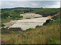
Military training area, Aldershot
by Alan Hunt geograph for square SU8350 The large area of exposed sand in the military training area on the heaths to... (more)
|
|
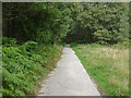
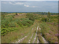
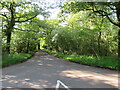
MOD training area near Aldershot
by Alan Hunt geograph for square SU8450 The track from the car park on Bourley Road into the large area of lowland heath... (more)
|
|
Military road near Cheese Hill
by Alan Hunt geograph for square SU8450 The main track into the military training area to the west of Aldershot.
|
|
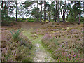
Path through the heather
by Alan Hunt geograph for square SU8450 One of many paths across the large area of lowland heath to the west of Aldershot.
|
|
Heathland, Bourley Hill
by Alan Hunt geograph for square SU8350 Lowland heath on Bourley Hill, part of the military training lands to the west... (more)
|
|
View from Caesar's Camp
by Alan Hunt geograph for square SU8350 The view from the northern slope of Caesar's Camp, an iron age hillfort on... (more)
|
|
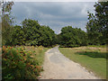
Bourley Hill training grounds
by Alan Hunt geograph for square SU8350 The large area of lowland heath to the west of Aldershot long used by the MOD as... (more)
|
|
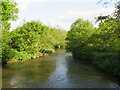
River Wey near Elstead, Surrey
by Malc McDonald geograph for square SU9243 A view of the River Wey near the village of Elstead in Surrey.
|
|
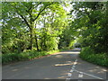
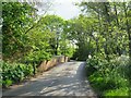
Shackleford Road, near Elstead
by Malc McDonald geograph for square SU9244 Shackleford Road is a minor road through woodland near the village of Elstead in... (more)
Tags:
near:Aldershot
near:ElsteadX
near:FarnhamX
type:GeographX
near:GodalmingX
road:Minor RoadX
Minor RoadX
Minor Rural RoadX
subject:RoadX
Road Through WoodlandX
top:Roads, Road TransportX
Rural RoadX
Sunlight and ShadowsX
county:SurreyX
|
|
Somerset Bridge, near Elstead
by Malc McDonald geograph for square SU9243 Somerset Bridge crosses the River Wey near the village of Elstead in Surrey.
|
|
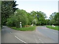
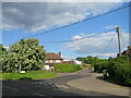
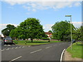
Road junction near Elstead, Surrey
by Malc McDonald geograph for square SU9143 A road junction near the village of Elstead in Surrey. The road to the right is... (more)
Tags:
near:Aldershot
road:B RoadX
road:B3001X
near:ElsteadX
near:FarnhamX
type:GeographX
near:GodalmingX
Junction of B Road and Minor RoadX
Junction of B-Road and Minor RoadX
subject:Road JunctionX
Road JunctionX
top:Roads, Road TransportX
county:SurreyX
|
|
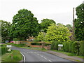
Red House Lane, Elstead, near Farnham
by Malc McDonald geograph for square SU9043 Red House Lane is a minor road in the village of Elstead in Surrey.
|
|
Attleford Lane, near Elstead
by Malc McDonald geograph for square SU9244 Attleford Lane is a minor lane through woodland in Surrey.
Tags:
near:Aldershot
near:ElsteadX
near:FarnhamX
type:GeographX
near:GodalmingX
subject:LaneX
road:Minor RoadX
Minor RoadX
Minor Rural LaneX
Minor Rural RoadX
Road Through WoodlandX
top:Roads, Road TransportX
Rural LaneX
Rural RoadX
Sunlight and ShadowsX
county:SurreyX
|
|
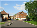
Weyburn Lane, Elstead, near Farnham
by Malc McDonald geograph for square SU9243 Weyburn Lane forms part of a recent housing development on the site formerly... (more)
Tags:
near:Aldershot
place:ElsteadX
Engineering Works (Site of Former)X
near:FarnhamX
type:GeographX
near:GodalmingX
subject:Housing EstateX
top:Housing, DwellingsX
Modern Housing DevelopmentX
Recently Built HousesX
ResidentialX
Residential AreaX
Residential DevelopmentX
Residential EstateX
Residential RoadX
county:SurreyX
|
|
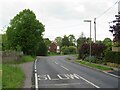
Milford Road, Elstead, near Farnham
by Malc McDonald geograph for square SU9143 Milford Road is on the route of the B3001 as it passes through the village of... (more)
|
|
West Hill, Elstead, near Farnham
by Malc McDonald geograph for square SU9043 West Hill is a residential road in Elstead, a village in Surrey.
|
|
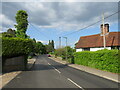
Thursley Road, Elstead, near Farnham
by Malc McDonald geograph for square SU9043 Thursley Road is a minor road leading into the village of Elstead in Surrey.
|
|
Thursley Road, Elstead, near Farnham
by Malc McDonald geograph for square SU9042 Thursley Road entering the village of Elstead in Surrey.
|
|
Thursley Road, Pot Common, near Elstead
by Malc McDonald geograph for square SU9042 Thursley Road is a minor road in Surrey, Here it passes through the hamlet of... (more)
|
|
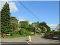
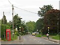
The Green, Elstead, near Farnham
by Malc McDonald geograph for square SU9043 The Green in the village of Elstead in Surrey.
Tags:
near:Aldershot
place:ElsteadX
near:FarnhamX
type:GeographX
subject:GreenX
top:Park and Public GardensX
Village GreenX
top:Village, Rural SettlementX
|
|
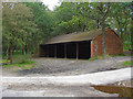
Vehicle shed
by Alan Hunt geograph for square SU8450 Vehicle parking shed near the entrance to the MOD training area off Bourley Road.
Tags:
near:Aldershot
top:Defence, MilitaryX
MOD Training AreaX
Rural ViewX
ShedX
top:Woodland, ForestX
|
|
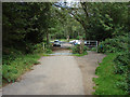
Car park off Bourley Road
by Alan Hunt geograph for square SU8450 The track from the car park on Bourley Road leading into the MOD training area.
|
|
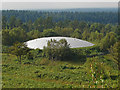
Covered reservoir, Bourley Hill
by Alan Hunt geograph for square SU8350 The distinctive covered reservoir on the MOD's Bourley Hill training... (more)
|