
|
Cumberland Drive, near Bexleyheath
by Malc McDonald
geograph for square TQ4877
Cumberland Drive is a residential road near Bexleyheath, in the outer suburbs of... (more)
|

|
Bostall Park Avenue, near Bexleyheath
by Malc McDonald
geograph for square TQ4877
Bostall Park Avenue is a residential road in the outer suburbs of south east London.
|
|
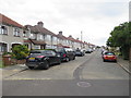
Bostall Park Avenue, near Bexleyheath
by Malc McDonald
geograph for square TQ4877
Bostall Park Avenue is a residential road in the outer suburbs of south east London.
|
|
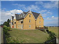
Apartment block on Perry Street, near Dartford
by Malc McDonald
geograph for square TQ5175
A recently-built apartment block on Perry Street, on the outermost fringe of... (more)
|

|
Sandringham Drive, near Dartford
by Malc McDonald
geograph for square TQ5172
Sandringham Drive forms part of a housing development built on the site of a... (more)
|

|
River Cray at Crayford
by Malc McDonald
geograph for square TQ5174
The River Cray at Crayford, on the outermost fringe of south east London.
|
|
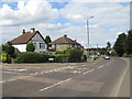
Perry Street, near Dartford
by Malc McDonald
geograph for square TQ5175
Perry Street forms part of the A2000 road on the outer fringe of south east London.
|

|
Railway bridge near Barnehurst
by Malc McDonald
geograph for square TQ5076
An arch bridge carrying a railway line over Manor Way near Barnehurst, in the... (more)
|

|
Welling Library
by Malc McDonald
geograph for square TQ4675
The public library in Welling, in the outer suburbs of south east London.
|

|
Bellegrove Road, Welling
by Malc McDonald
geograph for square TQ4675
Bellegrove Road is the main shopping street in Welling, in the outer suburbs of... (more)
|

|
Deepdene Road, Welling
by Malc McDonald
geograph for square TQ4675
Deepdene Road is a residential road in Welling, in the outer suburbs of south east London.
|

|
Ruskin Avenue, Welling
by Malc McDonald
geograph for square TQ4676
Ruskin Avenue is a residential street in Welling, in the outer suburbs of south... (more)
|
|
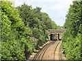
Railway at Crayford
by Malc McDonald
geograph for square TQ5174
Railway tracks at Crayford, on the outermost fringe of south east London. The... (more)
|

|
Crayford Town Hall
by Malc McDonald
geograph for square TQ5174
The town hall building in Crayford, on the outermost fringe of south east London.
|
|
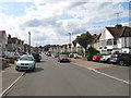
Holmsdale Grove, Barnehurst
by Malc McDonald
geograph for square TQ5175
Holmsdale Grove is a residential road in Barnehurst, on the outermost fringe of... (more)
|
|
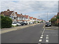
Parkside Avenue, Barnehurst
by Malc McDonald
geograph for square TQ5176
Parkside Avenue in Barnehurst, on the outer fringe of south east London.
|
|
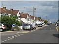
Parkside Avenue, Barnehurst
by Malc McDonald
geograph for square TQ5176
Parkside Avenue in barnehurst, on the outer fringe of south east London. Just... (more)
|
|
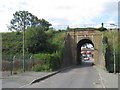
Railway bridge near Barnehurst
by Malc McDonald
geograph for square TQ5176
An arch bridge carrying a railway line over Parkside Cross, a minor road in the... (more)
|
|
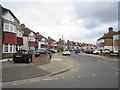
Budleigh Crescent, East Wickham
by Malc McDonald
geograph for square TQ4777
Budleigh Crescent is a residential road in the outer suburbs of south east London.
|
|
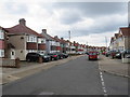
Budleigh Crescent, East Wickham
by Malc McDonald
geograph for square TQ4777
Budleigh Crescent is a residential road in the suburbs of south east London.
|
|
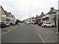
Sidmouth Road, East Wickham
by Malc McDonald
geograph for square TQ4777
Sidmouth Road is a residential road in East Wickham, in the outer suburbs of... (more)
|
|
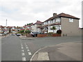
Totnes Road, East Wickham
by Malc McDonald
geograph for square TQ4777
Houses on Totnes Road, a residential road in the outer suburbs of south east London.
|

|
Totnes Road, East Wickham
by Malc McDonald
geograph for square TQ4677
Totnes Road is a residential road built on a hill in the outer suburbs of south... (more)
|

|
Bideford Road, East Wickham
by Malc McDonald
geograph for square TQ4677
Bideford Road is a short residential road in the suburbs of south east London.
|

|
Axminster Crescent, East Wickham
by Malc McDonald
geograph for square TQ4776
Axminster Crescent is a residential road in East Wickham, in the outer suburbs... (more)
|
|
Wrotham Road, East Wickham
by Malc McDonald
geograph for square TQ4776
Wrotham Road is a residential road in the suburbs of south east London.
|

|
Beverley Road, Barnehurst
by Malc McDonald
geograph for square TQ5076
Beverley Road is a residential road in Barnehurst, in the outer suburbs of south... (more)
|

|
Midfield Avenue, Barnehurst
by Malc McDonald
geograph for square TQ5075
Midfield Avenue is a residential road in Barnehurst, in the outer suburbs of... (more)
|

|
Local shops on Mayplace Road East, Barnehurst
by Malc McDonald
geograph for square TQ5075
A parade of local shops on Mayplace Road East in the outer suburbs of south east London.
|

|
Olyffe Avenue, Welling
by Malc McDonald
geograph for square TQ4676
Olyffe Avenue is a residential road in Welling, in the suburbs of south east London.
|

|
Church of St Mary the Virgin, Welling
by Malc McDonald
geograph for square TQ4576
The church of St Mary the Virgin in Welling, in the suburbs of south east London.
|
