
|
Sussex countryside near Burgess Hill
by Malc McDonald
geograph for square TQ3417
This view looks south, the South Downs ridge forms the backdrop.
|

|
Railway Line Near Burgess Hill
by Peter Trimming
geograph for square TQ3317
Looking in the London direction.
|

|
Railway Line Near Burgess Hill
by Peter Trimming
geograph for square TQ3318
Looking in the London direction.
|

|
Railway Line Near Burgess Hill
by Peter Trimming
geograph for square TQ3317
Those who specialise in railway photography will know that it is essential to... (more)
|

|
'Tangmere' Near Burgess Hill
by Peter Trimming
geograph for square TQ3317
'Tangmere', with 'The Christmas Sussex Belle'; routing:... (more)
|

|
'Tangmere' Near Burgess Hill
by Peter Trimming
for square TQ3317
'Tangmere', with 'The Christmas Sussex Belle'; routing:... (more)
|
|
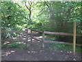
Path through Blackbrook Wood near Burgess Hill
by Malc McDonald
geograph for square TQ3417
|

|
Road junction near Burgess Hill
by Malc McDonald
geograph for square TQ3417
A junction of rural roads in Sussex.
|

|
Footpath and stile near Burgess Hill
by Malc McDonald
geograph for square TQ3417
|
|
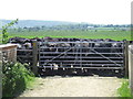
Cattle on the path, near Burgess Hill
by Malc McDonald
geograph for square TQ3317
In this image, a footpath enters a field where cattle graze. The small arrow... (more)
|
|
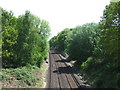
Railway near Burgess Hill
by Malc McDonald
geograph for square TQ3317
This railway is a branch from the main London to Brighton line. It links... (more)
|
|
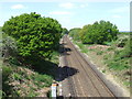
Railway near Burgess Hill
by Malc McDonald
geograph for square TQ3317
This railway is a branch from the main London to Brighton line. It links... (more)
|

|
The View South
by Peter Trimming
geograph for square TQ3017
The distant South Downs, seen from the outskirts of Burgess Hill.
|

|
Ditchling Common
by Peter Trimming
geograph for square TQ3318
On the outskirts of Burgess Hill, looking towards the roundabout where the B2113... (more)
|
|
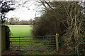
Footpath to Burgess Hill
by Peter Trimming
geograph for square TQ3217
Seen from the close to the edge of the Ridgeview Wine Estate.
|
|
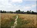
Footpath to Worlds End
by Paul Gillett
geograph for square TQ3220
World's End is a Northern district of Burgess Hill, It is thought that the... (more)
|

|
Bedelands Farm
by Paul Gillett
geograph for square TQ3120
to the north of Burgess Hill
|
|
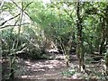
Leylands Wood
by Paul Gillett
geograph for square TQ3120
To the North of Burgess Hill
|
|
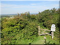
Footpath and Stile on Ditchling Down, near Brighton
by Malc McDonald
geograph for square TQ3213
A footpath and stile leading into woodland on Ditchling Down, on the South... (more)
|

|
Road junction near Ditchling
by Malc McDonald
geograph for square TQ3213
A minor road junction in the South Downs National Park. A traditional signpost... (more)
|

|
Footpath and county boundary, near Keymer
by Malc McDonald
geograph for square TQ3115
A wooden stile on a public footpath near Keymer, in West Sussex. The stile is... (more)
|

|
Footpath near Keymer
by Malc McDonald
geograph for square TQ3115
A gate on a public footpath near Keymer, in West Sussex.
|

|
Oldlands Avenue, Keymer
by Malc McDonald
geograph for square TQ3115
Oldlands Avenue is a residential road in Keymer, in West Sussex.
The South... (more)
|

|
Grand Avenue, Keymer
by Malc McDonald
geograph for square TQ3115
Grand Avenue is a residential road in Keymer, in West Sussex.
|

|
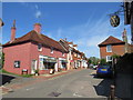
Ditchling High Street
by Malc McDonald
geograph for square TQ3215
The high street in the East Sussex village of Ditchling. Ditchling lies within... (more)
|
|
Ditchling High Street
by Malc McDonald
geograph for square TQ3215
High Street in the village of Ditchling in East Sussex, photographed on a warm... (more)
|

|
Ditchling High Street
by Malc McDonald
geograph for square TQ3215
High Street in the village of Ditchling, in East Sussex. Ditchling lies within... (more)
|

|
Orchard Lane, Hassocks
by Malc McDonald
geograph for square TQ3015
Orchard Lane is a public right of way as a footpath, as indicated by the wooden... (more)
|

|
Orchard Lane, Hassocks
by Malc McDonald
geograph for square TQ3015
A small housing development off Orchard Lane in Hassocks, West Sussex.
|
|
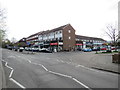
Shops on Keymer Road, Hassocks
by Malc McDonald
geograph for square TQ3015
A parade of shops with flats above, in Hassocks.
|

|
Keymer Road, Hassocks
by Malc McDonald
geograph for square TQ3015
Keymer Road is the main street in the small town of Hassocks, in West Sussex.
|
|
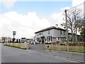
The Hassocks, Hassocks
by Malc McDonald
geograph for square TQ3015
The Hassocks pub next to Hassocks railway station
|

|
Beer Garden - Royal Oak Inn
by Paul Gillett
geograph for square TQ3319
Category: Beer garden
|

|
Stile on the Path
by Peter Trimming
geograph for square TQ3017
This stile, like many in the area, was erected by The Monday Group, a voluntary... (more)
|

|
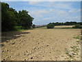
Footpath Junction
by Peter Trimming
geograph for square TQ3017
In the background is Hammond's Mill Farm.
|
|
Hope Farm
by Paul Gillett
geograph for square TQ3219
|

|
Clearwaters Farm
by Paul Gillett
geograph for square TQ3221
|

|
House in Clearwaters Lane
by Paul Gillett
geograph for square TQ3221
|

|
Clearwaters Lane
by Paul Gillett
geograph for square TQ3221
|

|
Pylon at Holmbush Farm
by Paul Gillett
geograph for square TQ3121
|

|
Valebridge Pond
by Paul Gillett
geograph for square TQ3221
At the Northern edge of Bedelands Local Nature Reserve
|
|
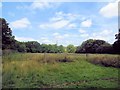
Bedeland Farm Local Nature Reserve
by Paul Gillett
geograph for square TQ3220
The Nature Reserve consists of ancient meadows, woodland, hedgerows and ponds,... (more)
|
|
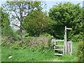
Stile on the Sussex Border Path
by Malc McDonald
geograph for square TQ3317
This stile was provided by the Monday Group, a voluntary organisation which... (more)
|
