About tags on Geograph

Public Tags

Related Tags | Coverage Map
Prefix: near    Tag:  Carshalton  
Other tags: Carshalton     place:Carshalton     station:Carshalton    

Showing images tagged with near:Carshalton tag.

View all tagged images - In Browser
:

TQ2661 : Banstead Road South, Carshalton Beeches by Malc McDonald Banstead Road South, Carshalton Beeches by Malc McDonald
geograph for square TQ2661
Banstead Road South is a residential road in Carshalton Beeches, in the outer... (more)
TQ2864 : Pond near Carshalton by Malc McDonald Pond near Carshalton by Malc McDonald
geograph for square TQ2864
A pond with a fountain at its centre, near Carshalton in the outer suburbs of... (more)
Tags: near:Carshalton   type:Geograph   near:Hackbridge   top:Park and Public Gardens   subject:Pond   Pond   place:South London   near:Sutton   near:Wallington  
TQ2661 : Downs Road, near Belmont by Malc McDonald Downs Road, near Belmont by Malc McDonald
geograph for square TQ2661
Downs Road is a residential road on the outer edge of Greater London. The road... (more)
TQ2661 : Bridleway onto Banstead Downs by Malc McDonald Bridleway onto Banstead Downs by Malc McDonald
geograph for square TQ2661
A public bridleway leading into woodland on Banstead Downs. The kerbline of... (more)
Tags: near:Banstead   near:Belmont   top:Boundary, Barrier   Bridleway   signpost:Bridleway   rights of way:Bridleway   path:Bridleway   Bridleway Signpost   near:Carshalton   near:Carshalton Beeches   boundary:County   County Boundary   County Boundary (Unmarked)   type:Geograph   top:Paths   sign:Public Bridleway   Public Bridleway   Public Bridleway Signpost   place:South London   county:Surrey   near:Sutton   top:Woodland, Forest  
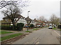
TQ2865 : Derek Avenue, near Carshalton by Malc McDonald Derek Avenue, near Carshalton by Malc McDonald
geograph for square TQ2865
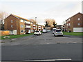
Derek Avenue is a residential road in the outer suburbs of south London.
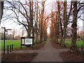
TQ2965 : Beddington Park at sunset by Malc McDonald Beddington Park at sunset by Malc McDonald
geograph for square TQ2965
A tree-lined avenue in Beddington Park, in the outer suburbs of south London.... (more)
TQ2865 : Riverbank Way, Hackbridge by Malc McDonald Riverbank Way, Hackbridge by Malc McDonald
geograph for square TQ2865
Riverbank Way is a newly-built housing development alongside the River Wandle in... (more)
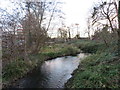
TQ2865 : River Wandle at Hackbridge by Malc McDonald River Wandle at Hackbridge by Malc McDonald
geograph for square TQ2865
A view upstream along the River Wandle at Hackbridge, in the outer suburbs of... (more)
Tags: near:Carshalton   type:Geograph   place:Hackbridge   place:River Wandle   top:Rivers, Streams, Drainage   place:South London   near:St Helier   near:Sutton   river:Wandle  
TQ2765 : Culvers Retreat, Hackbridge by Malc McDonald Culvers Retreat, Hackbridge by Malc McDonald
geograph for square TQ2765
Culvers Retreat is a short cul-de-sac in Hackbridge, in the outer suburbs of... (more)
TQ2766 : Kingswood Drive, Hackbridge by Malc McDonald Kingswood Drive, Hackbridge by Malc McDonald
geograph for square TQ2766
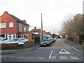
Kingswood Drive is a residential road in Hackbridge, in the outer suburbs of south London.
Tags: near:Carshalton   type:Geograph   place:Hackbridge   Residential   Residential Area   Residential Road   place:South London   near:St Helier   subject:Suburb   top:Suburb, Urban Fringe   near:Sutton  
TQ2766 : Millside, Hackbridge by Malc McDonald Millside, Hackbridge by Malc McDonald
geograph for square TQ2766
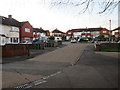
Millside is a short residential cul-de-sac in Hackbridge, in the outer suburbs... (more)
TQ2766 : Shared path and new apartments, Hackbridge by Malc McDonald Shared path and new apartments, Hackbridge by Malc McDonald
geograph for square TQ2766
A shared path for pedestrians and cyclists, passing a new housing development in... (more)
TQ2766 : Buckhurst Avenue, Hackbridge by Malc McDonald Buckhurst Avenue, Hackbridge by Malc McDonald
geograph for square TQ2766
Buckhurst Avenue is a residential cul-de-sac in Hackbridge, in the outer suburbs... (more)
TQ2863 : Shotfield, Wallington by Malc McDonald Shotfield, Wallington by Malc McDonald
geograph for square TQ2863
Shotfield is a residential road in Wallington, in the outer suburbs of south London.
Tags: near:Carshalton   type:Geograph   Residential   Residential Area   Residential Road   place:South London   subject:Suburb   top:Suburb, Urban Fringe   near:Sutton   place:Wallington  
TQ2863 : Elles House, Shotfield, Wallington by Malc McDonald Elles House, Shotfield, Wallington by Malc McDonald
geograph for square TQ2863
Elles House is a recently-built apartment block in Wallington, in the outer... (more)
Tags: building type:Apartment   subject:Apartment Block   Apartment Block   building type:Apartment Block   Apartment Building   housing:Apartments   near:Carshalton   type:Geograph   top:Housing, Dwellings   Modern Apartment Block   Residential   place:South London   top:Suburb, Urban Fringe   near:Sutton   place:Wallington  
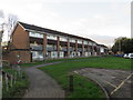
TQ2865 : New housing, Hackbridge by Malc McDonald New housing, Hackbridge by Malc McDonald
geograph for square TQ2865
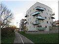
Newly-built apartment blocks at Hackbridge, in the outer suburbs of south London.
Tags: building type:Apartment   subject:Apartment Block   building type:Apartment Block   Apartment Block   Apartment Buildings   housing:Apartments   near:Carshalton   type:Geograph   place:Hackbridge   top:Housing, Dwellings   Modern Apartment Block   New Apartments   place:South London   top:Suburb, Urban Fringe   near:Wallington  
TQ2865 : Community garden in Hackbridge by Malc McDonald Community garden in Hackbridge by Malc McDonald
geograph for square TQ2865
A community garden in Hackbridge, in the outer suburbs of south London. This... (more)
View more in the Image Search or in Browser
View images matching 'Carshalton' anywhere in the tags
Don't click these: PotMel 1 PotMel 2