About tags on Geograph

Public Tags

Related Tags | Coverage Map
Prefix: near    Tag:  Christchurch  
Other tags: Christchurch     church:Christchurch     place:Christchurch    

Showing latest 50 of 284 images tagged with near:Christchurch tag.

View all tagged images - In Browser
:

SZ1393 : Iford Bridge, near Christchurch by Malc McDonald Iford Bridge, near Christchurch by Malc McDonald
geograph for square SZ1393
Iford Bridge crosses the River Stour, which forms the border separating... (more)
SZ1592 : Tuckton Gardens, near Christchurch by Malc McDonald Tuckton Gardens, near Christchurch by Malc McDonald
geograph for square SZ1592
Tuckton Gardens is located on the bank of the River Stour. The river forms the... (more)
Tags: near:Bournemouth   near:Christchurch   county:Dorset   ceremonial county:Dorset   Drought   weather:Drought   Drought 2026   type:Geograph   Park   top:Park and Public Gardens   top:Paths   river:River Stour   top:Rivers, Streams, Drainage   subject:Riverside   Riverside Path   near:Southbourne   Stour Valley Way   ldp:Stour Valley Way   long distance path:Stour Valley Way   river:Stour(Dorset)  
SZ1592 : Tuckton Gardens, near Christchurch by Malc McDonald Tuckton Gardens, near Christchurch by Malc McDonald
geograph for square SZ1592
Tuckton Gardens is located on the bank of the River Stour. The river forms the... (more)
Tags: near:Bournemouth   near:Christchurch   ceremonial county:Dorset   county:Dorset   weather:Drought   Drought   Drought 2026   type:Geograph   Park   top:Park and Public Gardens   subject:Path   top:Paths   river:River Stour   Riverside Path   near:Southbourne   ldp:Stour Valley Way   long distance path:Stour Valley Way   Stour Valley Way   river:Stour(Dorset)  
SZ1299 : Matchams Lane, near Christchurch by Malc McDonald Matchams Lane, near Christchurch by Malc McDonald
geograph for square SZ1299
A view of Matchams Lane in countryside between Christchurch and Ringwood.... (more)
Tags: subject:Boundary   Boundary   top:Boundary, Barrier   unitary authority:Bournemouth Christchurch and Poole   near:Christchurch   ceremonial county:Dorset   county:Dorset   unitary authority:Dorset   type:Geograph   Minor Country Road   road:Minor Road   Minor Road   Minor Rural Road   near:Ringwood   top:Roads, Road Transport   Rural Road   Unitary Authority Boundary  
SZ1596 : B3347 road near Christchurch by Malc McDonald B3347 road near Christchurch by Malc McDonald
geograph for square SZ1596
A view of the B3347 road as it approaches the village of Sopley, north of... (more)
Tags: road:B Road   road:B3347   Bend in Rural Road   near:Bournemouth   near:Christchurch   type:Geograph   county:Hampshire   subject:Road   top:Roads, Road Transport   Rural Road   near:Sopley   near:Winkton  
SZ1396 : Christchurch Road, near Christchurch by Malc McDonald Christchurch Road, near Christchurch by Malc McDonald
geograph for square SZ1396
Christchurch Road is on the route of the B3073 road. Here, it heads way from a... (more)
Tags: road:B Road   road:B3073   near:Christchurch   county:Dorset   ceremonial county:Dorset   type:Geograph   subject:Road   Road Classified B   top:Roads, Road Transport  
SZ1396 : Christchurch Road, near Christchurch by Malc McDonald Christchurch Road, near Christchurch by Malc McDonald
geograph for square SZ1396
Christchurch Road is on the route of the B3073. The pavement to the right of... (more)
Tags: road:B Road   road:B3073   near:Christchurch   Cycle and Pedestrian Path   Cycle and Pedestrian Path Sign   Cycle Path   Cycleway and Path   county:Dorset   ceremonial county:Dorset   type:Geograph   place:Hurn   subject:Road   Road Classified B   top:Roads, Road Transport   top:Woodland, Forest  
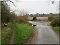
SZ1895 : Ford on Waterditch Lane, near Christchurch by Malc McDonald Ford on Waterditch Lane, near Christchurch by Malc McDonald
geograph for square SZ1895
A ford takes Waterditch Lane across the River Mude in countryside near... (more)
SZ1690 : Path at Hengistbury Head, near Christchurch by Malc McDonald Path at Hengistbury Head, near Christchurch by Malc McDonald
geograph for square SZ1690
A path descends from the top of Hengistbury Head. There is a view over... (more)
Tags: near:Bournemouth   near:Christchurch   ceremonial county:Dorset   county:Dorset   european long distance path:E9   top:Estuary, Marine   type:Geograph   Gorse   Gorse Bushes   Gorse Bushes in Flower   Gorse in Flower   Harbour   place:Hengistbury Head   Path   subject:Path   top:Paths   Stour Valley Way   ldp:Stour Valley Way   long distance path:Stour Valley Way  
SZ1690 : Path at Hengistbury Head, near Christchurch by Malc McDonald Path at Hengistbury Head, near Christchurch by Malc McDonald
geograph for square SZ1690
The path in this image is on the route of the Stour Valley Way. Christchurch... (more)
Tags: near:Bournemouth   near:Christchurch   county:Dorset   ceremonial county:Dorset   type:Geograph   place:Hengistbury Head   subject:Path   top:Paths   ldp:Stour Valley Way   long distance path:Stour Valley Way   Stour Valley Way  
SZ1690 : "Layers of Bournemouth", Hengistbury Head, near Christchurch by Malc McDonald "Layers of Bournemouth", Hengistbury Head, near Christchurch by Malc McDonald
geograph for square SZ1690
"Layers of Bournemouth" is a sculpture made in 2018 from varied soil... (more)
Tags: near:Bournemouth   near:Christchurch   county:Dorset   ceremonial county:Dorset   european long distance path:E9   type:Geograph   place:Hengistbury Head   Outdoor Sculpture   top:Paths   Public Sculpture   subject:Sculpture   Sculpture   artwork:Sculpture   ldp:Stour Valley Way   long distance path:Stour Valley Way   Stour Valley Way  
SZ1691 : Stour Valley Way near Christchurch by Malc McDonald Stour Valley Way near Christchurch by Malc McDonald
geograph for square SZ1691
A view of the Stour Valley Way path, with Christchurch Priory in the background.
Tags: near:Bournemouth   near:Christchurch   county:Dorset   ceremonial county:Dorset   path:Footpath   type:Geograph   subject:Path   Path   top:Paths   Stour Valley Way   ldp:Stour Valley Way   long distance path:Stour Valley Way  
SZ1396 : Slip road near Christchurch by Malc McDonald Slip road near Christchurch by Malc McDonald
geograph for square SZ1396
A slip road leading onto the trunk A338 road near Christchurch. This image was... (more)
Tags: road:A338   A338   near:Christchurch   ceremonial county:Dorset   county:Dorset   Electricity Pylon   Electricity Transmission Pylon   Entry Slip Road   type:Geograph   Gorse   plant:Gorse   Gorse Bushes   Gorse Bushes in Flower   Gorse in Flower   Pylon   subject:Road   top:Roads, Road Transport   Slip Road  
SZ1296 : Home Farm, Hurn, near Christchurch by Malc McDonald Home Farm, Hurn, near Christchurch by Malc McDonald
geograph for square SZ1296
Home Farm in the village of Hurn, near Christchurch. The road which passes is the B3073.
Tags: road:B Road   road:B3073   near:Christchurch   county:Dorset   ceremonial county:Dorset   subject:Farm Building   top:Farm, Fishery, Market Gardening   housing:Farmhouse   Farmhouse   type:Geograph   top:Housing, Dwellings   place:Hurn   Road Classified B  
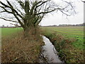
SZ1896 : River Mude near Christchurch by Malc McDonald River Mude near Christchurch by Malc McDonald
geograph for square SZ1896
A view of the River Mude in countryside to the north of Christchurch. Here, the... (more)
Tags: top:Boundary, Barrier   near:Christchurch   County Boundary   county:Dorset   weather:Dull   Dull Day   Dull Weather   type:Geograph   county:Hampshire   river:Mude   top:Rivers, Streams, Drainage   subject:Stream   Stream  
SZ2293 : Chewton Bunny Nature Reserve, near Christchurch by Malc McDonald Chewton Bunny Nature Reserve, near Christchurch by Malc McDonald
geograph for square SZ2293
A path through Chewton Bunny Nature Reserve, near Christchurch.
Tags: near:Bournemouth   place:Chewton Bunny   near:Christchurch   county:Dorset   ceremonial county:Dorset   type:Geograph   place:Highcliffe-on-Sea   subject:Nature Reserve   Nature Reserve   near:New Milton   Path   Path in Nature Reserve   Path Through Wood   top:Paths   Woodland Path   top:Woodland, Forest  
SZ2293 : Walkford Brook, Chewton Bunny, near Christchurch by Malc McDonald Walkford Brook, Chewton Bunny, near Christchurch by Malc McDonald
geograph for square SZ2293
Chewton Bunny is a short wooded valley near the town of Christchurch. It is a... (more)
Tags: top:Boundary, Barrier   near:Bournemouth   Brook   place:Chewton Bunny   near:Christchurch   County Boundary (Unmarked)   ceremonial county:Dorset   county:Dorset   type:Geograph   county:Hampshire   place:Highcliffe-on-Sea   Nature Reserve   near:New Milton   top:Rivers, Streams, Drainage   subject:Stream   Stream   Stream in Woodland   Wooded Valley   Woodland Stream   top:Woodland, Forest  
SZ2193 : Chewton Bunny, near Christchurch by Malc McDonald Chewton Bunny, near Christchurch by Malc McDonald
geograph for square SZ2193
Chewton Bunny is a short wooded valley near the town of Christchurch. It is a... (more)
SZ2193 : Path through Chewton Bunny, near Christchurch by Malc McDonald Path through Chewton Bunny, near Christchurch by Malc McDonald
geograph for square SZ2193
Chewton Bunny is a short wooded valley near the town of Christchurch. It is a... (more)
SZ2193 : Chewton Bunny Nature Reserve, near Christchurch by Malc McDonald Chewton Bunny Nature Reserve, near Christchurch by Malc McDonald
geograph for square SZ2193
A path leads into Chewton Bunny Nature Reserve. Chewton Bunny is the name of a... (more)
SZ2193 : Beach at Chewton Bunny, near Christchurch by Malc McDonald Beach at Chewton Bunny, near Christchurch by Malc McDonald
geograph for square SZ2193
A view eastwards along the coastline at Chewton Bunny, near Christchurch.... (more)
Tags: subject:Beach   Beach View   near:Bournemouth   place:Chewton Bunny   near:Christchurch   top:Coastal   County Boundary (Unmarked)   county:Dorset   ceremonial county:Dorset   type:Geograph   county:Hampshire   place:Highcliffe-on-Sea   near:New Milton  
SZ1196 : Hurn Court Farm, near Christchurch by Malc McDonald Hurn Court Farm, near Christchurch by Malc McDonald
geograph for square SZ1196
Hurn Court Farm is located in Dorset countryside, near Christchurch.
Tags: near:Christchurch   ceremonial county:Dorset   county:Dorset   subject:Farm   Farm   Farm Building   top:Farm, Fishery, Market Gardening   type:Geograph   near:Hurn  
SZ1890 : Path and beach huts on Mudeford Sandspit, near Christchurch by Malc McDonald Path and beach huts on Mudeford Sandspit, near Christchurch by Malc McDonald
geograph for square SZ1890
The beach huts on Mudeford Sandspit are reputed to be the most expensive beach... (more)
Tags: building type:Beach Hut   Beach Huts   near:Bournemouth   near:Christchurch   top:Coastal   Coastal Path   county:Dorset   ceremonial county:Dorset   european long distance path:E9   type:Geograph   near:Hengistbury Head   near:Mudeford   subject:Path   top:Paths   Stour Valley Way   ldp:Stour Valley Way   long distance path:Stour Valley Way  
SZ1790 : Mudeford Sandspit Lagoon, near Christchurch by Malc McDonald Mudeford Sandspit Lagoon, near Christchurch by Malc McDonald
geograph for square SZ1790
A lagoon in Christchurch Harbour. The beach huts in the background are on a... (more)
Tags: near:Bournemouth   near:Christchurch   Coastal Lagoon   ceremonial county:Dorset   county:Dorset   top:Estuary, Marine   type:Geograph   near:Hengistbury Head   subject:Lagoon   Lagoon   near:Mudeford  
SZ1691 : Reedbeds, Christchurch Harbour by Malc McDonald Reedbeds, Christchurch Harbour by Malc McDonald
geograph for square SZ1691
Reedbeds in Christchurch Harbour
Tags: near:Bournemouth   near:Christchurch   Christchurch Harbour   ceremonial county:Dorset   county:Dorset   subject:Estuary   top:Estuary, Marine   type:Geograph   place:Hengistbury Head   Reedbeds   Tidal Reedbed  
SU1301 : Matchams Close, near Christchurch by Malc McDonald Matchams Close, near Christchurch by Malc McDonald
geograph for square SU1301
Matchams Close leads to a residential development in countryside near Christchurch.
Tags: near:Christchurch   county:Dorset   ceremonial county:Dorset   type:Geograph   Residential Cul-De-Sac   near:Ringwood   subject:Road   top:Roads, Road Transport  
SU1301 : Car dealer near Christchurch by Malc McDonald Car dealer near Christchurch by Malc McDonald
geograph for square SU1301
A car dealer's premises in countryside near Christchurch.
SU1302 : Wattons Lane, near Christchurch by Malc McDonald Wattons Lane, near Christchurch by Malc McDonald
geograph for square SU1302
Wattons Lane is a minor road leading to a water pumping station on the River... (more)
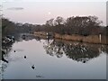
SZ1492 : Full moon at daybreak, River Stour, Christchurch by Malc McDonald Full moon at daybreak, River Stour, Christchurch by Malc McDonald
geograph for square SZ1492
A view of the River Stour at daybreak on a January morning. A full moon shines... (more)
SZ1795 : Waterditch Lane, near Christchurch by Malc McDonald Waterditch Lane, near Christchurch by Malc McDonald
geograph for square SZ1795
Waterditch Lane is a narrow, minor lane through countryside near Christchurch.... (more)
SZ2193 : Clifside at Highcliffe-on-Sea, near Christchurch by Malc McDonald Clifside at Highcliffe-on-Sea, near Christchurch by Malc McDonald
geograph for square SZ2193
A gorse bush on the cliffside at Highcliffe-on-Sea, on the Dorset coast. This... (more)
Tags: near:Bournemouth   near:Christchurch   subject:Cliff   Cliffside   top:Coastal   ceremonial county:Dorset   county:Dorset   Flowering Gorse   type:Geograph   Gorse   Gorse Bush   Gorse in Flower   place:Highcliffe-on-Sea   near:New Milton  
SZ1393 : Flooded ground at Bernard's Mead, near Christchurch by Malc McDonald Flooded ground at Bernard's Mead, near Christchurch by Malc McDonald
geograph for square SZ1393
In January 2026, Storm Chandra brought strong winds and heavy rain to parts of... (more)
Tags: near:Bournemouth   near:Christchurch   ceremonial county:Dorset   county:Dorset   Flood   subject:Flood   Flood Water   Flooded Area   Flooded Field   Flooded Ground   Flooded Land   type:Geograph   top:Grassland  
SZ1592 : Wick Green, near Christchurch by Malc McDonald Wick Green, near Christchurch by Malc McDonald
geograph for square SZ1592
A view of Wick Green, near Christchurch, on a dark evening in mid-December. The... (more)
Tags: near:Bournemouth   near:Christchurch   Christmas Lights   Darkness   ceremonial county:Dorset   county:Dorset   Festive Lights   type:Geograph   Night Time   Night Time Photography   subject:Village   Village   Village Green   top:Village, Rural Settlement   place:Wick  
SZ1196 : Cottages at West Hurn, near Christchurch by Malc McDonald Cottages at West Hurn, near Christchurch by Malc McDonald
geograph for square SZ1196
A pair of cottages at West Hurn, near Christchurch.
Tags: near:Christchurch   housing:Cottages   subject:Cottages   Cottages   Country Cottages   county:Dorset   ceremonial county:Dorset   type:Geograph   top:Housing, Dwellings   near:Hurn   Semi Detached Cottages   Semi-Detached Cottages   top:Village, Rural Settlement   place:West Hurn  
SZ1397 : Former railway station at Hurn, near Christchurch by Malc McDonald Former railway station at Hurn, near Christchurch by Malc McDonald
geograph for square SZ1397
The Avon Causeway Hotel near Christchurch occupies the site of Hurn railway... (more)
Tags: top:Business, Retail, Services   near:Christchurch   Converted Former Railway Station   ceremonial county:Dorset   county:Dorset   type:Geograph   subject:Hotel   Hotel   near:Hurn   former:Railway Station   top:Railways  
SZ1890 : Beach huts on Mudeford Sandspit, near Christchurch by Malc McDonald Beach huts on Mudeford Sandspit, near Christchurch by Malc McDonald
geograph for square SZ1890
Mudeford Sandspit reaches north from Hengistbury Head across the mouth of... (more)
Tags: Beach   subject:Beach   building type:Beach Hut   Beach Huts   near:Bournemouth   near:Christchurch   top:Coastal   ceremonial county:Dorset   county:Dorset   type:Geograph   place:Hengistbury Head   near:Mudeford   Sand Beach   Sandy Beach  
SZ1591 : Cattle grazing, Wick, near Christchurch by Malc McDonald Cattle grazing, Wick, near Christchurch by Malc McDonald
geograph for square SZ1591
Cattle grazing in a field at Wick, near Christchurch in Dorset.
Tags: near:Bournemouth   subject:Cattle   Cattle   animals:Cattle   Cattle Grazing   near:Christchurch   ceremonial county:Dorset   county:Dorset   top:Farm, Fishery, Market Gardening   Field   Field Gate   Gate   type:Geograph   place:Wick   Wooden Field Gate  
SZ2194 : Amberwood Drive, Walkford, near Christchurch by Malc McDonald Amberwood Drive, Walkford, near Christchurch by Malc McDonald
geograph for square SZ2194
Amberwood Drive is a residential road in Walkford, near Christchurch.
Tags: near:Christchurch   county:Dorset   type:Geograph   near:New Milton   Residential   Residential Area   Residential Road   subject:Suburb   top:Suburb, Urban Fringe   place:Walkford  
SZ2194 : Glenville Road, Walkford, near Christchurch by Malc McDonald Glenville Road, Walkford, near Christchurch by Malc McDonald
geograph for square SZ2194
Glenville Road is a residential road in Walkford, near Christchurch.
Tags: near:Christchurch   county:Dorset   type:Geograph   near:New Milton   Residential   Residential Area   Residential Road   subject:Suburb   top:Suburb, Urban Fringe   place:Walkford  
SZ2194 : Ringwood Road, Walkford, near Christchurch by Malc McDonald Ringwood Road, Walkford, near Christchurch by Malc McDonald
geograph for square SZ2194
Ringwood Road is a residential road in Walkford, near Christchurch.
Tags: near:Christchurch   county:Dorset   type:Geograph   near:New Milton   Residential   Residential Area   Residential Road   subject:Suburb   top:Suburb, Urban Fringe   place:Walkford  
SZ2194 : The Walkford pub, Walkford, near Christchurch by Malc McDonald The Walkford pub, Walkford, near Christchurch by Malc McDonald
geograph for square SZ2194
The Walkford pub in Walkford, near Christchurch in Dorset. The pub is part of... (more)
Tags: top:Business, Retail, Services   near:Christchurch   county:Dorset   type:Geograph   Greene King   brewer:Greene King   near:New Milton   Pub   Public House   subject:Public House   top:Suburb, Urban Fringe   place:Walkford  
SZ1298 : Track into Hurn Forest, near Christchurch by Malc McDonald Track into Hurn Forest, near Christchurch by Malc McDonald
geograph for square SZ1298
A track leading into Hurn Forest in countryside near Christchurch. The metal... (more)
SZ1299 : Entrance to Fillybrook Fields, near Christchurch by Malc McDonald Entrance to Fillybrook Fields, near Christchurch by Malc McDonald
geograph for square SZ1299
Fillybrook Fields is a development of residential bungalows in countryside near... (more)
Tags: near:Christchurch   county:Dorset   ceremonial county:Dorset   subject:Entrance   Entrance Drive   Entrance Driveway   type:Geograph   top:Housing, Dwellings   near:Ringwood   top:Roads, Road Transport  
SZ1299 : Longfield Caravan park, near Christchurch by Malc McDonald Longfield Caravan park, near Christchurch by Malc McDonald
geograph for square SZ1299
The entrance driveway to Longfield Caravan Park in countryside near Christchurch.
SZ1795 : Preston Lane, near Christchurch by Malc McDonald Preston Lane, near Christchurch by Malc McDonald
geograph for square SZ1795
Preston Lane is a narrow minor lane in countryside near Christchurch. This... (more)
Tags: near:Bournemouth   place:Burton   near:Christchurch   Country Lane   county:Dorset   weather:Dull   Dull Day   Dull Weather   type:Geograph   subject:Lane   Minor Country Lane   Minor Rural Lane   Narrow Country Lane   top:Roads, Road Transport   Rural Lane  
SZ1694 : Burton village green, near Christchurch by Malc McDonald Burton village green, near Christchurch by Malc McDonald
geograph for square SZ1694
The village green in Burton, near Christchurch. The road to the left of the... (more)
Tags: Bare Trees   Bare Trees in Winter   Bare Winter Trees   near:Bournemouth   place:Burton   near:Christchurch   county:Dorset   weather:Dull   Dull Day   Dull Weather   type:Geograph   subject:Village   Village Green   top:Village, Rural Settlement  
SZ1694 : The Oak Inn, Burton, near Christchurch by Malc McDonald The Oak Inn, Burton, near Christchurch by Malc McDonald
geograph for square SZ1694
The Oak Inn in the village of Burton, near Christchurch.
Tags: near:Bournemouth   place:Burton   top:Business, Retail, Services   near:Christchurch   county:Dorset   weather:Dull   Dull Day   Dull Weather   type:Geograph   subject:Inn   Village Inn   Village Pub   top:Village, Rural Settlement  
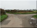
SZ1794 : Hawthorn Road, near Christchurch by Malc McDonald Hawthorn Road, near Christchurch by Malc McDonald
geograph for square SZ1794
A junction of two minor lanes in countryside near the town of Christchurch.... (more)
SZ1793 : Road junction near Christchurch by Malc McDonald Road junction near Christchurch by Malc McDonald
geograph for square SZ1793
A meeting of two minor roads near Christchurch. The road ahead forms part of... (more)
SZ1492 : Belle Vue Road, Tuckton, near Christchurch by Malc McDonald Belle Vue Road, Tuckton, near Christchurch by Malc McDonald
geograph for square SZ1492
Traffic queueing on Belle Vue Road in Tuckton, near Christchurch.
Tags: near:Bournemouth   near:Christchurch   type:Geograph   Queuing Traffic   top:Roads, Road Transport   top:Suburb, Urban Fringe   subject:Traffic   Traffic   Traffic Queue   place:Tuckton  
View more in the Image Search or in Browser
View images matching 'Christchurch' anywhere in the tags
Don't click these: PotMel 1 PotMel 2