Geograph - photograph every grid square
About tags on Geograph
Tags
Geographical Context
Subjects
Types
Other Prefixes
Public Tags
Related Tags
|
Coverage Map
Prefix:
near
Tag:
Crewe
Other tags:
Crewe
place:
Crewe
post town:
Crewe
railway station:
Crewe
Showing images tagged with
near:
Crewe
tag.
View all tagged images
-
In Browser
Search within these images
:
Duckboarded footpath near Crewe
by
Jonathan Hutchins
geograph for square
SJ7453
This is footpath Crewe Green FP 2, which is also part of two designated routes,... (
more
)
Tags:
near:
Crewe
Crewe and Nantwich Circular Walk
footpath:
Crewe Green FP 2
Duckboards
subject:
Path
top:
Paths
Public Footpath
South Cheshire Way
Stile and footpath under railway line near Crewe
by
Jonathan Hutchins
geograph for square
SJ7453
The line is the Alsager-Crewe line which is single track at this point. The... (
more
)
Tags:
near:
Crewe
Crewe and Nantwich Circular Walk
top:
Paths
Public Footpath
subject:
Railway
Railway Embankment
Railway Line
top:
Railways
South Cheshire Way
footpath:
Weston FP 15
Partly flooded field alongside railway line
by
Jonathan Hutchins
geograph for square
SJ7453
The line is the Alsager-Crewe line which is single track at this point. The... (
more
)
Tags:
near:
Crewe
Crewe and Nantwich Circular Walk
top:
Farm, Fishery, Market Gardening
subject:
Field
Flooded Field
top:
Paths
Public Footpath
Railway Embankment
Railway Line
South Cheshire Way
footpath:
Weston FP 15
Entrance to Quaker's Coppice
by
Jonathan Hutchins
geograph for square
SJ7254
This is the north end of the site, where entrance is down a path off Crewe Gates... (
more
)
Tags:
near:
Crewe
Fenced Footpath
Fenced Path
type:
Geograph
Industrial Estate Unit
top:
Industry
top:
Park and Public Gardens
subject:
Path
top:
Paths
top:
Woodland, Forest
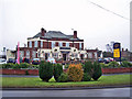
The Cheshire Cheese, Shavington
by
Richard Dorrell
geograph for square
SJ7053
Category: Public house
Described on its website as a Fusion pub, blending Indian and English food. The... (
more
)
Tags:
top:
Business, Retail, Services
near:
Crewe
Public House
place:
Shavington
top:
Suburb, Urban Fringe
Pond just outside Quaker's Coppice
by
Jonathan Hutchins
geograph for square
SJ7254
Tags:
near:
Crewe
type:
Geograph
top:
Lakes, Wetland, Bog
subject:
Pond
Pond in Woodland
top:
Woodland, Forest
Holly trees in Quaker's Coppice
by
Jonathan Hutchins
geograph for square
SJ7254
Tags:
near:
Crewe
type:
Geograph
trees:
Holly
Holly Trees
top:
Paths
subject:
Tree
Woodland Path
top:
Woodland, Forest
Footbridge into Quaker's Coppice
by
Jonathan Hutchins
geograph for square
SJ7254
Tags:
top:
Boundary, Barrier
subject:
Bridge
near:
Crewe
Footbridge
type:
Geograph
top:
Paths
top:
Woodland, Forest
Quaker's Coppice from the east
by
Jonathan Hutchins
geograph for square
SJ7254
Tags:
near:
Crewe
type:
Geograph
subject:
Woodland
top:
Woodland, Forest
Footbridge in Quaker's Coppice
by
Jonathan Hutchins
geograph for square
SJ7254
Tags:
subject:
Bridge
near:
Crewe
Footbridge
type:
Geograph
top:
Paths
top:
Woodland, Forest
Pond in Quaker's Coppice
by
Jonathan Hutchins
geograph for square
SJ7254
Compare this with a view from April 2012
Link
Tags:
near:
Crewe
type:
Geograph
Industrial Estate Unit
top:
Industry
top:
Lakes, Wetland, Bog
top:
Park and Public Gardens
subject:
Pond
Pond in Woodland
top:
Woodland, Forest
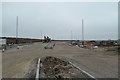
Last day of the A5020
by
Jonathan Hutchins
geograph for square
SJ7452
In connection with the Basford spine road development (see e.g.... (
more
)
Tags:
road:
A5020
Basford West Development
near:
Crewe
subject:
Road
top:
Roads, Road Transport
Roadsign
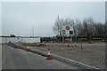
Basford West spine road
by
Jonathan Hutchins
geograph for square
SJ7052
The Basford West development is the proposed development of 32.5ha of land west... (
more
)
Tags:
road:
A500
Basford West Development
top:
Construction, Development
near:
Crewe
subject:
Road
top:
Roads, Road Transport
Basford West spine road
by
Jonathan Hutchins
geograph for square
SJ7052
The Basford West development is the proposed development of 32.5ha of land west... (
more
)
Tags:
road:
A500
Basford West Development
top:
Construction, Development
near:
Crewe
subject:
Road
top:
Roads, Road Transport
Path from woodland onto Weston Road
by
Jonathan Hutchins
geograph for square
SJ7253
Tags:
near:
Crewe
type:
Geograph
subject:
Path
Path / Road Junction
Path Gate
top:
Paths
Road and Path Junction
top:
Roads, Road Transport
Woodland Path
top:
Woodland, Forest
Path through woodland by industrial estate
by
Jonathan Hutchins
geograph for square
SJ7254
Tags:
near:
Crewe
type:
Geograph
Industrial Estate Unit
top:
Industry
subject:
Path
top:
Paths
Woodland Path
top:
Woodland, Forest
Path through woodland by industrial estate
by
Jonathan Hutchins
geograph for square
SJ7254
Tags:
near:
Crewe
type:
Geograph
Industrial Estate Unit
top:
Industry
subject:
Path
top:
Paths
Woodland Path
top:
Woodland, Forest
Path through strip of woodland
by
Jonathan Hutchins
geograph for square
SJ7254
Tags:
near:
Crewe
type:
Geograph
subject:
Path
top:
Paths
Woodland Path
top:
Woodland, Forest
Path through strip of woodland
by
Jonathan Hutchins
geograph for square
SJ7254
Tags:
near:
Crewe
type:
Geograph
subject:
Path
top:
Paths
Woodland Path
top:
Woodland, Forest
Path through strip of woodland
by
Jonathan Hutchins
geograph for square
SJ7254
Tags:
near:
Crewe
type:
Geograph
subject:
Path
top:
Paths
Woodland Path
top:
Woodland, Forest
View more in the Image Search
or
in Browser
View images matching 'Crewe' anywhere
in
the tags
Don't click these:
PotMel 1
PotMel 2
☰
Home
View
Search
Marked Images
Maps
Browser
Explore
Showcase
New Images
Collections
Interact
Games
Discussions
Blog
Contributors
Submit
Statistics
Leaderboards
General
FAQ
Help Pages
Sitemap
Contact Us
Support Us
sponsored by
🔍︎
What to search:
Photos
Enter keywords or a location/postcode to search nearby images
Enter a Grid Reference
Placenames
Collections
Website Pages
Everything
Others:
Advanced Search
|
Image Browser
Or:
Coverage Map
|
Searchable Map
You are not logged in
|
login
|
register