Public Tags
Other tags: place:Crockenhill
Showing images tagged with near:Crockenhill tag.
|
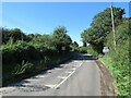
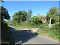
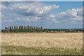
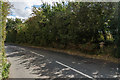
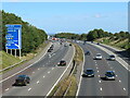
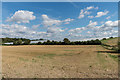
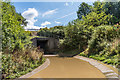
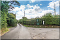
Eynsford Road, near Crockenhill
by Malc McDonald geograph for square TQ5167 Eynsford Road approaching the village of Crockenhill in Kent. Road markings and... (more)
Tags:
30 Mph SignX
30 Mph SignsX
30 Mph Speed Limit SignX
30 Mph Speed Limit SignsX
road sign:30mph Speed LimitX
30mph Speed Limit SignX
30mph Speed Limit SignsX
near:Crockenhill
near:EynsfordX
type:GeographX
county:KentX
Minor RoadX
road:Minor RoadX
subject:RoadX
top:Roads, Road TransportX
Rural RoadX
Speed Limit 30mphX
Speed Limit SignsX
near:SwanleyX
|
|
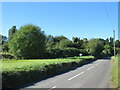
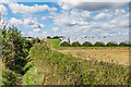
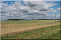
Crockenhill Road, near Crockenhill
by Malc McDonald geograph for square TQ4967 Crockenhill Road forms part of the route of the B258 road. Part of the B258 is... (more)
Tags:
road:B RoadX
B258X
near:Crockenhill
type:GeographX
subject:RoadX
Road Classified BX
top:Roads, Road TransportX
Rural RoadX
place:South East LondonX
near:SwanleyX
|
|
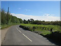
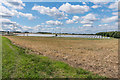
Crockenhill Road, near Crockenhill
by Malc McDonald geograph for square TQ4967 Crockenhill Road forms part of the route of the B258, which crosses the boundary... (more)
Tags:
road:B RoadX
B258X
near:Crockenhill
type:GeographX
subject:RoadX
Road Classified BX
top:Roads, Road TransportX
Rural RoadX
place:South East LondonX
near:SwanleyX
|
|
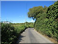
Crockenhill Lane, near Eynsford
by Malc McDonald geograph for square TQ5366 Crockenhill Lane in Kent countryside near the village of Eynsford. A sign to... (more)
Tags:
Bend in Rural RoadX
Country LaneX
Country RoadX
near:Crockenhill
near:EynsfordX
type:GeographX
county:KentX
subject:LaneX
Minor Country LaneX
Minor Country RoadX
Minor RoadX
road:Minor RoadX
Minor Rural LaneX
Minor Rural RoadX
top:Roads, Road TransportX
Rural LaneX
Rural RoadX
near:SwanleyX
|
|
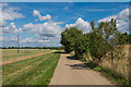
Eynsford Road, near Crockenhill
by Malc McDonald geograph for square TQ5167 Eynsford Road is a minor road through Kent countryside, near the village of... (more)
Tags:
near:Crockenhill
near:EynsfordX
type:GeographX
county:KentX
Long ShadowsX
road:Minor RoadX
Minor RoadX
subject:RoadX
top:Roads, Road TransportX
Rural RoadX
ShadowsX
Sunlight and ShadowsX
near:SwanleyX
|
|
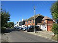
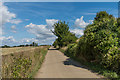
Eynsford Road, near Crockenhill
by Malc McDonald geograph for square TQ5166 Houses on Eynsford Road in the Kent countryside.
Tags:
near:Crockenhill
near:EynsfordX
type:GeographX
subject:HousesX
top:Housing, DwellingsX
county:KentX
road:Minor RoadX
Minor RoadX
Rural HousesX
Rural HousingX
Rural RoadX
near:SwanleyX
top:Village, Rural SettlementX
|
|
Crouch Farm Yard, near Crockenhill
by Malc McDonald geograph for square TQ4967 Crouch Farm is located on the outermost fringe of south east London, very close... (more)
Tags:
near:Crockenhill
subject:FarmX
Farm Access GateX
Farm YardX
top:Farm, Fishery, Market GardeningX
Gated Farm EntranceX
type:GeographX
place:South East LondonX
near:SwanleyX
|
|
Near Gables Farm
by Ian Capper geograph for square TQ5065 Looking towards Crockenhill from near Gables Farm. In the distance can be seen... (more)
|
|
Near Gables Farm
by Ian Capper for square TQ5066 Looking towards Crockenhill from near Gables Farm. In the distance can be seen... (more)
|
|
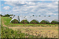
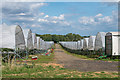
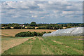
Wested Farm
by Ian Capper geograph for square TQ5065 Polytunnels on Wested Farm near Crockenhill. The whole area in and around the... (more)
Tags:
near:Crockenhill
top:Farm, Fishery, Market GardeningX
type:GeographX
PolytunnelX
Soft FruitX
StrawberryX
farm:Wested FarmX
|
|
Wested Farm
by Ian Capper geograph for square TQ5065 Polytunnels on Wested Farm near Crockenhill. The whole area in and around the... (more)
Tags:
near:Crockenhill
top:Farm, Fishery, Market GardeningX
type:GeographX
PolytunnelX
Soft FruitX
StrawberryX
farm:Wested FarmX
|
|
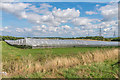
Wested Farm
by Ian Capper geograph for square TQ5165 Farmland on Wested Farm near Crockenhill with polytunnels growing soft fruits in... (more)
Tags:
near:Crockenhill
top:Farm, Fishery, Market GardeningX
type:GeographX
PolytunnelX
Soft FruitX
farm:Wested FarmX
|
|
Wested Farm
by Ian Capper geograph for square TQ5065 Polytunnels on Wested Farm near Crockenhill. The whole area in and around the... (more)
Tags:
near:Crockenhill
top:Farm, Fishery, Market GardeningX
type:GeographX
PolytunnelX
Soft FruitX
StrawberryX
farm:Wested FarmX
|
|
Wested Farm
by Ian Capper geograph for square TQ5065 Polytunnels on Wested Farm near Crockenhill. The whole area in and around the... (more)
Tags:
near:Crockenhill
top:Farm, Fishery, Market GardeningX
type:GeographX
PolytunnelX
Soft FruitX
farm:Wested FarmX
|
|
Wested Farm
by Ian Capper for square TQ5065 Polytunnels on Wested Farm near Crockenhill. The whole area in and around the... (more)
Tags:
near:Crockenhill
type:Cross GridX
top:Farm, Fishery, Market GardeningX
PolytunnelX
Soft FruitX
farm:Wested FarmX
|
|
Wested Farm
by Ian Capper geograph for square TQ5166 Farmland on Wested Farm near Crockenhill with polytunnels growing soft fruits in... (more)
Tags:
near:Crockenhill
top:Farm, Fishery, Market GardeningX
type:GeographX
PolytunnelX
Soft FruitX
farm:Wested FarmX
|
|
Wested Farm
by Ian Capper geograph for square TQ5166 Polytunnels on Wested Farm near Crockenhill. The whole area in and around the... (more)
Tags:
near:Crockenhill
top:Farm, Fishery, Market GardeningX
type:GeographX
PolytunnelX
Soft FruitX
farm:Wested FarmX
|
|
Wested Farm
by Ian Capper geograph for square TQ5166 Polytunnels on Wested Farm near Crockenhill. The whole area in and around the... (more)
Tags:
near:Crockenhill
top:Farm, Fishery, Market GardeningX
type:GeographX
PolytunnelX
PolytunnelsX
Soft FruitX
farm:Wested FarmX
|
|
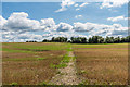
Footpath
by Ian Capper geograph for square TQ5166 Footpath on Wested Farm, leading towards Crockenhill.
|
|
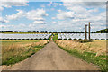
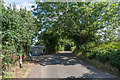
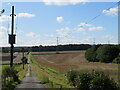
Daltons Road
by Ian Capper geograph for square TQ5065 Lane leading towards Crockenhill.
|
|
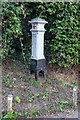
Coal Tax Post no 201
by Ian Capper for square TQ5065 This Coal Tax Post (no 201 on the list linked to below) is on Daltons Road, by... (more)
Tags:
type:Close LookX
Coal Tax PostX
near:Crockenhill
road:Daltons RoadX
top:Historic Sites and ArtefactsX
|
|
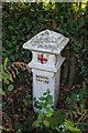
Coal Tax Post no 202
by Ian Capper for square TQ4967 This Coal Tax Post (no 202 on the list linked to below) is on Cray Road, just... (more)
Tags:
type:Close LookX
Coal Tax PostX
road:Cray RoadX
near:Crockenhill
top:Historic Sites and ArtefactsX
|
|
Cray Road
by Ian Capper geograph for square TQ4967 Cray Road as it approaches the village of Crockenhill, with a Coal Tax Post (no... (more)
Tags:
Coal Tax PostX
road:Cray RoadX
near:Crockenhill
type:GeographX
top:Historic Sites and ArtefactsX
top:Roads, Road TransportX
Soft FruitX
|
|
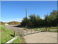
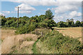
Access track near Swanley
by Malc McDonald geograph for square TQ5266 An access driveway in Kent countryside near Swanley.
Tags:
Access DriveX
Access TrackX
near:Crockenhill
near:EynsfordX
type:GeographX
county:KentX
top:LowlandsX
top:Roads, Road TransportX
near:SwanleyX
subject:TrackX
|
|
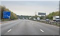
M25 near Swanley
by Malc McDonald geograph for square TQ5266 A view of the M25 motorway at Junction 3, near Swanley in Kent. The slip road... (more)
Tags:
near:Crockenhill
near:EynsfordX
type:GeographX
county:KentX
road:M25X
motorway:M25X
M25 London Orbital MotorwayX
M25 London Orbital Motorway Slip RoadX
M25 MotorwayX
Motorway Entrance Slip RoadX
Motorway Exit Slip RoadX
subject:Motorway JunctionX
Motorway JunctionX
Motorway Junction SignX
Motorway Slip RoadX
Motorway Slip RoadsX
top:Roads, Road TransportX
near:SwanleyX
|
|
Near Gables Farm
by Ian Capper geograph for square TQ4966 Path leading away from Gables Farm.
|
|
Near Gable Farms
by Ian Capper geograph for square TQ4966 Track connecting Darns Hill with Gables Farm. In the far left distance can be... (more)
|
|
Near Gables Farm
by Ian Capper geograph for square TQ4966 Water tank alongside the track connecting Darns Hill With Gables Farm.
|
|
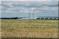
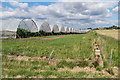
Wested Farm
by Ian Capper geograph for square TQ5166 Stubble on Wested Farm, with rows of polytunnels, used for growing soft fruit,... (more)
Tags:
near:Crockenhill
top:Farm, Fishery, Market GardeningX
type:GeographX
PolytunnelX
StubbleX
farm:Wested FarmX
|
|
Wested Farm
by Ian Capper geograph for square TQ5166 Stubble on Wested Farm, with rows of polytunnels, used for growing soft fruit,... (more)
Tags:
near:Crockenhill
top:Farm, Fishery, Market GardeningX
type:GeographX
PolytunnelX
farm:Wested FarmX
|
|
Farm track
by Ian Capper geograph for square TQ5166 Farm track running alongside the M25.
|
|
Farm track
by Ian Capper geograph for square TQ5165 Farm track running alongside the M25.
|
|
Flooded subway
by Ian Capper geograph for square TQ5065 Flooded subway under the M25, where it crosses a farm track/footpath.
|
|
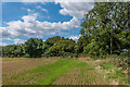
Footpath
by Ian Capper geograph for square TQ5065 Footpath across a field off Daltons Road, looking the direction of the road. In... (more)
|
|
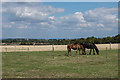
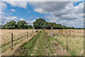
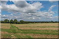
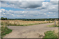
Field off Daltons Road
by Ian Capper geograph for square TQ5065 Looking along the edge of a field off Daltons Road.
|
|
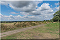
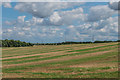
Field off Daltons Road
by Ian Capper geograph for square TQ5065 Field off Daltons Road. In the far distance is the line of the M25, with a sign... (more)
|
|
Footpath
by Ian Capper geograph for square TQ5065 Footpath across a field, leading away from Daltons Road.
|
|
Daltons Road
by Ian Capper geograph for square TQ5065 Looking along Daltons Road from where it is met by the driveway to Gables Farm.... (more)
Tags:
Coal Tax PostX
near:Crockenhill
road:Daltons RoadX
type:GeographX
top:Historic Sites and ArtefactsX
top:Roads, Road TransportX
|
|
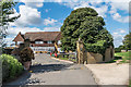
Gables Farm
by Ian Capper geograph for square TQ5065 Large house off Daltons Road, built in the c1960s.
|
|
Darns Hill
by Ian Capper geograph for square TQ4966 Track junction at the end of Darns Hill. In the far left distance can be seen... (more)
|
|
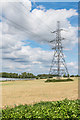
Wested Farm
by Ian Capper geograph for square TQ5065 An electricity pylon on Wested Farm, with polytunnels in the background.
Tags:
near:Crockenhill
top:Farm, Fishery, Market GardeningX
type:GeographX
PolytunnelX
PylonX
Soft FruitX
farm:Wested FarmX
|
|
M25 one mile to junction 4 sign
by Julian P Guffogg geograph for square TQ5065 |