
|
Class 156 near Dalston Hall
by Adrian Taylor
geograph for square NY3851
Class 156 number 156 484 on the Cumbrian Coast Line near Dalston Hall on the... (more)
|

|
The Cumbria Way near Dalston
by Adrian Taylor
geograph for square NY3750
The Cumbria Way follows the Caldew Cycleway between Dalston and Lowmill (next... (more)
|

|
Bridge End near Dalston
by Adrian Taylor
geograph for square NY3748
The B5299 Caldbeck to Carlisle road at Bridge End near Dalston.
The road here... (more)
|

|
Bridge End near Dalston
by Adrian Taylor
geograph for square NY3748
The B5299 Caldbeck to Carlisle road at Bridge End near Dalston.
The road here... (more)
|

|
The Cumbria Way near White Bridge
by Adrian Taylor
geograph for square NY3749
This wide path was once the road from Fourways to Dalston; this section largely... (more)
|

|
The Cumbria Way near Dalston
by Adrian Taylor
geograph for square NY3750
The Cumbria Way follows the Caldew Cycleway between Dalston and Lowmill (next... (more)
|

|
The Cumbria Way near Lowmill
by Adrian Taylor
geograph for square NY3751
The Cumbria Way follows the Caldew Cycleway approaching the Whitehaven to... (more)
|

|
The Cumbria Way near Brownelson Wood
by Adrian Taylor
geograph for square NY3851
Both The Cumbria Way and the Caldew Cycleway follow the same tarmacked path... (more)
|
|
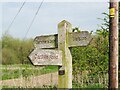
Footpath sign near Lowmill
by Adrian Taylor
for square NY3751
The sign directs walkers and cyclists along The Cumbria Way and Caldew Cycleway... (more)
|
|
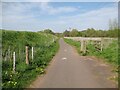
The Cumbria Way near Lowmill
by Adrian Taylor
geograph for square NY3751
The Cumbria Way long distance path follows the Caldew Cycleway near Lowmill... (more)
|

|
The Cumbria Way near Lowmill
by Adrian Taylor
geograph for square NY3751
The Cumbria Way follows the Caldew Cycleway near Lowmill (next photograph... (more)
|

|
Path by the mill stream
by Adrian Taylor
geograph for square NY3749
The Cumbria Way follows a path beside the tailrace of Ellers Mill between... (more)
|

|
The Cumbria Way near White Bridge
by Adrian Taylor
geograph for square NY3749
The Cumbria Way long distance path crosses a bridge over a mill stream on the... (more)
|

|
The Cumbria Way, Bridge End
by Adrian Taylor
geograph for square NY3748
The B5299 Caldbeck to Carlisle road at Bridge End near Dalston.
The road here... (more)
|

|
The Cumbria Way, Lowmill
by Adrian Taylor
geograph for square NY3751
The Cumbria Way long distance path follows the Caldew Cycleway near Lowmill... (more)
|

|
Gateway on The Caldew Cycleway
by Adrian Taylor
geograph for square NY3751
Near Lowmill, the gate for pedestrians and maintenance vehicles on the Caldew... (more)
|
|
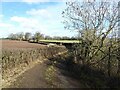
Lane near Dalston
by Adrian Taylor
geograph for square NY3650
The lane provides a farmer's access to fields and it is also a public footpath.
|

|
The Cumbria Way near Lowmill
by Adrian Taylor
geograph for square NY3851
The Cumbria Way follows the Caldew Cycleway between the River Caldew (hidden... (more)
|

|
Bridge End, Dalston
by Adrian Taylor
geograph for square NY3748
The Cumbria Way long distance path follows the B5299 road into Bridge End.... (more)
|

|
The Caldew Cycleway beside the River Caldew
by Adrian Taylor
geograph for square NY3851
The path is the route of both the Caldew Cycleway and The Cumbria Way long... (more)
|

|
The Cumbria Way beside the River Caldew
by Adrian Taylor
geograph for square NY3851
The path is the route of both The Cumbria Way and the Caldew Cycleway, at this... (more)
|

|
The Cumbria Way near Bridge End
by Adrian Taylor
geograph for square NY3748
The Cumbria Way follows a track across fields from Hawksdale Hall to Bridge End,... (more)
|

|
Lawford Road, near Hoxton
by Malc McDonald
geograph for square TQ3384
Lawford Road is closed to through traffic. At the crossroads ahead, all roads... (more)
|

|
Northchurch Terrace, near Hoxton
by Malc McDonald
geograph for square TQ3384
A crossroads at the junction of Northchurch Terrace, Lawford Road, Northchurch... (more)
|

|
The Cumbria Way near Ellers Mill
by Adrian Taylor
geograph for square NY3749
This path, formerly the Ellers Mill access road, runs parallel to the mill’s... (more)
|
|
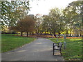
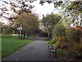
Rosemary Gardens, Hoxton
by Malc McDonald
geograph for square TQ3283
Rosemary Gardens in Hoxton, in inner north London
|
|
Rosemary Gardens, Hoxton
by Malc McDonald
geograph for square TQ3283
Rosemary Gardens is a small park in Hoxton, in inner north London.
|

|
Woodland path
by Adrian Taylor
geograph for square NY3648
A pleasant path in woodland beside the River Caldew near Hawksdale Bridge, Buckabank.
|

|
Ellerslea, Buckabank
by Adrian Taylor
geograph for square NY3748
The track and yard behind Ellerslea, a private house near Buckabank, is a public... (more)
|

|
Stile on The Cumbria Way
by Adrian Taylor
geograph for square NY3748
This stile leads from a track behind Ellerslea, a private house near Buckabank.... (more)
|

|
The Cumbria Way near White Bridge
by Adrian Taylor
geograph for square NY3749
The north end of the Ellers Mill access road joins the minor road from Fourways... (more)
|

|
The Bridge End Inn
by Adrian Taylor
geograph for square NY3748
Near Hawksdale Bridge at Buckabank, beside the B5299 road and The Cumbria Way,... (more)
|

|
Rose Castle
by Adrian Taylor
for square NY3746
In the Caldew Valley and near to The Cumbria Way long distance path, Rose Castle... (more)
|
|
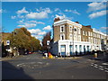
Almorah Road, Islington
by Malc McDonald
geograph for square TQ3284
A mini-roundabout at the junction of Almorah Road and Downham Road in Islington,... (more)
|
|
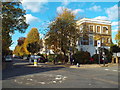
Halliford Street, Islington
by Malc McDonald
geograph for square TQ3284
A mini-roundabout at the end of Halliford Street, a tree-lined residential road... (more)
|
|
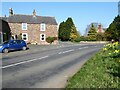
Fourways, Buckabank
by Adrian Taylor
geograph for square NY3749
There is an Ordnance Survey cut benchmark on the corner of Hill House below the... (more)
|

|
Gate on The Cumbria Way
by Adrian Taylor
geograph for square NY3748
The Cumbria Way follows a field track from Hawksdale Hall. The track ends at... (more)
|

|
The Cumbria Way, Ellers Mill
by Adrian Taylor
geograph for square NY3749
The Cumbria Way follows a public footpath beside buildings associated with... (more)
|

|
The Cumbria Way, Bridge End
by Adrian Taylor
geograph for square NY3748
The Cumbria Way follows a public footpath along a residential lane on the... (more)
|

|
The Cumbria Way, Hawksdale Bridge
by Adrian Taylor
geograph for square NY3748
The road from Bridge End to Durdar at Hawksdale Bridge.
The Cumbria Way long... (more)
|

|
The Cumbria Way, Buckabank
by Adrian Taylor
geograph for square NY3748
The Cumbria Way follows a public footpath behind Ellerslea, a private house,... (more)
|

|
The Cumbria Way, Buckabank
by Adrian Taylor
geograph for square NY3748
The Cumbria Way follows a public footpath behind Ellerslea, a private house,... (more)
|

|
The Cumbria Way, Buckabank
by Adrian Taylor
geograph for square NY3748
The Cumbria Way follows a public footpath through a small field on the approach... (more)
|

|
Bishop's Mill
by Adrian Taylor
geograph for square NY3749
Once owned by the Bishop of Carlisle, Bishop’s Mill is a former water powered... (more)
|

|
Ellers Mill, Buckabank
by Adrian Taylor
geograph for square NY3749
Originally a spinning mill, Ellers Mill was taken over by Jacob Cowens &... (more)
|

|
Ellers Mill, Buckabank
by Adrian Taylor
geograph for square NY3749
Originally a spinning mill, Ellers Mill was taken over by Jacob Cowens &... (more)
|
|
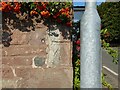
Benchmark, Fourways, Buckabank
by Adrian Taylor
for square NY3749
Detail of the Ordnance Survey cut benchmark on the corner of Hill House at... (more)
|
|
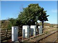
Electrical Cabinets, Low Mill Level Crossing
by Adrian Taylor
geograph for square NY3751
The electrical cabinets are beside the Maryport to Carlisle Railway adjacent to... (more)
|

|
Footpath Gate
by Adrian Taylor
geograph for square NY3650
The lane from Halfway Cottages ends at a gateway into an arable field beside a... (more)
|
