About tags on Geograph

Public Tags

Related Tags | Coverage Map
Prefix: near    Tag:  Doxford·Park  
Other tags: place:Doxford Park    

Showing images tagged with near:Doxford Park tag.

View all tagged images - In Browser
:

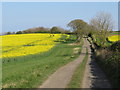
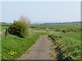
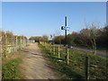
NZ3750 : Public footpath near Houghton-le-Spring by Malc McDonald Public footpath near Houghton-le-Spring by Malc McDonald
geograph for square NZ3750
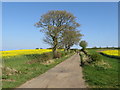
A public footpath along the edge of a field near Houghton-le-Spring, to the... (more)
Tags: near:Doxford Park   public footpath:Field Edge   Field Edge Footpath   Field Edge Path   path:Footpath   Footpath   type:Geograph   near:Houghton-Le-Spring   subject:Path   top:Paths   Public Footpath   near:Sunderland   county:Tyne & Wear   place:Wearside  
NZ3750 : Farm track and bridleway near Houghton-le-Spring by Malc McDonald Farm track and bridleway near Houghton-le-Spring by Malc McDonald
geograph for square NZ3750
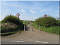
A farm track which is a public right of way as a bridleway near Houghton-le-Spring.
Tags: rights of way:Bridleway   path:Bridleway   Bridleway   subject:Bridleway   near:Doxford Park   type:Geograph   near:Houghton-Le-Spring   top:Paths   Public Bridleway   Public Bridleway on Driveway   Public Right of Way   top:Roads, Road Transport   near:Sunderland   county:Tyne & Wear   place:Wearside  
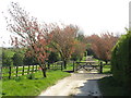
NZ3850 : Spring colour at Old Burdon, near Sunderland by Malc McDonald Spring colour at Old Burdon, near Sunderland by Malc McDonald
geograph for square NZ3850
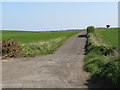
Spring blossom appearing on trees at Old Burdon, near Sunderland. This image... (more)
Tags: subject:Blossom   near:Burdon   near:Doxford Park   type:Geograph   place:Old Burdon   season:Spring   Spring Blossom   Spring Colour   Spring Foliage   near:Sunderland   county:Tyne & Wear   top:Village, Rural Settlement   place:Wearside  
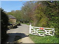
NZ3850 : Old Burdon, near Sunderland by Malc McDonald Old Burdon, near Sunderland by Malc McDonald
geograph for square NZ3850
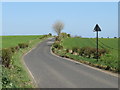
A sign on the open gate indicates that the road is private. It is a public... (more)
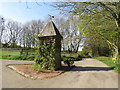
NZ3850 : Dovecote at Old Burdon, near Sunderland by Malc McDonald Dovecote at Old Burdon, near Sunderland by Malc McDonald
geograph for square NZ3850
A dovecote alongside the road in the tiny hamlet of Old Burdon, near Sunderland.... (more)
Tags: near:Burdon   Country Lane   Country Road   building type:Dovecote   subject:Dovecote   Dovecote   near:Doxford Park   type:Geograph   Minor Country Road   Minor Lane   Minor Road   place:Old Burdon   near:Ryhope   near:Sunderland   county:Tyne & Wear   top:Village, Rural Settlement   place:Wearside  
NZ3850 : Minor lane near Sunderland by Malc McDonald Minor lane near Sunderland by Malc McDonald
geograph for square NZ3850
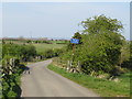
A minor lane in countryside to the south of Sunderland. The blue sign warns of... (more)
Tags: near:Burdon   Country Lane   Country Road   near:Doxford Park   type:Geograph   subject:Lane   Minor Country Road   Minor Lane   Minor Road   top:Roads, Road Transport   near:Ryhope   near:Sunderland   county:Tyne & Wear   place:Wearside  
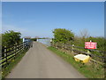
NZ3851 : Bridge over the A19 near Sunderland by Malc McDonald Bridge over the A19 near Sunderland by Malc McDonald
geograph for square NZ3851
A bridge carrying a minor country lane over the busy A19 road near Sunderland.
Tags: near:Burdon   near:Doxford Park   type:Geograph   subject:Lane   Minor Lane   road:Minor Road   Minor Road   Minor Road Bridge   top:Roads, Road Transport   near:Ryhope   near:Sunderland   county:Tyne & Wear   place:Wearside  
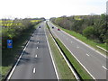
NZ3851 : A19 near Sunderland by Malc McDonald A19 near Sunderland by Malc McDonald
geograph for square NZ3851
The trunk A19 road near Sunderland.
Tags: road:A Road   A19   road:A19   near:Burdon   near:Doxford Park   road:Dual Carriageway   Dual Carriageway   Dual Carriageway Road   type:Geograph   subject:Road   top:Roads, Road Transport   near:Ryhope   near:Sunderland   Trunk Road   county:Tyne & Wear   place:Wearside  
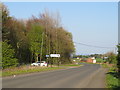
NZ3851 : Burdon Village Road, near Sunderland by Malc McDonald Burdon Village Road, near Sunderland by Malc McDonald
geograph for square NZ3851
Burdon Village Road is a minor road through countryside to the south of Sunderland.
Tags: near:Burdon   Country Lane   Country Road   near:Doxford Park   type:Geograph   subject:Lane   Minor Country Road   Minor Lane   Minor Rural Road   top:Roads, Road Transport   Rural Lane   Rural Road   near:Ryhope   near:Sunderland   county:Tyne & Wear   place:Wearside  
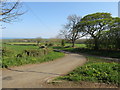
NZ3851 : Country lane near Ryhope by Malc McDonald Country lane near Ryhope by Malc McDonald
geograph for square NZ3851
A minor lane through countryside to the south of Sunderland.
Tags: near:Burdon   Country Lane   Country Road   near:Doxford Park   type:Geograph   subject:Lane   Minor Country Road   Minor Lane   Minor Rural Road   top:Roads, Road Transport   Rural Lane   Rural Road   near:Ryhope   near:Sunderland   county:Tyne & Wear   place:Wearside  
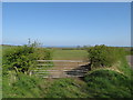
NZ3951 : Field near Ryhope by Malc McDonald Field near Ryhope by Malc McDonald
geograph for square NZ3951
A gate leading into a field in countryside to the south of Sunderland.
Tags: near:Burdon   near:Doxford Park   top:Farm, Fishery, Market Gardening   Field   Field Gate   subject:Gate   type:Geograph   Metal Field Gate   Metal Gate   near:Ryhope   near:Sunderland   county:Tyne & Wear   place:Wearside  
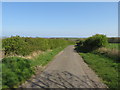
NZ3951 : Country lane near Ryhope by Malc McDonald Country lane near Ryhope by Malc McDonald
geograph for square NZ3951
An un-named lane in countryside to the south of Sunderland.
Tags: near:Burdon   Country Lane   Country Road   near:Doxford Park   type:Geograph   subject:Lane   Minor Country Road   Minor Lane   Minor Rural Road   top:Roads, Road Transport   Rural Lane   Rural Road   near:Ryhope   near:Sunderland   county:Tyne & Wear   place:Wearside  
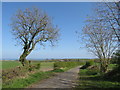
NZ3951 : Country lane near Ryhope by Malc McDonald Country lane near Ryhope by Malc McDonald
geograph for square NZ3951
An un-named lane through countryside to the south of Sunderland. The North Sea... (more)
Tags: near:Burdon   Country Lane   Country Road   near:Doxford Park   type:Geograph   subject:Lane   Minor Country Road   Minor Lane   Minor Rural Road   top:Roads, Road Transport   Rural Lane   Rural Road   near:Ryhope   near:Sunderland   county:Tyne & Wear   place:Wearside  
NZ3851 : Burdon Lane, near Ryhope by Malc McDonald Burdon Lane, near Ryhope by Malc McDonald
geograph for square NZ3851
A view east along Burdon Lane, at the junction with Burdon Village Road.
Tags: near:Burdon   Country Road   near:Doxford Park   type:Geograph   Minor Country Road   Minor Rural Road   subject:Road   top:Roads, Road Transport   Rural Road   near:Ryhope   near:Sunderland   county:Tyne & Wear   place:Wearside  
NZ3751 : Cycle path near Sunderland by Malc McDonald Cycle path near Sunderland by Malc McDonald
geograph for square NZ3751
A shared path for walking and cycling near Sunderland. This path is on the... (more)
NZ3751 : A19 near Sunderland by Malc McDonald A19 near Sunderland by Malc McDonald
geograph for square NZ3751
The trunk A19 road near Sunderland.
Tags: road:A Road   A19   road:A19   near:Doxford Park   road:Dual Carriageway   Dual Carriageway   Dual Carriageway Road   type:Geograph   subject:Road   top:Roads, Road Transport   near:Sunderland   Trunk Road   county:Tyne & Wear   place:Wearside  
NZ3650 : Stile near Houghton-le-Spring by Malc McDonald Stile near Houghton-le-Spring by Malc McDonald
geograph for square NZ3650
A stile on a public footpath through countryside to the south of Sunderland.... (more)
Tags: near:Doxford Park   path:Footpath   Footpath   Footpath and Stile   type:Geograph   near:Houghton-Le-Spring   top:Paths   Public Footpath   Public Footpath Stile   Stile   subject:Stile   near:Sunderland   county:Tyne & Wear   place:Wearside  
NZ3750 : Stile and footpath near Houghton-le-Spring by Malc McDonald Stile and footpath near Houghton-le-Spring by Malc McDonald
geograph for square NZ3750
A stile on a public footpath through fields to the south of Sunderland.
Tags: near:Doxford Park   public footpath:Field Edge   Field Edge Footpath   Field Edge Path   path:Footpath   Footpath   Footpath and Stile   type:Geograph   near:Houghton-Le-Spring   top:Paths   Public Footpath   Public Footpath Stile   subject:Stile   Stile   near:Sunderland   county:Tyne & Wear   place:Wearside   Wooden Stile  
NZ3750 : Footpath stile near Houghton-le-Spring by Malc McDonald Footpath stile near Houghton-le-Spring by Malc McDonald
geograph for square NZ3750
A stile on a public footpath through countryside to the south of Sunderland.
Tags: near:Doxford Park   public footpath:Field Edge   Field Edge Footpath   Field Edge Path   path:Footpath   Footpath   Footpath and Stile   type:Geograph   near:Houghton-Le-Spring   top:Paths   Public Footpath   Public Footpath Stile   Stile   subject:Stile   near:Sunderland   county:Tyne & Wear   place:Wearside   Wooden Stile  
NZ3750 : Farm track and bridleway near Houghton-le-Spring by Malc McDonald Farm track and bridleway near Houghton-le-Spring by Malc McDonald
geograph for square NZ3750
A farm track which is a public right of way as a bridleway in countryside south... (more)
NZ3750 : Farm track and bridleway near Houghton-le-Spring by Malc McDonald Farm track and bridleway near Houghton-le-Spring by Malc McDonald
geograph for square NZ3750
A farm track which is a public right of way as a bridleway, in countryside to... (more)
Tags: rights of way:Bridleway   path:Bridleway   Bridleway   subject:Bridleway   near:Doxford Park   type:Geograph   near:Houghton-Le-Spring   top:Paths   Public Bridleway   Public Bridleway on Driveway   Public Right of Way   top:Roads, Road Transport   near:Sunderland   county:Tyne & Wear   place:Wearside  
NZ3750 : Public bridleway near Houghton-le-Spring by Malc McDonald Public bridleway near Houghton-le-Spring by Malc McDonald
geograph for square NZ3750
A farm driveway which is also a public right of way as a bridleway.
Tags: rights of way:Bridleway   path:Bridleway   Bridleway   subject:Bridleway   near:Doxford Park   type:Geograph   near:Houghton-Le-Spring   top:Paths   Public Bridleway   Public Bridleway on Driveway   Public Right of Way   top:Roads, Road Transport   near:Sunderland   county:Tyne & Wear   place:Wearside  
NZ3952 : Nettles Lane, near Ryhope by Malc McDonald Nettles Lane, near Ryhope by Malc McDonald
geograph for square NZ3952
Nettles Lane, on the southern fringe of Sunderland, is closed to motor traffic.
Tags: near:Doxford Park   type:Geograph   subject:Lane   Road Closed   top:Roads, Road Transport   near:Ryhope   near:Sunderland   Traffic-Free Route   county:Tyne & Wear   place:Wearside  
NZ3952 : Public bridleway near Ryhope by Malc McDonald Public bridleway near Ryhope by Malc McDonald
geograph for square NZ3952
A public bridleway through countryside on the southern fringe of Sunderland.
Tags: Bridle Path   subject:Bridleway   path:Bridleway   rights of way:Bridleway   Bridleway   near:Doxford Park   type:Geograph   top:Paths   Public Bridleway   near:Ryhope   near:Sunderland   county:Tyne & Wear   place:Wearside  
NZ3952 : Burdon Lane, near Ryhope by Malc McDonald Burdon Lane, near Ryhope by Malc McDonald
geograph for square NZ3952
Burdon Lane passing through countryside on the southern fringe of Sunderland.
Tags: Country Road   near:Doxford Park   type:Geograph   Minor Country Road   Minor Rural Road   subject:Road   top:Roads, Road Transport   Rural Road   near:Ryhope   near:Sunderland   county:Tyne & Wear   place:Wearside  
NZ3952 : Nettles Lane, near Ryhope by Malc McDonald Nettles Lane, near Ryhope by Malc McDonald
geograph for square NZ3952
Nettles Lane is a road which has been closed to motor vehicles, on the southern... (more)
Tags: near:Doxford Park   type:Geograph   subject:Lane   Road Closed   Road Closed to Motor Vehicles   top:Roads, Road Transport   near:Ryhope   near:Sunderland   Traffic-Free Route   county:Tyne & Wear   place:Wearside  
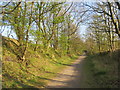
NZ3652 : W2W cycle route near Sunderland by Malc McDonald W2W cycle route near Sunderland by Malc McDonald
geograph for square NZ3652
The Walney to Wear (W2W) cycle route in woodland on the outskirts of Sunderland.... (more)
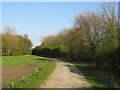
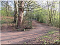
NZ3651 : Former railway path near Sunderland by Malc McDonald Former railway path near Sunderland by Malc McDonald
geograph for square NZ3651
This path, which is shared by walkers, cyclists and horse riders, is on the... (more)
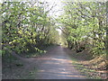
NZ3651 : Former railway path near Sunderland by Malc McDonald Former railway path near Sunderland by Malc McDonald
geograph for square NZ3651
This path, which is shared by walkers, cyclists and horse riders, is on the... (more)
NZ3751 : Cycle path alongside the A19 near Sunderland by Malc McDonald Cycle path alongside the A19 near Sunderland by Malc McDonald
geograph for square NZ3751
A shared use path for walking, cycling and horse riding alongside the A19 trunk... (more)
NZ3751 : Hangman's Lane, near Sunderland by Malc McDonald Hangman's Lane, near Sunderland by Malc McDonald
geograph for square NZ3751
Hangman's Lane is on the route of the Walney to Wear (W2W) cycle route as... (more)
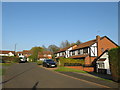
NZ3752 : Noirmont Way, Silksworth, Sunderland by Malc McDonald Noirmont Way, Silksworth, Sunderland by Malc McDonald
geograph for square NZ3752
Noirmont Way is a residential cul-de-sac in the Silksworth area of Sunderland.... (more)
Tags: near:Doxford Park   type:Geograph   subject:Housing Estate   top:Housing, Dwellings   Residential Area   Residential Cul-De-Sac   place:Silksworth   top:Suburb, Urban Fringe   place:Sunderland   county:Tyne & Wear   place:Wearside  
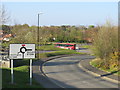
NZ3752 : Moorside Road, Moorside, Sunderland by Malc McDonald Moorside Road, Moorside, Sunderland by Malc McDonald
geograph for square NZ3752
Moorside Road in the southern suburbs of Sunderland.
Tags: near:Doxford Park   type:Geograph   subject:Suburb   top:Suburb, Urban Fringe   Suburban Road   place:Sunderland   county:Tyne & Wear   place:Wearside  
NZ3752 : Maree Close, Moorside, Sunderland by Malc McDonald Maree Close, Moorside, Sunderland by Malc McDonald
geograph for square NZ3752
Maree Close is a residential cul-de-sac in the suburbs of Sunderland.
NZ3752 : Path through housing at Moorside, Sunderland by Malc McDonald Path through housing at Moorside, Sunderland by Malc McDonald
geograph for square NZ3752
A path through a housing estate at Moorside, in the suburbs of Sunderland.
Tags: near:Doxford Park   Footpath   type:Geograph   subject:Housing Estate   Housing Estate   top:Paths   Residential   Residential Area   top:Suburb, Urban Fringe   place:Sunderland   place:Wearside  
NZ3752 : Markby Close, Moorside, Sunderland by Malc McDonald Markby Close, Moorside, Sunderland by Malc McDonald
geograph for square NZ3752
Markby Close is a residential cul-de-sac in the Moorside area of Sunderland.
NZ3652 : Midsomer Close, Moorside, Sunderland by Malc McDonald Midsomer Close, Moorside, Sunderland by Malc McDonald
geograph for square NZ3652
Midsomer Close is a residential cul-de-sac in the Moorside district of Sunderland.
NZ3752 : Path and bridge at Silksworth, Sunderland by Malc McDonald Path and bridge at Silksworth, Sunderland by Malc McDonald
geograph for square NZ3752
A path and a bridge over a dry stream at Silksworth, in Sunderland.
Tags: near:Doxford Park   Dry Stream   Dry Stream Bed   path:Footpath   Footpath   type:Geograph   subject:Path   Path   top:Paths   top:Rivers, Streams, Drainage   place:Silksworth   place:Sunderland   county:Tyne & Wear   place:Wearside  
View more in the Image Search or in Browser
View images matching 'Doxford Park' anywhere in the tags
Don't click these: PotMel 1 PotMel 2