About tags on Geograph

Public Tags

Related Tags | Coverage Map
Prefix: near    Tag:  Epping·Forest  
Other tags: Epping Forest     forest:Epping Forest     place:Epping Forest    

Showing images tagged with near:Epping Forest tag.

View all tagged images - In Browser
:

TQ3997 : Looking up Lippitts Hill in Autumn  by Roger Jones Looking up Lippitts Hill in Autumn by Roger Jones
geograph for square TQ3997
On the right is the Blind Lane Footpath close to Fernhill and Trueloves in Epping Forest.
Tags: Autumn Colour   near:Epping Forest   type:Geograph   near:High Beach   top:Roads, Road Transport   Trees   place:Waltham Abbey   top:Woodland, Forest  
TL4101 : Temple Hill View by Roger Jones Temple Hill View by Roger Jones
for square TL4101
This is part of Warlies Park. Sir Thomas Fowell Buxton was a C19 campaigner to... (more)
Tags: near:Epping Forest   Epping Forest Buffer Land   county:Essex   top:Farm, Fishery, Market Gardening   top:Grassland   bucket:Landscape   top:Lowlands   Pasture   place:Upshire   top:Woodland, Forest  
TL4100 : M25 motorway near Epping Forest by Malc McDonald M25 motorway near Epping Forest by Malc McDonald
geograph for square TL4100
The M25 motorway runs around the edge of London. This view is of the motorway... (more)
Tags: near:Epping Forest   place:Essex   motorway:M25   Motorway   top:Roads, Road Transport   near:Upshire  
TL4100 : M25 near Epping Forest by Malc McDonald M25 near Epping Forest by Malc McDonald
geograph for square TL4100
The M25 motorway runs around the edge of London. This view is of the motorway... (more)
Tags: near:Epping Forest   place:Essex   motorway:M25   Motorway   top:Roads, Road Transport   near:Upshire  
TL4101 : Warlies Lodge and entrance to Warlies  by Roger Jones Warlies Lodge and entrance to Warlies by Roger Jones
geograph for square TL4101
Sir Thomas Fowell Buxton was a C19 campaigner to establish Epping Forest. He... (more)
TL4401 : Cricket over the M25 by Roger Jones Cricket over the M25 by Roger Jones
geograph for square TL4401
This is the ground of the Epping Foresters Cricket Club, the pitch is over the... (more)
Tags: Cricket Pitch   place:Epping   near:Epping Forest   county:Essex   bucket:People   top:Sport, Leisure   top:Suburb, Urban Fringe  
TL4100 : Bridge over the M25 near Upshire by Malc McDonald Bridge over the M25 near Upshire by Malc McDonald
geograph for square TL4100
This bridge carries the Forest Way across the M25 motorway. Forest Way is a... (more)
Tags: near:Epping Forest   place:Essex   Motorway Bridge   Path   top:Paths   Public Footpath   near:Upshire  
TL4100 : Path through the woods near Upshire by Malc McDonald Path through the woods near Upshire by Malc McDonald
geograph for square TL4100
A path leading through woodland near Upshire, on the edge of Epping Forest.
Tags: near:Epping Forest   place:Essex   Path   top:Paths   Public Footpath   near:Upshire   top:Woodland, Forest  
TL4802 : Essex Way, from footbridge over M11 by Roger Jones Essex Way, from footbridge over M11 by Roger Jones
geograph for square TL4802
View of the footpath as seen whilst exiting the Essex Way footbridge... (more)
Tags: place:Coopersale   near:Epping Forest   county:Essex   footpath:Essex Way   Essex Wildlife Trust   place:Gernon Bushes   M25   Nature Reserve   top:Paths   Public Footpath   SSSI   place:Theydon Garnon   top:Woodland, Forest  
TL4802 : Essex Way Bridge over the M11 by Roger Jones Essex Way Bridge over the M11 by Roger Jones
geograph for square TL4802
As seen from Gernon Bushes
Tags: Bridge   place:Coopersale   near:Epping Forest   county:Essex   footpath:Essex Way   Essex Wildlife Trust   place:Gernon Bushes   M25   Nature Reserve   top:Paths   Public Footpath   top:Roads, Road Transport   SSSI   place:Theydon Garnon   top:Woodland, Forest  
TL4803 : Path near the edge of the wood by Roger Jones Path near the edge of the wood by Roger Jones
geograph for square TL4803
A path running north of the main trackway, along the eastern border of this part... (more)
Tags: place:Coopersale   near:Epping Forest   county:Essex   Essex Wildlife Trust   place:Gernon Bushes   Nature Reserve   top:Paths   SSSI   place:Theydon Garnon   top:Woodland, Forest  
TQ3994 : Forest Avenue, Chingford by Malc McDonald Forest Avenue, Chingford by Malc McDonald
geograph for square TQ3994
Forest Avenue in Chingford, on the edge of Epping Forest.
TL4101 : Obelisk Farm by Roger Jones Obelisk Farm by Roger Jones
geograph for square TL4101
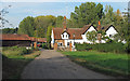
Obelisk Farm, and to the left part of the farm pond. The farm adjoins the... (more)
TL4702 : Steps down the slope by Roger Jones Steps down the slope by Roger Jones
geograph for square TL4702
Wooden steps have been added to this slope.
Tags: place:Coopersale   near:Epping Forest   county:Essex   footpath:Essex Way   Essex Wildlife Trust   place:Gernon Bushes   Nature Reserve   top:Paths   Public Footpath   SSSI   Steps   place:Theydon Garnon   top:Woodland, Forest  
TL4702 : Farmland adjoining Gernon Bushes by Roger Jones Farmland adjoining Gernon Bushes by Roger Jones
geograph for square TL4702
The boundary of Gernon Bushes is on the left.
TL4702 : Footbridge over small stream by Roger Jones Footbridge over small stream by Roger Jones
geograph for square TL4702
Gernon Bushes
TL4803 : Raised walkway by Roger Jones Raised walkway by Roger Jones
geograph for square TL4803
Walkway heading north to meet main track.
Tags: place:Coopersale   near:Epping Forest   county:Essex   Essex Wildlife Trust   place:Gernon Bushes   Nature Reserve   top:Paths   SSSI   place:Theydon Garnon   Trees   top:Woodland, Forest  
TL4703 : Gernon Bushes information board by Roger Jones Gernon Bushes information board by Roger Jones
for square TL4703
As seen at the entrance from Garnon Mead.
Tags: bucket:CloseCrop   bucket:Closeup   place:Coopersale   near:Epping Forest   county:Essex   Essex Wildlife Trust   place:Gernon Bushes   Information Board   bucket:Informative   Nature Reserve   SSSI   place:Theydon Garnon   top:Woodland, Forest  
TL4702 : Westward path by Roger Jones Westward path by Roger Jones
geograph for square TL4702
Sunlight breaks through on a path leading west, note the old hornbeam pollard on... (more)
Tags: place:Coopersale   near:Epping Forest   county:Essex   Essex Wildlife Trust   place:Gernon Bushes   Hornbeam   Nature Reserve   top:Paths   Pollard   SSSI   place:Theydon Garnon   Trees   top:Woodland, Forest  
TL4802 : Hornbeam pollards by Roger Jones Hornbeam pollards by Roger Jones
geograph for square TL4802
Gernon Bushes
Tags: place:Coopersale   near:Epping Forest   county:Essex   Essex Wildlife Trust   place:Gernon Bushes   Hornbeam   Nature Reserve   Pollard   SSSI   place:Theydon Garnon   Trees   top:Woodland, Forest  
TL4703 : Woodland pathway by Roger Jones Woodland pathway by Roger Jones
geograph for square TL4703
A small path running north of the main trackway.
Tags: place:Coopersale   near:Epping Forest   county:Essex   Essex Wildlife Trust   place:Gernon Bushes   Nature Reserve   top:Paths   SSSI   place:Theydon Garnon   top:Woodland, Forest  
TQ4399 : Footbridge to Birch Wood by Roger Jones Footbridge to Birch Wood by Roger Jones
geograph for square TQ4399
Taken from Birch Hall Fields
TL4100 : Public footpath near Upshire by Malc McDonald Public footpath near Upshire by Malc McDonald
geograph for square TL4100
A sign for Forest Way, a public footpath, through countryside near Upshire in Essex.
Tags: near:Epping Forest   place:Essex   Footpath Signpost   Path   top:Paths   Public Footpath   Signpost   near:Upshire  
TQ4088 : It is a criminal offence to take photographs ... of the court by Roger Jones It is a criminal offence to take photographs ... of the court by Roger Jones
for square TQ4088
Sign near Snaresbrook Court, which made me feel it was not wise to photograph... (more)
TL4802 : Looking uphill by Roger Jones Looking uphill by Roger Jones
geograph for square TL4802
Looking uphill at a path in Gernon Bushes.
Tags: place:Coopersale   near:Epping Forest   county:Essex   Essex Wildlife Trust   place:Gernon Bushes   Nature Reserve   top:Paths   SSSI   place:Theydon Garnon   Trees   top:Woodland, Forest  
TQ3997 : Looking down Lippitts Hill by Roger Jones Looking down Lippitts Hill by Roger Jones
geograph for square TQ3997
Tags: near:Epping Forest   county:Essex   place:High Beach   top:Roads, Road Transport   top:Suburb, Urban Fringe   top:Woodland, Forest  
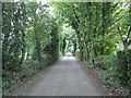
TQ3997 : Pepper Alley (lower) by Roger Jones Pepper Alley (lower) by Roger Jones
geograph for square TQ3997
The lower part of Pepper Alley goes through scrubland. Compare to TQ3997 : Pepper Alley (mid)... (more)
Tags: Bridleway   near:Epping Forest   county:Essex   place:High Beach   top:Paths   top:Suburb, Urban Fringe   top:Woodland, Forest  
TQ3997 : Dead tree on field boundary by Roger Jones Dead tree on field boundary by Roger Jones
geograph for square TQ3997
Taken from Pepper Alley
TQ4297 : Foresters Arms by Roger Jones Foresters Arms by Roger Jones
geograph for square TQ4297
Tags: near:Epping Forest   county:Essex   place:Loughton   Pub   top:Sport, Leisure   top:Suburb, Urban Fringe  
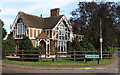
TL4201 : Lower Lodge House by Roger Jones Lower Lodge House by Roger Jones
geograph for square TL4201
TL4803 : Paddock, Horses, Farm Buildings by Roger Jones Paddock, Horses, Farm Buildings by Roger Jones
geograph for square TL4803
TL4100 : Bridleway sign at Upshire by Malc McDonald Bridleway sign at Upshire by Malc McDonald
geograph for square TL4100
A signpost for a bridleway at Upshire in Essex.
Tags: Bridleway Sign   Bridleway Signpost   near:Epping Forest   top:Lowlands   top:Paths   Signpost   place:Upshire  
TQ3896 : Gilwell Lane by Roger Jones Gilwell Lane by Roger Jones
geograph for square TQ3896
Leading from the scouting centre to Bury Road.
Tags: near:Epping Forest   county:Essex   top:Roads, Road Transport   Scouting   place:Sewardstonebury   top:Suburb, Urban Fringe  
TQ3997 : Abandoned farm building by Roger Jones Abandoned farm building by Roger Jones
geograph for square TQ3997
This still sound structure has young trees growing inside it.
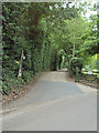
TQ3997 : Pepper Alley (mid) by Roger Jones Pepper Alley (mid) by Roger Jones
geograph for square TQ3997
Just past the cricket club, the surface of the alley changes. Compare to... (more)
Tags: Bridleway   near:Epping Forest   county:Essex   place:High Beach   top:Paths   top:Suburb, Urban Fringe  
TQ4097 : Pepper Alley (upper) by Roger Jones Pepper Alley (upper) by Roger Jones
geograph for square TQ4097
This part of the alley has a different character to that further south. See... (more)
Tags: Bridleway   near:Epping Forest   county:Essex   place:High Beach   top:Paths   top:Suburb, Urban Fringe  
TQ4097 : Pepper Alley entrance by Roger Jones Pepper Alley entrance by Roger Jones
geograph for square TQ4097
From Mott Street
Tags: Bridleway   near:Epping Forest   county:Essex   place:High Beach   top:Paths   top:Suburb, Urban Fringe  
TQ4296 : Staples Road Junior School by Roger Jones Staples Road Junior School by Roger Jones
geograph for square TQ4296
TQ3996 : Footpath Entrance, Lippitts Hill, High Beach by Roger Jones Footpath Entrance, Lippitts Hill, High Beach by Roger Jones
geograph for square TQ3996
The path runs past some stables and farmland towards Ludgate Plain. Just up the... (more)
Tags: near:Epping Forest   county:Essex   Footpath Signpost   place:High Beach   top:Paths   Public Footpath  
View more in the Image Search or in Browser
View images matching 'Epping Forest' anywhere in the tags
Don't click these: PotMel 1 PotMel 2