About tags on Geograph

Public Tags

Related Tags | Coverage Map
Prefix: near    Tag:  Hackbridge  
Other tags: Hackbridge     place:Hackbridge    

Showing images tagged with near:Hackbridge tag.

View all tagged images - In Browser
:

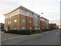
TQ2866 : Clover Way, near Hackbridge by Malc McDonald Clover Way, near Hackbridge by Malc McDonald
geograph for square TQ2866
Clover Way provides access to a housing development near Hackbridge, in the... (more)
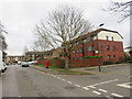
TQ2866 : Helios Road, near Hackbridge by Malc McDonald Helios Road, near Hackbridge by Malc McDonald
geograph for square TQ2866
Helios Road in the BedZED housing development in south London.
TQ2866 : Sandmartin Way, near Hackbridge by Malc McDonald Sandmartin Way, near Hackbridge by Malc McDonald
geograph for square TQ2866
Sandmartin Way is a path in the BedZED housing development in south London.
Tags: path:Alley   Alley   Alleyway   subject:Alleyway   near:Beddington   Eco Home   Eco House   Eco Houses   Eco-Friendly Area   Eco-House   type:Geograph   near:Hackbridge   top:Housing, Dwellings   near:Mitcham   top:Paths   place:South London   Sustainable Development  
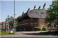
TQ2866 : BedZED by Peter Trimming BedZED by Peter Trimming
geograph for square TQ2866
Beddington Zero Energy Development (BedZED) is an environmentally friendly... (more)
TQ2864 : Pond near Carshalton by Malc McDonald Pond near Carshalton by Malc McDonald
geograph for square TQ2864
A pond with a fountain at its centre, near Carshalton in the outer suburbs of... (more)
Tags: near:Carshalton   type:Geograph   near:Hackbridge   top:Park and Public Gardens   subject:Pond   Pond   place:South London   near:Sutton   near:Wallington  
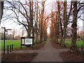
TQ2965 : Beddington Park at sunset by Malc McDonald Beddington Park at sunset by Malc McDonald
geograph for square TQ2965
A tree-lined avenue in Beddington Park, in the outer suburbs of south London.... (more)
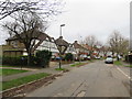
TQ2865 : Derek Avenue, near Carshalton by Malc McDonald Derek Avenue, near Carshalton by Malc McDonald
geograph for square TQ2865
Derek Avenue is a residential road in the outer suburbs of south London.
TQ2866 : London Road, near Mitcham by Malc McDonald London Road, near Mitcham by Malc McDonald
geograph for square TQ2866
London Road forms part of the route of the A237 road through south London's suburbs
Tags: road:A Road   near:Beddington   place:Beddington Corner   type:Geograph   near:Hackbridge   housing:Low Rise   housing:Low Rise Flats   Low Rise Housing   near:Mitcham   subject:Road   top:Roads, Road Transport   place:South London   Suburban Road  
TQ2866 : Mill Court, near Mitcham by Malc McDonald Mill Court, near Mitcham by Malc McDonald
geograph for square TQ2866
Mill Court is a housing estate comprising low-rise blocks of flats, at... (more)
Tags: near:Beddington   place:Beddington Corner   type:Geograph   near:Hackbridge   Housing Estate   subject:Housing Estate   building type:Housing Estate   top:Housing, Dwellings   housing:Low Rise   housing:Low Rise Flats   Low Rise Housing   near:Mitcham   place:South London   top:Suburb, Urban Fringe  
TQ2965 : Sunset in Beddington Park by Malc McDonald Sunset in Beddington Park by Malc McDonald
geograph for square TQ2965
Beddington Park in the outer suburbs of south London, photographed as the sun... (more)
Tags: near:Beddington   near:Croydon   type:Geograph   near:Hackbridge   subject:Park   top:Park and Public Gardens   Park Path   Park Path Junction   Park Paths   Path in Public Park   place:South London   weather:Sunset   Sunset   Sunset Light   near:Wallington   Winter Sunset  
TQ2766 : Bridge over the River Wandle near St Helier by Malc McDonald Bridge over the River Wandle near St Helier by Malc McDonald
geograph for square TQ2766
A bridge carrying the Wandle Trail over the River Wandle in south London. The... (more)
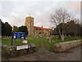
TQ2965 : Church of St. Mary the Virgin, Beddington by Malc McDonald Church of St. Mary the Virgin, Beddington by Malc McDonald
geograph for square TQ2965
The church and churchyard of Saint Mary the Virgin, in Beddington in the outer... (more)
TQ2864 : Butter Hill, Carshalton by Malc McDonald Butter Hill, Carshalton by Malc McDonald
geograph for square TQ2864
Butter Hill in Carshalton, in the outer suburbs of south London. This section... (more)
Tags: place:Carshalton   type:Geograph   near:Hackbridge   Narrow Road   Narrow Street   No Stopping   subject:Road   top:Roads, Road Transport   place:South London   near:Sutton   near:Wallington   Yellow Box  
TQ2864 : Caledon Road, Carshalton by Malc McDonald Caledon Road, Carshalton by Malc McDonald
geograph for square TQ2864
Caledon Road is a short residential street in Carshalton, in the outer suburbs... (more)
TQ2865 : Apartment block in Carshalton by Malc McDonald Apartment block in Carshalton by Malc McDonald
geograph for square TQ2865
A modern apartment block on Butter Hill, in Carshalton.
Tags: building type:Apartment   subject:Apartment Block   Apartment Block   building type:Apartment Block   Apartment Building   place:Carshalton   type:Geograph   near:Hackbridge   top:Housing, Dwellings   Modern Apartment Block   Modern Apartments   place:South London   top:Suburb, Urban Fringe   near:Sutton   near:Wallington  
TQ2865 : Mill Lane, Carshalton by Malc McDonald Mill Lane, Carshalton by Malc McDonald
geograph for square TQ2865
Mill Lane in Carshalton, in the outer suburbs of south London. The River... (more)
View more in the Image Search or in Browser
View images matching 'Hackbridge' anywhere in the tags
Don't click these: PotMel 1 PotMel 2