Public Tags
Showing images tagged with near:Halifax tag.

|
Stocks Lane, near Halifax
by Malc McDonald geograph for square SE0527 Stocks Lane descends a steep hill near Halifax, in West Yorkshire.
The road... (more)
Tags:
type:Geograph
near:Halifax
subject:Hill
top:Roads, Road Transport
top:Uplands
View
county:West Yorkshire
|
|
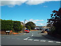
Waindale Close, Mount Tabor, near Halifax
by Malc McDonald geograph for square SE0527 Waindale Close is a short residential cul-de-sac in the village of Mount Tabor,... (more)
Tags:
Cul-De-Sac
type:Geograph
near:Halifax
place:Mount Tabor
Residential Area
Residential Cul-De-Sac
subject:Road
top:Village, Rural Settlement
county:West Yorkshire
|

|
Shibden Hall, Halifax
by Dave Pickersgill geograph for square SE1025 Tags:
top:Educational Sites
Folk Museum
type:Geograph
Halifax
near:Halifax
place:Halifax
subject:Hall
top:Historic Sites and Artefacts
Museum
top:Park and Public Gardens
top:People, Events
top:Public Buildings and Spaces
Shibden Hall
Shibden Park
top:Suburb, Urban Fringe
place:West Yorkshire
county:West Yorkshire
West Yorkshire
|

|
Shibden Hall, Halifax
by Dave Pickersgill geograph for square SE1025 Tags:
top:Educational Sites
type:Geograph
near:Halifax
Halifax
place:Halifax
subject:Hall
top:Historic Sites and Artefacts
top:Housing, Dwellings
Museum
top:Park and Public Gardens
top:People, Events
top:Public Buildings and Spaces
Shibden Hall
Shibden Park
top:Suburb, Urban Fringe
county:West Yorkshire
place:West Yorkshire
West Yorkshire
|

|
New Inn, Mount Tabor, near Halifax
by Malc McDonald geograph for square SE0527 The New Inn in the village of Mount Tabor, just outside Halifax.
Tags:
top:Business, Retail, Services
type:Geograph
near:Halifax
subject:Inn
Inn
place:Mount Tabor
Pub
Public House
Village Inn
Village Pub
Village Public House
top:Village, Rural Settlement
county:West Yorkshire
|

|
Mount Tabor, near Halifax
by Malc McDonald geograph for square SE0527 This crossroads is in the village of Mount Tabor, just outside Halifax.
Tags:
subject:Crossroad
Crossroads
type:Geograph
near:Halifax
place:Mount Tabor
top:Village, Rural Settlement
county:West Yorkshire
|

|
Shibden Hall
by Steven Haslington geograph for square SE1025 The front facade of Shibden Hall, in Halifax, West Yorkshire, England.
Tags:
type:Geograph
near:Halifax
place:Halifax
Halifax
top:Historic Sites and Artefacts
top:Housing, Dwellings
Shibden Hall
West Yorkshire
county:West Yorkshire
place:West Yorkshire
|

|
Mount Tabor Road, near Wainstalls
by Malc McDonald geograph for square SE0527 A view along Mount Tabor Road looking towards Wainstalls, in the hills west of Halifax.
Tags:
type:Geograph
near:Halifax
subject:Road
top:Roads, Road Transport
near:Wainstalls
county:West Yorkshire
|

|
A bench with a view, near Wainstalls
by Malc McDonald geograph for square SE0527 A bench with a view, in the hills west of Halifax.
On lower ground, towards... (more)
Tags:
Bench
Bench Seat
type:Geograph
near:Halifax
Roadside Bench
Seat with a View
top:Uplands
subject:View
View
View Across Valley
View From Hillside
near:Wainstalls
county:West Yorkshire
|
|
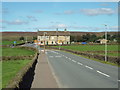
Mount Tabor Road, near Wainstalls
by Malc McDonald geograph for square SE0427 A view along Mount Tabor Road, as it enters the small village of Wainstalls in... (more)
Tags:
type:Geograph
near:Halifax
subject:Road
top:Roads, Road Transport
place:Wainstalls
county:West Yorkshire
|

|
Hebble Brook Close, Mixenden
by Malc McDonald geograph for square SE0627 Hebble Brook Close is a new development of houses in mixenden, on the outskirts... (more)
Tags:
type:Geograph
near:Halifax
subject:Housing Estate
top:Housing, Dwellings
place:Mixenden
New Housing
New Housing Development
top:Suburb, Urban Fringe
county:West Yorkshire
|
|
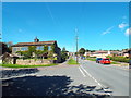
Mixenden Road, Mixenden
by Malc McDonald geograph for square SE0628 Mixenden Road at its junction with Ash Tree Road, in Mixenden on the outskirts of Halifax.
Tags:
type:Geograph
near:Halifax
place:Mixenden
subject:Suburb
top:Suburb, Urban Fringe
Telegraph Pole
county:West Yorkshire
|

|
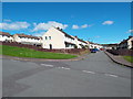
Woodbrook Road, Mixenden
by Malc McDonald geograph for square SE0628 Housing on Woodbrook Road in Mixenden, on the outskirts of Halifax. Some of the... (more)
Tags:
type:Geograph
near:Halifax
subject:Housing Estate
Housing Estate
top:Housing, Dwellings
place:Mixenden
top:Suburb, Urban Fringe
county:West Yorkshire
|
|
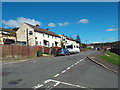
Stanningley Avenue, Mixenden
by Malc McDonald geograph for square SE0528 Stanningley Avenue in Mixenden, on the outskirts of Halifax.
Tags:
type:Geograph
near:Halifax
Housing Estate
subject:Housing Estate
top:Housing, Dwellings
place:Mixenden
top:Suburb, Urban Fringe
county:West Yorkshire
|
|
Stanningley Drive, Mixenden
by Malc McDonald geograph for square SE0528 Stanningley Drive in Mixenden, on the outskirts of Halifax.
Tags:
type:Geograph
near:Halifax
subject:Housing Estate
top:Housing, Dwellings
place:Mixenden
top:Suburb, Urban Fringe
county:West Yorkshire
|

|
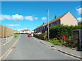
Clough Bank, Mixenden
by Malc McDonald geograph for square SE0528 Clough Bank is a steep cobbled slope in Mixenden, on the outskirts of Halifax.
Tags:
Cobbled
Cobbled Path
Cobbled Road
type:Geograph
near:Halifax
place:Mixenden
subject:Slope
top:Suburb, Urban Fringe
county:West Yorkshire
|
|
Hambleton Drive, Mixenden
by Malc McDonald geograph for square SE0528 Hambleton Drive in Mixenden, on the outskirts of Halifax.
Tags:
type:Geograph
near:Halifax
subject:Housing Estate
place:Mixenden
Post Box
Post Box on Post
top:Suburb, Urban Fringe
Telegraph Pole
county:West Yorkshire
|

|
Clough Lane, Mixenden
by Malc McDonald geograph for square SE0528 Clough Lane passing a new housing development in Mixenden, on the outskirts of Halifax.
Tags:
type:Geograph
near:Halifax
subject:Housing Estate
top:Housing, Dwellings
place:Mixenden
top:Suburb, Urban Fringe
county:West Yorkshire
|

|
Clough Lane, Mixenden
by Malc McDonald geograph for square SE0528 Clough Lane, heading into Mixenden on the outskirts of Halifax.
Tags:
type:Geograph
near:Halifax
road:Minor Road
Minor Road
place:Mixenden
subject:Road
top:Roads, Road Transport
top:Suburb, Urban Fringe
Telegraph Pole
county:West Yorkshire
|

|
Mount Tabor Road, Wainstalls
by Malc McDonald geograph for square SE0428 Mount Tabor Road passing through the village of Wainstalls, west of Halifax.
Tags:
type:Geograph
near:Halifax
subject:Village
top:Village, Rural Settlement
place:Wainstalls
county:West Yorkshire
|

|
Wainstalls Lane, Wainstalls
by Malc McDonald geograph for square SE0427 Wainstalls lane, heading out of Wainstalls in the hills west of Halifax.
Tags:
type:Geograph
near:Halifax
subject:Road
top:Roads, Road Transport
road sign:Unsuitable for Heavy Goods Vehicles
top:Uplands
place:Wainstalls
county:West Yorkshire
|

|
Balkram Edge, near Mixenden
by Malc McDonald geograph for square SE0528 This road, between Wainstalls and Mixenden, is named Balkram Edge. This view... (more)
Tags:
type:Geograph
near:Halifax
Minor Road
road:Minor Road
near:Mixenden
subject:Road
top:Roads, Road Transport
top:Uplands
county:West Yorkshire
|

|
Balkram Edge, near Wainstalls
by Malc McDonald geograph for square SE0528 This minor road between Wainstalls and Mixenden is called Balkram Edge. The... (more)
Tags:
type:Geograph
near:Halifax
Minor Road
road:Minor Road
subject:Road
top:Roads, Road Transport
near:Wainstalls
county:West Yorkshire
|

|
Gatehead Mill near Stainland
by Chris Allen geograph for square SE0720 The very ruinous Gatehead Mill. The place name is two words on the Land Ranger... (more)
Tags:
top:Derelict, Disused
type:Geograph
near:Halifax
top:Industry
subject:Mill
former:Textile Mill
top:Uplands
|

|
Gatehead Mill near Stainland
by Chris Allen for square SE0720 The very ruinous Gatehead Mill. The place name is two words on the Land Ranger... (more)
Tags:
type:Close Look
top:Derelict, Disused
near:Halifax
top:Industry
subject:Mill
former:Textile Mill
top:Uplands
|

|
Gatehead Mill near Stainland
by Chris Allen geograph for square SE0720 The very ruinous Gatehead Mill. The place name is two words on the Land Ranger... (more)
Tags:
top:Derelict, Disused
type:Geograph
near:Halifax
top:Industry
subject:Mill
former:Textile Mill
|

|
Gate Head near Stainland with a derelict mill
by Chris Allen geograph for square SE0720 The mill is the very ruinous Gatehead Mill. The place name is two words on the... (more)
Tags:
top:Derelict, Disused
type:Geograph
near:Halifax
subject:Hamlet
top:Industry
former:Textile Mill
top:Uplands
top:Village, Rural Settlement
|

|
Gatehead Mill near Stainland
by Chris Allen geograph for square SE0720 The very ruinous Gatehead Mill. The place name is two words on the Land Ranger... (more)
Tags:
top:Derelict, Disused
type:Geograph
near:Halifax
top:Industry
subject:Mill
former:Textile Mill
top:Uplands
top:Village, Rural Settlement
|

|
Dean Clough Mills
by Jonathan Hutchins geograph for square SE0825 Built in the mid-nineteenth century for Crossley's Carpets. Finally closed... (more)
|

|
Clough Lane, Mixenden
by Malc McDonald geograph for square SE0528 A housing terrace on Clough Lane, in Mixenden.
In the foreground, speed... (more)
Tags:
type:Geograph
near:Halifax
building type:Housing Terrace
place:Mixenden
Speed Cushions
top:Suburb, Urban Fringe
housing:Terrace
Terrace Houses
Terrace Housing
building type:Terrace Housing
Terrace of Houses
subject:Traffic Calming
Traffic Calming
county:West Yorkshire
|
