
|
Green Lane near Higham
by Geographer
geograph for square TM0436
At the junction with the B1068
|

|
B1068 near Higham
by Geographer
geograph for square TM0436
At the junction with Green Lane
|

|
B1068 near Higham
by Geographer
geograph for square TM0436
At the junction with Sandpits Lane at Holly Bush Corner
|

|
Sandpits Lane, near Higham
by Geographer
geograph for square TM0436
At the junction with the B1068 at Holly Bush Corner
|

|
B1068 near Higham
by Geographer
geograph for square TM0436
At the junction with Sandpits Lane at Holly Bush Corner
|

|
Sandpits Lane, near Higham
by Geographer
geograph for square TM0436
At the junction with the B1068 at Holly Bush Corner
|

|
B1068 near Higham
by Geographer
geograph for square TM0436
At the junction with Sandpits Lane at Holly Bush Corner
|

|
Higham Road, near Cliffe
by Malc McDonald
geograph for square TQ7375
Higham Road is a minor country road on the Hoo peninsula, in Kent.
|

|
Line of trees near Higham
by Malc McDonald
geograph for square TQ7273
A line of trees near Higham, in Kent.
|

|
Marsh Road, Higham Marsh
by Geographer
geograph for square TM0235
At the junction with the B1068 Thorington Street near Wasses Farm
Road No.U8523
|

|
B1068 Thorington Street, Higham Marsh
by Geographer
geograph for square TM0235
At the junction with Marsh Road near Wasses Farm
|

|
Higham Road towards the A14 through a tree tunnel
by J Hannan
geograph for square TL7467
Near Higham.
|

|
Roadsign on the B1068
by Geographer
for square TM0436
At the junction with Sandpits Lane at Holly Bush Corner
|

|
Sandpits Lane sign
by Geographer
for square TM0436
On Sandpits Lane at the junction with the B1068 at Holly Bush Corner
|

|
Buckland Road, near Higham
by Malc McDonald
geograph for square TQ7373
Buckland Road, passing through Kent countryside. This road is on the route of... (more)
|

|
Buckland Road, near Higham
by Malc McDonald
geograph for square TQ7373
Buckland Road, passing through Kent countryside.
Buckland Road is on the... (more)
|

|
Buckland Road, near Higham
by Malc McDonald
geograph for square TQ7273
Buckland Road is on the route of National Cycle Network route 179, "The... (more)
|

|
Buckland Road, near Higham
by Malc McDonald
geograph for square TQ7273
Buckland Road in the Kent countryside.
The small blue signs on the signpost... (more)
|

|
Gore Green Road, near Higham
by Malc McDonald
geograph for square TQ7273
Gore Green Road passing through Kent countryside.
|

|
Two Gates Hill, near Higham
by Malc McDonald
geograph for square TQ7272
A view westwards down Two Gates Hill, at the end of a February day.
This road... (more)
|

|
Bend in the road, near Higham
by J Hannan
geograph for square TL7466
Towards the A14.
|
|
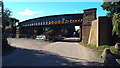
Railway bridge near Higham
by Malc McDonald
geograph for square TQ7073
This railway bridge over Canal Road carries freight trains heading to/from the... (more)
|

|
Farmland near Higham
by Malc McDonald
geograph for square TQ7173
Farmland in North Kent.
|

|
Canal Road, near Higham
by Malc McDonald
geograph for square TQ7073
The road sign indicates that the road has a height restriction, as it passes... (more)
|

|
Lower Rochester Road, near Higham
by Malc McDonald
geograph for square TQ7272
This country lane forms part of the National Cycle Network. It is on route 1,... (more)
|

|
Lower Rochester Road, near Higham
by Malc McDonald
geograph for square TQ7272
This country lane in Kent forms part of National Cycle Network Route 1, which... (more)
|

|
Footpath and stile near Cliffe
by Malc McDonald
geograph for square TQ7375
A stile and a public footpath marker stone near Cliffe, on the Hoo peninsula in Kent.
|

|
Salt Lane, near Cliffe
by Malc McDonald
geograph for square TQ7275
A view eastwards along Salt lane, near Cliffe in Kent.
|

|
Houses on Buckland Road, near Cliffe
by Malc McDonald
geograph for square TQ7374
Buckland Road forms part of National Cycle Network route 179 "The Heron... (more)
|

|
Buckland Road, near Cliffe
by Malc McDonald
geograph for square TQ7374
A view south on Buckland Road, on a sunny February day in 2019.
Buckland Road... (more)
|

|
Railway line near Cliffe
by Malc McDonald
geograph for square TQ7374
This railway line on the Hoo peninsula closed to passengers in 1961. It... (more)
|

|
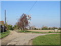
A house with a view, near Cliffe
by Malc McDonald
geograph for square TQ7376
A newly-built house with a view over the Thames Estuary.
|
|
West Street, near Cliffe
by Malc McDonald
geograph for square TQ7376
This road forms part of National Cycle Network route 179 "The Heron... (more)
|

|
West Street, near Cliffe
by Malc McDonald
geograph for square TQ7376
West Street is on the route of National Cycle Network route 179 "The Heron... (more)
|

|
Salt Lane, near Cliffe
by Malc McDonald
geograph for square TQ7275
Salt Lane, with a lorry depot to the left of the image.
|
|
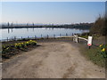
Driveway in Buckland Lake Reserve, near Cliffe
by Malc McDonald
geograph for square TQ7375
Buckland Lake Reserve is a nature reserve in a former chalk quarry which has... (more)
|

|
Buttway Lane, Cliffe
by Malc McDonald
geograph for square TQ7376
Buttway Lane is a minor road leading into the village of Cliffe, on the Hoo... (more)
|

|
Pylons on Shorne Marshes
by Malc McDonald
geograph for square TQ6973
The path to the right of the image forms part of National Cycle Network route 1.
|

|
Track across Shorne Marshes
by Malc McDonald
geograph for square TQ6973
|
