|
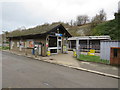
Knockholt station entrance
by Malc McDonald
geograph for square TQ4862
Knockholt railway station has a modern, single-storey station building. The... (more)
|
|
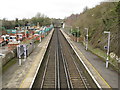
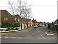
Knockholt railway station
by Malc McDonald
geograph for square TQ4862
Knockholt railway station, on the border of Greater London and Kent.
|
|
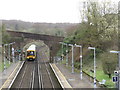
Train leaving Knockholt station
by Malc McDonald
geograph for square TQ4862
A suburban train leaving Knockholt station, on the border of Greater London and Kent.
|
|
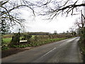
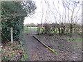
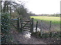
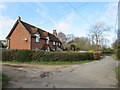
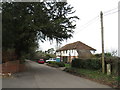
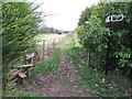
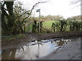
Halstead Lane, near Knockholt Pound
by Malc McDonald
geograph for square TQ4860
Halstead Lane near Knockholt Pound in Kent. A public footpath leads off to the left.
|
|
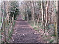
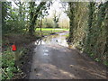
Muddy track near Knockholt Pound
by Malc McDonald
geograph for square TQ4859
A muddy track through woodland near Knockholt Pound, in Kent. The track is a... (more)
|
|
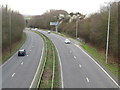
A21 near Knockholt railway station
by Malc McDonald
geograph for square TQ4863
A view of the trunk A21 road near Knockholt railway station. The village of... (more)
|
|
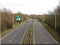
A21 near Knockholt station
by Malc McDonald
geograph for square TQ4863
A view of the A21 trunk road, near Knockholt railway station. The village of... (more)
|
|
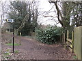
Gate on the North Downs Way, near Knockholt Pound
by Malc McDonald
for square TQ4759
A gate on the North Downs Way long distance footpath, near Knockholt Pound in Kent.
|
|
North Downs Way near Knockholt Pound
by Malc McDonald
geograph for square TQ4758
A gate on the North Downs Way near Knockholt Pound.
|
|
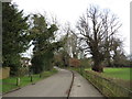
Old London Road, Knockholt Pound
by Malc McDonald
geograph for square TQ4859
Old London Road heading out of the village of Knockholt Pound in Kent.
|
|
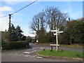
Road junction at Knockholt Pound
by Malc McDonald
geograph for square TQ4859
The junction of Harrow Road and Old London Road in the village of Knockholt... (more)
|
|
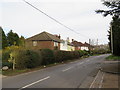
Harrow Road, Knockholt Pound
by Malc McDonald
geograph for square TQ4859
Harrow Road in the village of Knockholt Pound, in Kent.
|
|
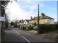
Knockholt Pound village centre
by Malc McDonald
geograph for square TQ4859
A road junction at the centre of Knockholt Pound.
Although the village is in... (more)
|
|
Houses on Chevening Lane, Knockholt Pound
by Malc McDonald
geograph for square TQ4859
Houses on Chevening Lane, in the village of Knockholt Pound in Kent.
|
|
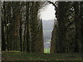
Chevening through The Keyhole, near Knockholt
by Malc McDonald
geograph for square TQ4758
A narrow avenue through trees on the North Downs, providing a view of Chevening.... (more)
|
|
Chevening Lane, near Knockholt Pound
by Malc McDonald
geograph for square TQ4859
The North Downs Way passes through the gate to the left of the lane.
|
|
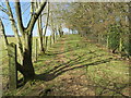
Track near Knockholt
by Malc McDonald
geograph for square TQ4659
A track through Kent countryside, near Knockholt.
|
|
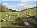
Public footpath near Knockholt
by Malc McDonald
geograph for square TQ4659
A public footpath on a hillside in the Kent countryside near Knockholt.
|
|
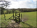
Stile near Knockholt
by Malc McDonald
geograph for square TQ4659
A stile on a public footpath near Knockholt, in Kent.
|
|
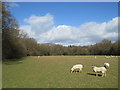
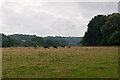
Sheep grazing near Knockholt
by Malc McDonald
geograph for square TQ4660
Sheep grazing in a field near Knockholt.
Although it is not clearly visible,... (more)
|
|
Washneys Road near Knockholt
by Malc McDonald
geograph for square TQ4660
Washneys Road is a narrow country lane near Knockholt in Kent.
|
|
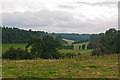
Towards Knockholt
by Ian Capper
geograph for square TQ4660
Looking from near Newlands Wood towards the ridge on which Knockholt stands. On... (more)
|
|
Towards Knockholt
by Ian Capper
geograph for square TQ4659
Looking towards the ridge on which Knockholt stands, from near Long Bottoms... (more)
|
|
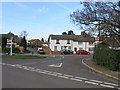
Halstead Place, Halstead
by Malc McDonald
geograph for square TQ4861
Halstead Place is a recent housing development in the village of Halstead, in... (more)
|
|
Church Road, Halstead
by Malc McDonald
geograph for square TQ4861
A row of houses on Church Road in the village of Halstead.
|
|
Church Road, Halstead
by Malc McDonald
geograph for square TQ4861
Church Road in the village of Halstead in Kent.
|
|
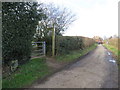
Public footpath, Halstead
by Malc McDonald
geograph for square TQ4861
A public footpath at Halstead, in Kent.
|
|
Public footpath, Halstead
by Malc McDonald
geograph for square TQ4861
A public footpath at Halstead, in Kent
|
|
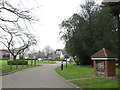
Meadway, Halstead
by Malc McDonald
geograph for square TQ4860
Meadway is a residential road in the village of Halstead, in Kent.
|
|
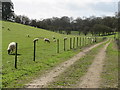
Track through countryside near Knockholt
by Malc McDonald
geograph for square TQ4659
Sheep grazing on a hillside alongside a track in the Kent countryside.
|
|
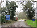
Broke Hill Golf Club car park entrance, near Knockholt
by Malc McDonald
geograph for square TQ4862
The entrance to the car park at Broke Hill Golf Club, on the border of Kent and... (more)
|
|
Public footpath near Pratts Bottom
by Malc McDonald
geograph for square TQ4660
A public footpath near Pratts Bottom, on the outer fringe of south east London.... (more)
|