|
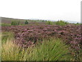
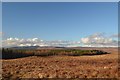
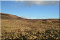
Heather on the Ord Hill Path
by M J Richardson
geograph for square NC5705
A view northeast from near the site of a hut circle.
|
|
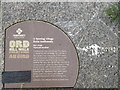
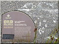
Hut circle information plaque
by M J Richardson
for square NC5705
Adjacent to the site of a hut circle on the Ord Hill Walk.
|
|
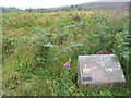
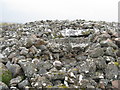
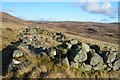
Hut circle on The Ord
by M J Richardson
geograph for square NC5705
A levelled area in the moorland, the site of a round house, one of many in this... (more)
|
|
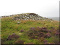
A tomb with a view
by M J Richardson
for square NC5705
|
|
Entrance to Ord North Chambered Cairn
by M J Richardson
geograph for square NC5705
Two large lintels over the entrance to the cairn.
|
|
Ord North Chambered Cairn
by M J Richardson
geograph for square NC5705
|
|
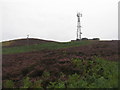
Radio mast on The Ord
by M J Richardson
geograph for square NC5705
A modern feature on this Neolithic site - an ever increasing feature of the... (more)
|
|
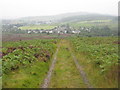
Ord Hill Walk
by M J Richardson
geograph for square NC5705
Track from Ord Place to the chambered cairn and other Neolithic remains on The Ord.
|
|
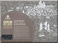
Ord North Chambered Cairn
by M J Richardson
for square NC5705
Information about a last resting place on the Ord - a massive Neolithic cairn... (more)
|
|
Moorland near Dalnessie, Sutherland
by Andrew Tryon
geograph for square NC6211
View facing north over Dalchork Wood. Ben Klibreck is on the horizon.
|
|
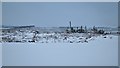
Cleared Landscape, Sutherland
by Andrew Tryon
geograph for square NC5813
View over an area of felled trees in winter, Scotland.
|
|
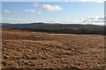
Moorland near Allt Tigh na Creige, Sutherland
by Andrew Tryon
geograph for square NC6210
Moorland on the edge of Dalchork woods in central Sutherland.
|
|
Moorland near Tighcreag, Sutherland
by Andrew Tryon
geograph for square NC6309
|
|
Ruin near Tighcreag, Sutherland
by Andrew Tryon
geograph for square NC6309
|
|
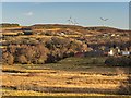
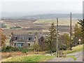
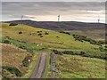
Drumnahaving Farm
by valenta
geograph for square NC5804
Drumnahaving farm viewed from the B864. The wind turbines are on the hill Cnoc... (more)
|
|
Ruined farm at Culbuie
by valenta
for square NC5907
|
|
Cattle Grid at Balcharn
by valenta
geograph for square NC5906
The three turbines of Laig wind Farm on the summit of Cnoc na h-Inghinn
|
|
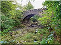
Achany Bridge
by valenta
geograph for square NC5702
A stone arch bridge carries the single track B864 over the Grudie Burn
|
|
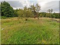
Achany Chambered Cairn
by valenta
geograph for square NC5702
Little evidence of this Orkney-Cromarty type cairn due to the long grass
|
|
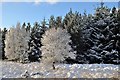
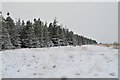
White Trees in Dalchork Woods, Sutherland
by Andrew Tryon
geograph for square NC5914
|
|
Break in Dalchork Woods, Sutherland
by Andrew Tryon
geograph for square NC5815
Part of the Forestry Commission forest at Dalchork has been felled, leaving this... (more)
|

|
Hiking in the Highlands
by Andrew Tryon
geograph for square NC5914
|
|
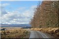
Forestry Track in Dalchork Woods, Sutherland
by Andrew Tryon
geograph for square NC5810
|
|
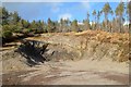
Quarry in Dalchork Wood, Sutherland
by Andrew Tryon
geograph for square NC6009
A small quarry hidden away in the woods.
|
|
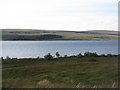
Loch Shin - east shore
by M J Richardson
geograph for square NC5511
Looking across the Loch from the A838. The large expanse of conifer plantation... (more)
|