Public Tags
Showing latest 50 of 100 images tagged with near:Newhaven tag.
|
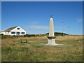
War Memorial, Saltdean
by Malc McDonald geograph for square TQ3801 This war memorial stands at the top of cliffs at Saltdean, on the south coast... (more)
Tags:
near:Brighton
county:East Sussex
type:Geograph
top:Historic Sites and Artefacts
near:Newhaven
place:Saltdean
subject:War Memorial
memorial:War Memorial
War Memorial
|
|
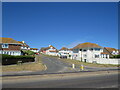
Bannings Vale, Saltdean
by Malc McDonald geograph for square TQ3801 Bannings Vale is a residential road in Saltdean, on the Sussex coast near Brighton.
Tags:
near:Brighton
county:East Sussex
type:Geograph
near:Newhaven
Residential
Residential Area
Residential Road
Residential Street
place:Saltdean
subject:Suburb
top:Suburb, Urban Fringe
|
|
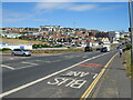
Marine Drive, Saltdean
by Malc McDonald geograph for square TQ3701 Marine Drive forms part of the route of the coastal A259 road as it passes... (more)
Tags:
road:A Road
road:A259
A259
near:Brighton
Coast Road
Coastal Road
type:Geograph
near:Newhaven
top:Roads, Road Transport
place:Saltdean
subject:Suburb
top:Suburb, Urban Fringe
|
|
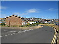
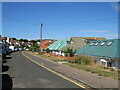
Saltdean Drive, Saltdean
by Malc McDonald geograph for square TQ3702 Saltdean Drive is a residential road in Saltdean, on the Sussex coast near Brighton.
Tags:
near:Brighton
type:Geograph
near:Newhaven
Residential
Residential Area
Residential Road
Residential Street
place:Saltdean
subject:Suburb
top:Suburb, Urban Fringe
|
|
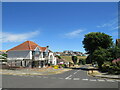
Chichester Drive West, Saltdean
by Malc McDonald geograph for square TQ3702 Chichester Drive West is a residential road in Saltdean, on the Sussex coast... (more)
Tags:
near:Brighton
type:Geograph
near:Newhaven
Residential
Residential Area
Residential Road
Residential Street
place:Saltdean
subject:Suburb
top:Suburb, Urban Fringe
|
|
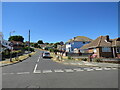
Founthill Avenue, Saltdean
by Malc McDonald geograph for square TQ3702 Founthill Avenue is a residential road in Saltdean, on the Sussex coast near Brighton.
Tags:
near:Brighton
type:Geograph
near:Newhaven
Residential
Residential Area
Residential Road
Residential Street
place:Saltdean
subject:Suburb
top:Suburb, Urban Fringe
|
|
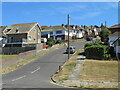
Founthill Avenue, Saltdean
by Malc McDonald geograph for square TQ3702 Founthill Avenue is a residential road in Saltdean, on the Sussex coast near Brighton.
Tags:
near:Brighton
type:Geograph
near:Newhaven
Residential
Residential Area
Residential Road
Residential Street
place:Saltdean
subject:Suburb
top:Suburb, Urban Fringe
|
|
Chichester Drive East, Saltdean
by Malc McDonald geograph for square TQ3802 Chichester Drive East is a residential road on a hillside in Saltdean, on the... (more)
Tags:
near:Brighton
type:Geograph
near:Newhaven
Residential
Residential Area
Residential Road
Residential Street
place:Saltdean
subject:Suburb
top:Suburb, Urban Fringe
|

|
St. Nicholas parish church, Saltdean
by Malc McDonald geograph for square TQ3802 The parish church of St. Nicholas in Saltdean, on the Sussex coast near Brighton.
Tags:
near:Brighton
subject:Church
type:Geograph
near:Newhaven
Parish Church
top:Religious Sites
place:Saltdean
top:Suburb, Urban Fringe
|
|
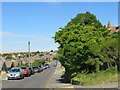
Greenbank Avenue, Saltdean
by Malc McDonald geograph for square TQ3802 Greenbank Avenue is a residential road in Saltdean, on the Sussex coast near Brighton.
Tags:
near:Brighton
type:Geograph
near:Newhaven
Residential
Residential Area
Residential Road
place:Saltdean
subject:Suburb
top:Suburb, Urban Fringe
|
|
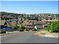
Oaklands Avenue, Saltdean
by Malc McDonald geograph for square TQ3802 Oaklands Avenue is a residential road in Saltdean, on the Sussex coast near Brighton.
Tags:
near:Brighton
type:Geograph
near:Newhaven
Residential
Residential Area
Residential Road
Residential Street
place:Saltdean
top:Suburb, Urban Fringe
|
|
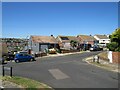
Rodmell Avenue, Saltdean
by Malc McDonald geograph for square TQ3802 Rodmell Avenue is a residential road in Saltdean, on the Sussex coast near... (more)
Tags:
near:Brighton
type:Geograph
Minor Road Junction
near:Newhaven
Residential
Residential Area
Residential Road
Residential Street
place:Saltdean
subject:Suburb
top:Suburb, Urban Fringe
|
|
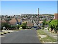
Rodmell Avenue, Saltdean
by Malc McDonald geograph for square TQ3802 Rodmell Avenue is a residential road in Saltdean, on the Sussex coast near Brighton.
Tags:
near:Brighton
type:Geograph
near:Newhaven
Residential
Residential Area
Residential Road
Residential Street
place:Saltdean
subject:Suburb
top:Suburb, Urban Fringe
|
|
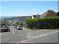
Linchmere Avenue, Saltdean
by Malc McDonald geograph for square TQ3802 Linchmere Avenue is a residential road in Saltdean, on the Sussex coast near Brighton.
Tags:
near:Brighton
Coastal
Coastal Area
type:Geograph
near:Newhaven
Residential
Residential Area
Residential Road
Residential Street
place:Saltdean
subject:Suburb
top:Suburb, Urban Fringe
|
|
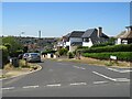
Rodmell Avenue, Saltdean
by Malc McDonald geograph for square TQ3802 Rodmell Avenue is a residential road in Saltdean, on the Sussex coast near Brighton.
Tags:
near:Brighton
type:Geograph
near:Newhaven
Residential
Residential Area
Residential Road
Residential Street
place:Saltdean
subject:Suburb
top:Suburb, Urban Fringe
|
|
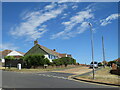
Rodmell Avenue, Saltdean
by Malc McDonald geograph for square TQ3802 Rodmell Avenue is a residential road in Saltdean, on the Sussex coast near Brighton.
Tags:
near:Brighton
county:East Sussex
type:Geograph
near:Newhaven
Residential
Residential Area
Residential Road
Residential Street
place:Saltdean
subject:Suburb
top:Suburb, Urban Fringe
|
|
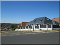
Bevendean Avenue, Saltdean
by Malc McDonald geograph for square TQ3802 Bevendean Avenue is a residential road in Saltdean, on the Sussex coast near Brighton.
Tags:
near:Brighton
type:Geograph
near:Newhaven
Residential
Residential Area
Residential Road
Residential Street
place:Saltdean
subject:Suburb
top:Suburb, Urban Fringe
|
|
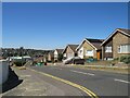
Wicklands Avenue, Saltdean
by Malc McDonald geograph for square TQ3802 Wicklands Avenue is a residential road in Saltdean, on the Sussex coast near Brighton.
Tags:
near:Brighton
type:Geograph
near:Newhaven
Residential
Residential Area
Residential Road
Residential Street
place:Saltdean
subject:Suburb
top:Suburb, Urban Fringe
|
|
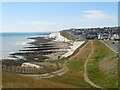
Coastline at Saltdean
by Malc McDonald geograph for square TQ3801 A view westwards along the south coast at Saltdean, near Brighton. The... (more)
Tags:
near:Brighton
Chalk Cliff
Chalk Cliffs
subject:Coast
top:Coastal
Coastal View
county:East Sussex
type:Geograph
near:Newhaven
place:Saltdean
top:Suburb, Urban Fringe
View of Coast
|

|
Undercliff walk, Saltdean
by Malc McDonald geograph for square TQ3801 The undercliff walk at Saltdean, on the Sussex coast near Brighton.
This... (more)
Tags:
near:Brighton
top:Coastal
long distance path:England Coast Path
England Coast Path
path:England Coast Path
type:Geograph
National Cycle Network
NCN
NCN2
near:Newhaven
subject:Path
top:Paths
place:Saltdean
Undercliff Walk
|

|
Beach and undercliff walk at Saltdean
by Malc McDonald geograph for square TQ3801 The beach and undercliff walk at Saltdean, near Brighton.
The undercliff walk... (more)
Tags:
Beach
subject:Beach
near:Brighton
top:Coastal
path:England Coast Path
long distance path:England Coast Path
England Coast Path
type:Geograph
National Cycle Network
NCN
NCN2
near:Newhaven
top:Paths
place:Saltdean
Shingle Beach
Undercliff Walk
|
|
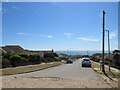
Longridge Avenue, Saltdean
by Malc McDonald geograph for square TQ3802 Longridge Avenue is a residential road in Saltdean, on the Sussex coast near... (more)
Tags:
Boundary
near:Brighton
County Boundary
county:East Sussex
type:Geograph
near:Newhaven
Residential
Residential Area
Residential Road
Residential Street
place:Saltdean
subject:Suburb
top:Suburb, Urban Fringe
Unitary Authority Boundary
|
|
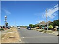
Longridge Avenue, Saltdean
by Malc McDonald geograph for square TQ3802 Longridge Avenue is a residential road in Saltdean, on the Sussex coast near... (more)
Tags:
Boundary
top:Boundary, Barrier
near:Brighton
County Boundary
county:East Sussex
type:Geograph
near:Newhaven
Residential
Residential Area
Residential Road
Residential Street
place:Saltdean
subject:Suburb
top:Suburb, Urban Fringe
Unitary Authority Boundary
|
|
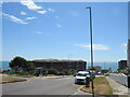
Longridge Avenue, Saltdean
by Malc McDonald geograph for square TQ3802 Longridge Avenue is a residential road in Saltdean, on the Sussex coast near... (more)
Tags:
Boundary
top:Boundary, Barrier
near:Brighton
County Boundary
county:East Sussex
type:Geograph
near:Newhaven
Residential
Residential Area
Residential Road
Residential Street
place:Saltdean
subject:Suburb
top:Suburb, Urban Fringe
Unitary Authority Boundary
|
|
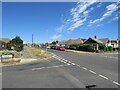
Longridge Avenue, Saltdean
by Malc McDonald geograph for square TQ3802 Longridge Avenue is a residential road in Saltdean, on the Sussex coast near... (more)
Tags:
Boundary
top:Boundary, Barrier
near:Brighton
County Boundary
county:East Sussex
type:Geograph
near:Newhaven
Residential
Residential Area
Residential Road
Residential Street
place:Saltdean
subject:Suburb
top:Suburb, Urban Fringe
Unitary Authority Boundary
|

|
Former Newhaven Seaplane Station
by Ian Capper geograph for square TQ4500 The concrete base of one of the hangars of the former RNAS Newhaven Seaplane... (more)
Tags:
top:Air Transport
top:Coastal
top:Defence, Military
type:Geograph
Helipad
near:Newhaven
place:Newhaven Seaplane Station
place:RNAS Newhaven Seaplane Station
place:Tide Mills
|

|
Newhaven incinerator from the train
by Robin Stott geograph for square TQ4402 On OpenStreetMap it is labelled North Quay Newhaven Energy Recovery Facility... (more)
Tags:
postcode district:BN9
top:Coastal
type:Geograph
Incinerator
Incinerator Bottom Ash
top:Lowlands
near:Newhaven
top:Suburb, Urban Fringe
top:Waste, Waste Management
|

|
England Coast Path at Telscombe Cliffs, near Newhaven
by Malc McDonald geograph for square TQ3901 The England Coast Path at Telscombe Cliffs, between Brighton and Newhaven.
Tags:
near:Brighton
county:East Sussex
long distance path:England Coast Path
England Coast Path
path:England Coast Path
type:Geograph
near:Newhaven
subject:Path
top:Paths
Public Footpath
near:Saltdean
place:Telscombe Cliffs
|
|
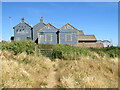
England Coast Path at Telscombe Cliffs, near Newhaven
by Malc McDonald geograph for square TQ3901 A view of the England Coast Path at Telscombe Cliffs, between Brighton and Newhaven.
Tags:
near:Brighton
county:East Sussex
path:England Coast Path
long distance path:England Coast Path
England Coast Path
type:Geograph
near:Newhaven
subject:Path
top:Paths
Public Footpath
near:Saltdean
place:Telscombe Cliffs
|

|
Sewage outfall, Telscombe Cliffs, near Newhaven
by Malc McDonald geograph for square TQ3901 A sewage outfall pipe at Telscombe Cliffs, on the south coast between Brighton... (more)
Tags:
near:Brighton
top:Coastal
county:East Sussex
type:Geograph
near:Newhaven
near:Saltdean
Sewage Outfall
Sewage Outfall Pipe
subject:Sewer
place:Telscombe Cliffs
|
|
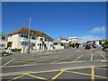
Longridge Avenue, Saltdean
by Malc McDonald geograph for square TQ3801 Longridge Avenue runs along the boundary between Brighton & Hove unitary... (more)
Tags:
top:Boundary, Barrier
near:Brighton
boundary:County
County Boundary
county:East Sussex
type:Geograph
near:Newhaven
place:Saltdean
subject:Suburb
top:Suburb, Urban Fringe
Unitary Authority Boundary
|
|
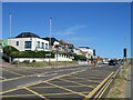
South Coast Road, Saltdean
by Malc McDonald geograph for square TQ3801 South Coast Road is on the route of the A259 as it leaves Saltdean, crossing the... (more)
Tags:
road:A Road
road:A259
A259
top:Boundary, Barrier
near:Brighton
Coast Road
Coastal Road
boundary:County
County Boundary
County Boundary Sign
county:East Sussex
type:Geograph
near:Newhaven
top:Roads, Road Transport
place:Saltdean
top:Suburb, Urban Fringe
Unitary Authority Boundary
|

|
Low tide at Saltdean
by Malc McDonald geograph for square TQ3801 A view along the coastline at Saltdean, taken at low tide.
To the left, a... (more)
|

|
Ramp to the shore, Saltdean
by Malc McDonald geograph for square TQ3801 A ramp enables vehicles to access the undercliff walk and beach in an emergency.... (more)
Tags:
near:Brighton
top:Coastal
Emergency Access Gate
Emergency Vehicles Access
long distance path:England Coast Path
England Coast Path
path:England Coast Path
subject:Gate
type:Geograph
National Cycle Network
NCN
NCN2
near:Newhaven
place:Saltdean
|

|
Former Newhaven Seaplane Station
by Ian Capper geograph for square TQ4500 The concrete base of one of the hangars of the former RNAS Newhaven Seaplane... (more)
Tags:
top:Air Transport
top:Coastal
top:Defence, Military
type:Geograph
near:Newhaven
place:Newhaven Seaplane Station
place:RNAS Newhaven Seaplane Station
place:Tide Mills
|

|
Roadside stone
by Ian Capper for square SK1761 Stone alongside the road that runs south from near Middleton towards the A5012... (more)
Tags:
sculptor:Celia Kilner
type:Close Look
poet:David Fine
Marker Stone
near:Middleton
near:Newhaven
top:People, Events
top:Roads, Road Transport
project:Sites of Meaning
|

|
Tide Mills Beach
by Ian Capper geograph for square TQ4500 Looking along the track that runs alongside the shingle bank at the top of Tide... (more)
Tags:
top:Coastal
type:Geograph
near:Newhaven
place:Newhaven Seaplane Station
top:Paths
place:RNAS Newhaven Seaplane Station
place:Tide Mills
place:Tide Mills Beach
|

|
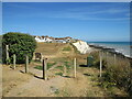
The Promenade, Peacehaven, near Newhaven
by Malc McDonald geograph for square TQ4000 The Promenade runs along part of the clifftop at Peacehaven, on the Sussex... (more)
Tags:
near:Brighton
county:East Sussex
long distance path:England Coast Path
England Coast Path
path:England Coast Path
type:Geograph
near:Newhaven
place:Peacehaven
Residential Area
near:Saltdean
subject:Suburb
top:Suburb, Urban Fringe
|
|
England Coast Path at Peacehaven, near Newhaven
by Malc McDonald geograph for square TQ4000 The England Coast Path clings to the clifftop at Peacehaven, on the Sussex coast.
Tags:
near:Brighton
Clifftop
Clifftop Path
subject:Coast
top:Coastal
Coastal Path
county:East Sussex
long distance path:England Coast Path
England Coast Path
path:England Coast Path
type:Geograph
near:Newhaven
top:Paths
place:Peacehaven
near:Saltdean
|

|
The Promenade, Peacehaven, near Newhaven
by Malc McDonald geograph for square TQ4000 The Promenade runs a short distance along the clifftop at Peacehaven, on the... (more)
Tags:
near:Brighton
Clifftop
subject:Coast
top:Coastal
county:East Sussex
long distance path:England Coast Path
England Coast Path
path:England Coast Path
type:Geograph
near:Newhaven
place:Peacehaven
near:Saltdean
top:Suburb, Urban Fringe
|
|
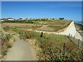
England Coast Path at Telscombe Cliffs, near Newhaven
by Malc McDonald geograph for square TQ4001 A view of the England Coast Path on the clifftop at Telscombe Cliffs, on the Sussex coast.
Tags:
near:Brighton
Clifftop
Clifftop Path
top:Coastal
county:East Sussex
path:England Coast Path
long distance path:England Coast Path
England Coast Path
type:Geograph
near:Newhaven
subject:Path
top:Paths
Public Footpath
near:Saltdean
place:Telscombe Cliffs
|

|
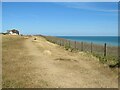
The Promenade, Telscombe Cliffs, near Newhaven
by Malc McDonald geograph for square TQ4001 The Promenade is a short stretch of minor road on the clifftop at Telscombe... (more)
Tags:
near:Brighton
Clifftop
subject:Coast
top:Coastal
county:East Sussex
path:England Coast Path
long distance path:England Coast Path
England Coast Path
type:Geograph
Minor Road
near:Newhaven
near:Saltdean
top:Suburb, Urban Fringe
place:Telscombe Cliffs
|
|
England Coast Path at Telscombe Cliffs, near Newhaven
by Malc McDonald geograph for square TQ4001 A view of the England Coast Path on the clifftop at Telscombe Cliffs, on the... (more)
Tags:
near:Brighton
Clifftop
Clifftop Path
top:Coastal
county:East Sussex
long distance path:England Coast Path
England Coast Path
path:England Coast Path
type:Geograph
near:Newhaven
subject:Path
top:Paths
Public Footpath
near:Saltdean
place:Telscombe Cliffs
|
|
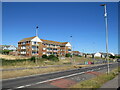
South Coast Road, Telscombe Cliffs, near Newhaven
by Malc McDonald geograph for square TQ3901 The South Coast Road is on the route of the A259 as it passes through Telscombe... (more)
Tags:
road:A Road
road:A259
A259
near:Brighton
Coast Road
Coastal Road
county:East Sussex
type:Geograph
near:Newhaven
near:Saltdean
subject:Suburb
top:Suburb, Urban Fringe
place:Telscombe Cliffs
|
|
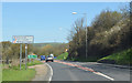
A26 out of Newhaven
by J.Hannan-Briggs geograph for square TQ4402 As Newhaven is a port, foreigners are reminded to drive on the left.
|

|
Milestone
by Ian Capper for square SK1761 Milestone alongside the road that runs south from near Middleton towards the... (more)
|

|
Road
by Ian Capper geograph for square SK1761 Looking along the road that runs south from near Middleton towards the A5012 and... (more)
|

|
Road
by Ian Capper geograph for square SK1761 Looking along the road that runs south from near Middleton towards the A5012 and... (more)
|

|
Harbour Heights
by Ian Capper geograph for square TV4499 Clifftop grassland on the western edge of Newhaven. In the background is the... (more)
|

|
Harbour Heights
by Ian Capper geograph for square TV4499 Clifftop grassland on the western edge of Newhaven. In the background is the... (more)
|
