Public Tags
Showing latest 50 of 205 images tagged with near:Peebles tag.

|
Eddleston Water path near Peebles
by Jim Barton geograph for square NT2442 The recently completed cyclepath to Eddleston by the A703 north of Peebles.
|

|
Morning Hill near Peebles
by Jim Barton geograph for square NT2439 Looking past Tantah House across Peebles to Ven Law and the Glentress... (more)
Tags:
type:Geograph
Gorse Bushes
Hill Path
top:Housing, Dwellings
top:Moorland
top:Paths
near:Peebles
View Across Town
|

|
Remains of old golf course, Peebles (4)
by Jim Barton geograph for square NT2439 With the founding of the Peebles Golf Club in 1893 a 9-hole golf course was made... (more)
Tags:
Former Golf Course
type:Geograph
top:Moorland
top:Paths
Pedestrian Gate
near:Peebles
top:Sport, Leisure
|

|
Peebles path reopened
by Jim Barton geograph for square NT2742 The path from Shieldgreen to Peebles has been reopened after it was... (more)
Tags:
Clear-Felled Forestry
Footpath Signpost
Forest Path
type:Geograph
top:Paths
near:Peebles
top:Woodland, Forest
|

|
Path on Janet's Brae, Peebles
by Jim Barton geograph for square NT2640 A path not shown on the 1:25,000, descending to meet the Peebles - Cardrona cyclepath.
|

|
Gate on the John Buchan Way above Peebles
by Jim Barton geograph for square NT2439 On the hill path leaving Peebles on the route to Broughton.
Tags:
type:Geograph
John Buchan Way
top:Moorland
top:Paths
Pedestrian Gate
near:Peebles
View of Town
Waymark Post
|

|
Track in Venlaw Woods, Peebles
by Jim Barton geograph for square NT2540 The access track from Glenbield descending to Peebles.
Tags:
type:Geograph
top:Paths
near:Peebles
top:Roads, Road Transport
Walker
Woodland Track
top:Woodland, Forest
|

|
Footpath sign at Standalane, Peebles
by Jim Barton for square NT2441 The drove road route crosses the Pentland Hills to West Linton, Romanno Bridge... (more)
Tags:
type:Close Look
Cross Borders Drove Road
Footpath Sign
top:Paths
near:Peebles
top:Suburb, Urban Fringe
|

|
Minor road north of Peebles
by Jim Barton geograph for square NT2442 The back road through farmland between Peebles and Winkston.
Tags:
top:Farm, Fishery, Market Gardening
Farmland
type:Geograph
Minor Road with Passing Places
near:Peebles
top:Roads, Road Transport
|

|
Forest road near Venlaw farm
by Jim Barton geograph for square NT2541 The forest road from Whitfold Hill bears right lower down to descend to the A72... (more)
Tags:
top:Farm, Fishery, Market Gardening
Forest Road
type:Geograph
Hill Pasture
top:Paths
near:Peebles
top:Roads, Road Transport
Woodland
top:Woodland, Forest
|

|
Sewage plant near Peebles
by Jim Barton for square NT2640 Presumably a pumping station a short distance west of the main sewage works at Eshiels.
|

|
Gas pipeline marker near Bonnington
by Jim Barton geograph for square NT2438 Marker no. 343 on the ethylene pipeline between Grangemouth and Wilton,... (more)
Tags:
top:Farm, Fishery, Market Gardening
Gas Pipeline Marker
type:Geograph
top:Industry
top:Paths
near:Peebles
|

|
Cyclepath to Eddleston
by Jim Barton geograph for square NT2441 The cyclepath leaving the northern side of Peebles. For much of its length it... (more)
|

|
Path to Bonnington, Peebles
by Jim Barton geograph for square NT2539 Sunshine after a heavy shower on the path near the Jubilee Park residential... (more)
|
|
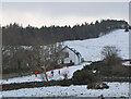
Winter walkers, Tantah
by Jim Barton geograph for square NT2439 On the John Buchan Way below Cademuir near Peebles.
Tags:
top:Air, Sky, Weather
type:Geograph
top:Housing, Dwellings
John Buchan Way
top:Paths
near:Peebles
Snowy Hillside
Walkers
top:Woodland, Forest
|

|
Railway path nearing Soonhope
by Jim Barton geograph for square NT2640 The cyclepath from Innerleithen meets the access road to Soonhope with Peebles... (more)
|

|
Fields near Standalane
by Jim Barton for square NT2341 Looking across the gorse fringing the southern slopes to the end of Jedderfield... (more)
Tags:
type:Cross Grid
top:Farm, Fishery, Market Gardening
Farmland
Gorse in Flower
near:Peebles
View of Town
top:Woodland, Forest
|

|
A field full of sheep
by Jim Barton for square NT2341 A field near Standalane farm seen from Hamilton Hill with Peebles golf course in... (more)
|

|
Track past the holiday cabins, Soonhope
by Jim Barton geograph for square NT2641 Access from Peebles to the holiday cabins by the Soonhope Burn.
|

|
Descent from Cademuir
by Jim Barton for square NT2439 The hill path bordering the plantation descends past Tantah to join the John... (more)
Tags:
Cademuir
type:Cross Grid
Grass and Heather Moorland
Hill Path
top:Moorland
top:Paths
near:Peebles
top:Suburb, Urban Fringe
View of Town
|

|
Rider on the John Buchan Way, Peebles
by Jim Barton geograph for square NT2439 Passing Tantah House on the ascent to the ridge of Cademuir.
Tags:
type:Geograph
Horse Rider
John Buchan Way
top:Moorland
top:Paths
near:Peebles
top:Sport, Leisure
|

|
Fallen tree in South Park Wood, Peebles
by Jim Barton geograph for square NT2339 Brought down by gales relatively recently.
|

|
Cottages at Tantah, Peebles
by Jim Barton geograph for square NT2439 Note the hare wind vane.
|

|
A ray of sunshine
by Jim Barton geograph for square NT2439 A rare glimpse of sunshine after several days of cloudy weather in a continuing... (more)
Tags:
top:Air, Sky, Weather
top:Farm, Fishery, Market Gardening
type:Geograph
John Buchan Way
top:Paths
Pedestrian Gate
near:Peebles
top:Suburb, Urban Fringe
Waymark Post
|

|
John Buchan Way on Cademuir
by Jim Barton for square NT2438 The path crossing moorland on the descent towards Peebles. In the background the... (more)
Tags:
top:Air, Sky, Weather
Cloud Cover
type:Cross Grid
Grass and Heather Moorland
Hill Path
John Buchan Way
top:Moorland
top:Paths
near:Peebles
|

|
Crossroads at Morning Hill, Peebles
by Jim Barton geograph for square NT2439 The junction with Edderston Road and the minor road to Manor Sware.
Tags:
Crossroads
top:Farm, Fishery, Market Gardening
Farmland
type:Geograph
near:Peebles
top:Roads, Road Transport
top:Suburb, Urban Fringe
|

|
Bonnington farm, Peebles
by Jim Barton geograph for square NT2538 Looking from the log cabin farm shop.
Tags:
Burn
top:Business, Retail, Services
Farm Access Track
Farm Buildings
top:Farm, Fishery, Market Gardening
type:Geograph
near:Peebles
|

|
Peebles from Cademuir Hill
by Jim Barton geograph for square NT2438 A Christmas Day free of snow and frost with light cloud cover. Looking from the... (more)
Tags:
type:Geograph
top:Moorland
top:Paths
near:Peebles
Plantation Edge
View Across Valley
View of Town
|

|
Gates and path by The Cut
by Jim Barton geograph for square NT2538 The path to Peebles passes through two gates here at the access to water for... (more)
Tags:
top:Farm, Fishery, Market Gardening
type:Geograph
top:Paths
near:Peebles
top:Rivers, Streams, Drainage
Watering Hole
Woodland Path
|

|
An oak tree, Walker's Haugh Peebles
by Jim Barton geograph for square NT2540 A fine tree only now beginning to shed its leaves.
Tags:
type:Geograph
Oak Tree
top:Paths
near:Peebles
Playing Fields
top:Sport, Leisure
top:Woodland, Forest
|

|
Woodland at Kerfield, Peebles
by Jim Barton geograph for square NT2540 A small area of woodland bordering the edge of the playing fields at The Gytes.
|

|
Cyclepath crossing
by Jim Barton geograph for square NT2442 The path to Eddleston crosses the minor road from Peebles to Winkston.... (more)
Tags:
Cyclepath and Road Junction
type:Geograph
top:Paths
near:Peebles
top:Roads, Road Transport
Surfaced Cyclepath
|

|
Cyclepath north of Peebles
by Jim Barton geograph for square NT2442 The path moves away from the A703 to skirt around a field. The hills around Glen... (more)
|

|
Chapelhill farm and Hamilton Hill
by Jim Barton geograph for square NT2442 A hill farm north of Peebles seen from the cyclepath to Eddleston.
Tags:
Farm Buildings
top:Farm, Fishery, Market Gardening
Farmland
type:Geograph
Hillside
top:Moorland
near:Peebles
|

|
Peebles from the Drove Road on Craig Head
by Jim Barton geograph for square NT2638 The views northward open up as the Drove Road gains height around Craig Head and... (more)
Tags:
Cross Borders Drove Road
type:Geograph
Metal Pedestrian Gate
top:Moorland
top:Paths
near:Peebles
top:Uplands
View of Town
|

|
Path by the Cut in autumn
by Jim Barton geograph for square NT2538 A pleasant walk alongside the drainage channel through farmland south of Peebles.
Tags:
Autumn Colours
Drainage Channel
type:Geograph
top:Paths
near:Peebles
top:Rivers, Streams, Drainage
Woodland Path
top:Woodland, Forest
|

|
Trees and fields, Venlaw farm
by Jim Barton geograph for square NT2541 Looking across the valley to the outskirts of Peebles at Standalane with the... (more)
Tags:
top:Farm, Fishery, Market Gardening
Farmland
type:Geograph
weather:Low Cloud
near:Peebles
View Across Valley
top:Woodland, Forest
|

|
Southwest from Falla Brae
by Jim Barton for square NT2739 Looking across farmland east of Peebles' outskirts to Cademuir Hill with... (more)
Tags:
type:Cross Grid
top:Farm, Fishery, Market Gardening
Farmland
Forestry Plantations
top:Moorland
near:Peebles
View Across Valley
top:Woodland, Forest
|

|
Field path to South Parks, Peebles
by Jim Barton for square NT2440 A descent to the outskirts of the town to the business park at South Parks.
Tags:
type:Cross Grid
top:Farm, Fishery, Market Gardening
Field Path
top:Paths
near:Peebles
top:Suburb, Urban Fringe
View Across Valley
View of Town
|

|
Peebles ahead
by Jim Barton geograph for square NT2339 The path descending from the road at Manor Sware.
Tags:
top:Farm, Fishery, Market Gardening
Field Path
type:Geograph
top:Paths
near:Peebles
View Across Valley
View of Town
|

|
Peebles Memorial Wood
by Jim Barton geograph for square NT2339 A plot overlooking the town from Manor Sware - see also NT2339 : Peebles Memorial Wood, Manor Sware.
|

|
Eshiels tunnel
by Jim Barton geograph for square NT2739 The cyclepath uses this short oblique tunnel under the A72 east of Peebles.... (more)
Tags:
top:Derelict, Disused
Former Railway Route
type:Geograph
top:Paths
near:Peebles
top:Railways
Surfaced Cyclepath
Tunnel Under Road
|

|
Drove Road at Standalane, Peebles
by Jim Barton geograph for square NT2441 On the way up Hamilton Hill past the sheep pens on the Cross Borders Drove Road.
Tags:
Cross Borders Drove Road
top:Farm, Fishery, Market Gardening
Farmland
type:Geograph
Hill Track
top:Paths
near:Peebles
Sheep Pens
|

|
Access track for Glenbield
by Jim Barton geograph for square NT2641 The track from Peebles to the kennels at Glenbield.
Tags:
Access Track
type:Geograph
Gorse in Bloom
top:Paths
near:Peebles
top:Roads, Road Transport
Woodland
top:Woodland, Forest
|

|
Bridge over the Soonhope Burn
by Jim Barton geograph for square NT2640 The bridge carries the cyclepath between Peebles and Innerleithen.
|

|
Canoe on the Tweed, Peebles
by Jim Barton geograph for square NT2639 Boats on the Tweed are not very common this far up the river, but a canoe may be... (more)
|

|
Track descending to Peebles
by Jim Barton geograph for square NT2341 The track from Hamilton Hill through Jedderfield plantation.
|

|
Food on the way, Hamilton Hill
by Jim Barton geograph for square NT2342 A trailer of silage being brought up to cattle on the hillside above Peebles.
Tags:
Cattle in Field
top:Farm, Fishery, Market Gardening
Farmland
type:Geograph
near:Peebles
Tractor and Trailer
|

|
Minor road at Standalane
by Jim Barton geograph for square NT2441 The minor road from Winkston to Peebles on the northern edge of the town.
Tags:
type:Geograph
Minor Road
near:Peebles
top:Roads, Road Transport
top:Suburb, Urban Fringe
top:Woodland, Forest
|
|
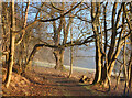
Sunlit trees above Peebles Hydro
by Jim Barton geograph for square NT2640 The woodland path above the hotel with sun rising above valley fog on a frosty morning.
|
