About tags on Geograph

Public Tags

Related Tags | Coverage Map
Prefix: near    Tag:  Poole·Harbour  
Other tags: Poole Harbour     place:Poole Harbour    

Showing images tagged with near:Poole Harbour tag.

View all tagged images - In Browser

SZ0090 : Ordnance Survey Benchmark on the Hotel Du Vin, Poole by Owen lovell Ordnance Survey Benchmark on the Hotel Du Vin, Poole by Owen lovell
for square SZ0090
Benchmark on the Hotel Du Vin. Full information can be found here... (more)
Tags: subject:Benchmark   Benchmark Site   Benchmarks   top:Business, Retail, Services   top:City, Town Centre   type:Close Look   Cut Benchmark   subject:Hotel   building type:Hotel   Ordnance Survey Benchmark   OS Benchmark   near:Poole   place:Poole   Poole   near:Poole Harbour   place:Poole Harbour   top:Sport, Leisure   Wall Benchmark  
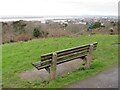
SZ0392 : Upper Parkstone viewpoint, near Poole by Malc McDonald Upper Parkstone viewpoint, near Poole by Malc McDonald
geograph for square SZ0392
A viewpoint at Upper Parkstone, with views over Poole Harbour. This image was... (more)
Tags: Bench   Bench Seat   top:Coastal   county:Dorset   type:Geograph   place:Parkstone   near:Poole   near:Poole Harbour   Seat with a View   Viewpoint  
SZ0285 : Track on Studland Heath, south of Jerry's Point, Poole Harbour by Phil Champion Track on Studland Heath, south of Jerry's Point, Poole Harbour by Phil Champion
geograph for square SZ0285
Tags: top:Coastal   county:Dorset   type:Geograph   Heath   top:Heath, Scrub   subject:Heathland   place:Isle of Purbeck   near:Jerrys Point   National Nature Reserve   near:Poole Harbour   Purbeck   place:Studland   place:Studland Heath  
SY9791 : Holton Point, southwest shore of Lytchett Bay, west of Poole by Robin Stott Holton Point, southwest shore of Lytchett Bay, west of Poole by Robin Stott
geograph for square SY9791
Gabions, lower left, protect the railway embankment from this tidal extension of... (more)
Tags: subject:Bay   top:Coastal   top:Estuary, Marine   type:Geograph   Inlet   top:Lowlands   near:Poole   near:Poole Harbour   Saltmarsh   Tidal Mudflats  
SY9990 : Level crossing at Hamworthy, near Poole by Malc McDonald Level crossing at Hamworthy, near Poole by Malc McDonald
geograph for square SY9990
A level crossing without barriers or gates, across Ashmore Avenue in Hamworthy,... (more)
SZ0090 : Poole Quay and Custom House by Malc McDonald Poole Quay and Custom House by Malc McDonald
geograph for square SZ0090
A view of Poole Quay, with the former custom house building. The custom house,... (more)
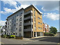
SZ0090 : Apartment block on Norton Way, Hamworthy, near Poole by Malc McDonald Apartment block on Norton Way, Hamworthy, near Poole by Malc McDonald
geograph for square SZ0090
A modern apartment block on Norton Way in Hamworthy, near Poole.
Tags: building type:Apartment   building type:Apartment Block   subject:Apartment Block   Apartment Block   housing:Apartments   type:Geograph   place:Hamworthy   top:Housing, Dwellings   Modern Apartment Block   Modern Apartments   near:Poole   near:Poole Harbour  
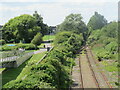
SZ0090 : Disused railway tracks, Hamworthy, near Poole by Malc McDonald Disused railway tracks, Hamworthy, near Poole by Malc McDonald
geograph for square SZ0090
A disused railway line which had previously used by freight trains to and from... (more)
SZ0092 : Green and sandy mudflats, northeast shore of Holes Bay, Poole by Robin Stott Green and sandy mudflats, northeast shore of Holes Bay, Poole by Robin Stott
geograph for square SZ0092
I was on one of these: SZ0092 : Crossing Holes Bay, looking to the right. You can just make out... (more)
Tags: subject:Bay   top:Coastal   top:Estuary, Marine   top:Flat Landscapes   type:Geograph   Inlet   near:Poole   near:Poole Harbour   Saltmarsh   top:Suburb, Urban Fringe   Tidal Mudflats  
SZ0092 : Mudflats and northeast shore of Holes Bay, Poole by Robin Stott Mudflats and northeast shore of Holes Bay, Poole by Robin Stott
geograph for square SZ0092
Photographed from here: SZ0092 : Crossing Holes Bay, looking to the right. Lighting columns... (more)
Tags: subject:Bay   top:Coastal   top:Estuary, Marine   top:Flat Landscapes   type:Geograph   Inlet   near:Poole   near:Poole Harbour   top:Suburb, Urban Fringe   Tidal Mudflats  
SZ0090 : High Street, Poole by Malc McDonald High Street, Poole by Malc McDonald
geograph for square SZ0090
The High Street in Poole, at its junction with Poole Quay. The High Street is... (more)
SZ0090 : The King Charles Public House on Thames Street, Poole by Rod Grealish The King Charles Public House on Thames Street, Poole by Rod Grealish
geograph for square SZ0090
The King Charles Public House is a Grade II listed building. Initially it was a... (more)
Tags: date:1770   postcode district:BH15   unitary authority:Bournemouth Christchurch and Poole   top:Business, Retail, Services   top:City, Town Centre   type:Geograph   Grade II Listed   top:Park and Public Gardens   place:Poole   near:Poole Harbour   subject:Public House   top:Sport, Leisure   on:Thames Street   name:The King Charles  
SZ0090 : High Street, Poole by Malc McDonald High Street, Poole by Malc McDonald
geograph for square SZ0090
The High Street in Poole. The street has been pedestrianised.
View more in the Image Search or in Browser
View images matching 'Poole Harbour' anywhere in the tags
Don't click these: PotMel 1 PotMel 2