Public Tags
Showing images tagged with near:Shoreham tag.

|
Beneath Shoreham Flyover
by Paul Gillett geograph for square TQ2006 Category: Flyover On the Downs Link path going north from Shoreham, the flyover carries the A27... (more)
|

|
Gate by Downs Link
by Paul Gillett geograph for square TQ2007 Near to the River Adur, north of Shoreham
|

|
Downs Link Cycle Path
by Paul Gillett geograph for square TQ2006 Category: Cycle path Taken to the north of the Shoreham Bypass
|

|
Tree by Downs Link
by Paul Gillett geograph for square TQ1908 Near Beeding Cement works
|

|
High Street, Steyning, near Shoreham-by-Sea
by Malc McDonald geograph for square TQ1711 The high street in the small town of Steyning in West Sussex.
Tags:
near:Brighton
top:City, Town Centre
Clock
Clock Tower
type:Geograph
High Street
near:Shoreham
near:Shoreham by Sea
place:Steyning
subject:Town
county:West Sussex
near:Worthing
|

|
Steyning Fire Station, near Shoreham-by-Sea
by Malc McDonald geograph for square TQ1711 A fire station in the small town of Steyning in West Sussex.
Tags:
near:Brighton
Fire Station
subject:Fire Station
type:Geograph
top:Public Buildings and Spaces
near:Shoreham
near:Shoreham by Sea
place:Steyning
county:West Sussex
near:Worthing
|

|
Mouse Lane, Steyning, near Shoreham-by-Sea
by Malc McDonald geograph for square TQ1611 Mouse Lane is a minor lane on the edge of the town of Steyning in West Sussex.
Tags:
near:Brighton
type:Geograph
subject:Lane
Minor Country Lane
Minor Lane
Minor Rural Lane
top:Roads, Road Transport
Rural Lane
near:Shoreham
near:Shoreham by Sea
place:Steyning
county:West Sussex
near:Worthing
|

|
Mouse Lane, Steyning, near Shoreham-by-Sea
by Malc McDonald geograph for square TQ1711 Mouse Lane is a minor lane leading out of the town of Steyning in West Sussex.... (more)
Tags:
near:Brighton
type:Geograph
subject:Lane
near:Shoreham
near:Shoreham by Sea
place:Steyning
top:Suburb, Urban Fringe
county:West Sussex
near:Worthing
|

|
Church Street, Steyning, near Shoreham-by-Sea
by Malc McDonald geograph for square TQ1711 A mini-roundabout at the end of Church Street in the town of Steyning in West Sussex.
Tags:
near:Brighton
top:City, Town Centre
type:Geograph
Mini-Roundabout
Painted Mini Roundabout
near:Shoreham
near:Shoreham by Sea
place:Steyning
county:West Sussex
near:Worthing
|

|
Tree lopping, Steyning, near Shoreham-by-Sea
by Malc McDonald geograph for square TQ1710 An open-top double-deck bus being used for tree lopping in Steyning, in Sussex.... (more)
Tags:
near:Brighton
type:Geograph
Open Top Bus
near:Shoreham
near:Shoreham by Sea
place:Steyning
Tree-Lopping
subject:Village
top:Village, Rural Settlement
county:West Sussex
near:Worthing
|

|
Public bridleway at Steyning, near Shoreham-by-Sea
by Malc McDonald geograph for square TQ1611 A signpost indicates the route of a public bridleway along a gated track on the... (more)
Tags:
rights of way:Bridleway
subject:Bridleway
Bridleway
Bridleway Direction Sign
Bridleway Sign
Bridleway Signpost
near:Brighton
type:Geograph
top:Paths
Public Bridleway
Public Bridleway on Driveway
Public Bridleway Signpost
near:Shoreham
near:Shoreham by Sea
place:Steyning
county:West Sussex
near:Worthing
|
|
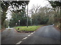
Road junction near Shoreham
by Malc McDonald geograph for square TQ5162 A country lane junction near the Kent village of Shoreham.
Tags:
near:Eynsford
type:Geograph
county:Kent
Minor Country Road
Minor Road Junction
junction:Minor Roads
Minor Rural Road
Road Junction
subject:Road Junction
top:Roads, Road Transport
Rural Road Junction
Rural Roads
near:Shoreham
|

|
Memorial stone near Shoreham (Kent)
by Malc McDonald geograph for square TQ5162 A memorial stone by the roadside near Shoreham, in Kent.
Tags:
near:Eynsford
type:Geograph
top:Historic Sites and Artefacts
county:Kent
subject:Memorial
Memorial
Memorial Stone
near:Shoreham
|
|
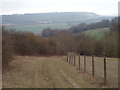
Footpath near Shoreham
by Malc McDonald geograph for square TQ5162 A public footpath near Shoreham, in the Kent countryside. The hills in this... (more)
Tags:
near:Eynsford
type:Geograph
county:Kent
place:North Downs
North Downs
subject:Path
top:Paths
Public Footpath
Public Right of Way
near:Shoreham
|
|
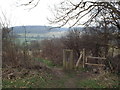
Stile near Shoreham
by Malc McDonald geograph for square TQ5163 A stile and dog gate on a footpath in Kent countryside, near Shoreham. The dog... (more)
Tags:
Dog Gate
near:Eynsford
Footpath Stile
type:Geograph
county:Kent
top:Paths
Public Footpath
Public Footpath Stile
Public Right of Way
near:Shoreham
Stile
subject:Stile
Stile and Gate
Wooden Stile
|

|
Footpath near Shoreham
by Malc McDonald geograph for square TQ5161 A public footpath in the Kent countryside, near Shoreham.
|

|
Path on White Hill near Shoreham
by Malc McDonald geograph for square TQ5261 A path on White Hill, near Shoreham in Kent.
|

|
Whitehill Farm track, near Shoreham
by Malc McDonald geograph for square TQ5361 A track leading to Whitehill Farm, near Shoreham in Kent. The sign on the tree... (more)
|

|
Kent countryside near Shoreham
by Malc McDonald geograph for square TQ5360 A view of coutryside near Shoreham, Kent.
|

|
Footpath near Shoreham
by Malc McDonald geograph for square TQ5162 A public footpath leading into woodland near Shoreham, in Kent.
Tags:
path:Footpath
Footpath
Footpath Sign
Footpath Signpost
type:Geograph
county:Kent
subject:Path
top:Paths
sign:Public Footpath
Public Footpath
Public Footpath Sign
Public Footpath Signpost
near:Shoreham
|

|
Public Bridleway near Shoreham
by Malc McDonald geograph for square TQ5261 A public bridleway through the woods near Shoreham, Kent.
Tags:
path:Bridleway
Bridleway Sign
January
place:Kent
top:Paths
sign:Public Bridleway
Public Bridleway
Public Right of Way
near:Shoreham
top:Woodland, Forest
|

|
Public bridleway near Shoreham
by Malc McDonald geograph for square TQ5361 A public bridleway near Shoreham, Kent.
The trees have shed their leaves... (more)
Tags:
rights of way:Bridleway
Bridleway
path:Bridleway
January
place:Kent
top:Paths
Public Bridleway
Public Right of Way
near:Shoreham
Winter Sun
Winter Sunshine
|

|
Public bridleway near Shoreham
by Malc McDonald geograph for square TQ5361 A public bridleway through woodland near Shoreham, Kent.
Tags:
path:Bridleway
rights of way:Bridleway
Bridleway
Bridleway Sign
Bridleway Signpost
January
place:Kent
top:Paths
Public Bridleway
sign:Public Bridleway
Public Right of Way
near:Shoreham
Winter Sun
Winter Sunshine
|

|
Shoreham Woods car park
by Ian Capper geograph for square TQ5061 Car park and visitors centre in Andrew's Wood, part of the Shoreham Woods... (more)
|

|
Path into Meenfield Wood, Shoreham
by Malc McDonald geograph for square TQ5161 A footpath leading into woodland near Shoreham in Kent.
Tags:
type:Geograph
county:Kent
subject:Path
top:Paths
near:Shoreham
Stepped
Stepped Footpath
Steps
Woodland Path
top:Woodland, Forest
|

|
Meenfield Wood, Shoreham
by Malc McDonald geograph for square TQ5162 A track leading into Meenfield Wood near Shoreham. A footpath leads off to the left.
Tags:
Footpath
type:Geograph
county:Kent
subject:Path
top:Paths
Public Footpath
near:Shoreham
top:Woodland, Forest
|

|
Farm track at Great Cockerhurst, near Shoreham (Kent)
by Malc McDonald geograph for square TQ5163 This farm track, leading to Greenacres farm, is a public right of way for walkers.
Tags:
near:Eynsford
Farm Access Track
Farm Track
Gate
type:Geograph
place:Great Cockerhurst
county:Kent
Public Footpath
Public Right of Way
top:Roads, Road Transport
near:Shoreham
near:Swanley
subject:Track
|

|
Road junction at Great Cockerhurst, near Shoreham
by Malc McDonald geograph for square TQ5063 A road junction at Great Cockerhurst, in the Kent countryside.
Tags:
3-Arm Signpost
near:Eynsford
type:Geograph
place:Great Cockerhurst
county:Kent
subject:Road Junction
Road Junction
top:Roads, Road Transport
Rural Road Junction
near:Shoreham
near:Swanley
|

|
Great Cockerhurst, near Shoreham (Kent)
by Malc McDonald geograph for square TQ5063 A road junction at Great Cockerhurst, in the Kent countryside. In the... (more)
Tags:
near:Eynsford
type:Geograph
place:Great Cockerhurst
subject:Hamlet
county:Kent
Road Junction
Rural Road Junction
near:Shoreham
near:Swanley
top:Village, Rural Settlement
|

|
Track junction
by Ian Capper geograph for square TQ5162 Track junction on the edge of Meenfield Wood, part of the Shoreham Woods complex... (more)
|

|
Path on the hillside, Shoreham
by Malc McDonald geograph for square TQ5161 A path on the hillside leading down to the village of Shoreham, in Kent.
Tags:
Footpath Gate
Gate
subject:Gate
Gate and Kissing Gate
type:Geograph
Hillside Path
county:Kent
gate:Kissing Gate
Kissing Gate
top:Lowlands
footpath gate:Metal Kissing
gate:Metal Kissing
Metal Kissing Gate
top:Paths
near:Shoreham
|

|
Shacklands Road, Shoreham
by Malc McDonald geograph for square TQ5162 Shacklands Road passing through Kent countryside close to the village of... (more)
Tags:
Country Lane
Footpath Signpost
type:Geograph
county:Kent
Minor Country Road
Minor Rural Road
Public Footpath Signpost
subject:Road
top:Roads, Road Transport
Rural Lane
Rural Road
near:Shoreham
|
|
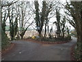
Road junction near Shoreham
by Malc McDonald geograph for square TQ5162 The junction of Castle Farm Road and Cockerhurst Road, in woodland in Kent.
Tags:
near:Eynsford
type:Geograph
county:Kent
Minor Country Road
Minor Road Junction
junction:Minor Roads
Minor Rural Road
subject:Road Junction
Road Junction
top:Roads, Road Transport
Rural Road Junction
Rural Roads
near:Shoreham
top:Woodland, Forest
|

|
Fackenden Lane, near Shoreham
by Malc McDonald geograph for square TQ5361 |

|
Meenfield Wood sign
by Ian Capper for square TQ5162 Sign for Meenfield Wood at track junction in TQ5162 : Track junction.
|

|
Pylons near Great Cockerhurst
by Malc McDonald geograph for square TQ5163 Electricity pylons in the Kent countryside.
Tags:
Electricity Pylon
Electricity Pylons
top:Energy Infrastructure
near:Eynsford
type:Geograph
place:Great Cockerhurst
county:Kent
Power Pylon
Power Pylons
subject:Pylon
Pylon
Pylons
near:Shoreham
near:Swanley
|

|
M25 approaching an elegant bridge
by Julian P Guffogg geograph for square TQ5060 The bridge, near Pilot's wood, carries a footpath, and is almost directly... (more)
|

|
Towards the Darent Valley
by Ian Capper geograph for square TQ5163 Looking towards the Darent Valley from by Redmans Lane.
|
|
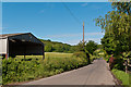
Timberden Farm
by Ian Capper geograph for square TQ5162 Outbuildings of this farm on Shacklands Road.
|

|
Towards Cockerhurst Road
by Ian Capper geograph for square TQ5162 Looking across fields from Shacklands Road towards buildings in Cockerhurst Road.
|
