About tags on Geograph

Public Tags

Related Tags | Coverage Map
Prefix: near    Tag:  Stafford  
Other tags: Stafford     county:Stafford     district:Stafford     district council:Stafford     place:Stafford     post town:Stafford     posttown:Stafford     railway station:Stafford    

Showing images tagged with near:Stafford tag.

View all tagged images - In Browser
:

SJ9625 : Stafford: road near Park Farm by Jonathan Hutchins Stafford: road near Park Farm by Jonathan Hutchins
geograph for square SJ9625
This is also public footpath Hopton and Coton 18. It runs NW to join the A518... (more)
Tags: top:Paths   subject:Road   near:Stafford   Stafford Horse Trials  
SJ9425 : View of tree-covered Beacon Hill near Stafford by Rod Grealish View of tree-covered Beacon Hill near Stafford by Rod Grealish
for square SJ9425
The view was taken from the upper floors of The County Hospital, Stafford, when... (more)
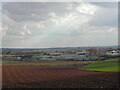
SJ9424 : View from Beacon Hill to RAF Maintenance Unit and Stafford by Rod Grealish View from Beacon Hill to RAF Maintenance Unit and Stafford by Rod Grealish
geograph for square SJ9424
Stafford is in the far distance. The green-grey buildings beyond the ploughed... (more)
SJ8930 : Stafford Services by Steven Haslington Stafford Services by Steven Haslington
geograph for square SJ8930
The entrance to the (southbound) Stafford Services, in Staffordshire, England.
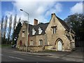
SJ9323 : Stafford: former Lodge of Coton Hill Asylum by Jonathan Hutchins Stafford: former Lodge of Coton Hill Asylum by Jonathan Hutchins
geograph for square SJ9323
149-151 Weston Road is a former lodge of the Coton Hill Asylum, built in the... (more)
SJ9422 : Canal towpath near Baswich Stafford by Rod Grealish Canal towpath near Baswich Stafford by Rod Grealish
geograph for square SJ9422
The Staffordshire and Worcestershire Canal is a navigable canal linking the... (more)
Tags: place:Baswich   subject:Canal Towpath   top:Canals   type:Geograph   postcode district:ST18   near:Stafford   county:Staffordshire   canal:Staffordshire and Worcestershire   top:Suburb, Urban Fringe  
SJ8725 : Victorian wall-mounted postbox, Seighford near Stafford by Rod Grealish Victorian wall-mounted postbox, Seighford near Stafford by Rod Grealish
for square SJ8725
A Victorian wall-mounted postbox on Clanford Road, Seighford near Stafford.
SJ8824 : Cooper Perry Primary School, Seighford near Stafford by Rod Grealish Cooper Perry Primary School, Seighford near Stafford by Rod Grealish
geograph for square SJ8824
Cooper Perry Primary School, Seighford near Stafford is named after Sir Edwin... (more)
Tags: person:Cooper Perry   school:Cooper Perry Junior School   top:Educational Sites   type:Geograph   subject:School   place:Seighford   postcode district:ST18   near:Stafford   county:Staffordshire   top:Village, Rural Settlement  
SJ9422 : Foot and Cycle Bridge crossing valley of Rivers Sow and Penk near Stafford by Rod Grealish Foot and Cycle Bridge crossing valley of Rivers Sow and Penk near Stafford by Rod Grealish
geograph for square SJ9422
The image shows part of the foot and cycle bridge built in 2014 to allow... (more)
Tags: subject:Bridge   top:Flat Landscapes   Foot and Cycle Bridge   type:Geograph   top:Paths   River Penk   River Sow   top:Rivers, Streams, Drainage   postcode district:ST16   near:Stafford   county:Staffordshire  
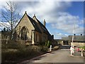
SJ9323 : County Hospital, Stafford: Library and Postgraduate Medical Centre by Jonathan Hutchins County Hospital, Stafford: Library and Postgraduate Medical Centre by Jonathan Hutchins
geograph for square SJ9323
The Library is housed in the former chapel of the Coton Hill Asylum, built in... (more)
SJ9323 : County Hospital, Stafford: staff car park by Jonathan Hutchins County Hospital, Stafford: staff car park by Jonathan Hutchins
geograph for square SJ9323
SJ8825 : View over Seighford near Stafford by Rod Grealish View over Seighford near Stafford by Rod Grealish
for square SJ8825
A view of Seighford taken from Oldford Lane looking north, showing the red-brick... (more)
Tags: type:Cross Grid   top:Farm, Fishery, Market Gardening   Farmland   top:Grassland   near:Seighford   postcode district:ST18   near:Stafford   county:Staffordshire   subject:View   top:Village, Rural Settlement  
SJ9625 : Stafford Horse Trials: rolltop on the cross-country course by Jonathan Hutchins Stafford Horse Trials: rolltop on the cross-country course by Jonathan Hutchins
geograph for square SJ9625
Tags: type:Geograph   top:Grassland   subject:Horse Jump   top:Sport, Leisure   near:Stafford   Stafford Horse Trials  
SJ9625 : Stafford Horse Trials: showjumping arena by Jonathan Hutchins Stafford Horse Trials: showjumping arena by Jonathan Hutchins
geograph for square SJ9625
SJ9625 : Stafford Horse Trials: lorry park by Jonathan Hutchins Stafford Horse Trials: lorry park by Jonathan Hutchins
geograph for square SJ9625
SJ9625 : Stafford Horse Trials: lorry park by Jonathan Hutchins Stafford Horse Trials: lorry park by Jonathan Hutchins
geograph for square SJ9625
A bridleway designated Tixall 0.1628, runs along the line of the wall.
SJ9625 : Stafford Horse Trials: edge of lorry park and bridleway by Jonathan Hutchins Stafford Horse Trials: edge of lorry park and bridleway by Jonathan Hutchins
geograph for square SJ9625
The cars are parked right on the bridleway itself which runs along the wall.
SJ9524 : Stafford Horse Trials: water obstacle with wind turbine by Jonathan Hutchins Stafford Horse Trials: water obstacle with wind turbine by Jonathan Hutchins
geograph for square SJ9524
SJ9524 : Stafford Horse Trials: Ship Wreck by Jonathan Hutchins Stafford Horse Trials: Ship Wreck by Jonathan Hutchins
geograph for square SJ9524
Park Farm is behind this cross-country fence.
SJ9524 : Stafford Horse Trials: water obstacle by Jonathan Hutchins Stafford Horse Trials: water obstacle by Jonathan Hutchins
geograph for square SJ9524
SJ9625 : Stafford Horse Trials: burger bar by Jonathan Hutchins Stafford Horse Trials: burger bar by Jonathan Hutchins
geograph for square SJ9625
SJ9524 : Stafford Horse Trials: sunken road by Jonathan Hutchins Stafford Horse Trials: sunken road by Jonathan Hutchins
geograph for square SJ9524
Park Farm is in the background.
SJ9524 : Stafford Horse Trials: dogs' pit stop by Jonathan Hutchins Stafford Horse Trials: dogs' pit stop by Jonathan Hutchins
geograph for square SJ9524
Canine thirst-quenching facilities provided by a thoughtful fence judge. In the... (more)
SJ9625 : Stafford Horse Trials: showjumping arena by Jonathan Hutchins Stafford Horse Trials: showjumping arena by Jonathan Hutchins
geograph for square SJ9625
Weetman's Plantation is in the background.
SJ9625 : Stafford Horse Trials: showjumping by Jonathan Hutchins Stafford Horse Trials: showjumping by Jonathan Hutchins
geograph for square SJ9625
Lucy Rudd and Chiefs Blue Moon in the BE80(T) class.
SJ9625 : Stafford Horse Trials: lorry park looking to Weetman's Plantation by Jonathan Hutchins Stafford Horse Trials: lorry park looking to Weetman's Plantation by Jonathan Hutchins
geograph for square SJ9625
SJ9625 : Stafford Horse Trials: dressage arenas and wind turbine by Jonathan Hutchins Stafford Horse Trials: dressage arenas and wind turbine by Jonathan Hutchins
geograph for square SJ9625
SJ9625 : Stafford Horse Trials: showjumping arena by Jonathan Hutchins Stafford Horse Trials: showjumping arena by Jonathan Hutchins
geograph for square SJ9625
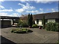
SJ9323 : County Hospital, Stafford: landscaping at Postgraduate Medical Centre by Jonathan Hutchins County Hospital, Stafford: landscaping at Postgraduate Medical Centre by Jonathan Hutchins
geograph for square SJ9323
The PGMC is constructed around a small quadrangle in the form of a formal garden.
SJ9625 : Park Farm, Stafford: Weetman's Plantation by Jonathan Hutchins Park Farm, Stafford: Weetman's Plantation by Jonathan Hutchins
geograph for square SJ9625
Isolated triangular copse in the middle of grassland. The agricultural quad bike... (more)
Tags: top:Farm, Fishery, Market Gardening   top:Grassland   near:Stafford   subject:Woodland   top:Woodland, Forest  
SJ8824 : The Holly Bush, Seighford, near Stafford by Rod Grealish The Holly Bush, Seighford, near Stafford by Rod Grealish
geograph for square SJ8824
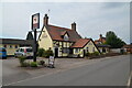
The Holly Bush PH is a grade II listed building situated on The Cumbers,... (more)
Tags: top:Business, Retail, Services   type:Geograph   Grade II Listed Building   subject:Public House   Public House   Public House Sign   place:Seighford   postcode district:ST18   near:Stafford   county:Staffordshire   top:Village, Rural Settlement  
SJ8824 : The Green, Seighford, near Stafford by Rod Grealish The Green, Seighford, near Stafford by Rod Grealish
geograph for square SJ8824
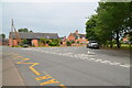
A view across The Green, Seighford, towards a barn conversion in the... (more)
Tags: house:Barn Conversion   type:Geograph   subject:Road Junction   top:Roads, Road Transport   place:Seighford   postcode district:ST18   near:Stafford   county:Staffordshire   road:The Green   top:Village, Rural Settlement  
SJ9222 : Tamping machine by Bob Harvey Tamping machine by Bob Harvey
geograph for square SJ9222
Operated by Swietelsky Babcock Rail (SBRail) DR93109 is a Plasser and Theurer... (more)
Tags: type:Geograph   top:Lowlands   Network Rail Depot   Permanent Way Depot   subject:Railway Equipment   top:Railways   near:Stafford   Tamping Machine   colour:Yellow  
SJ9122 : Permanent way depot by Bob Harvey Permanent way depot by Bob Harvey
geograph for square SJ9122
Track maintenance vehicles belonging to Network Rail, just to the Southeast of... (more)
Tags: subject:Depot   type:Geograph   top:Lowlands   Network Rail Depot   Permanent Way Depot   top:Railways   near:Stafford   season:Summer  
SJ9625 : Park Farm, Stafford: Weetman's Plantation by Jonathan Hutchins Park Farm, Stafford: Weetman's Plantation by Jonathan Hutchins
geograph for square SJ9625
Tags: top:Farm, Fishery, Market Gardening   type:Geograph   near:Stafford   subject:Woodland   Woodland   top:Woodland, Forest  
SJ9625 : Park Farm, Stafford: bridleway alongside wall by Jonathan Hutchins Park Farm, Stafford: bridleway alongside wall by Jonathan Hutchins
geograph for square SJ9625
This bridleway appears to be designated Tixall 0.1628
Tags: top:Boundary, Barrier   subject:Bridleway   top:Country Estates   top:Farm, Fishery, Market Gardening   top:Grassland   top:Paths   near:Stafford  
SJ9625 : Park Farm, Stafford: Weetman's Plantation with wind turbine by Jonathan Hutchins Park Farm, Stafford: Weetman's Plantation with wind turbine by Jonathan Hutchins
geograph for square SJ9625
SJ9625 : Park Farm, Stafford: no exit by Jonathan Hutchins Park Farm, Stafford: no exit by Jonathan Hutchins
geograph for square SJ9625
This massive roller prevents both unauthorised entry and exit. This is right... (more)
Tags: top:Boundary, Barrier   top:Farm, Fishery, Market Gardening   subject:Roller   near:Stafford  
SJ9525 : Park Farm, Stafford by Jonathan Hutchins Park Farm, Stafford by Jonathan Hutchins
geograph for square SJ9525
Tags: subject:Farm Building   top:Farm, Fishery, Market Gardening   near:Stafford  
SJ9625 : Staffordshire County Showground from Park Farm by Jonathan Hutchins Staffordshire County Showground from Park Farm by Jonathan Hutchins
geograph for square SJ9625
Behind the green fence lies the eastern corner of the County Showground. On the... (more)
Tags: top:Boundary, Barrier   top:Roads, Road Transport   subject:Showground   near:Stafford  
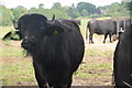
SJ8725 : Buffalo in field off the Combers, Seighford, Stafford by Rod Grealish Buffalo in field off the Combers, Seighford, Stafford by Rod Grealish
geograph for square SJ8725
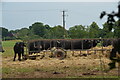
An unusual feature of the British countryside. The buffalo are raised by Beeches... (more)
Tags: subject:Animal   Buffalo   top:Farm, Fishery, Market Gardening   Farmland   type:Geograph   top:Grassland   place:Seighford   postcode district:ST18   near:Stafford   county:Staffordshire  
SJ9426 : Public footpath near Hopton, Staffordshire by Oliver Mills Public footpath near Hopton, Staffordshire by Oliver Mills
geograph for square SJ9426
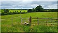
Located near the top of Church Hill. The stile, as seemed to be the case with... (more)
Tags: Church Hill   path:Footpath   type:Geograph   place:Hopton   top:Paths   near:Stafford   place:Staffordshire   subject:Stile   top:Village, Rural Settlement  
SJ9024 : Doxey Marshes by Jonathan Hutchins Doxey Marshes by Jonathan Hutchins
geograph for square SJ9024
Boundary Flash is visible beyond the reedbed.
Tags: place:Doxey Marshes   Freshwater Reedbed   type:Geograph   top:Lakes, Wetland, Bog   subject:Marsh   Marshland   Reedbed   near:Stafford  
SJ9024 : Doxey Marshes by Jonathan Hutchins Doxey Marshes by Jonathan Hutchins
geograph for square SJ9024
Tags: place:Doxey Marshes   type:Geograph   top:Lakes, Wetland, Bog   subject:Marsh   Marshland   near:Stafford   Telescope  
SJ8725 : Buffalo close up by Rod Grealish Buffalo close up by Rod Grealish
for square SJ8725
One young buffalo comes forward to investigate the photographer. An unusual... (more)
Tags: subject:Animal   Buffalo   type:Close Look   top:Farm, Fishery, Market Gardening   Farmland   top:Grassland   place:Seighford   postcode district:ST18   near:Stafford   county:Staffordshire  
View more in the Image Search or in Browser
View images matching 'Stafford' anywhere in the tags
Don't click these: PotMel 1 PotMel 2