Public Tags
Showing latest 50 of 427 images tagged with near:Stroud tag.
|
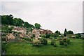
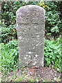
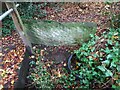
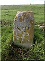
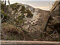
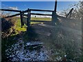
Milestone, Frocester Hill
by Mr Red geograph for square SO7902 The Bench Mark on top put the ASL at variously 62.7m in 1965 or 203.3ft in... (more)
Tags:
type:GeographX
milestoneid:GL TBGL10X
subject:Milepost or MilestoneX
top:Roads, Road TransportX
near:Stroud
top:Village, Rural SettlementX
|
|
Scrub near Stroude
by Alan Hunt geograph for square TQ0069 An area of scrubland near the railway line on the footpath from Whitehall Farm... (more)
|
|
Whitehall Lane, Stroude
by Alan Hunt geograph for square TQ0069 Looking east along Whitehall Lane from near Whitehall Farm.
|
|
Field off Whitehall Lane
by Alan Hunt geograph for square TQ0069 The field to the north of Whitehall Lane near Stroude.
Tags:
top:Farm, Fishery, Market GardeningX
near:StroudeX
|
|
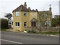
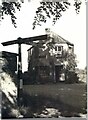
View from a lorry
by John Winder geograph for square SO8503 This is Bagpath Lane near Stroud, which has a 6'6" width limit, a 7.5... (more)
Tags:
place:BagpathX
Bagpath LaneX
Film PhotographyX
type:GeographX
subject:HouseX
top:Housing, DwellingsX
LorryX
near:Stroud
top:Village, Rural SettlementX
|
|
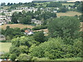
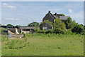
Humphries End
by Christine Johnstone geograph for square SO8306 Looking westwards across the northern edge of Stroud.
|
|
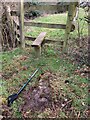
Stone Stile, Lightpill
by Mr Red for square SO8303 Off the A46 Bath Rd, in the Lightpill area of Rodborough, Stroud. Not on a... (more)
|
|
Stone Stile, Lightpill
by Mr Red for square SO8303 Off the A46 Bath Rd, in the Lightpill area of Rodborough, Stroud. Not on a... (more)
|
|
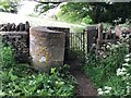
Stancombe Toll House, Bisley
by Mr Red geograph for square SO8906 Currently named "The Old Toll House" by the owners. On Bisley Road,... (more)
|
|
Whitehall Farm, Stroude
by Alan Hunt geograph for square TQ0069 The derelict farmstead viewed from the northwest.
|
|
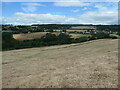
The valley of Ruscombe Brook
by Christine Johnstone geograph for square SO8306 In the Cotswolds AONB, just north of Stroud.
|
|
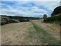
Path descending into the valley of Ruscombe Brook
by Christine Johnstone geograph for square SO8306 Public footpath heading north from Stroud.
Tags:
area:Cotswolds AONBX
Cross Field FootpathX
path:FootpathX
type:GeographX
subject:PathX
top:PathsX
Public FootpathX
near:Stroud
|
|
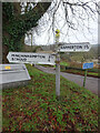
Old Fingerpost, Frampton Mansell
by Mr Red for square SO9202 On Main Street in the centre of the village. The post is of the old design with... (more)
Tags:
type:Close LookX
subject:FingerpostX
place:Frampton MansellX
top:Roads, Road TransportX
near:Stroud
|
|
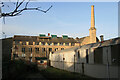
Lightpill Mill
by Chris Allen geograph for square SO8303 A large complex now better known as the Bath Road industrial Estate. This former... (more)
Tags:
top:Business, Retail, ServicesX
ChimneyX
type:GeographX
Grade II ListedX
top:Historic Sites and ArtefactsX
Industrial EstateX
top:IndustryX
subject:MillX
top:Rivers, Streams, DrainageX
StreamX
near:Stroud
former:Textile MillX
|
|
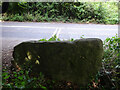
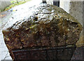
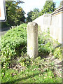
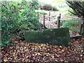
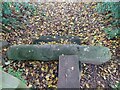
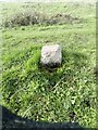
Milestone & rivet Benchmark, Horsepools Hill, Brookthorpe
by Mr Red for square SO8410 Adjacent to Pike House, (probably an old Toll House). A4173. BM is 121.9 m ASL.... (more)
Tags:
subject:BenchmarkX
type:Close LookX
top:Roads, Road TransportX
near:Stroud
top:Village, Rural SettlementX
|
|
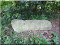
Old Milestone, Berkeley Heath
by Milestone Society for square SO6999 Carved stone post by the B4066, in parish of BERKELEY (STROUD District),... (more)
Tags:
type:Close LookX
milestoneid:GL BKDY01X
subject:Milepost or MilestoneX
top:Roads, Road TransportX
near:Stroud
top:Village, Rural SettlementX
|
|
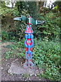
National Cycle Network signpost, Dudbridge Junction
by Mr Red for square SO8304 On the old Midland Rail line where the original line diverted to Stroud or to... (more)
Tags:
type:Close LookX
subject:Milepost or MilestoneX
top:PathsX
near:Stroud
top:Suburb, Urban FringeX
|
|
Milestone, Frampton on Severn / Fretherne
by Mr Red geograph for square SO7408 Located just in the road to Arlingham, visible from the canal swing bridge.... (more)
Tags:
type:GeographX
milestoneid:GL GLAP10X
subject:Milepost or MilestoneX
top:Roads, Road TransportX
near:Stroud
top:Village, Rural SettlementX
|
|
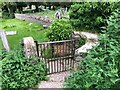
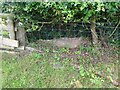
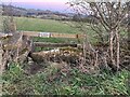
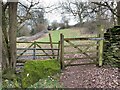
Stone Kissing Gate, Avening
by Jayne Tovey for square ST8797 Gate between fields above the church, looking West, the view East is... (more)
|
|
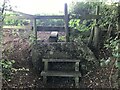
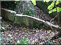
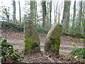
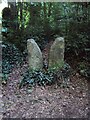
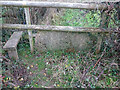
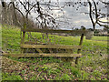
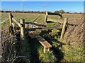
Stone Stile, King's Stanley
by Mr Red for square SO8103 The remains of a "Fallen Idle" near Manor Farm on Gloucestershire... (more)
|
|
Stone Stile, King's Stanley
by Mr Red geograph for square SO8103 On Gloucestershire footpath MKS9 near King's Stanley Village Hall looking... (more)
|
|
Stone Stile, King's Stanley
by Mr Red for square SO8103 On Gloucestershire footpath MKS9 near King's Stanley Village Hall looking... (more)
|
|
Stone Stile, Selsley
by Mr Red for square SO8203 A slab stile on Gloucestershire footpath MKS16, near "Badgers",... (more)
|
|
Stone Stile, Selsley
by Ian Kenny Roberts for square SO8203 A slab stile on Gloucestershire footpath MKS16, near "Badgers",... (more)
|
|
Turnpike Cottage, B4058, Horsley
by Nailsworth Town Archives geograph for square ST8197 Opposite to the lodge for Owlpen Manor, at Latterwood. This Toll House was... (more)
|
|
Stone Kissing Gate, Avening
by Jayne Tovey for square ST8797 Between fields South & above church, looking West, the view East is... (more)
|
|
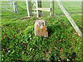
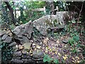
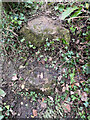
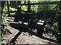
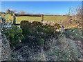
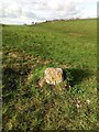
Boundary Marker, Uley Bury
by Mr Red for square ST7898 On the South flank one level down from the enclosed part of the opidum (Hill... (more)
Tags:
top:Boundary, BarrierX
type:Close LookX
top:Historic Sites and ArtefactsX
near:Stroud
near:UleyX
|
|
Boundary Marker, Uley Bury
by Mr Red for square ST7898 On the South flank one level down from the enclosed part of the opidum (Hill... (more)
Tags:
top:Boundary, BarrierX
type:Close LookX
top:Historic Sites and ArtefactsX
near:Stroud
near:UleyX
|
|
Boundary Marker, Uley Bury
by Mr Red for square ST7898 On the South flank one level down from the enclosed part of the opidum (Hill... (more)
Tags:
top:Boundary, BarrierX
type:Close LookX
top:Historic Sites and ArtefactsX
near:Stroud
near:UleyX
|
|
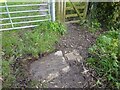
Stone Stile, Whips Lane, Pinfarthing
by Mr Red for square SO8500 OnOn the SW fringes of Minchinhampton Common. NE of Watledge on Gloucestershire... (more)
|
|
Stone Stile, Whips Lane, Pinfarthing
by Mr Red for square SO8500 On the SW fringes of Minchinhampton Common. NE of Watledge on Gloucestershire... (more)
|
|
Stone Stile, Standish Wood
by Mr Red geograph for square SO8206 Off Ash Lane, in the Parish of Standish. Looking SW to the road, the view from... (more)
|
|
Stone Stile, Standish Wood
by Patricia McCurry geograph for square SO8206 Near Ash Lane, in the Parish of Standish. Looking from the road, the view from... (more)
|
|
Stone Stile, Cam
by Mr Red for square SO7401 Near the leisure fields, along but not connected to, Everside Lane. This view... (more)
|
|
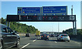
M25 southbound nearing junction 12 for M3
by Robin Stott geograph for square TQ0169 The footbridge carries a local footpath.
|
|
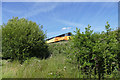
Freight train
by Alan Hunt geograph for square TQ0069 A freight train approaching Virginia Water near the footpath tunnel on the path... (more)
|
|
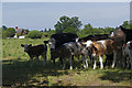
Cattle, Whitehall Farm
by Alan Hunt geograph for square TQ0069 Curious cattle in a shady corner of a field near the derelict Whitehall Farm... (more)
|
|
Remains of a Stone Stile, Stinchcombe
by Jayne Tovey for square ST7398 The steps left from a lost slab stone stile, 130 yds NE of St Cyr Church.
|
|
Stone Stile, Stinchcombe GS6438
by Jayne Tovey for square ST7299 On an old route of the Gloucestershire footpath CST55, which now runs slightly... (more)
|
|
Stone Stile, Upthorpe
by Mr Red for square SO7500 A "Fallen Idle" in the parish of Cam, near Dursley, on Gloucestershire... (more)
|
|
Stone Stile, Nailsworth
by Ian Kenny Roberts for square SO8300 A "Fallen Idle" on Gloucestershire footpath ZNA1 looking SE.... (more)
|
|
Stone Stile, Thougham
by Jayne Tovey for square SO9107 On Gloucestershire footpath MBL160 running diagonal through the field. Looking... (more)
|
|
Stone Stile, Thougham
by Jayne Tovey geograph for square SO9107 On Gloucestershire footpath MBL160 running diagonal through the field. Looking... (more)
|
|
Stone Stile, Bournes Green
by Mr Red for square SO9003 A "Fallen Idle" at a very old field boundary on Gloucestershire... (more)
|
|
Stone Stile, Nympsfield
by Mike Kom for square ST8199 A "Fallen Idle" on Gloucestershire footpath CNY13 looking East. A... (more)
|
|
Stone Stile, Nympsfield
by Mike Kom geograph for square ST8199 On Gloucestershire footpath CNY13 looking West in the direction of Nympsfield.
|
|
Stone Stile, Bournes Green GS1047
by Jayne Tovey geograph for square SO9004 Near the Money Tump (tumulous). On the Wysis Way looking North, the alternative... (more)
|
|
Stone Stile, Bisley GS1055
by Jayne Tovey geograph for square SO9005 Near to Nash End looking North away from the Bournes Green direction. The view... (more)
|
|
Stone Stile, Bisley GS1041
by Jayne Tovey for square SO9005 On Gloucestershire footpath MBL38 looking North away from Bournes Green, the... (more)
|
|
Boundary Marker, Uley Bury
by Mr Red geograph for square ST7898 On the South flank one level down from the enclosed part of the opidum (Hill... (more)
Tags:
top:Boundary, BarrierX
type:GeographX
top:Historic Sites and ArtefactsX
near:Stroud
near:UleyX
|