About tags on Geograph

Public Tags

Related Tags | Coverage Map
Prefix: near    Tag:  Tealby  
Other tags: place:Tealby    

Showing images tagged with near:Tealby tag.
View all tagged images - In Browser

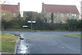
TF1490 : Road Junction near Tealby by J.Hannan-Briggs Road Junction near Tealby by J.Hannan-Briggs
geograph for square TF1490
Walesby Lane joins the B1203, Rasen Road.
Tags: road:B1203   Road Junction   top:Roads, Road Transport   near:Tealby   lane:Walesby Lane  
TF1691 : Track to Manor Farm by J.Hannan-Briggs Track to Manor Farm by J.Hannan-Briggs
geograph for square TF1691
Off Papermill Lane.
Tags: Farm Access Track   near:Manor Farm   top:Roads, Road Transport   near:Tealby  
TF1489 : Public Footpath 149 by J.Hannan-Briggs Public Footpath 149 by J.Hannan-Briggs
geograph for square TF1489
To Willingham Hall 1 mile.
Tags: top:Paths   Public Footpath   near:Tealby  
TF1790 : Entrance to Kirmond Hall Estate by J.Hannan-Briggs Entrance to Kirmond Hall Estate by J.Hannan-Briggs
geograph for square TF1790
Off B1225
TF1791 : B1225 Caistor High Street by J.Hannan-Briggs B1225 Caistor High Street by J.Hannan-Briggs
geograph for square TF1791
Towards Ludford.
Tags: road:B1225   top:Roads, Road Transport   near:Tealby  
TF1591 : Caistor Lane by J.Hannan-Briggs Caistor Lane by J.Hannan-Briggs
geograph for square TF1591
Tags: lane:Caistor Lane   top:Roads, Road Transport   near:Tealby  
TF1589 : Junction of Sandy Lane and Thorpe Lane by J.Hannan-Briggs Junction of Sandy Lane and Thorpe Lane by J.Hannan-Briggs
geograph for square TF1589
Tags: Road Junction   top:Roads, Road Transport   lane:Sandy Lane   near:Tealby   lane:Thorpe Lane  
View more in the Image Search or in Browser
View images matching 'Tealby' anywhere in the tags
Don't click these: PotMel 1 PotMel 2