|
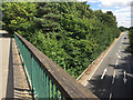
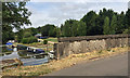
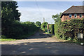
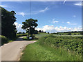
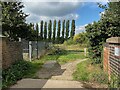
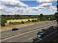
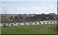
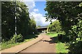
A452 Warwick Bypass from the lane overbridge northeast of Barford
by Robin Stott
geograph for square SP2862
In 1968, when it first appears on an OS 1:10,560 map, this was the southern end... (more)
|
|
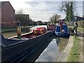
Energy afloat fuel sales boat, Grand Union Canal, Myton, Warwick
by Robin Stott
geograph for square SP3065
The nimble man in the check shirt plies the canals in Warwickshire and... (more)
|
|
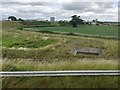
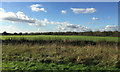
Crop and drainage at Longbridge near Warwick
by Robin Stott
geograph for square SP2662
Longbridge is the local name for the six-way interchange at junction 15 of the... (more)
|
|
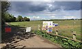
Land at Heathcote Hill Farm fenced for development, Warwick
by Robin Stott
for square SP3063
The land lies to the north of the summit of Gallows Hill, behind the camera.... (more)
|
|
Station Road bridge and the Grand Union Canal at Hatton
by Robin Stott
geograph for square SP2266
On maps since 1925 it has been faithfully named Hatton Glebe Bridge; there was a... (more)
|
|
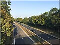
A46 near Loes Farm, Guy's Cliffe, Warwick
by Robin Stott
for square SP2867
This view is the nearest possible re-creation of the first photo submitted for... (more)
|
|
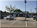
Busy Bees Nursery, Warwick Gates estate, Heathcote
by Robin Stott
geograph for square SP3063
The first photograph posted for this gridsquare was SP3063 : Hawkes Farm taken 15 years ago... ( more) |
|
Tree-planted land adjoining new residential development, Myton, Warwick
by Robin Stott
geograph for square SP3064
Two small farms to the south of Warwick and Leamington, Brook Farm and Henry... (more)
|
|
Drive to a former sewage treatment site, Heathcote, south Leamington
by Robin Stott
for square SP3062
|
|
New residential development south of Harbury Lane, Heathcote, south Leamington
by Robin Stott
geograph for square SP3162
For years the south side of Harbury Lane had a couple of farms and a... (more)
|
|
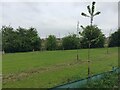
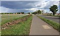
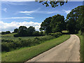
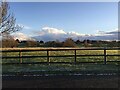
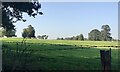
Line of a brook, a footpath and a field boundary north of Wellesbourne
by Robin Stott
geograph for square SP2757
Flat land in the Avon Valley, part of the University of Warwick's... (more)
|
|
Autumn-sown crop emerging, field north of Wellesbourne
by Robin Stott
geograph for square SP2757
A field belonging to the Wellesbourne Campus of the University of Warwick,... (more)
|
|
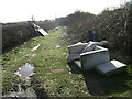
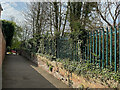
Flytipping off Coventry Road near Warwick
by Robin Stott
geograph for square SP2967
Brambles encroaching on a wide verge have created a space screened from the... (more)
|
|
West end of Rugby Road
by Robin Stott
geograph for square SP3065
|
|
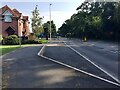
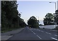
Southwest on Rugby Road, Royal Leamington Spa
by Robin Stott
geograph for square SP3065
Traffic is heading for the junction with Warwick New Road, then across the Avon... (more)
|
|
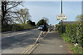
Welcome to Warwick sign at Portobello Bridge
by Robin Stott
geograph for square SP3065
The A445 Rugby-Warwick road crosses the River Avon here.
|
|
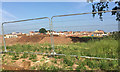
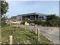
Car showroom under construction, Gallows Hill, Warwick
by Robin Stott
geograph for square SP2963
A sign declares "Rybrook are proud to bring a new BMW and MOTORRAD Centre... (more)
|
|
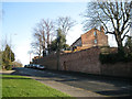
Changes on Banbury Road, Warwick
by Robin Stott
geograph for square SP2864
The recent relocation of King's High School for Girls to the Warwick School... (more)
|
|
Bridge off Leam Road, Myton, near Warwick
by Robin Stott
geograph for square SP3065
A sign from the Rail Authority identifies it as Bridge DCL/141 occupation bridge... (more)
|
|
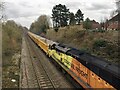
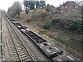
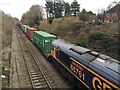
Empty northbound stone train, Myton, near Warwick
by Robin Stott
geograph for square SP3065
Similar trains may be observed during the week, some full, some empty, rattling... (more)
|
|
Approaching Warwick Parkway station
by Robin Stott
geograph for square SP2665
A multistorey car park is being built. For earlier stages and more information,... (more)
|
|
Developments by Gallows Hill, Heathcote
by Robin Stott
geograph for square SP2963
Residential developments expected for decades are now taking place. The day when... (more)
|
|
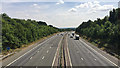
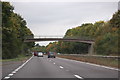
M40 northwest of Hareway Lane
by Robin Stott
geograph for square SP3060
Ahead are junctions 14 and 15 southwest of Warwick. The dark skyline is the Arden plateau.
|
|
Prospect Farm, Wedgnock Lane, northwest of Warwick
by Robin Stott
geograph for square SP2667
The farmhouse is dated 1743 and is listed Grade II:... (more)
|
|
Turning for the Activity Centre, Wedgnock Old Park north of Warwick
by Robin Stott
geograph for square SP2767
The public road turns east for the activity centre. A private road and public... (more)
|
|
Approaching Prospect Farm, Wedgnock Old Park north of Warwick
by Robin Stott
geograph for square SP2667
This private road and public bridleway gives a gentle climb from the Avon valley... (more)
|
|
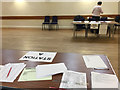
Leek Wootton village hall arranged as a double polling station
by Robin Stott
for square SP2869
The occasion was the General Election held on 8th June 2017. Elections are run... (more)
|
|
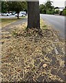
Fallen catkins of Sweet Chestnut, Warwick
by Robin Stott
geograph for square SP3065
By Myton Road near Lidl. Note the characteristic twist of the trunk.
|
|
North end of Leam Road bridge, Myton
by Robin Stott
geograph for square SP3065
Once a private accommodation bridge it now serves the public, connecting the... (more)
|
|
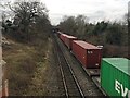
Head of a southbound container freight train, Myton, Warwick
by Robin Stott
geograph for square SP3065
|
|
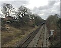
Underwater railway, Myton, Warwick
by Robin Stott
geograph for square SP3065
A Birmingham-bound Chiltern Railways service dives under the Grand Union Canal... (more)
|
|
Tail of northbound container freight train, Myton, Warwick
by Robin Stott
geograph for square SP3065
|
|
Head of northbound container freight train, Myton, Warwick
by Robin Stott
geograph for square SP3065
|
|
A wintry shower over Warwick
by Robin Stott
geograph for square SP2867
The view south from the Warwickshire Golf and Country Club car park that became... (more)
|

|
Japanese Knotweed fights back, Leam Road field, Warwick
by Robin Stott
for square SP3065
This land, sloping steeply down to the River Leam north of Leam Road, was... (more)
|
|
M40 looking southeast from the Dark Lane crossing
by Robin Stott
for square SP2364
The motorway negotiates the southern edge of the Arden plateau a long climb... (more)
|
|
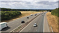
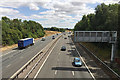
M40 east of junction 14, south of Warwick
by Robin Stott
geograph for square SP2862
The view is roughly east from the Flatrabbit Lane overbridge. The reverse view... (more)
|
|
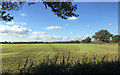
Fields by the M40 seen from the B4463 crossing
by Robin Stott
geograph for square SP2563
The crossing is about 1km west of junction 15; the B4463 runs from there towards... (more)
|
|
Houses on the University of Warwick's Wellesbourne Campus
by Robin Stott
geograph for square SP2757
Formerly Horticulture Research International, formerly Wellesbourne... (more)
|
|
Footbridge over A46, near Warwick
by J.Hannan-Briggs
geograph for square SP2766
The footbridge carries a bridleway.
|
|
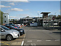
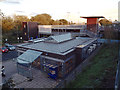
Booking Hall and new multistorey car park, Warwick Parkway railway station
by Robin Stott
geograph for square SP2665
The station is operated by Chiltern Railways. The new car park concentrates... (more)
|
|
Midsummer Meadow, Myton
by Robin Stott
geograph for square SP3064
Meadow once: another estate recently built on the small farms in Myton, Warwick.... (more)
|
|
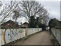
Footpath to Warwick New Road from Rugby Road, Royal Leamington Spa
by Robin Stott
geograph for square SP3065
|

|
St John's shops, Warwick, with gas supply cover
by Robin Stott
geograph for square SP2865
This parade of shops with parking dates from about 1969.
|
|
Guy's Cliffe landscape, north Warwick
by Robin Stott
geograph for square SP2866
The former parkland of the Guy's Cliffe estate is distinguished by some... (more)
|
|
Stratford Road out of Warwick
by Steve Daniels
geograph for square SP2763
|
|
The Myton cycleway passes under Europa Way, south Leamington
by Robin Stott
geograph for square SP3064
The cycleway connects south Warwick and south Leamington. It's a route to... (more)
|
|
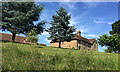
The Anchor Inn, Warwick Road, Leek Wootton
by Robin Stott
geograph for square SP2868
The rear of the pub from the steep car park. Not a listed building.
|
|
Crops and hedgerows northwest of Warwick
by Robin Stott
geograph for square SP2766
The view is from the unnamed road that continues north from Wedgnock Lane. The... (more)
|
|
Towards the outdoor activity centre, Wedgnock Old Park north of Warwick
by Robin Stott
geograph for square SP2767
Adventure Sports is in the vicinity of a former rifle range.
|