Public Tags
Prefix:
near
Tag:
Whempstead
Showing images tagged with near:Whempstead tag.
|
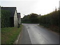
Whempstead Lane, near Dane End, Hertfordshire
by Malc McDonald
geograph for square TL3120
Whempstead Lane is a minor road through north Hertfordshire countryside. This... (more)
|
|
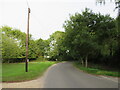
Whempstead Road, near Stevenage
by Malc McDonald
geograph for square TL3122
Whempstead Road is a minor road through the countryside in north Hertfordshire.
|

|
Whempstead Road, near Stevenage
by Malc McDonald
geograph for square TL3122
Whempstead Road is a minor road through north Hertfordshire countryside.
|

|
Whempstead Road, near Stevenage
by Malc McDonald
geograph for square TL3122
Whempstead Road is a minor road through north Hertfordshire countryside.
|
|
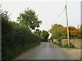
Whempstead Lane, near Dane End, Hertfordshire
by Malc McDonald
geograph for square TL3220
Whempstead Lane is a minor lane through north Hertfordshire countryside.
|

|
Whempstead Lane, near Dane End, Hertfordshire
by Malc McDonald
geograph for square TL3221
Whempstead Lane is a minor road through countryside in north Hertfordshire. The... (more)
|

|
Whempstead Road, near Stevenage
by Malc McDonald
geograph for square TL3121
Whempstead Road is a minor road through north Hertfordshire countryside. Here,... (more)
|
|
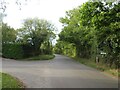
Road junction near Stevenage
by Malc McDonald
geograph for square TL3022
A minor road junction in north Hertfordshire countryside.
|
|
Cutting Hill Farm, near Stevenage
by Malc McDonald
geograph for square TL3122
Cutting Hill Farm in the north Hertfordshire countryside. The green sign... (more)
|

|
Public byway near Stevenage
by Malc McDonald
geograph for square TL3121
A restricted public byway along a track into woodland in the north Hertfordshire... (more)
|

|
Public byway near Stevenage
by Malc McDonald
geograph for square TL3121
A restricted public byway heading into woodland in north Hertfordshire. The... (more)
|

|
Public footpath near Stevenage
by Malc McDonald
geograph for square TL3121
A public footpath leading towards woodland in north Hertfordshire countryside.
|
